Redditch
United Kingdom /
England /
Redditch /
World
/ United Kingdom
/ England
/ Redditch
World / United Kingdom / England
town, district
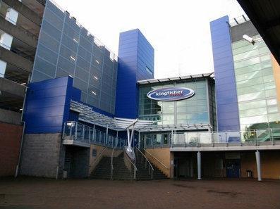
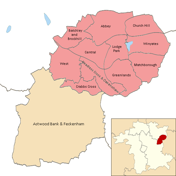
Redditch is a town and local government borough district in north-east Worcestershire, England, approximately 15 miles (24 km) south of Birmingham. The district had a population of 79,216 in 2005. The Borough district has a dozen electoral wards of which all but one comprise parts of the urban area of the town of Redditch, as represented by the attached polygon (see outline map above). The borough district also encloses two parishes and four county electoral division.
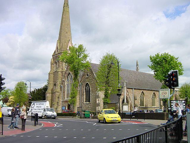
The first recorded mention of Redditch ("Red-Dych", thought to be a reference to the red clay of the nearby River Arrow) is in 1348, the year of the outbreak of the Black Death. During the Middle Ages it became a centre of needle-making and later prominent industries were fish-hooks, fishing tackle, motorcycles and springs, the latter notably by Herbert Terry and Sons. At one point 90% of the world's needles were manufactured in the town and its neighbourhoods.
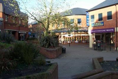
It was designated a new town in 1964 and the population increased dramatically from 32,000 to around 77,000. Housing developments such as Church Hill, Matchborough, Winyates, Lodge Park and Woodrow were created to accommodate the large overspill from an industrially expanding Birmingham. In the 1960s it became a model for modern new town planning. Redditch was built as a 'flagship' town using new methods and new town planning; all the main roads (mostly new dual carriageways as well as a ring road for the town centre) in Redditch were banked to reduce noise to the new housing estates and the whole of Redditch was landscaped.
The town is twinned with Auxerre in Burgundy, France and Mtwara in Tanzania.
redditch.whub.org.uk/cms/default.aspx
www.redditch.com/index.html
for more on the history of Redditch see @:
www.redditchhistory.com/
for on-line inter-actice large-scale map on Worcestershire C.C. website (used in drawing attached polygon) see @:
gis.worcestershire.gov.uk/wccgisonline/maps.aspx?mlapc=...
The first recorded mention of Redditch ("Red-Dych", thought to be a reference to the red clay of the nearby River Arrow) is in 1348, the year of the outbreak of the Black Death. During the Middle Ages it became a centre of needle-making and later prominent industries were fish-hooks, fishing tackle, motorcycles and springs, the latter notably by Herbert Terry and Sons. At one point 90% of the world's needles were manufactured in the town and its neighbourhoods.
It was designated a new town in 1964 and the population increased dramatically from 32,000 to around 77,000. Housing developments such as Church Hill, Matchborough, Winyates, Lodge Park and Woodrow were created to accommodate the large overspill from an industrially expanding Birmingham. In the 1960s it became a model for modern new town planning. Redditch was built as a 'flagship' town using new methods and new town planning; all the main roads (mostly new dual carriageways as well as a ring road for the town centre) in Redditch were banked to reduce noise to the new housing estates and the whole of Redditch was landscaped.
The town is twinned with Auxerre in Burgundy, France and Mtwara in Tanzania.
redditch.whub.org.uk/cms/default.aspx
www.redditch.com/index.html
for more on the history of Redditch see @:
www.redditchhistory.com/
for on-line inter-actice large-scale map on Worcestershire C.C. website (used in drawing attached polygon) see @:
gis.worcestershire.gov.uk/wccgisonline/maps.aspx?mlapc=...
Wikipedia article: http://en.wikipedia.org/wiki/Redditch
Nearby cities:
Coordinates: 52°17'58"N 1°55'50"W
- Solihull 18 km
- Gloucester 51 km
- Northampton 66 km
- Oxford 71 km
- Swindon 77 km
- Bristol 98 km
- Luton 106 km
- Slough 121 km
- Basingstoke 123 km
- Bournemouth 169 km
- Arrow Valley Park 1.4 km
- The Abbey Hotel Golf and Country Club 2.3 km
- Winyates East 2.8 km
- Matchborough East 2.8 km
- Industrial Estate (Moons Moat North) 3.4 km
- Ladbrook Park Golf Club 7.2 km
- Kings Norton Golf Club 8.2 km
- Henley Golf and Country Club 9 km
- Solihull (Metropolitan Borough) 20 km
- Warwickshire 25 km