Rugeley
United Kingdom /
England /
Rugeley /
World
/ United Kingdom
/ England
/ Rugeley
World / United Kingdom / England
town
Add category

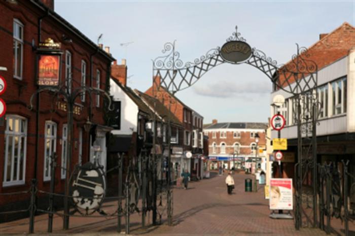
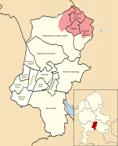
Rugeley is an historic market town in the county of Staffordshire, England. It lies on the northern most edge of Cannock Chase within the Cannock Chase District Council area, and is situated roughly midway between the towns of Stafford, Cannock, Lichfield and Uttoxeter. The population as at the 2001 census was 22,724 (including the Brereton and Etchinghill wards). The county parish of Rugeley (upon which the attached polygon is based)takes in all of the District Council electoral wards of Hagley and Etching Hill & The Heath, and the Brereton part of the Brereton & Ravenhill ward and the northern most part of the Hednesford Green Heath ward (see outline map above).
The town was a centre of coal mining until 1991, when the Lea Hall Colliery was demolished. The Rugeley B coal-fired power station dominates the skyline where a flue gas desulphurisation plant is currently being constructed. This will allow it to continue to generate electricity and comply with environmental legislation. The former Rugeley A station took its fuel directly from the neighbouring mine by conveyor belt. This was the first such arrangement in Britain. It is twinned with Western Springs, Illinois in the United States.
The town, historically known as Rudgeley, is listed in the Domesday Book. This name is thought to be derived from 'Ridge lee', or 'the hill over the field'. In the mediaeval period, it thrived on iron workings and was also a site of glass manufacturing.
www.rugeleytowncouncil.gov.uk/
for more on the history of Rugeley see @:
www.cannockchasehistory.org.uk/places/rugeley.htm
for large-scale online map on Cannock Chase DC website showing electoral & parish ward boundaries (used in drawing attached polygon) see @:
mapping.cannockchasedc.com/readconditionsbeforeuse.htm
Wikipedia article: http://en.wikipedia.org/wiki/Rugeley
Nearby cities:
Coordinates: 52°45'21"N 1°56'22"W
- Walsall 14 km
- Sutton Coldfield 17 km
- Telford 41 km
- Leicester 49 km
- Nottingham 53 km
- Metropolitan Borough of Stockport 79 km
- Warrington 90 km
- Doncaster 102 km
- Huddersfield 104 km
- York 149 km
- Fair Oak Business and Enterprise College 0.7 km
- Etching Hill 1.8 km
- Staffs Wildlife Trust Centre 3.2 km
- Cannock Chase 3.2 km
- Colwich CP 5.1 km
- Brocton CP 7.2 km
- Berkswich CP 8.1 km
- Tixall CP 9 km
- Stafford 19 km
- South Staffordshire 22 km