Back in May I was kindly invited to speak about the wonderful Cornish ancient sites on Bodmin Moor and the research I have been doing into the relationship they have with the sky. Here’s a link to the talk,


Back in May I was kindly invited to speak about the wonderful Cornish ancient sites on Bodmin Moor and the research I have been doing into the relationship they have with the sky. Here’s a link to the talk,


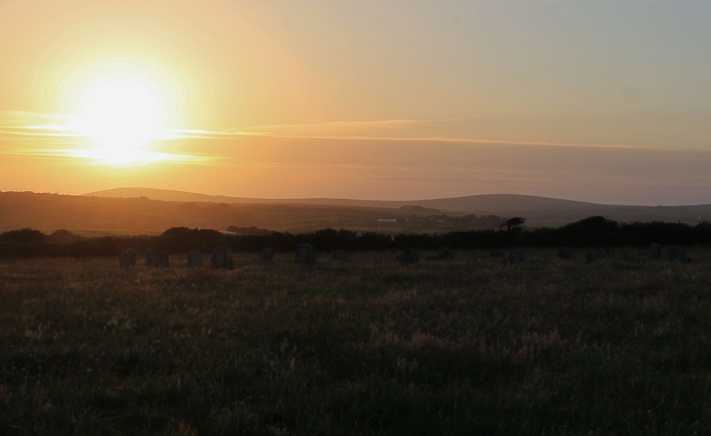
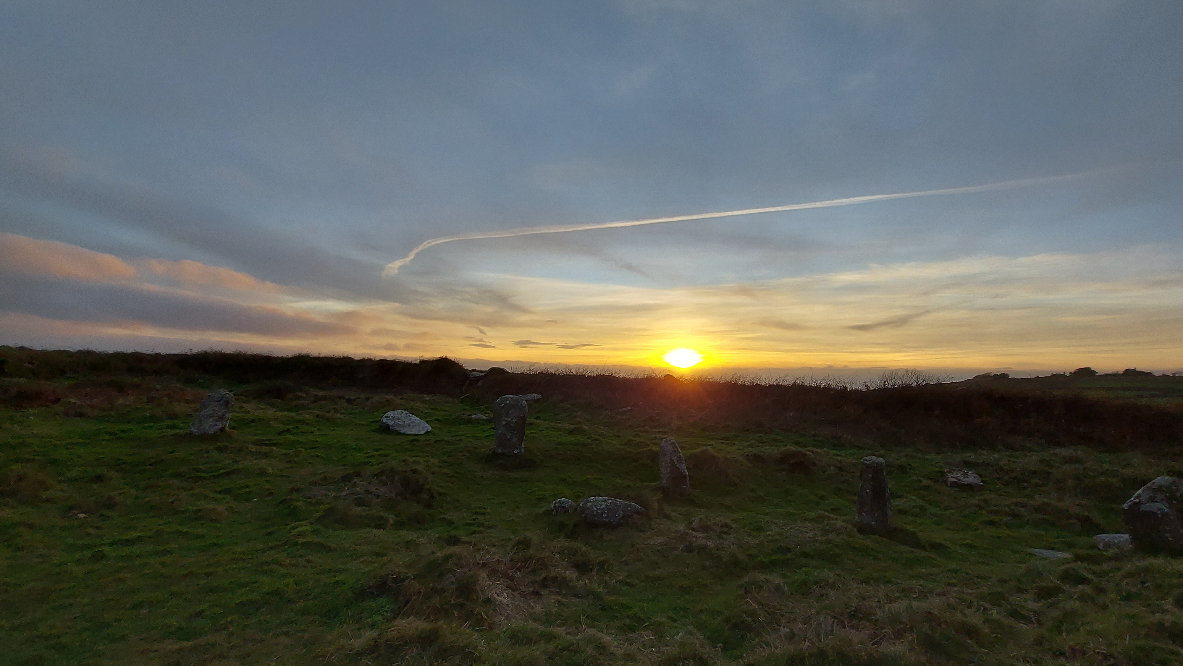
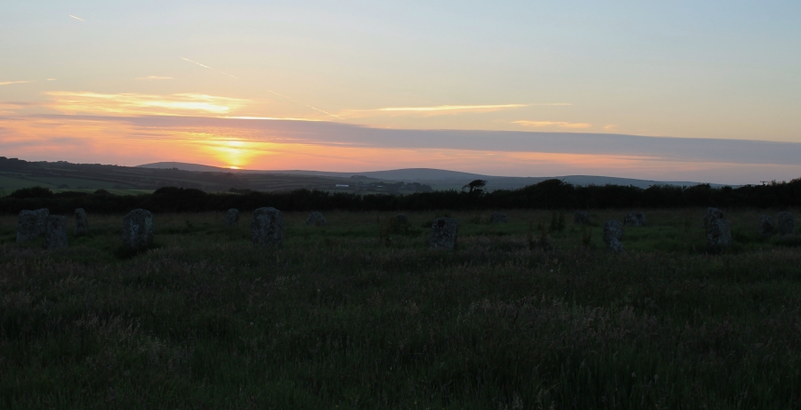
On summer solstice eve I was able to photograph the alignment between the circle and the setting sun over Brown Willy and the setting sun lines up well with the prominent hill. Even taking into account that in prehistory the sun wouldn’t set in exactly the same position today (it would be 2 solar discs to the right in the photo above) there is a clear correlation between the two.

Craddock Moor circle isn’t the only prehistoric site where you can watch the summer solstice sunset over Brown Willy and there is an extended line of monuments across the moor where this can be seen. These include the standing stone above the Hurlers and at Goodaver circle.
Craddock Moor circle has another alignment this time with the rising summer solstice sun and Stowe’s Hill. The winter solstice sunrise and sunset have a loose arrangement with the barrows on Caradon Hill and a rolling sunset down Tregarrick Tor. This makes it a very remarkable solstice-aligned circle.
On solstice eve I was treated to sun dogs forming either side of the sun which was a magical sight which kept me watching the skies before the sunset.

Please be aware that Goodaver Circle is on private land and permission must be sought before visiting it.
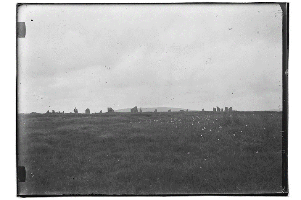
Within the digitised Stanley Opie collection of photographs at Penzance’s Morrab Library, three images bear the title “Unidentified stone circle. Possibly on Bodmin Moor.” These photos initially evoke the essence of a typical Bodmin Moor circle akin to the Stripple Stones, nestled in expansive moorland with panoramic vistas.
Stanley Opie, an archaeologist with a penchant for capturing historic sites and archaeological excavations in Cornwall, was born in Barncoose, Redruth, in 1884. Armed with an Ensign Cameo No. 2 camera and Imperial Eclipse plates, he documented these sites from 1930 to 1950. The Morrab Library in Penzance now houses its comprehensive collection, which has been meticulously digitized and is accessible online and through authorized visits. Throughout his career, Opie photographed numerous locations in Cornwall and beyond, presenting a formidable challenge in identifying the locales depicted in his images.
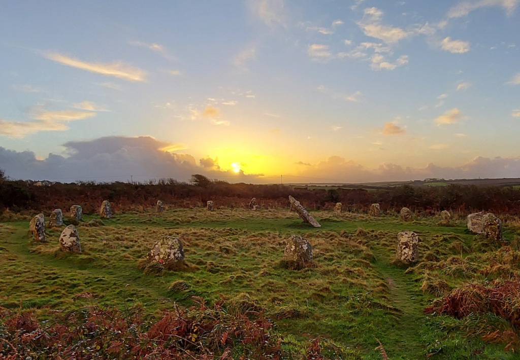
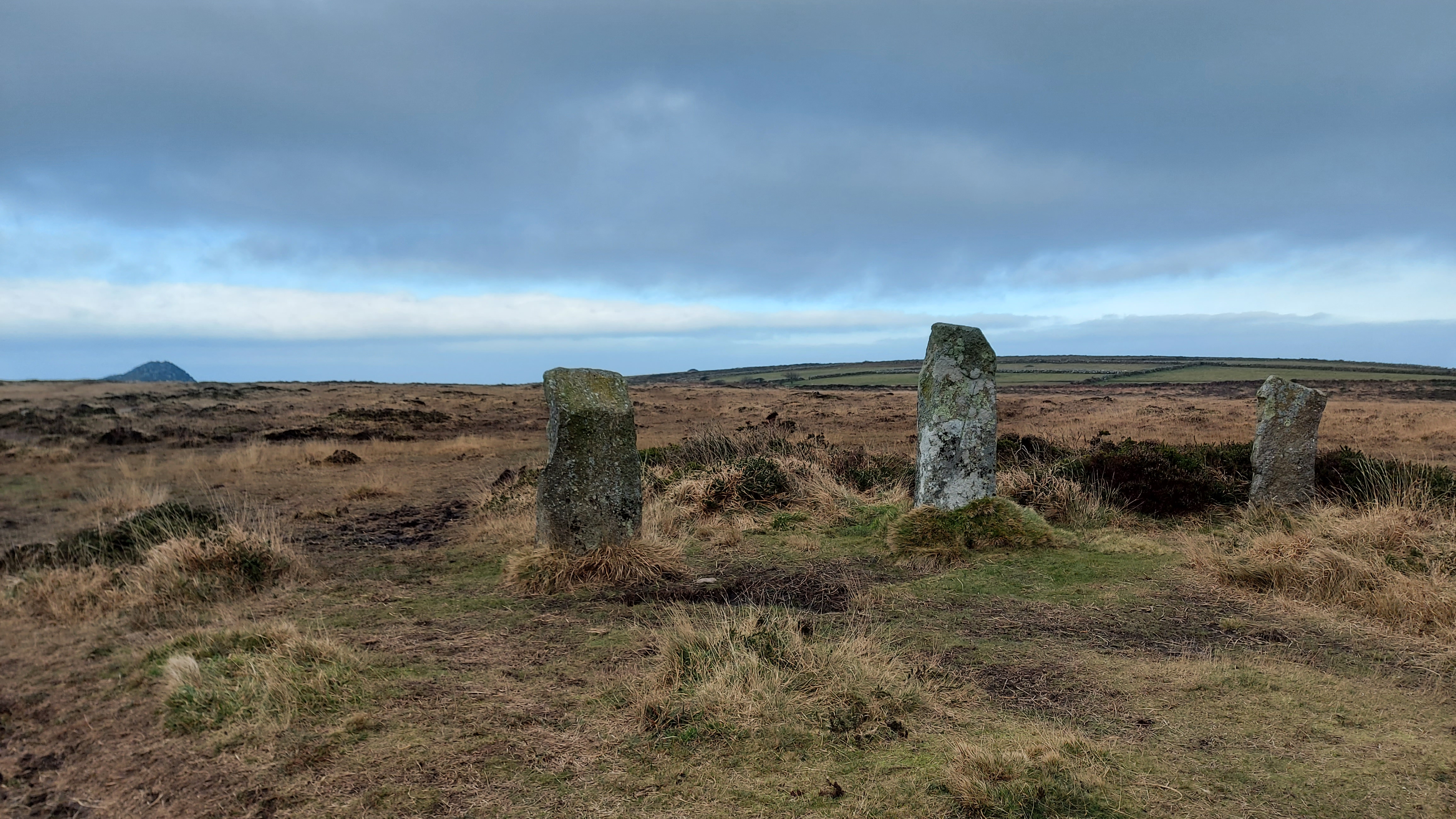
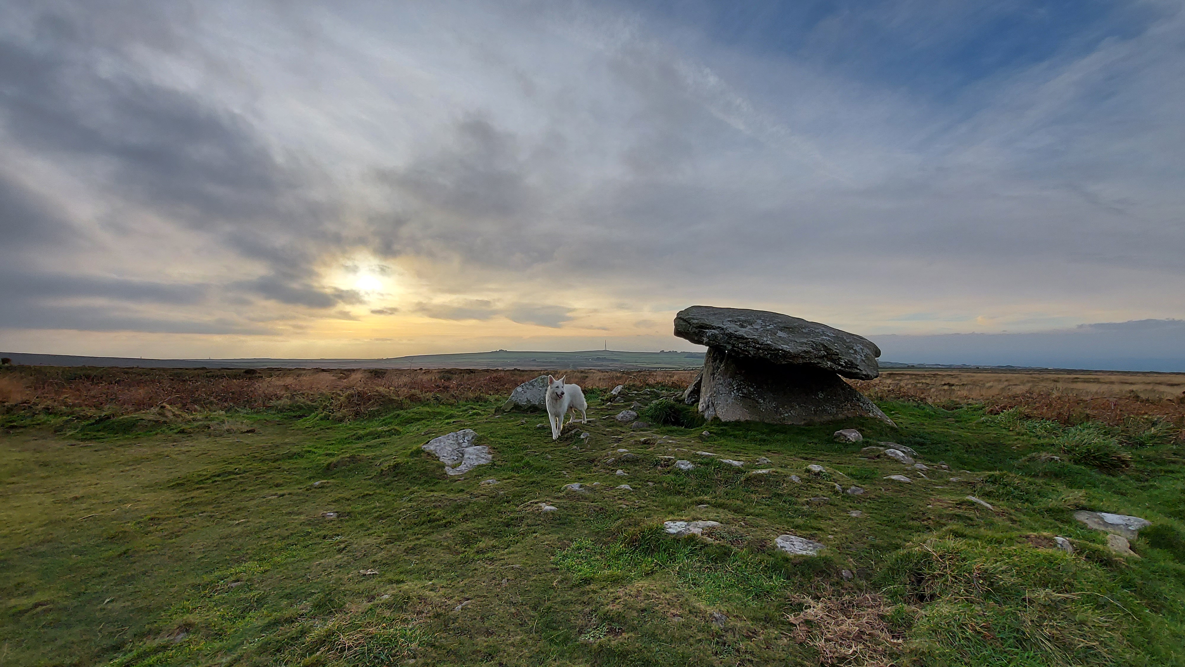
Closer scrutiny of the three images confirms their association with the Goodaver stone circle on Bodmin Moor. This revelation may surprise observers, as a contemporary visit to the site reveals a markedly different landscape. Presently surrounded by trees from a local plantation, the circle’s original context is obscured. However, this wooded enclosure provides a tantalizing glimpse into the potential positioning of the circle and its conceivable sightlines. Such insights allow us to speculate about astronomical alignments that may have held significance for the circle’s original builders.
In the current era, the entire site is enveloped by trees, except for a western view that descends to the farm and riverbed below. An opportunity arose to capture the site before aligning Opie’s photos with the landscape features, offering a unique perspective on the possible sightlines that the original builders may have considered when siting their circle, unobstructed by the present-day vegetation.

The Rabbit stone helped orientate the circle in the photos (to the left of the image
It helped that there were several unusually shaped stones. One in particular got named the rabbit stone after having a similar profile of the Lindt rabbit, it can be seen on the left of this image. (I should say at this stage that the circle was heavily restored in 1906 and some of the stones are thought to have been replaced incorrectly, even upside down).
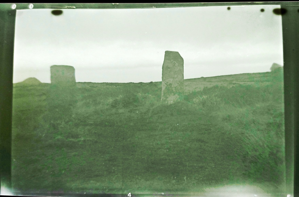
Opie Photograph no 1
This image took a bit of matching. The two central blocky-looking stones and the rabbit-shaped stone on the right of the image helped orientate it. In my image below the rabbit, the stone is also to the right and slightly obscured by the rocks in front of it.
The rise in the ground beyond the circle is Brown Gelly, which is towards the southwest. This Tor is obscured by the trees on the left of the more recent image. The area has several interesting ancient sites on it including some Cairns on the top, which can be seen on the ridgeline of the image. There can be no solar or lunar alignment with these local cairns as they are too far to the south when standing within the circle.
Stanley Opie, “Unidentified stone circle. Possibly on Bodmin Moor,” Morrab Library Photographic Archive, accessed January 4, 2022, http://photoarchive.morrablibrary.org.uk/items/show/6371

Image 1 match
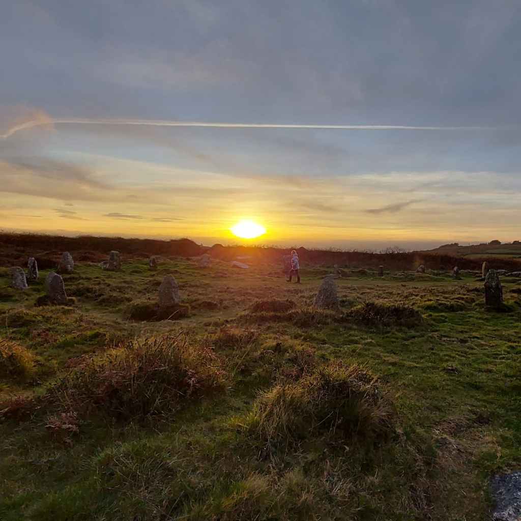
Opie Photograph number 2
This second image gives a more expansive view looking out from the circle to several ridgeways and hills beyond.
Looking at the stones in the image, the tall pointy stone and gap next to the man at the front of the circle helped orientate the image, as did the rabbit-shaped stone behind him. The image looks from the south of the circle facing north.
The hill towards the centre-left of the image is Leskernick, Bronn Wennili (Brown Willy) may be visible to the left of the image. This is exciting as it means that standing in the circle you could have seen the summer solstice sunset over the distant hill. This is an extension of the line which starts at the newly discovered menhir on the ridge above the Hurlers Circle, extends through Craddock Moor Circle and the avenue at Craddock Moor, and onwards to Goodaver Circle. Making it possible to see the same summer solstice sunset at important prehistoric locations across the moor.
Continuing to the centre-right of the image is the local plantation ridge. Fox Tor which is relatively local to the circle would have been to the right of the image.
The pointed stone that the man is standing beside in the Opie image is front left in the recent one. My image is orientated slightly differently from the old image. It would have been pointing directly down the field to the right of the modern image. Looking down the neighbouring field in recent times there is no possibility of seeing what hills lay beyond.

Stanley Opie, “Unidentified stone circle. Possibly on Bodmin Moor,” Morrab Library Photographic Archive, accessed January 4, 2022, http://photoarchive.morrablibrary.org.uk/items/show/6370

Image 2 Match
Opie Photograph no 3
The Opie photo shows stones in profile against the sky above with no plantation beyond, the rabbit-shaped stone is in the front row of the circle on the central left. Matching it to my photos of the circle, it has been taken from the northwestern side of the circle down the ridge a little way. Kilmar Tor would have been visible if the photo had been taken with slightly increased elevation. This Tor is directly east from the circle and in the position of the rising sun at the equinox (midpoint between the solstices). The modern photo has been taken from higher up the hill and the craggy tops of Kilmar Tor can still be seen through the gaps made by the less dense boundary of trees.

Stanley Opie, “Unidentified stone circle. Possibly on Bodmin Moor,” Morrab Library Photographic Archive, accessed January 4, 2022, http://photoarchive.morrablibrary.org.uk/items/show/6372

Image 3 Match
A plan of the matched direction of the photographs taken by Opie numbered 1-3
From matching the photographs old to modern I was able to make a plan of the directions which the Opie images were taken: The plan below is as follows:
R = Rabbit stone
L = taller long stone

Credit: Annotated Google Maps image
Finally, I should add that within the Opie photographs, none were taken in the direction of Hawks Tor in the west. This has been identified by Cheryl Straffon and John Barnett as an equinox setting position when standing in the circle. When visiting the circle in more recent times the Tor can still be seen in the gap made by the plantation to the west and is the one remaining solar alignment that could be viewed in action. Maybe one day the larger plantation trees will be replaced with smaller saplings and make the other viewpoints possible.
Access to the Stanley Opie collection and all the other wonderful historic digitalised images that the library has can be made here:
By Carolyn Kennett
First published in Meyn Mamvro 95 (Spring/Summer 2018) and still can be read in the collected works Watching the Sun Booklet by Meyn Mamvro and Mayes Creative (2021)

Boscawen-ûn summer solstice sunset (Credit Carolyn Kennett)
During the last few years, in many ways, Boscawen-ûn became a second home to me. While waiting for sunrises and sunsets I observed the change in the seasons at the circle, all accompanied by the changing looks, sounds and smells. But one thing remained the same and that was the tranquillity of the site. I kept some strange hours, as I was mainly there for sunrises or sunsets and quite often at night. More often than not I was alone in the circle, sometimes for hours on end. One of these visits, in particular, comes to the forefront of my mind. Having risen when it was still dark, I drove to the circle with the beginnings of dawn, hoping the low developing horizontal cloud would clear. I arrived in time for the sunrise of the 25th June 2016. The week had been wet and the solstice had passed behind a thick blanket of cloud. I stood atop Creeg Tol willing the low bank of clouds to blow out of the way, even though I knew I was nearly a week late to see the summer solstice sunrise. The vantage point of Creeg Tol meant that I would see the Sun peer above the horizon, something that I could not replicate in person in the circle below due to the large hedge obscuring this direction. The dawn had a stillness about it which makes it one of my favourite times of the day. The clouds were starting to disperse and right on schedule, the Sun started to peer above the horizon, accompanied by the mixed dawn chorus of birds, roosters and cattle. I photographed the sunrise from my vantage point at Creeg Tol and set off down the hill towards the circle. About halfway down into the hill I started to lose the sunrise, the Sun was setting behind the hill it had just risen from. By the time I reached the circle the Sun was once again well below the horizon. I realised that without the hedgerow I could witness the Sun rising twice, in effect a double sunrise. Once from atop Creeg Tol and then again from inside the circle. I hoped this would work in reverse: with the Sun setting visually from the circle and once again from Creeg Tol. It was an idea I would test out repeatedly over the summer months with great success. I think this double sunset and sunrise during the summer months is one of the most visually beautiful aspects of the circle. A local settlement Goldherring, which has some Bronze Age round huts is north of the site and people could have accessed the circle from the direction of Creeg Tol. Double sunsets and double sunrises are something that we can all witness from the site and this is only the beginning of what makes Boscawen-ûn astronomically special.
It is important to consider Boscawen-ûn in the landscape as holistically as possible. During this project, I wanted to consider the way the circle sat at the base of the northern hill, in what would have been a marshy area and quite possibly difficult to get access to, particularly at wet times. Why had it been positioned here? What would have been seen in the sky? It was equally important to view the site as a part of a changing landscape, where man has shaped and changed the site itself over a large period of time as well as the surrounding landscape. I am a great believer in looking what archaeoastronomy ideas have been historically suggested about a site. These historic ideas brought another list of questions such as: Is there any truth in a Lunar link at Boscawen-ûn? Does the carving on the back of the central stone light up at summer solstice? These were just the start of a list of burning questions that would keep me returning to the site, making measurements, and calculating positions of celestial objects over the coming year. Hopefully enabling me to answer if the site was built with astronomy in mind.
I started by considering if there were any alignments between the circle and features on the horizon. This meant that I needed to map out all the natural and man-made features which would have been found from the period of the stone circle. This was in itself quite a task. The internet was a wealth of information, but local knowledge from people such as Cheryl was a great help to me. Many local sites such as barrows and menhirs had disappeared and I needed to try to reconstruct where they were as accurate as possible in relation to the circle. My final list identified 48 local features or as I would name them, targets. These targets would then be considered against a number of pre-selected celestial events. If all 48 targets were considered against the chosen celestial events, statistically a match would be highly likely. For instance, if we were to consider the targets located around the site in a circle of 360 degrees. If each target considered covered 1 degree with an error of +/- 0.5 degrees a total of 96 degrees or just over a quarter of our circle would be covered in targets. (The error from this project was set as 1.04 degrees this came from a small amount of measurement error as well as error for refraction, extinction, and parallax). Statistically, this would mean that it would be far more likely for a target to make a match with a considered event. Therefore to make the project more robust I needed to reduce the number of targets. I decided first of all to consider targets that were visible from the site and only targets that sat proud against the horizon. The reduction in targets could have been undertaken in a number of ways but I felt that this made the most robust format for retesting any results. This left me with just 7 remaining targets out of the original 48 to match with my events. These were as follows:
The Lamorna Gap – yes it is just visible from the site through the hedgerows. A smaller sea gap further south to the Lamorna gap, Creeg Tol. A barrow just west of Creeg Tol, Chapel Carn Brea, Boscawen-ûn Field Menhir and finally Bunkers Hill Menhir (East). Once the targets were identified I made on-site measurements of their azimuth and altitude and this was converted into an astronomical declination. Alongside the on-site measurements, I ran a computer program called HORIZON. This also gave me declinations for my 7 targets and it acted as a test of accuracy for the on-site measurement, as well as allowing for reconstruction of the horizon behind the hidden, hedgerow covered NE direction.

Boscawen-ûn Field Menhir, with possible fallen menhir in hedge behind (Credit Cheryl Straffon)
Next, I considered which astronomical events I would examine alongside the targets. I decided to look initially at five events in total. These five events would give 14 positions along the horizon: 7 rising positions and 7 setting positions. These were the extremes of the solar calendar or the solstices, as well as the solar equinox positions. I also considered the lunar standstill positions both for lunar major and lunar minor. I then calculated the declinations of these 14 events for a date of 2500BCE. The horizon position of a solstice Sun and the lunar positions in 2500BCE has moved slightly compared to its current position, whereas the equinox would be in virtually the same place. So a rising solstice Sun would have a declination of 23.9 degrees in 2500BCE whereas it would have a declination of 23.4 degrees currently which is on a flat horizon at the latitude of Boscawen-ûn equates to an azimuth difference of 1.02 degrees.
When all this was considered I could look for matches between my 14 events and 7 targets. I could see immediately that 4 of my 7 targets declinations matched with one of the fourteen identified events, within the limits of the error I had set. The first and probably most primary of these is that an observer in the circle at 2500BCE would see the winter solstice sunrise rising from the Lamorna Gap. The Lamorna Gap at present is obscured by hedgerows, but without this vegetation would have been a subtle sea view at best. The Lamorna gap declination was measured as -23.6 +/-1.04 degrees, matching a winter solstice sunrise of 23.9 degrees. Also, you must consider that the sea view extends for more than 1 degree along the horizon and that this event could be observable over the coming millennia.
This first alignment extends through the circle to my second alignment. This is to a barrow which is no longer visible, it was located to the west of Creeg Tol. It would be in the position of the summer solstice sunset when observed from the circle. It had a measured declination of 24.3 +/- 1.04 degrees coinciding with the declination of 24.9 degrees. Equally an observer at the barrow would have been in a position to observe the winter solstice sunrise out of the Lamorna Gap. Its position just above the circle would give an observer a more advantageous height and a more pronounced view of the winter solstice sunrise from the Lamorna Gap. It is interesting to note that the winter solstice sunset at this time would just fall into the large sea gap at the Tregeseal stone circles. Although at Tregeseal the sea gap is far more pronounced, there is possible that there is a connection between the two sites on this date.
The other two matched alignments came between the circle and lunar major standstill positions. I found that the position of Creeg Tol matched the lunar major sunset northernmost position, it had a measured declination of 28.3+/-1.04 degrees coinciding with an event declination of 28.9 degrees. The nearby Boscawen-ûn Field menhir was the final alignment and it was in the lunar major sunrise position. This had a measured declination of 28.9+/1.04-degrees which coincided with the event declination of 28.15 degrees in 2500BCE. The position of the Field menhir was slightly to the west of calculated declination for the lunar alignment, but it is conceivable that another stone now recumbent in the hedge made a pair and this pair once framed the rising Moon at the extreme of the lunar major cycle. Although we should note here that it may not have necessarily been a full Moon at that time, as the Moon at its standstill declination can be at a number of positions within in its phase cycle.
Lunar standstill links are not well documented in Cornwall. They are considered a feature of recumbent stone circles in East Scotland but have also been found in western Ireland and more recently in western Scotland. The discovery of two lunar standstill points at Boscawen-ûn is both interesting and intriguing; raising more questions than it answers. Boscawen-ûn does have myths surrounding it which are linked to the lunar cycle, so this could be a feature of this site. Future work in west Penwith will consider evidence for lunar links. For instance, the Merry Maidens which I had discounted through my reduction of data, as it did not stand proud against the horizon is in the Lunar Major Standstill Southern rising position from Boscawen-ûn with a declination of 29.9 degrees. This concludes the main horizon findings but as I said I also looked at other features within the circle.

Boscawen-ûn hedge menhir (Credit Carolyn Kennett)
The positioning of the quartz stone to the SW of the circle could signify the start or end of the winter season, but due to its localised vicinity to an observer, it could never pinpoint an actual date, without another position to line it up. The stone on the opposite side could have well been used to align the position but this does not line up with anything calendrically significant. The quartz stone does though align with the cist (located in the NE of the circle) and the out of sight Boscawen-ûn Hedge menhir. The summer solstice sunrise would have occurred along this alignment around 2500BCE. This alignment was first suggested by Norman Lockyer in his consideration of the circle. There is another stone between the Hedge menhir and the stone circle, this would possibly bring inter-visibility between the circle and the Boscawen-ûn Hedge menhir. Even so, there are numerous examples of standing stones being just over brows of ridges that form alignments so this could be a viable consideration when looking at this alignment.

The edge of the foot at the bottom of the central stone is illuminated (Credit Carolyn Kennett)
Rock art carving (or either foot or axes) have been identified on the central stone. I was able to calculate the amount of time the art would be illuminated for in the year 2500BCE. The art on the back of the central stone is only fully illuminated in and around summer solstice sunrise. Without any vegetation, a full illumination would occur for 30 days on either side of the solstice. The maximum time in minutes that the art would be illuminated would occur on the summer solstice. This amount of time would reduce each day until a full illumination could not happen 31 days later. It must be noted that this measurement takes into account a completely flat landscape. Any vegetation would significantly reduce the length of time and amount of days the art would be fully illuminated. Partial illumination of the art also occurs and this time it happens both in the morning and the evening in and around the summer solstice, this partial illumination would occur over a much longer period.
There are many more suggestions that could be made particularly linking stellar events to the site. Without more accurate dating these suggestions must be taken under advisement. For instance, the Pleiades would set over Chapel Carn Brea in 1500BCE but at an earlier date of 1800BCE, it would have set to the south of the framed hill. I did consider if the central stone could have pointed at a star. The only bright star that it could have pointed at was Arcturus and this would have been at a remarkably early date of 3820BCE. This must be taken under advisement, as the stone could have moved over time. Overall the suggestions of stellar alignments without accurate dating are always difficult to suggest. It does seem that a number of astronomical features were considered by the builders of Boscawen-ûn. They certainly had an eye for the solar calendar within the design but perhaps more unusually a knowledge of the lunar cycle. This project, for me, has raised more questions than it answered and I will be continuing it by looking for further examples of lunar alignments within Cornwall and trying to draw more conclusions about the astronomical features at some of the other Cornish circle sites.
More of this story can be read about in my book Celestial Stone Circles of West Cornwall. Which can be accessed here
Winter Solstice is the day we mark the longest hours of darkness and the movement towards the lengthening of daylight hours once more. For many it is a powerful time in their calendar, a day to mark the start of a new year, to reflect on what they can leave behind and look forward to the time ahead. There are a number of ancient sites within Cornwall that have links to the Solstice and many of these suggest a relationship that our ancestors had with this moment within their in their lives. Connectivity that we feel resonating through the ages and is particularly heightened at times such as this one.
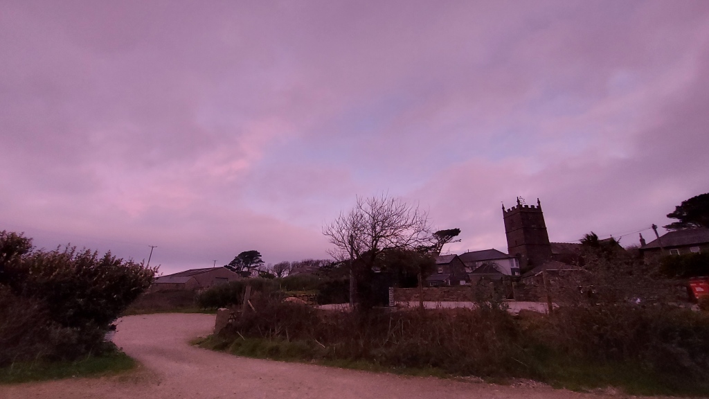
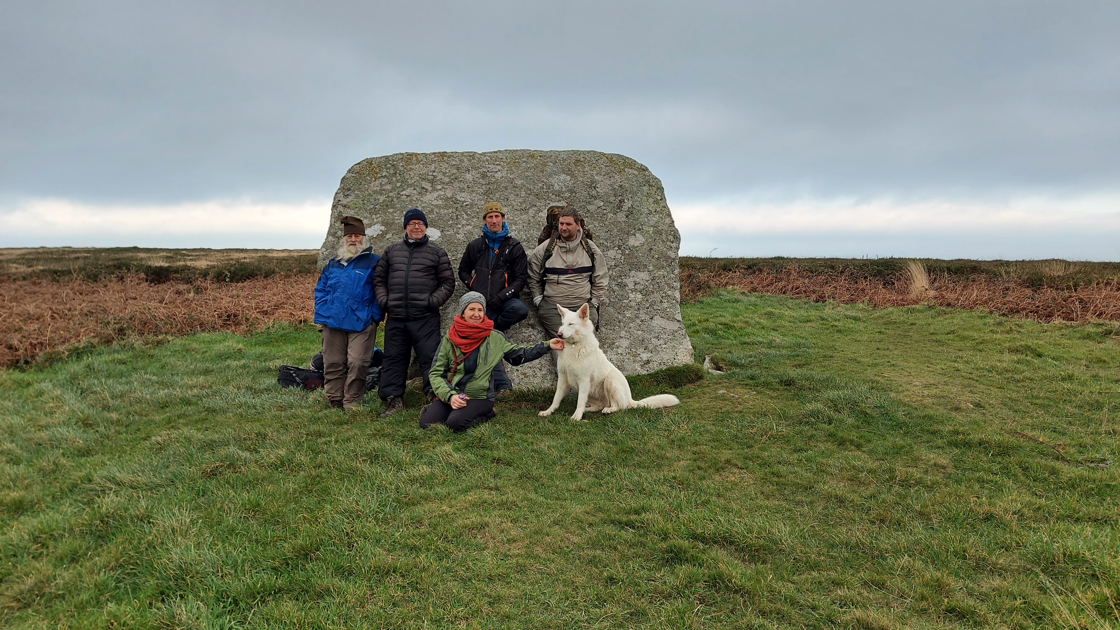
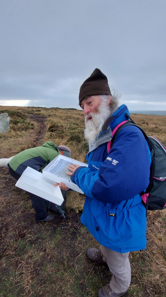
This year a small group of us decided to join the ancient pathway the Tinners Way to the north of Zennor and walk to the Tregeseal stone circle. A walk which we would start in the half-light before sunrise and end after we had watched the sunset at the stone circle. Anyone who knows me will hear me talk about my love of the wider Tregeseal landscape and how I believe it lends itself to a winter solstice gathering; where people can watch the sunset over the distant Isles of Scilly. The whole of Penwith is rich with prehistory, and a large number of the sites are along the Tinners Way and the direction of travel we would be moving in would take us towards the southwest and the setting sun. An imaginary line could be drawn through the monuments we were to visit and a number of them, if you had stopped there, would have the setting winter sun at another monument further along our journey, making a long winter solstice line of running down the spine of Penwith hills and part of this journey for me is to see how far people could process through the landscape, on the shortest day of the year, with a final destination in mind.
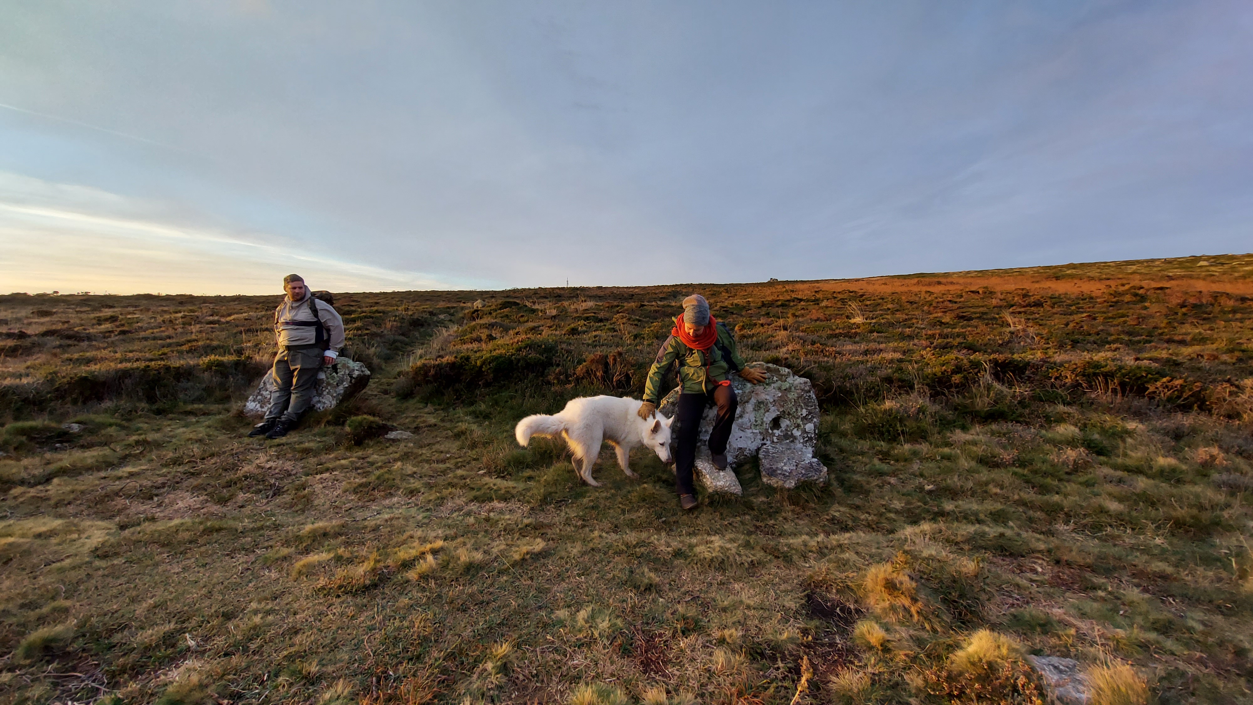
I am very interested in the ideas around processional journeys and movement through the landscape, particularly ones which would connect people to the ideas of cosmologies and be started in the time of dawn and end after sundown. I hoped the small group who joined me that day were also in the same mind. This was also a time for us to take a moment out of the daily grind and reflect on what we wanted to leave behind and how we would move forward, with mindfulness, into the next year of our lives. Walking has become a really important part of my life and during the last two years of upheaval and turmoil, I have come to appreciate the quiet and reflective time I can enjoy when out in the landscape, but it is always wonderful to be joined on an adventure especially a journey of such length, which would require both fortitude and endurance.
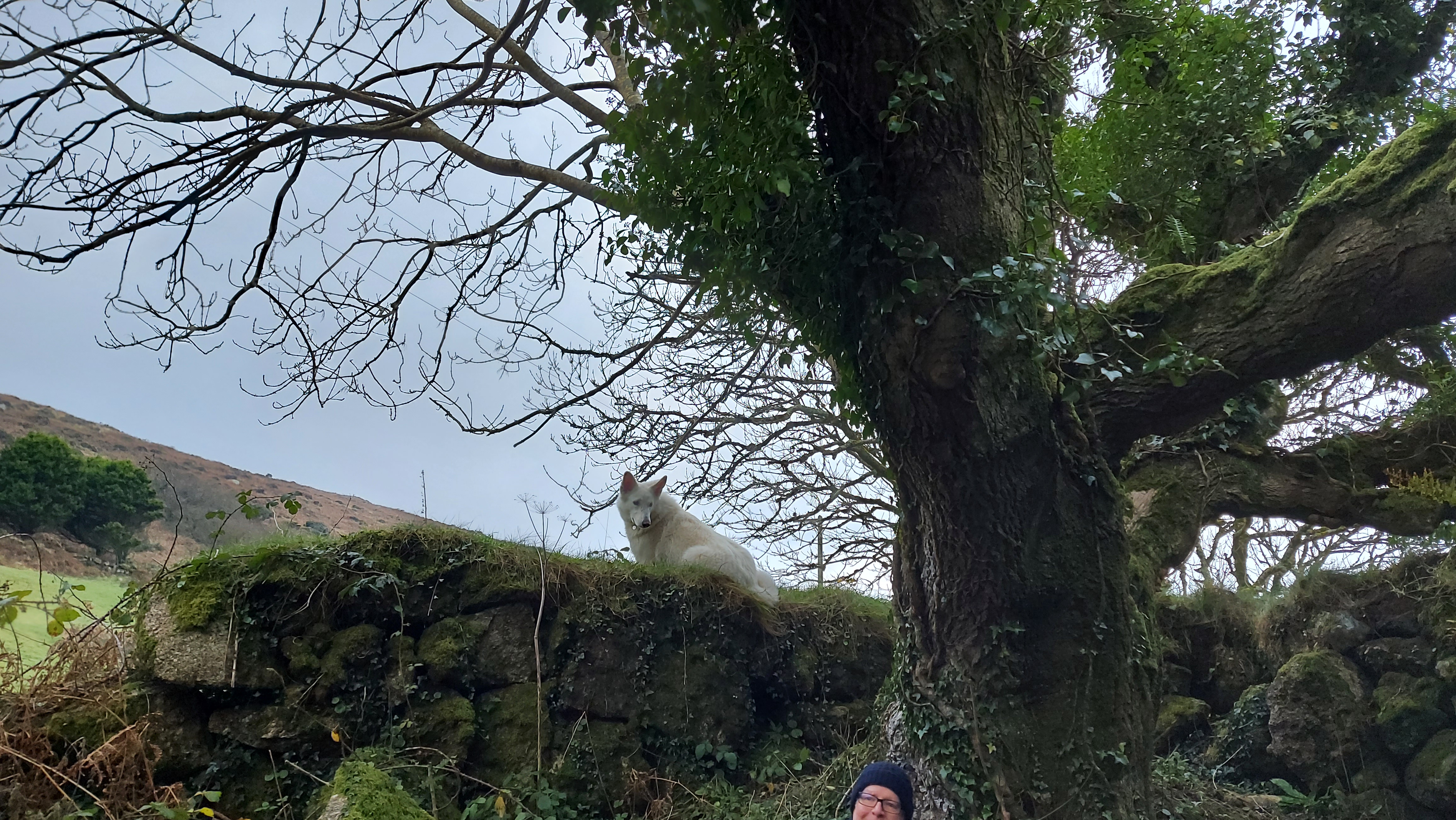
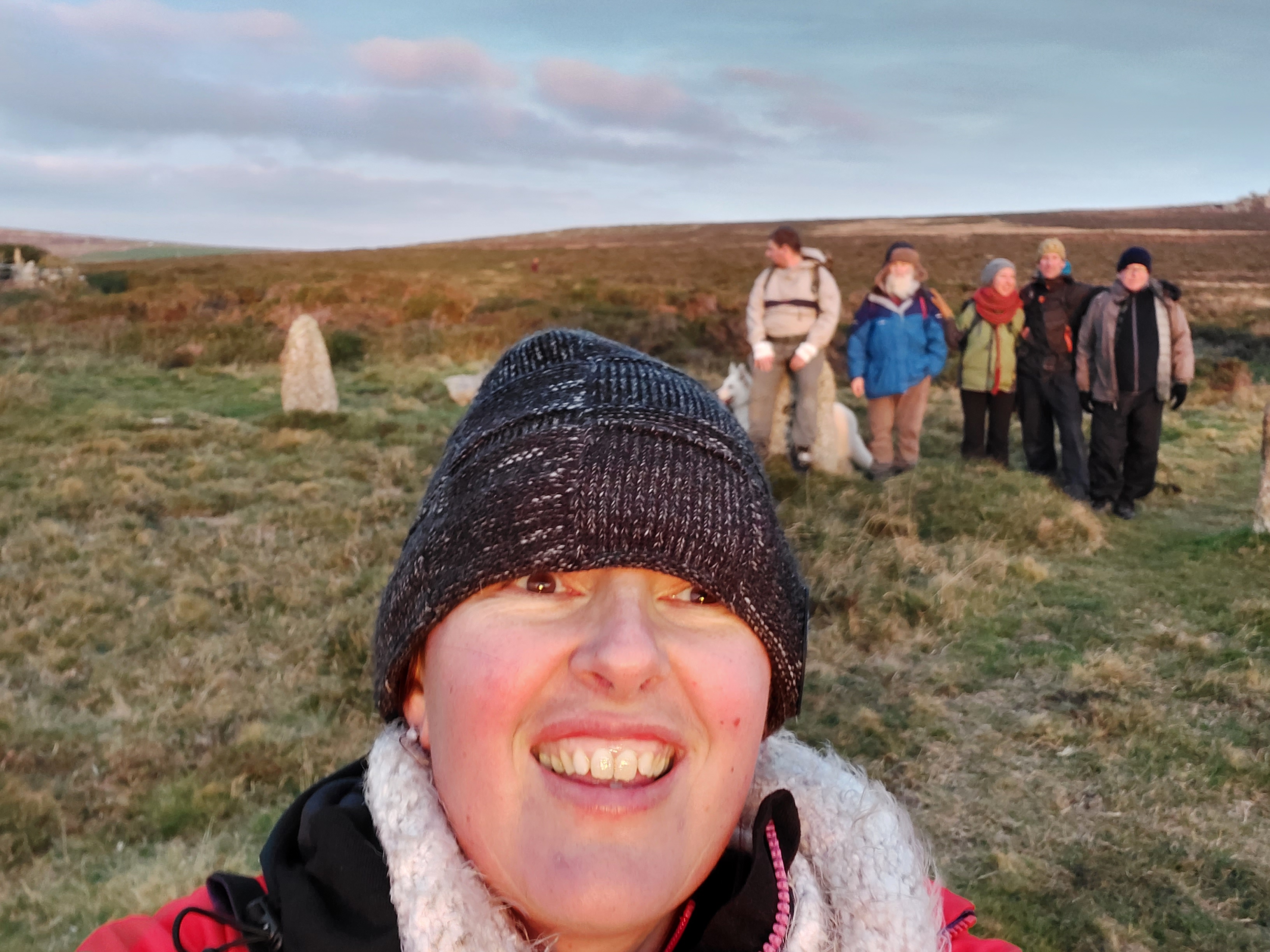
We met in Zennor just before dawn and the sky was in the main overcast, the clouds pink with the nearing sunrise. The Moon, which had been full two days prior, was still in the sky in the northwest, bringing an added element of light. Starting our journey we travelled up Rosevale valley, stopping to gather our thoughts for the day in the old and ruined miners cottage by the riverbed. It was commented on how we were a group of seven, six humans and a white wolf and in that moment of time it all felt a little otherworldly, like the start of a plagiarised fantasy tale., we all laughed at the sentiment and with the sunrise, we started on our way. Mulfra Quoit was a couple of miles away and we had to initially join the Tinners way, reaching it at the roadside near where the once impressive Tol Creeg passage grave had been destroyed and then removed in the 1960s. looking behind us we could see Zennor Quoit standing proud on the ridgeway and we got out first view of the southern coastline looking down the valley to the bay and St Michaels Mount.
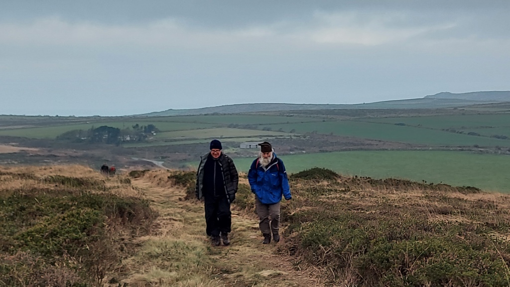
The first hill of the day was in front, with Mulfa standing prominent on the top. We had settled into a nice pace at this point and think we were all excited about reaching our first ancient site of the day, one of many more to come. We had dropped into a rhythm of walking in pairs with the white wolf running back and forth between us covering triple the distance we were.
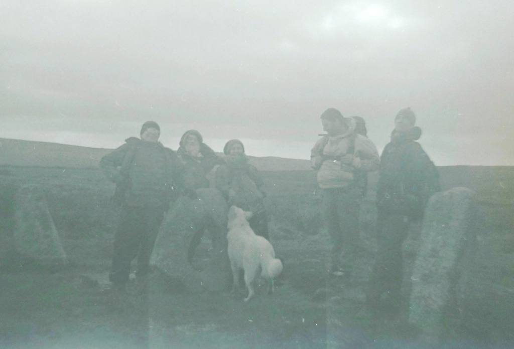
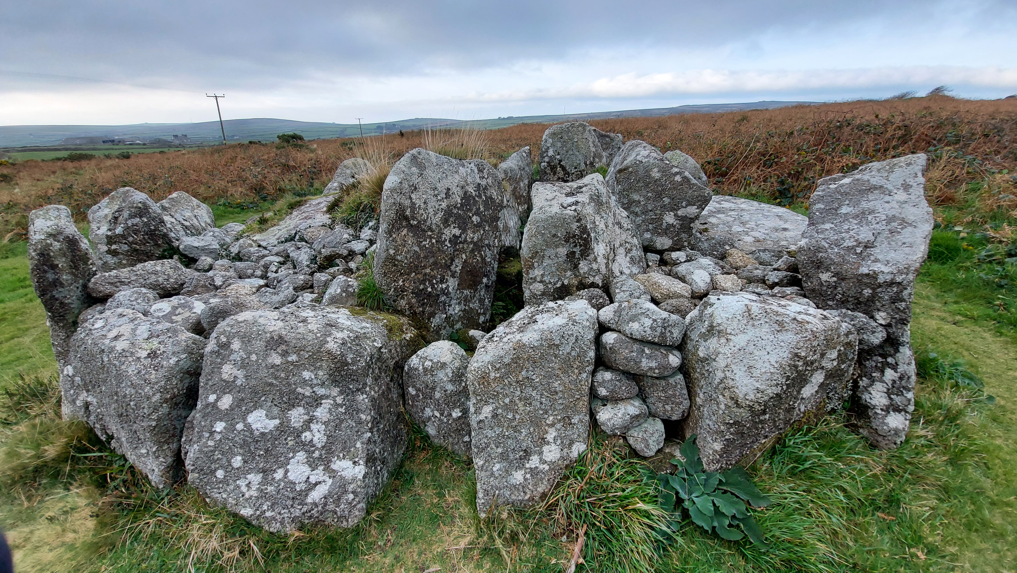
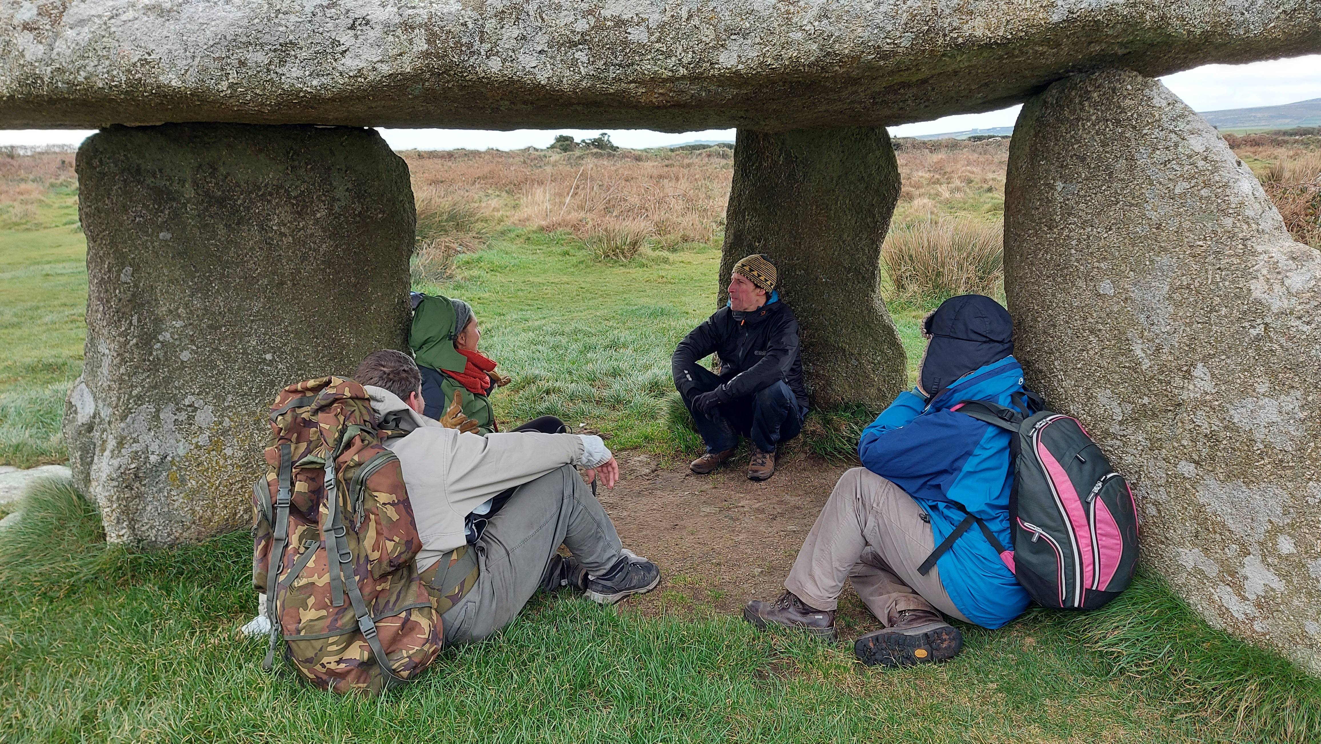
Mulfra was an opportunity to take a morning break. We huddled inside the quoit listening to the wind rip around outside. We marked the occasion with songs, poems and blessings while thinking about the journey ahead. We had a decision to make, would we continue along the Tinners or drop through Bodrifty courtyard house village and head towards Ding Dong mine, which would enable us to walk the processional route past Nine Maidens, we chose the latter. Walking down the hill to Bodrifty courtyard house village proved interesting, the white wolf, who often chose to be in front, stopped short and started to howl, spooked by something we could not see, but it nevertheless brought us all up short with notions of ancestors, meaning and what the animal could sense that we couldn’t. I must admit I really like Bodrifty, I often spend time here in the summer and as ancient sites go, I always find it peaceful, and have never had a sense of anything foreboding at the site, neither had anyone else when we discussed it, but its amazing how common ancient sites invoke feelings that we cannot explain, that connectivity with the past runs deep through us all and visiting some sites can have profound effects on peoples emotions and sense of being. With some convincing, the animal seemed to move beyond what had been bothering it and started to visit the ruined huts alongside us all. As we explored the sun started to send shafts of light onto the southern coastline and even at the distance we were from it, we could see part of the ocean shining golden. A promise of what was to come and a brightening of the skies ahead.
On reaching the path to Ding Dong we swung our journey to face to the north and started to walk the pathway to Nine Maidens on the top of Boskednan moor. Taking a moment to stop at the barrow we faced the impressive rocky outcrop of Carn Galva and took a moment to reflect on the people past doing the same of what we were about to today. This ridgeway is lined with barrows on both sides and by moving along it towards Carn Galver you really are walking in the footsteps of the many who have come before. I thought about the people who had built the monuments, those that had excavated them in the Victorian people (bless William Copeland Borlase and his dodgy excavation techniques :)) and the people who still come here today. The circle itself was a natural place to stop and talk about the Moon. If you are able to return here in 2025, the standstill year, you will see the moon set over Carn Galva. I would recommend heading to see the bright winter full Moon which will set over the rocky outcrop. This is a possible reason for them positioning the stone circle as they did. From here we could see the hills which we would be approaching later in our walk, those of Chûn and Kenidjack. We could also see the marker Boswen’s Menhir, which has been positioned in the winter solstice sunset position from the circle.
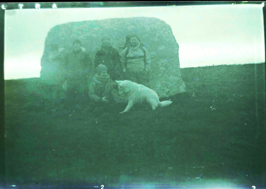
This seemed like a good spot for a break for lunch, the ridgeway is exposed we headed for the ring cairn and its large triangular stone., where we chatted and watched the sun emerge from behind the clouds for the first time that day.
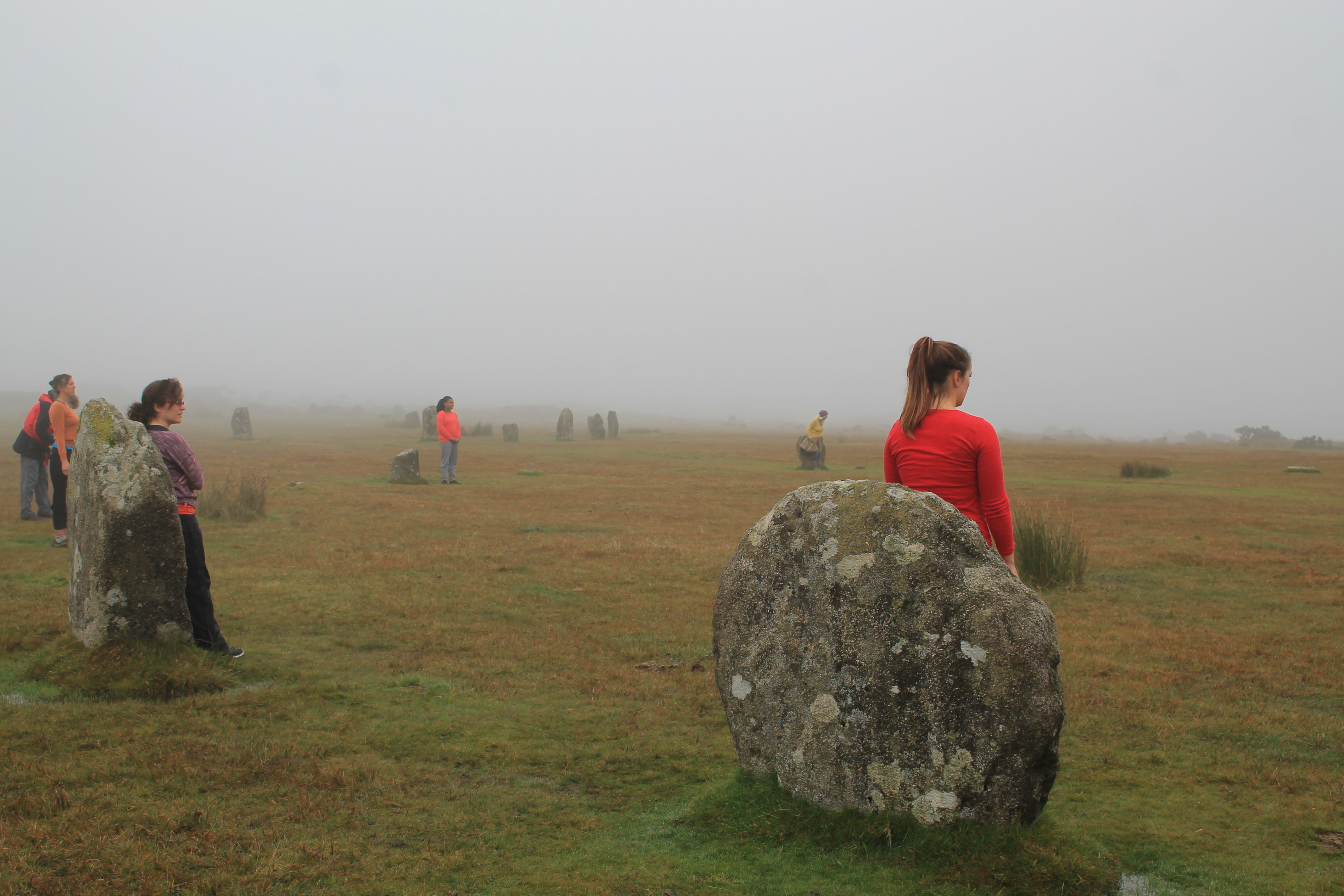
Rested up we headed down the hill to Mên Scryfa, an inscribed stone which was recommissioned in the early medieval period, originally, most likely, being a much earlier menhir. the inscription reads Royal Raven and could mark the resting place of Bran, Welsh King who had been hiding out at Caer Bran before being attacked and chased to his death at this spot. I like to think there is treasure underneath but maybe treasure from the Bronze Age, a Trevisker Style Urn with cremated remains in, rather than a king from the dark ages. The Mên-an-Tol was one of the first times we met people, others out marking the solstice day, a number of us took the opportunity to wiggle through the holed stone, the lack of water at its base made it a more present prospect than usual.
Once more we had a decision. we could head towards Chûn from here, but as we had time we decided to zigzag and include Bosiliack and Lanyon on our journey and I am so pleased we made that choice. A number of the group had never been to Bosiliack Scillonian style passage grave before and the adjoining Bronze Age village. This is such an impressive monument, perhaps even more so since it wasn’t known about until the 1980s when a gorse fire uncovered it from the undergrowth. The excavation revealed so much about the tomb, and it contained cremated remains from the Bronze Age, along with a much later dated skeleton. The tomb felt important to me to visit on this day, as it is orientated towards the sunrise at this time, and I have photographed it myself in a previous year. I doubt anyone would have been able to watch from inside, but it shows how as a community that wanted to mark this day and maybe bring light to their own ancestors who were buried within the tomb.
It had been a long time since I had approached Lanyon Quoit from this direction and although viewed from nearly everywhere else it sits within the landscape, this is one direction where it stands proud on the horizon, impressively towering up above everything around it. This quoit is interesting in that it was rebuilt after falling over and is not necessarily how the original designers, back in the neolithic imagined it.
From here we started to see the sun break through the clouds with more regularity, it was arching low in the sky and we realised that although we had a fair way to travel, the sun was well past the mid part of the day, time for us all to move on again.
The next stretch was longer again and we approached Chûn Castle from the farm in the dip. The wind was howling and we didn’t hang around too long in the Iron Age hill fort before we headed down the hillside to the neolithic quoit of Chûn. Unlike Lanyon this quoit is in fantastic condition, which says a lot about our ancestors. The people who came millennia later in the Iron Age and built the hill fort must have held some beliefs about the monument, as they left it intact on the hillside and did not rob the stone from their grand hilltop fortress. The quoit’s capstone is heavily decorated with cup marks and there is still room to wiggle inside, which is fun. Standing here for sunset you would see the sun dip behind Carn Kenidjack and a number of people were already making their way up the hillside, in the opposite direction to us watch the sunset from this location as we headed down the hillside to Tregeseal.
I had wondered if our small group were rocked out!! But they were still keen to see as much as we could and we stopped at Portherras cist and after much chatter all day we decided we would walk the next section to the inscribed stone in quiet, giving us a time to reflect on the journey we had made already and the time ahead at the stone circle. As we walked in the direction the sun was already dropping fast and low in the sky. This was a moment I think we will all cherish from the walk, as a group we can often lose the quiet purpose behind our decision to make the journey.
The inscribed stone was very apt, most likely a Christianised menhir this stones inscription reads TAETVERA. This is Latinised 7th century Cornish: Taithuere, or “exalter of the journey”. I have read that St Just himself could be buried here, once more I like to think that if anyone was then it is most likely an urn of Bronze Age cremated remains underneath the cairn at its base.
As we reached the holed stones it was incredible to see the low golden sunlight come along the row of stones, making shadows along the line of them. I love these holed stones and feel they have a really important role to play on the wider Tregeseal landscape, I reflected how long it must have taken for people to have made the holes and how they could have been used to mark the days, through the shadows and beams of light shining through the holes, possibly at this time of year. As we sat watching the sun from this location I checked my watch and the sun passed the actual moment of solstice. The time when the sun is directly above the Tropic of Capricorn. The sunset was also fast approaching and we needed to move to the circle below to watch it.
Tregeseal is such a special landscape to watch the winter solstice sunset from. A lot has changed since the circle was built. Originally another circle stood next to this one, and the huge hedge to the south was not put in place until the mid 20th century. Nevertheless, you can get a small sense of what it was like for people who made the journey to this site to watch the sunset on the solstice. There is a small glimpse of the sea, and on this sea gap on a clear day you can see the distant Isles of Scilly and it is on these islands that the sun will set. Suggesting connectivity which we can see reflected in shared monuments and material goods between the islands and mainland. At this moment more people came to add to our group and we celebrated the closing of one chapter and moved into the next with the setting of the sun on the shortest day of the year.
With weary legs and tired feet we had one more hill to climb back to our transport, we made this in the gloom of dusk; the night was fast approaching and by the time we reached the end, reflected sunlight could be seen on Venus and Jupiter. A reminder that sunlight was ever-present even in the darkest of times
I want to thank everyone who joined me on this walk and I am so pleased the weather was much improved to last years, Lanomrna Gap to Tregeseal.
We will be back next year with another walk, so if you are mad enough to want to join a hardy but fun bunch of people on a full day winter solstice walk let me know.
Places visited
Mulfra Quoit, Bodrifty courtyard house village, Nine Maidens stone circle, Nine Maidens barrows, Ring Cairn, Mên Scryfa, Mên-an-tol, Bosiliack passage grave, Bosiliack bronze age village, Lanyon Quoit, Chûn Castle, Chûn Quoit, Portharras barrow cist, Inscribed Menhir, Kenidjack Stone row, Tregeseal barrows, Tregeseal stone circle
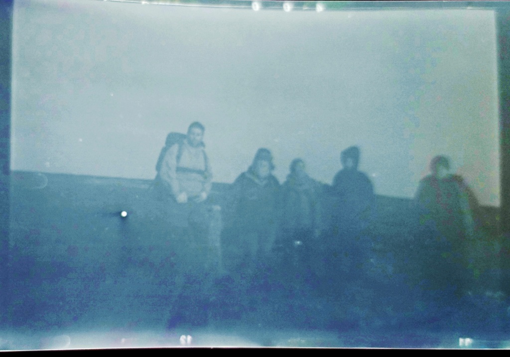
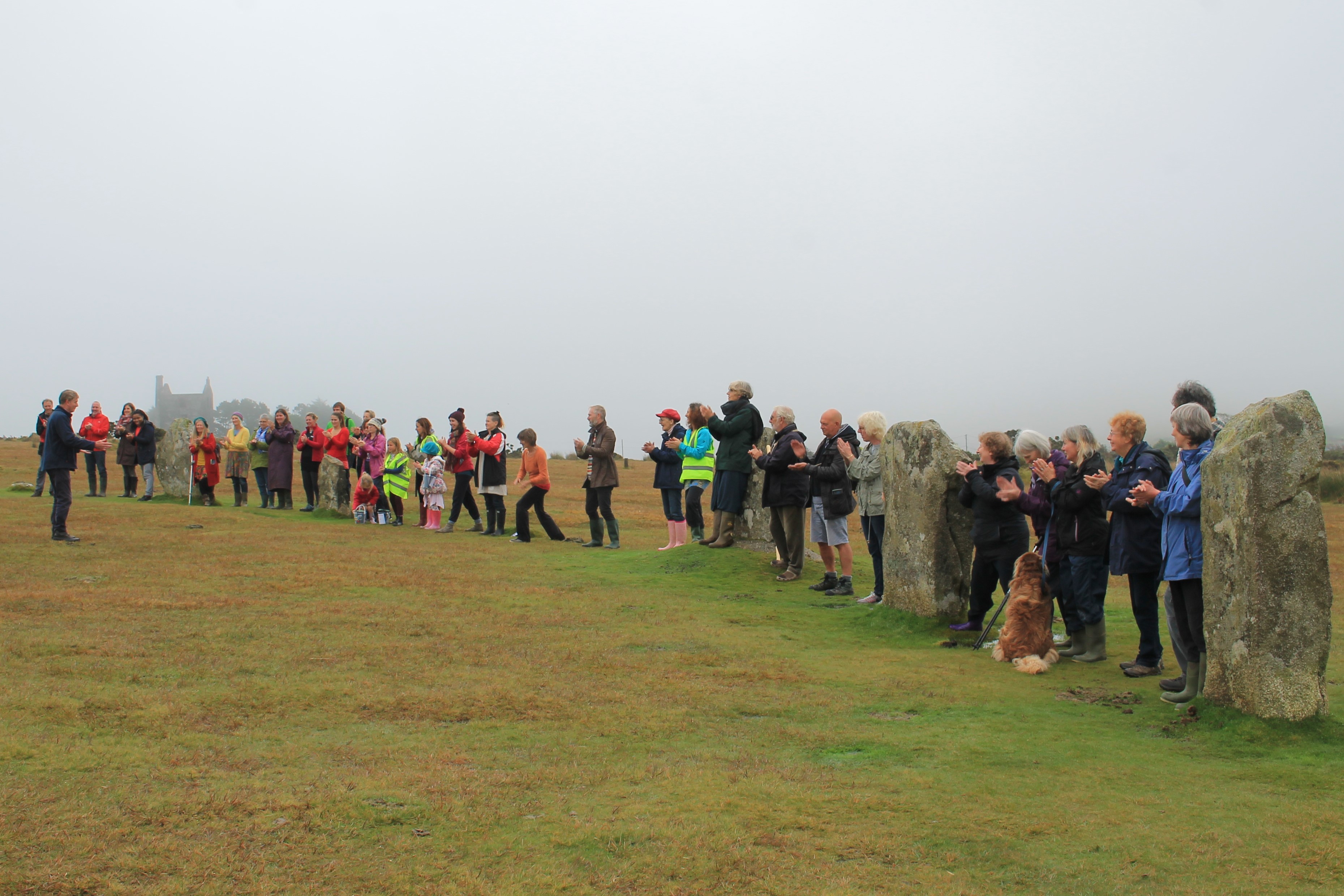
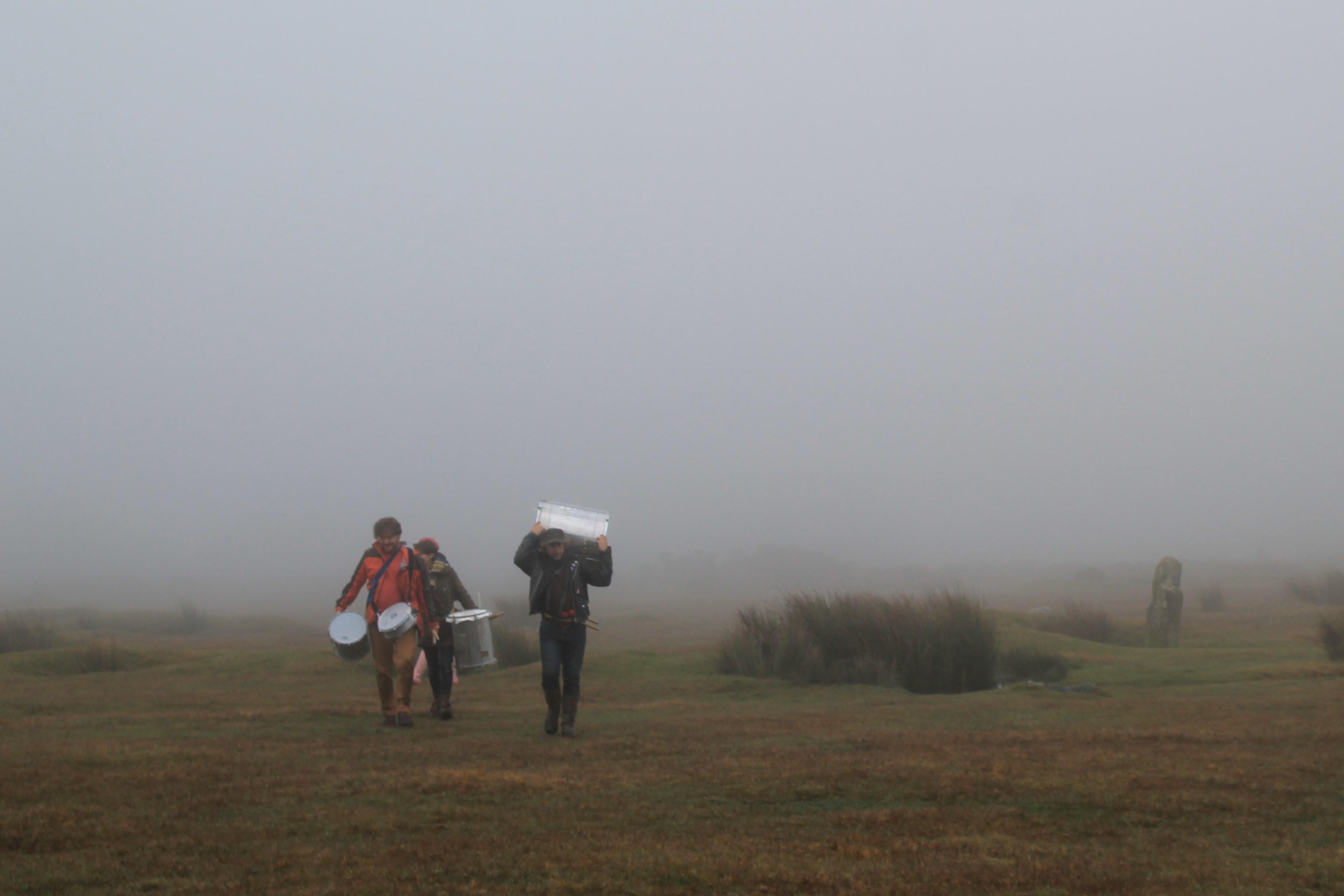
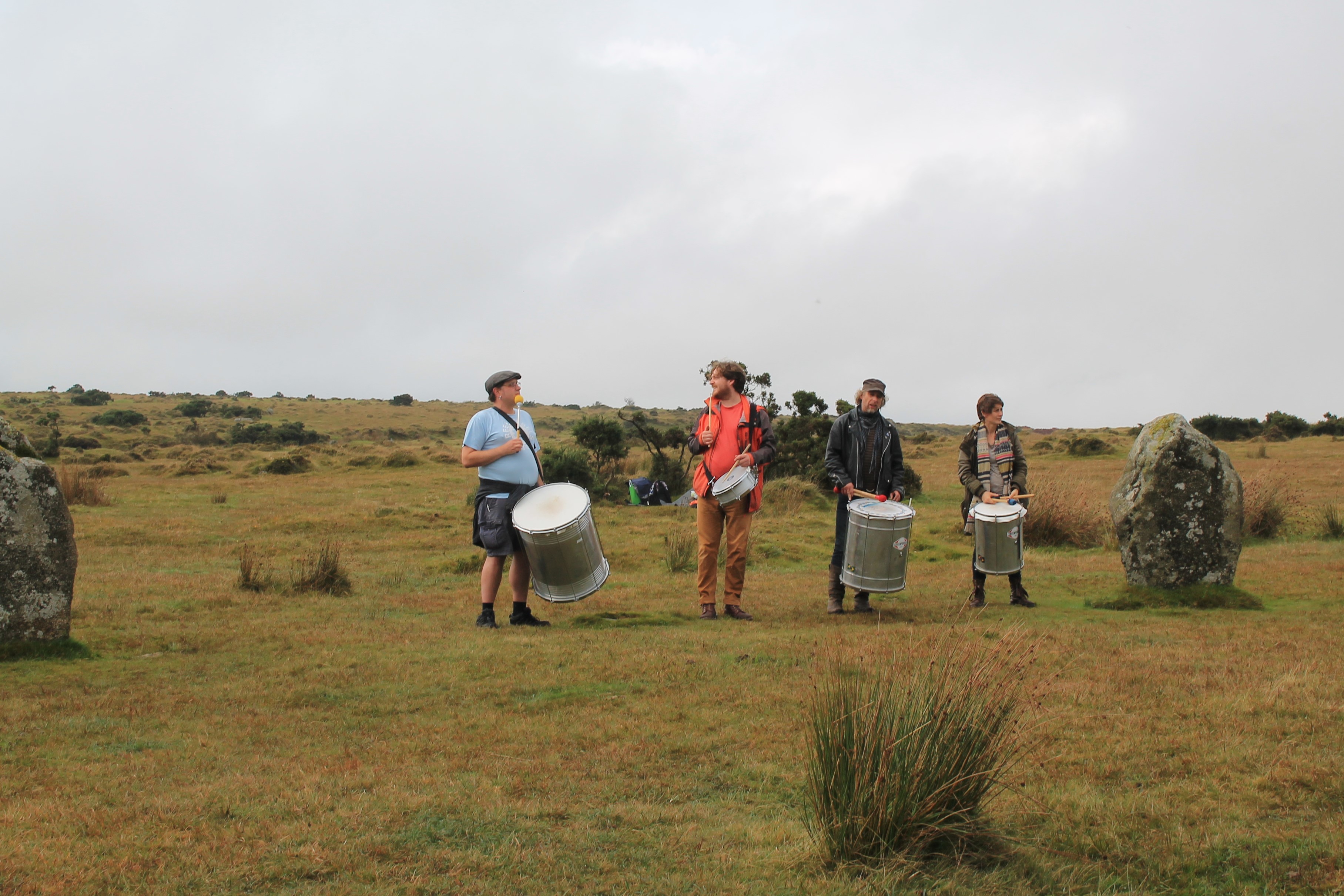
Equinox brought experiments, fun and antics. Sunday was spent at The Hurlers on Bodmin Moor. We were there to celebrate the equinox weekend and the project Dark Skies Bright Stars – organised by Mayes creative. On arrival the site was shrouded with mist which added to the whole atmospherics of the event. At 2pm the event started with dancing and singing in the stones, it was wonderful to see the site used in such a creative way. The dancers were very expressive using the whole of the central circle. A choir accompanied the moves with melody, lyrics and tuneful notes. Once the mood had been set the crowd were invited to participate in an experiment. This experiment was to test the resonance of the stones. The stones themselves have flat sides and could have been used to reflect sound back to groups of people singing or making noise within them. Sound testing equipment was set up and a number of tests were undertaken. First of all the crowd was asked to line up with the stones and the sound test equipment was placed in the center of the circle. A number of notes were sung straight and in staccato. Then the crowd were asked to clap together and then one at a time. Amazingly an echo could be heard with the claps and the sound testing equipment picked up a resonance. With this early success we repeated the experiment but this time had the crowd stood in the center of the circle and the test equipment on the edge. This did not give us the same results, it in fact increased the resonance.
Bring on the drums!!
A number of drummers had been invited along to attend. It was time to check the resonance with a larger sound. The drums first of all stood with the stones and it was amazing to hear the noise echo and reverberate around the circle. But when a snare drum was brought into the circle the effect was very noticeable. The resonance of the snare drum was particularly effected when the drummer reached the center of the circle. This experiment was a huge success and shows what can be achieved by just trying out ideas and having a go!
Boskednan circle is located on a ridge near New Mill north of Penzance. Here is an image looking towards Carn Galver a local easily recognisable outcrop. The summer solstice sunset imaged falls to the south of this outcrop onto an area known as watch croft. But what is interesting is that a Lunar Major Northern setting point would be directly on the Carn itself, as it measures 318 degrees. Could this have been built as a lunar observatory? rather than a solar one?
Other circles in the area have links to the lunar cycle, The Merry Maidens also has a local outcrop in the lunar major setting position and Boscawen-un has lunar links with its quartz stone and positioning of a menhir (standing stone) in the lunar northern rising position. All these discoveries and much more are being compiled and will be released in a book dedicated to wonderful circles found here in West Penwith, within the new year. I will keep you all posted.
As the summer solstice draws close. I thought it would be nice to image the position of the setting sun at the Merry Maidens stone circle in West Cornwall. Currently, the sun is setting to the north (right) of the locally important hill, Chapel Carn Brea. The sun will move only one solar width between now and the solstice (or about 0.5 a degree), as the daily displacement of the sun at this time is at its smallest. If we to wind back time to the late Neolithic or early Bronze age the sunset would be another degree to the north or to the left in the images. So the setting sun in the bronze age would be 3 solar widths to the north (right) in the images. So the solstice sun would be setting on the lower ridge between Chapel Carn Brea and the next hill in the photo which is called Bartinney.
Anyhow here are the images – enjoy.