To prepare for a snowy Mount Whitney summit bid in a few weeks, Kim and I decided to climb a tall, snowy mountain a little closer to home. We really only have a few options for wintry, high-altitude hiking in southern California: Mount Baldy, San Bernardino Peak, San Gorgonio Mountain, and San Jacinto Peak. Both Bernardino and Gorgonio are within the El Dorado fire closure (closed until 8 Oct 2021 as of the time of writing), and Baldy had an uncomfortably high avalanche risk this week, so we chose San Jacinto! It’s been about five years since I last visited the mountain in mid-July and I was very excited to visit in very different conditions.
Trip Planning
Specs: 11.9 mi | +/- 4600 ft
Difficulty: Class 1 [learn more]
Location: Mount San Jacinto State Wilderness, San Bernardino National Forest | Home of the Cahuilla people | View on Map
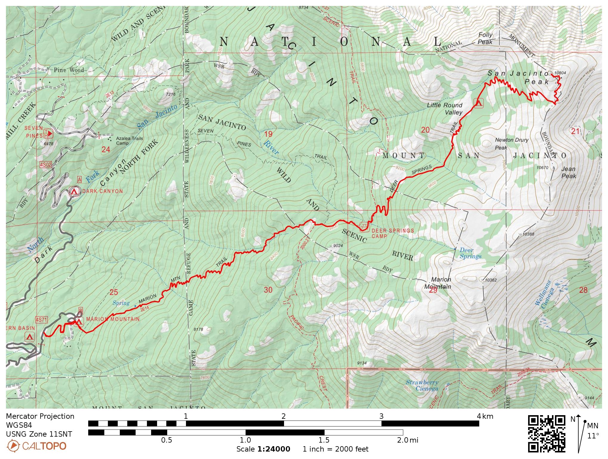
Route: Begin at the Marion Mountain Trailhead. Pass through the Marion Mountain Campground and follow signs for the Marion Mountain Trail and/or San Jacinto summit. The trail meets the PCT about 2.8 miles in; follow this wilderness highway for about 0.5 mile to the Fuller Ridge junction and then continue up the Deer Springs Trail to the summit.
Permits and Regulations: a permit is either required to enter the wilderness. There is no fee or permit to park at the Marion Mountain Trailhead, however. Otherwise, the usual leave-no-trace and other outdoor ethics apply.
Resources: Visit the Marion Mountain Trailhead page for up-to-date forest service information. The San Jacinto Trail Report website is also an invaluable resource to get current conditions on the trails throughout the San Jacinto Mountains. I recommend the Tom Harrison map for navigation, with Gaia GPS as a backup.
A Winter Wonderland
20 March, 2021
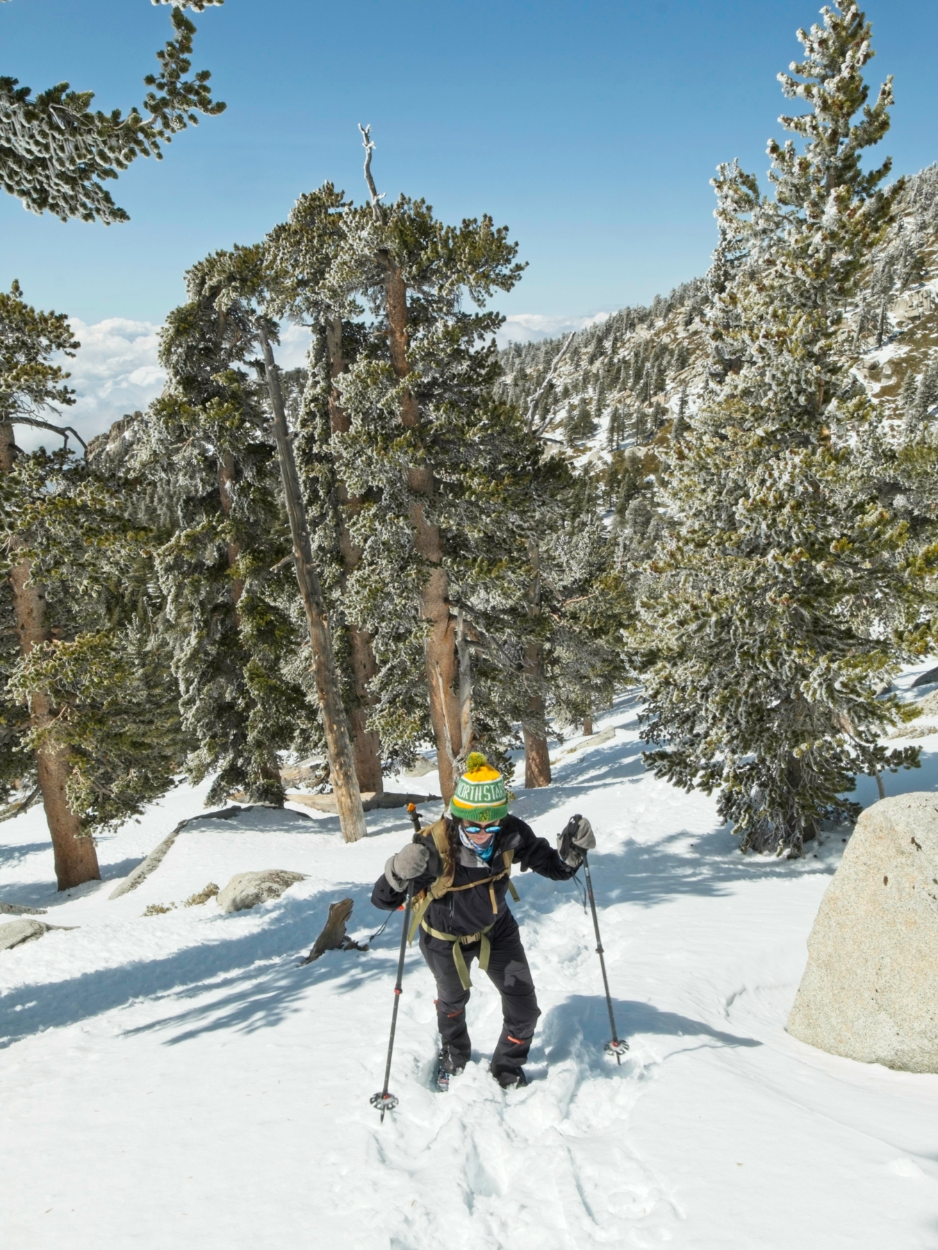
Kim and I meet up an hour before sunrise to begin the drive to the Marion Mountain Trailhead. The trip takes about two hours, so the sun is up when we arrive. We join a few cars parked on the side of the narrow mountain road and hop out into the chilly morning air. Thanks to Jon King’s trail conditions update earlier this week, we’re prepared for the snow and ice with microspikes, gaiters, ice axes, and plenty of layers should the forecast high winds appear up top. Once we’ve organized our gear, Kim and I set off up the Marion Mountain Trail. We follow a few pairs of boot prints up the hill, switching back a few times until we reach the closed Marion Mountain Campground.
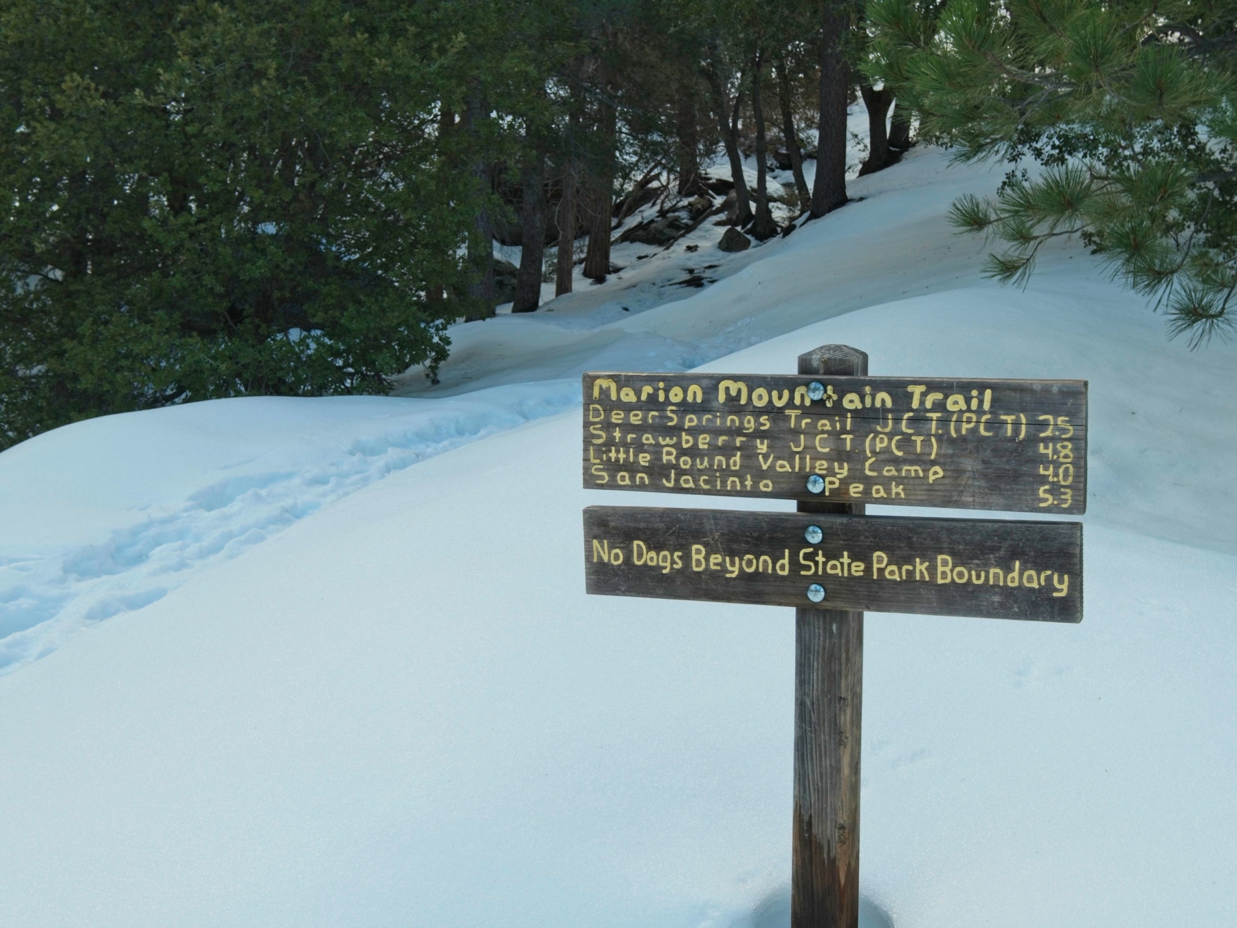
Just above the snow-filled sites, a trail sign declares that only 5.3 miles stand between us and the summit! Of all the routes to the top, the Marion Mountain Trail offers the shortest path. That’s not to say it is particularly short or easy, however. We have over 4500 feet of elevation to gain, every step through the snow. This early in the morning, the snow is solid and crunchy, particularly on the northwest side of the ridge. Kim and I pull microspikes and gaiters over our shoes and then continue past the trail sign. Two cheerful, energetic hikers in trail running gear pass us with a friendly, “See you at the top!”
Over the course of the next two hours, we tramp between towering conifers and massive boulders. Besides the crunch-crunch of our boots in the snow, the forest is quiet; the wind rustles gently through the needles above, and somewhere a woodpecker drills into a tree. I’m surprised at the lack of people on the trail this morning. It’s a beautiful day with a great weather forecast and the trailhead is easily accessible, so where is everyone? I don’t really care, to be frank; I love the serenity that a deserted trail offers.


We reach the Pacific Crest Trail (PCT) a little before 11 AM. I check the Gaia GPS app and am pleased to see that we’ve covered 4.3 miles (only 1.6 to go!) and 2300 feet (halfway there!) in the past three hours. A speed of about 1.4 miles per hour seems reasonable to me; it’s consistent with heavily-laden, high-altitude backpacking trips I’ve completed in the past, albeit on dry trails. I don’t realize it at the time, but the GPS is actually very wrong. In reality, the Marion Mountain Trail reaches the PCT after 2.8 miles, a distance that is clearly marked on the Tom Harrison map had I thought to check. (The real-time altitude measurement, which does not rely on an integral of our path, is correct though!) So Kim and I continue up the trail, unaware for the moment that we’re averaging a little over 0.9 mph rather than 1.4.


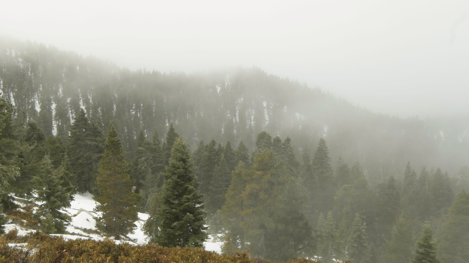
The hike continues to be breathtaking and wild and amazing. We leave the PCT after half a mile, passing a camped PCT thru-hiker, and continue uphill on the Deer Springs Trail. The boot track becomes noticeably less compact, either from a relative lack of traffic or perhaps a greater volume of snow. We post-hole (sinking up to the hip) every once in a while, but thankfully most of our steps are solid and sink no more than a few inches into the snow. The shaded woods soon give way to open hillsides with manzanita protruding from the snow here and there. We also seem to be passing through the clouds at the moment as the entire world is shrouded in mist.
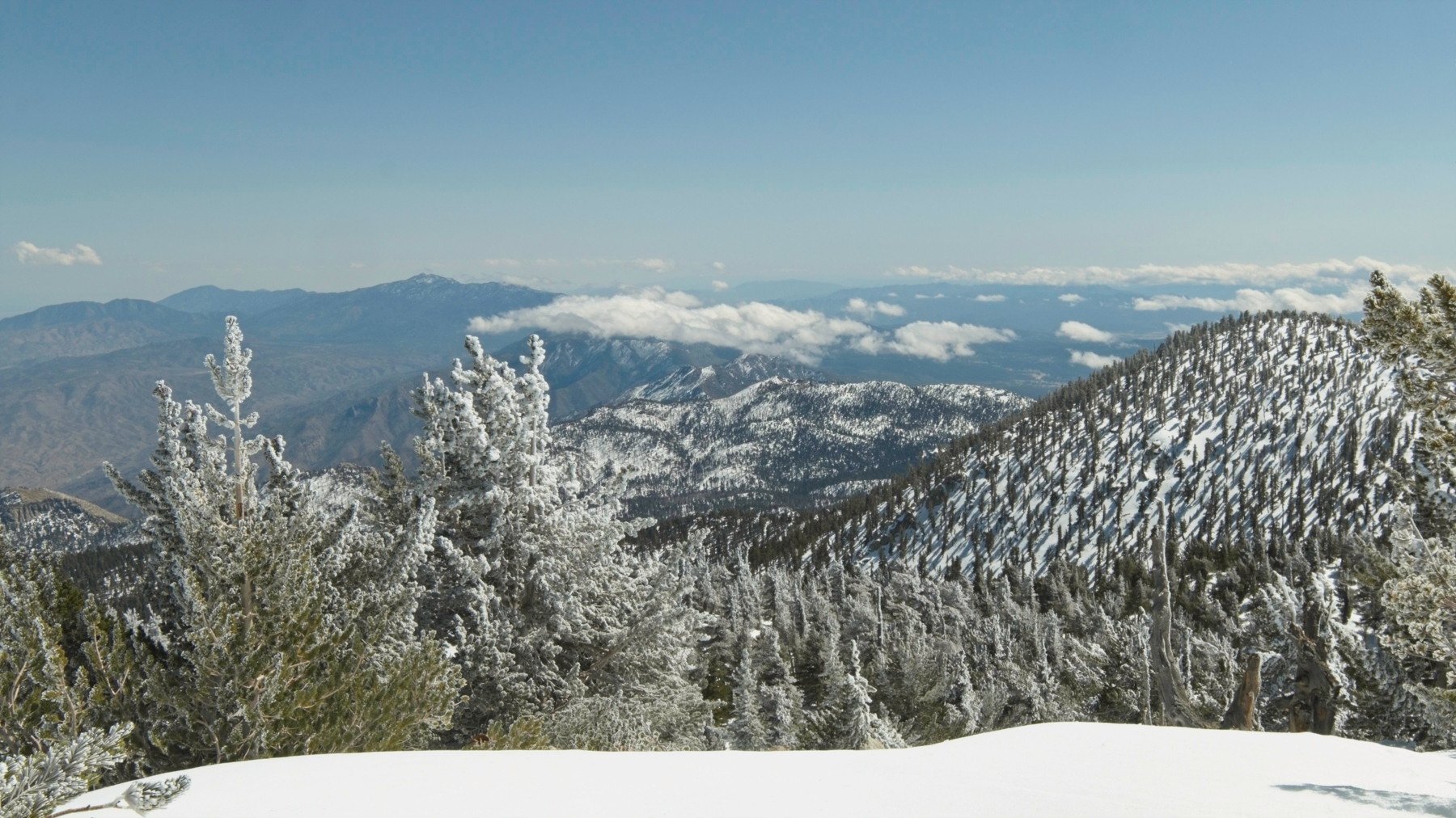
As we climb higher and the morning turns into afternoon, the clouds thin out and patches of blue sky appear. The frosted trees sparkle whenever the sun breaks through, one of the most beautiful sights wintertime has to offer. We pass a hiker on the traverse across the slope beneath Newton Drury Peak; he’s walked all the way from the Deer Springs Trailhead and is also headed for the San Jacinto summit!


A steep climb leads to Little Round Valley, one of only a few backcountry campsites in the San Jacinto Wilderness. The signs that mark the various sites are mostly buried in snow, providing a sense of just how deep the snow is. A short, mostly level walk across the small valley brings us to the final ascent. A pair of snowshoe prints and a few boot prints lead straight up the slope. Kim and I gather our resolve and begin the climb.

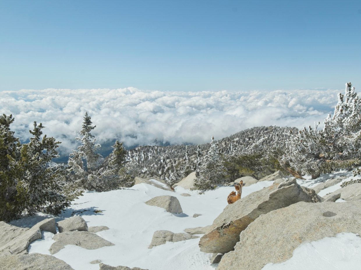
It takes us nearly an hour to reach the summit. It’s a difficult climb, gaining 1000 feet in less than a mile, but the soft snow and high altitude (Little Round Valley is at 9800 ft) are the real obstacles. I haven’t done any real exercise at this altitude since the Sierra High Route last summer, and it shows; I stop every minute or two to let my racing heart slow down. On the other hand, the views from every intermittent rest stop are fantastic! We’ve climbed above the clouds and the sun shines brightly through the frosty trees.
By the time we reach the summit, I’m beginning to feel slightly dizzy. It’s always a strange sensation, taking deep breaths but feeling like you can’t quite fill your lungs. The hikers we passed early this morning are chatting at the top, so we exchange a few pleasantries and photos before they begin their descent. Kim and I pull on extra layers to stay warm on the windy peak and then relax on the leeward side of a big rock and eat a much-deserved lunch. The views are phenomenal, particularly looking south and west where a thick layer of clouds span the horizon. On the opposite side of the mountain lies the desert, devoid of clouds, snow, and greenery in general.


Two other climbers we passed this afternoon arrive soon after us. I’m again surprised that there aren’t more hikers up here. I figured we’d meet folks that had taken the aerial tram most of the way up, but none appear. Once we’ve finished eating, we begin our descent. The trip up took about five and a half hours and the sun sets five hours from now; it would be nice to be back in the car by then.
I enjoy speedily plunge stepping down to Little Round Valley in the soft snow, but spend the rest of the return journey following the boot track. Although we make excellent time, the descent drags on and on, particularly when we begin slipping and sliding through the soft, slushy snow in the final few miles. I think I can safely speak for both of us when I say that Kim and I are very tired by the time we reach the car. This hike has been the most physically and mentally taxing challenge I’ve completed in quite some time, but I thoroughly enjoyed it, strange as that may sound. We brought the right gear, made a good plan, and accomplished something really difficult! The magnificent summit views, near complete lack of other people, and pristine, wintry wilderness made for a marvelous day.