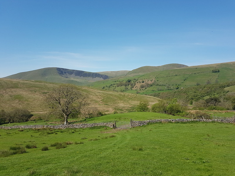
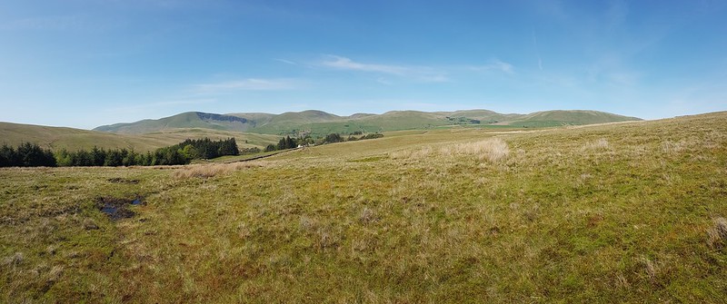
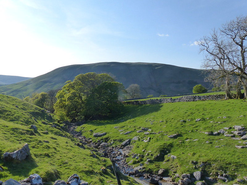
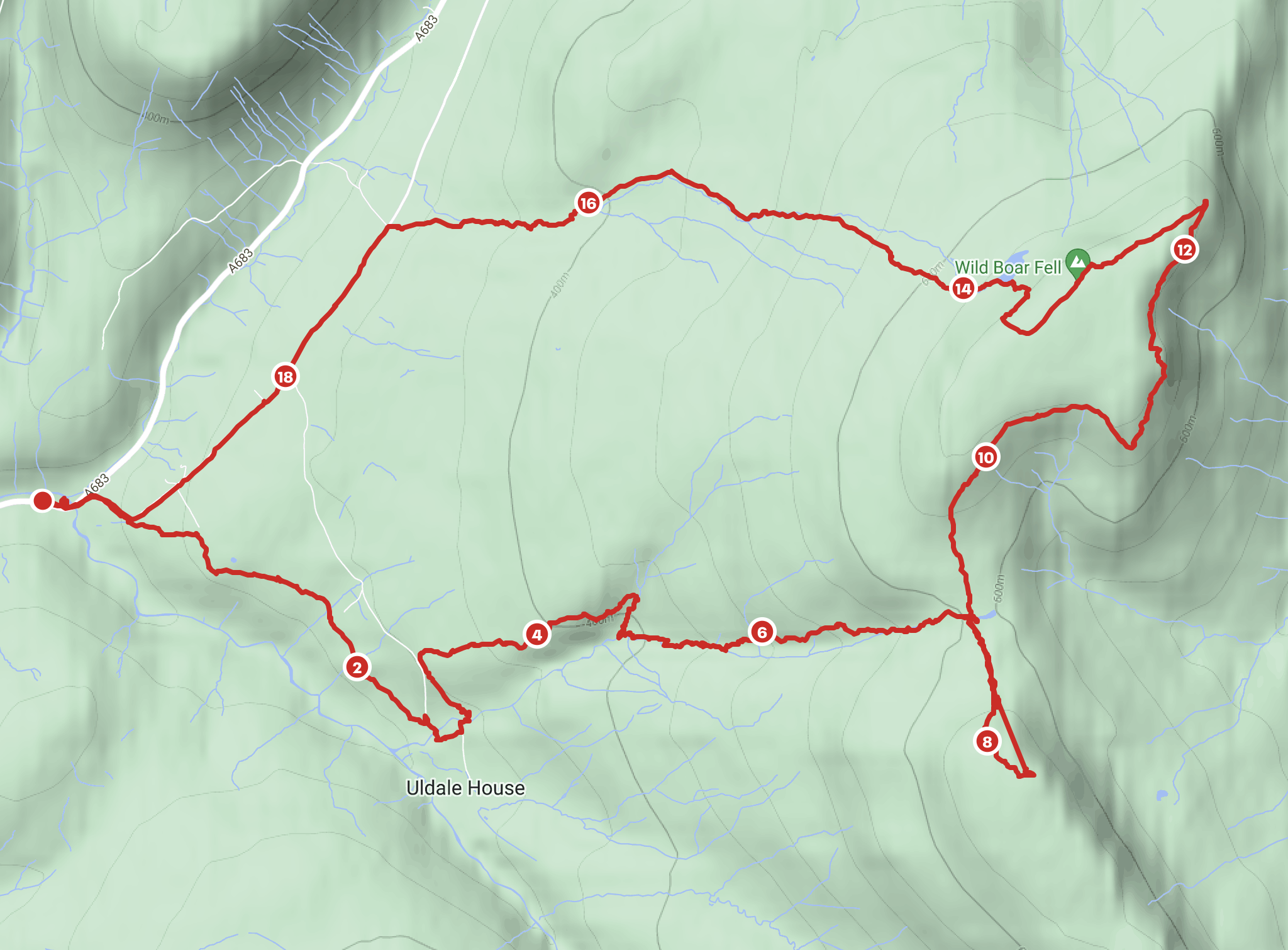
Another Lune catchment outing, which, once again, didn’t disappoint. I had splendid views of the Howgill Fells all day. I’d parked down by Rawthey Bridge and when I left the minor road which leaves the A road there, took another version of this view which was rather spoiled by the foreground of dessicated Mole corpses hanging from the barbed wire fence – a grisly traditional method for a mole-catcher to show the success of his labour.
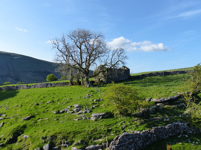
The field path took me past a series of old farmhouses, heading up the valley of the Rawthey.
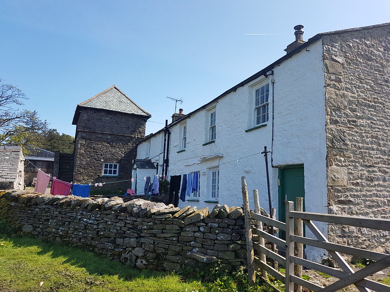
What intrigued me about this farmhouse was the unusual tall building with the pyramidal roof, which is a coach house apparently, according to Historic England, added in 1914 to a building which is “probably early/mid C18”. I should have taken a photo back down the hill at Wraygreen, which is considerably older. Next time.
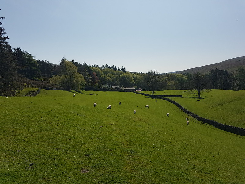
I’ve included this photo because it shows the trees beyond the house, clearly planted, looking almost like an arboretum, of which more in a moment.
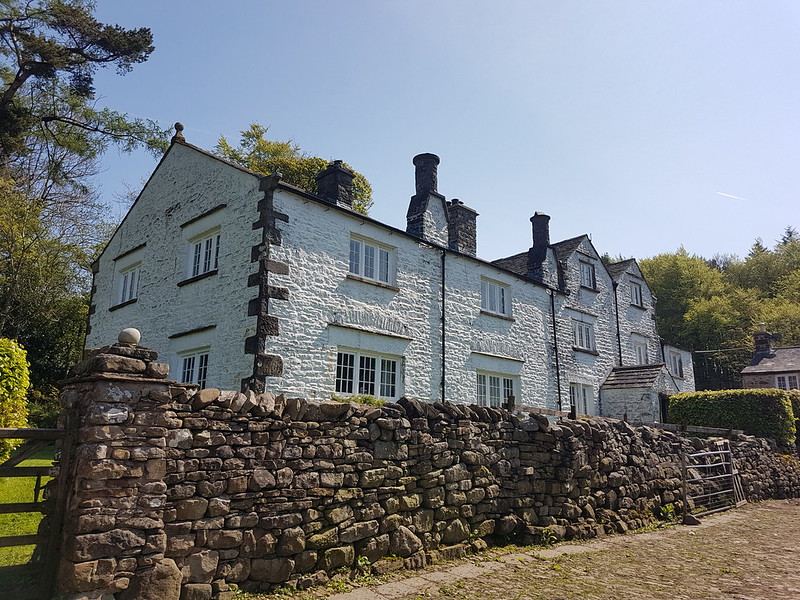
I was surprised to find that the very striking Needle House is not listed. I did find a fascinating history of the Frankland family, who lived here and modified the house, written by Dr Helga Frankland, whose father seems to have been taken with all things Scandinavian (so hence Helga?).
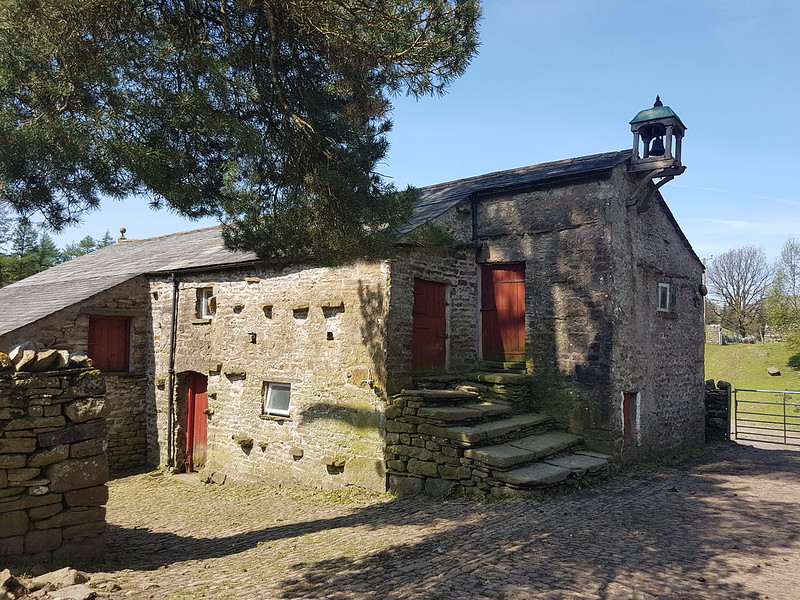
“Unusual features created by my father include the belfry on the gable end of West Laithe in the yard at Needlehouse. It is based on belfries seen on farms in Scandinavia. We used the bell to summon people to the house from the fields.”
Laithe is a northern word for Barn, apparently.

“My father planted all the woods on our land, except for the much older Uldale Wood and the natural woodland in the gills. Scandinavia held a strong fascination for my great grandfather, grandfather and my father. By skillful placing of relatively small, largely coniferous woods, my father managed to create a landscape that looks more wooded than it actually is and therefore, has echoes of Scandinavia.”
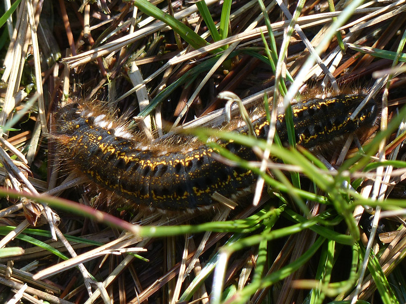
In the woods beyond the gill, I was delighted to spot four or five Red Squirrels, or, very possibly, the same Red Squirrel four or five times. I have one very blurred photo to remind me, but if I hadn’t taken it myself, I don’t think I would know that it was of a squirrel. Much of the walk to this point had been accompanied by the sound of Cuckoos, but, as usual, I didn’t see them at all.
I watched a largish bird of prey fly up and along the gill. I don’t know what type sadly.
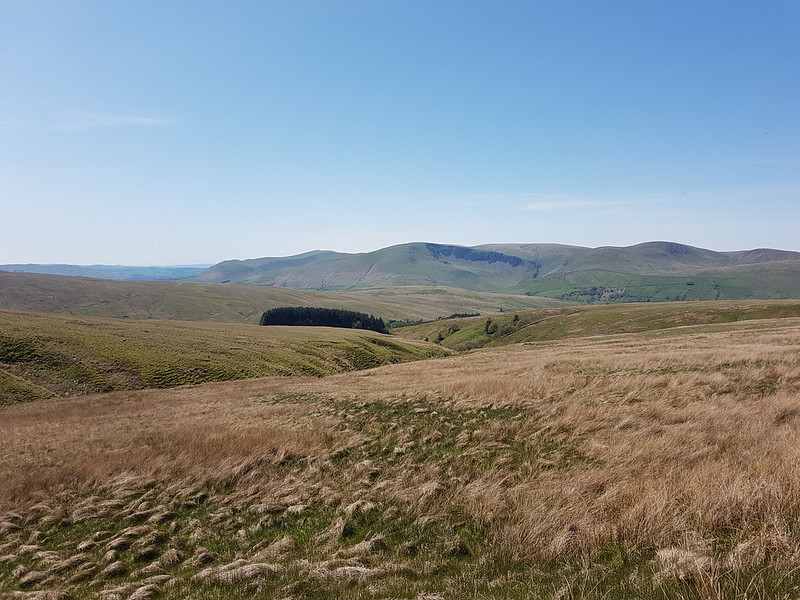
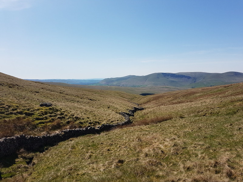
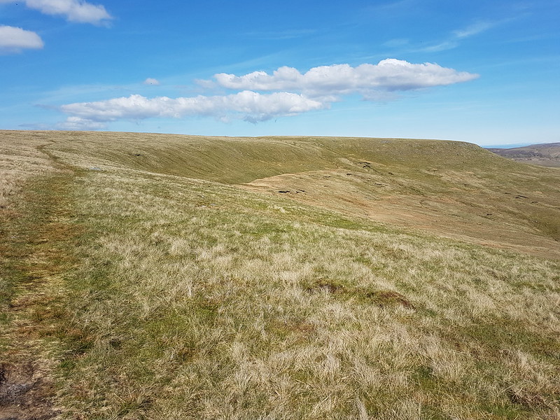
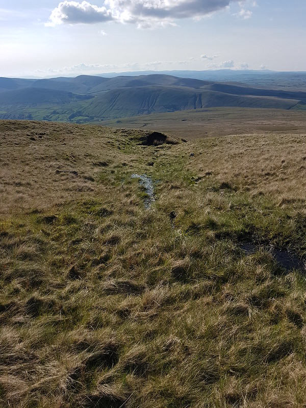
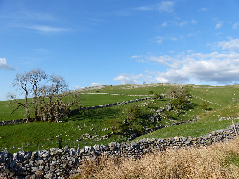
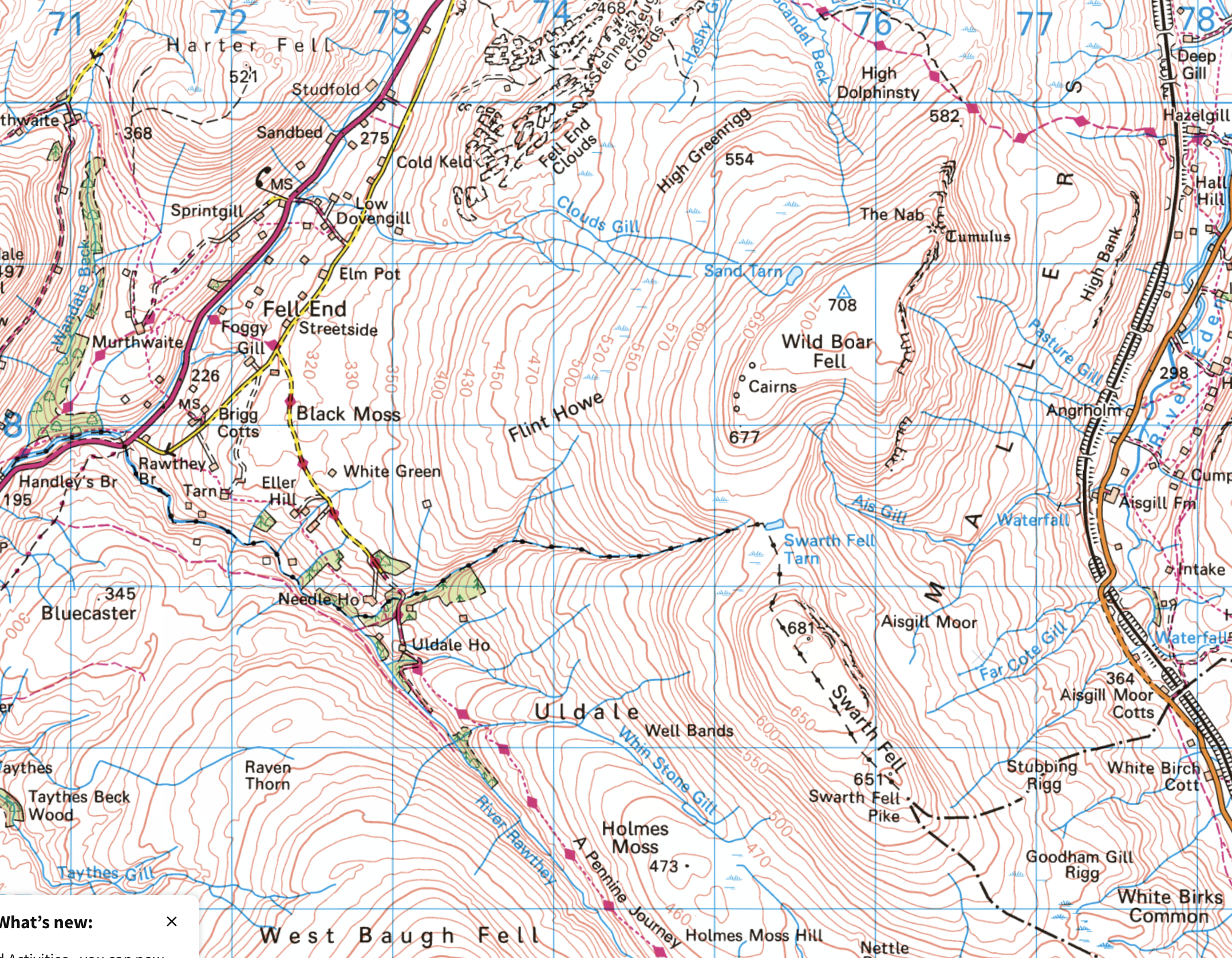
Part of the reason for choosing this route was the fact that I haven’t climbed Wild Boar Fell for far too long. It used to be a bit of a favourite. I always used the same route: up the Rawthey, over Holmes Moss Fell, which was invariably very wet, then onto Swarth Fell, Wild Boar Fell and down via Fell End Clouds. This time I intended to ring the changes and explore some more Lune feeders. My original plan had been to hop over the fence here, onto access land, and follow the gill upstream, but the going looked like it might be difficult, due to the steep banks and fallen trees, so instead I almost doubled back on the track and then took to the open fell-side.
It wasn’t half as wet underfoot as it might have been I suspect.
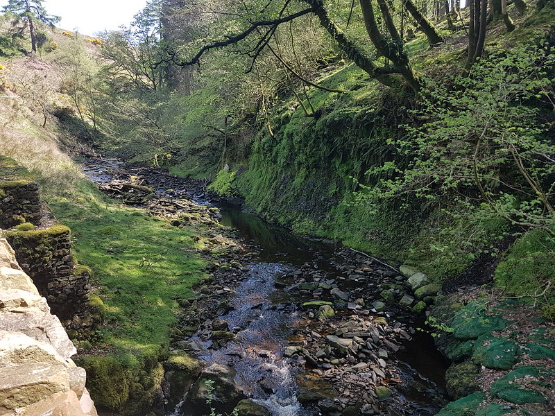
I found a hint of a path, which took me down into Grain Gill, and then followed the gill down into Needlehouse Gill which at some point becomes Uldale Gill.
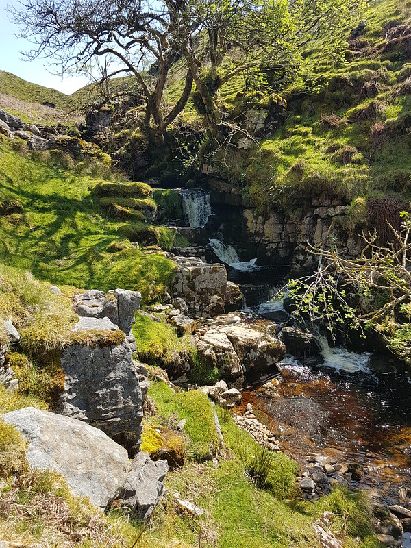
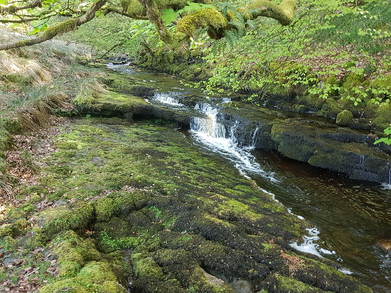
I took lots of photos of small falls and cascades, but this was the best, so can stand in for them all.
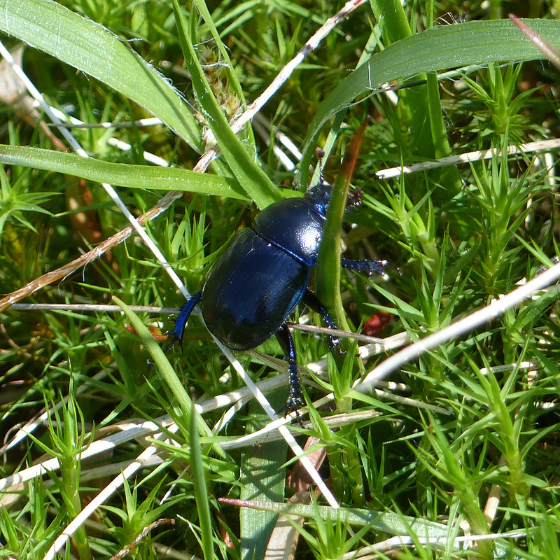
I watched this Dor Beetle as it wandered around in the rough vegetation, laboriously and seemingly with quite a lot of effort, going back and forth over the same ground for reasons I couldn’t fathom.
On the left of this photo you can see a small sliver of white, which is where water was spouting from a hole in the crags and pouring under the wall into the stream. The boulders in the foreground are, I assumed, the dry bed of a tributary stream where a spring would emerge in wet weather.
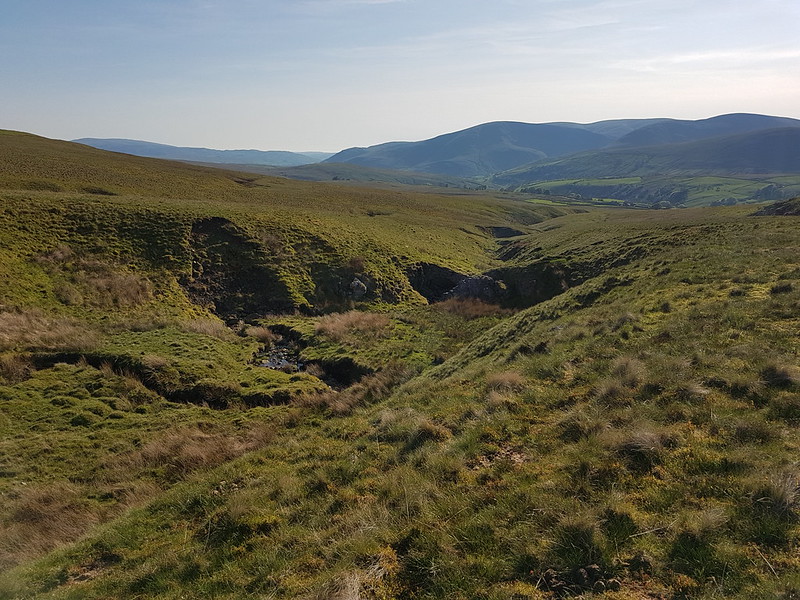
In the absence of a path, following the stream turned out to be quite heavy going, so I decided that it would be a good idea to climb up to the left, above the northern bank of the gill. I was wrong. That bright idea brought me into very boggy ground with tall reeds. The only upside was that I saw a number of Common Lizards…
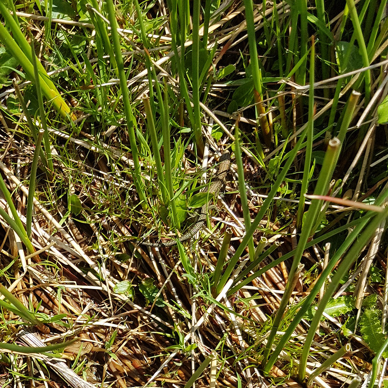
…which were all too fast for me to get any decent photos.
Fortunately, when I climbed high enough, the going got much easier.
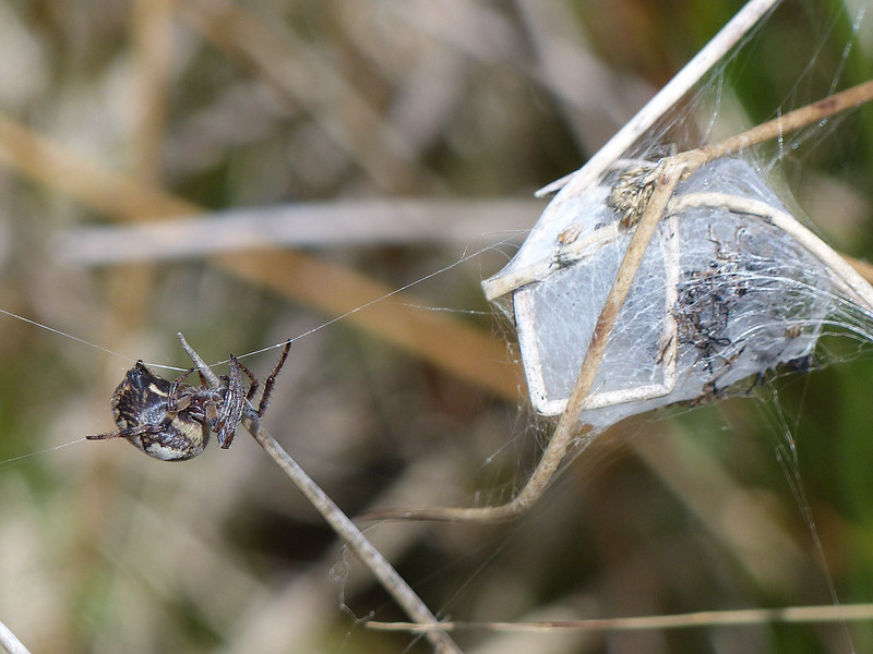
I’m reliably informed that this spider, on an impressive web stretching between sedge stems, is Larinioides cornutus, the Furrow Orbweaver. They like damp places, which fits. This must be a female, which makes a silken cocoon and then produces pheromones to attract a mate.
At the time, I thought the cocoon might be full of babies, but with hindsight, it looks more like a larder.
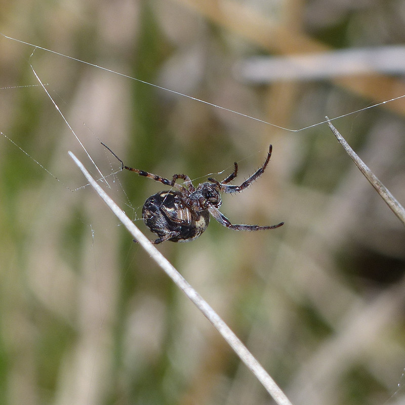
The ‘furrow’ in her name refers to the pattern on her back, which sadly she never deigned to reveal to me.
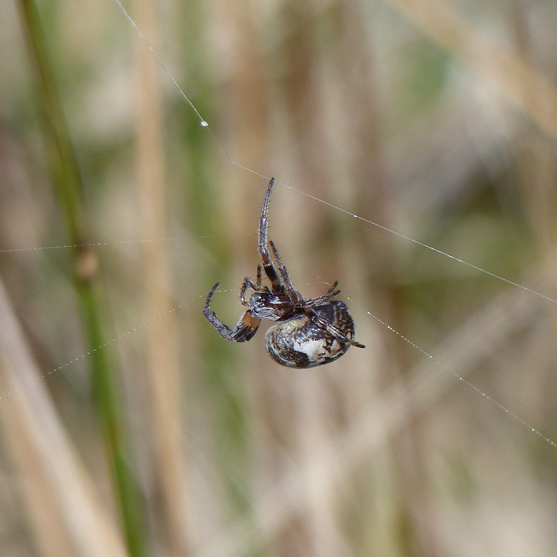
She was intent on running repairs of her web.

But then I must have upset her in some way and she disappeared into her lair.
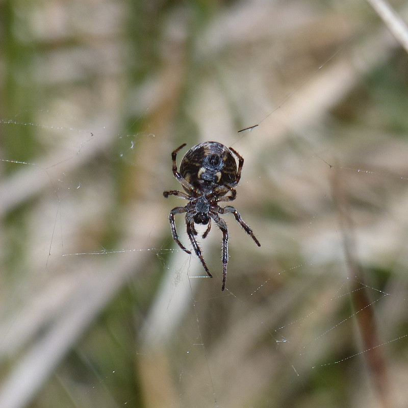
I’m well aware that not everyone likes arachnids, but as you can probably tell, I was entranced.
I found a very comfortable spot amongst the boulders on Swarth Fell, made a brew and then had a little nap in the sun whilst it cooled down. You can’t beat a bit of a snooze during a hill walk if you ask me.
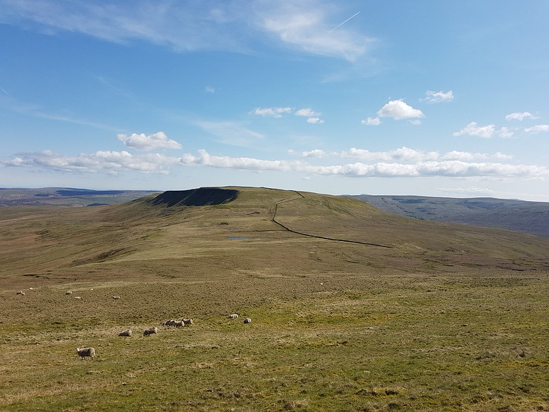
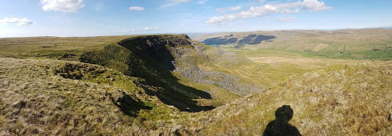
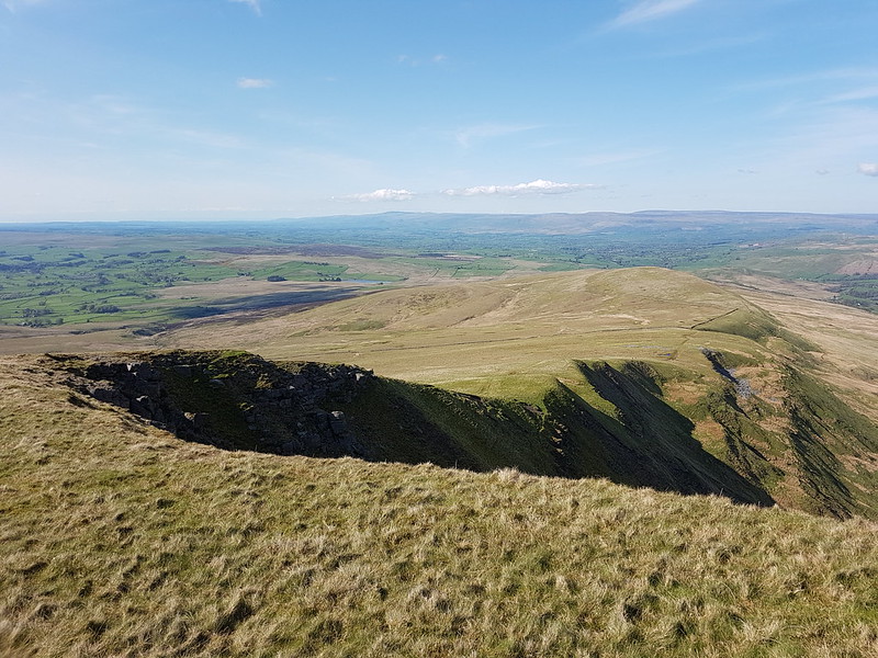
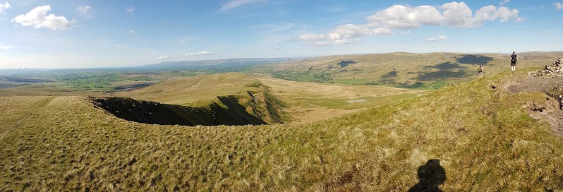
On the way back down to the col, I followed the steep eastern edge…

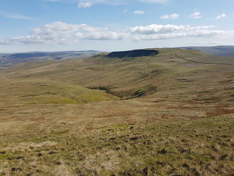
The rivers both Eden and Ure rise down there somewhere. The first is heading for Carlisle, the Solway Firth and hence the Irish Sea, whilst the other, via the Ouse and the Humber, heads through York to the North Sea.
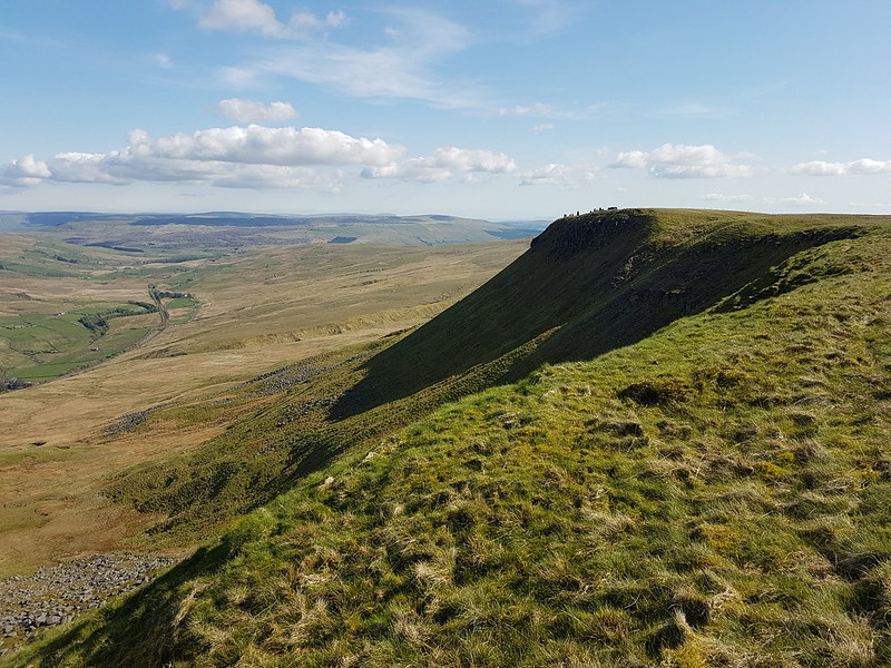
This path, around The Band to High White Scar, is not marked on the OS map, but it is an absolute delight. As I walked along it, I watched a Buzzard gliding out across Aisgill Head.
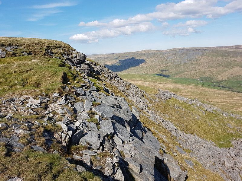
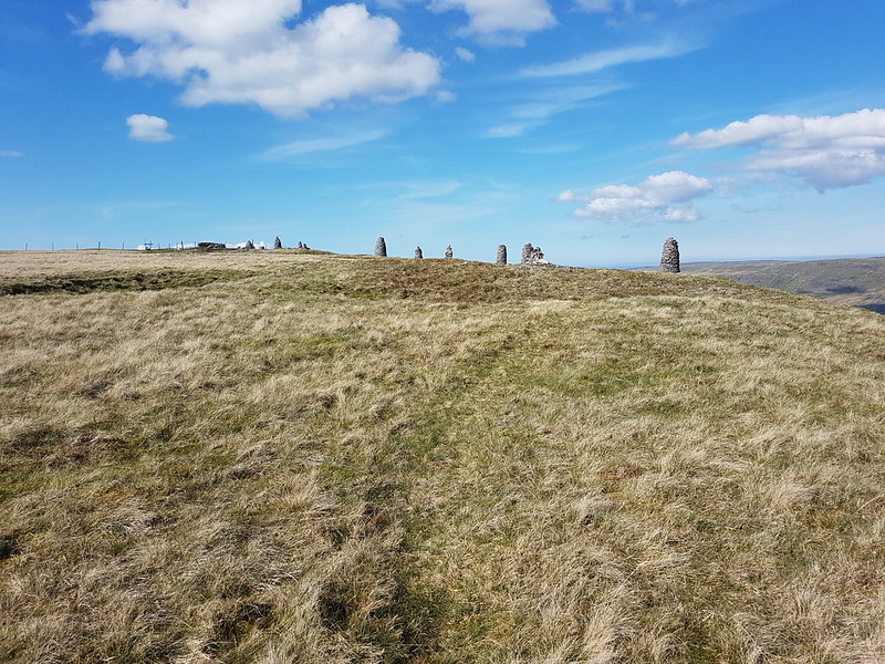
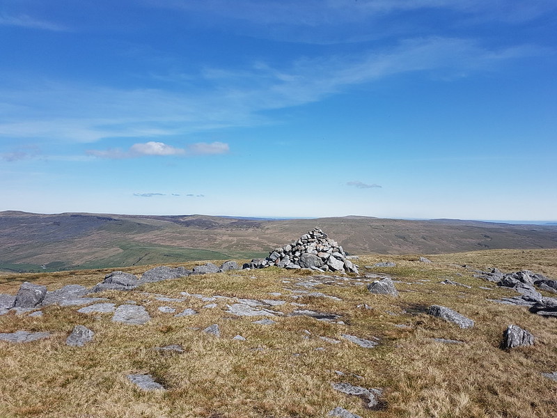
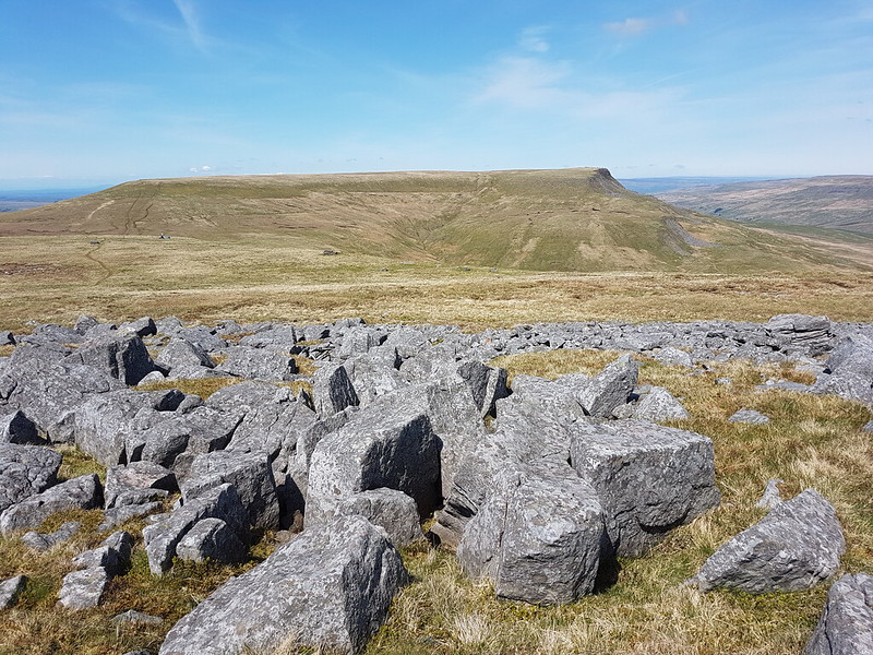
Wild Boar Fell has a large summit plateau and two tops, both with a spot height of 708m.
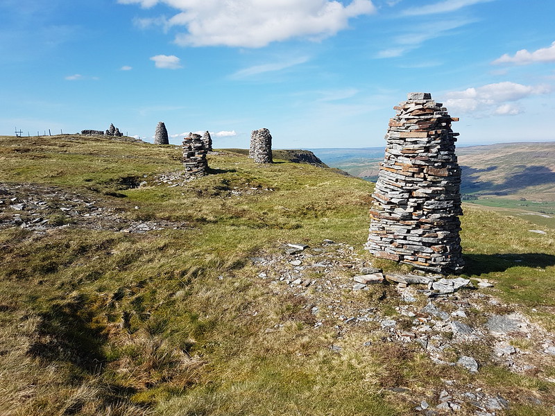

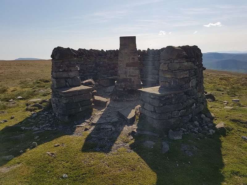
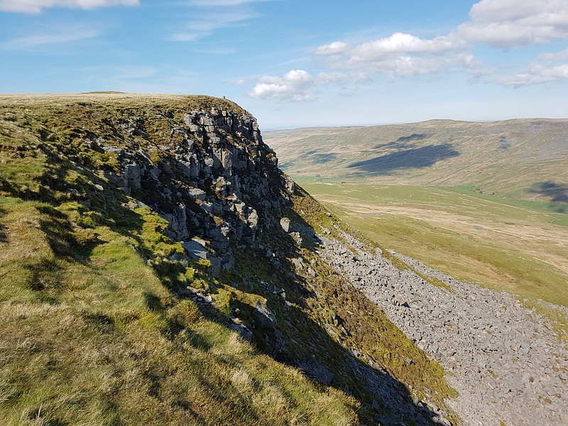
Here’s ‘the other’ top. Not quite as exciting as the one to the east, to be honest.
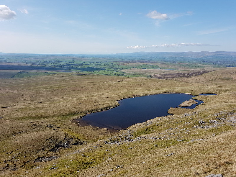
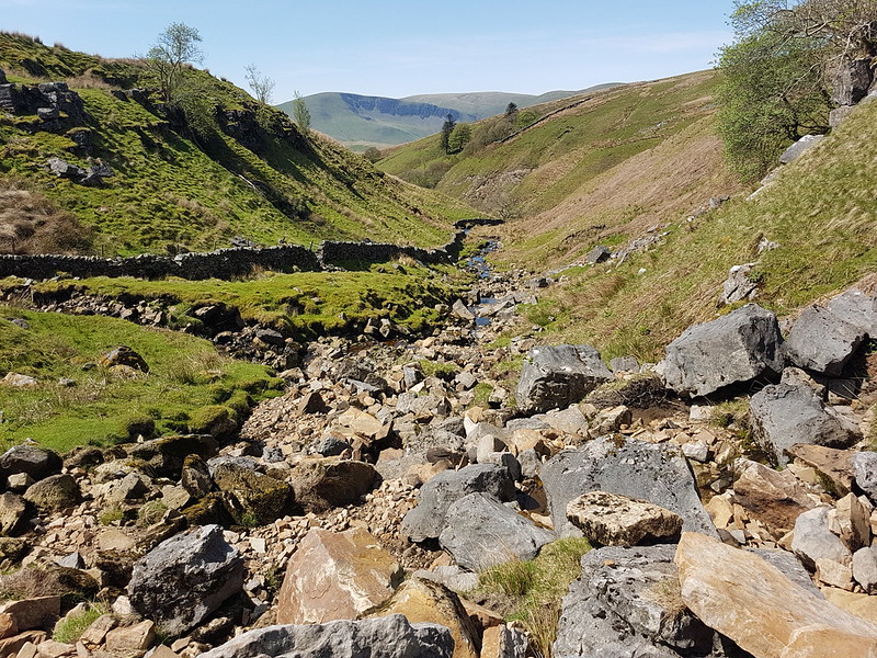
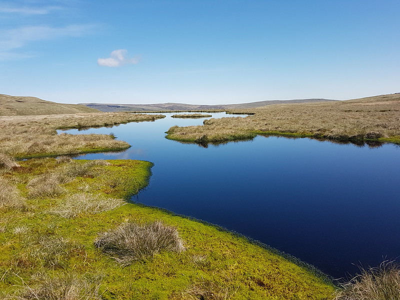
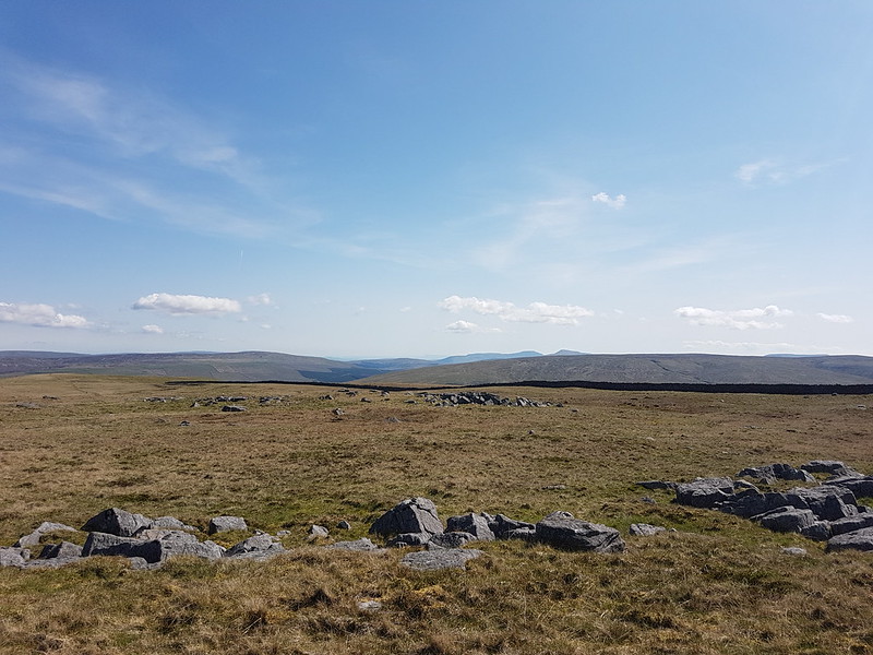
Forcepot Sike apparently drains Sand Tarn, although there wasn’t an obvious or easy to spot outflow. The hills opposite are Harter Fell (there’s a few of those about!) and Green Bell. I don’t think I’ve ever climbed the former, and it must be about thirty years since I climbed the latter – and since the source of the Lune is said to be on its slopes, it’s high on my to do list. Of course, we know that the Lune, like any river, has countless sources, but we’ll let that lie.
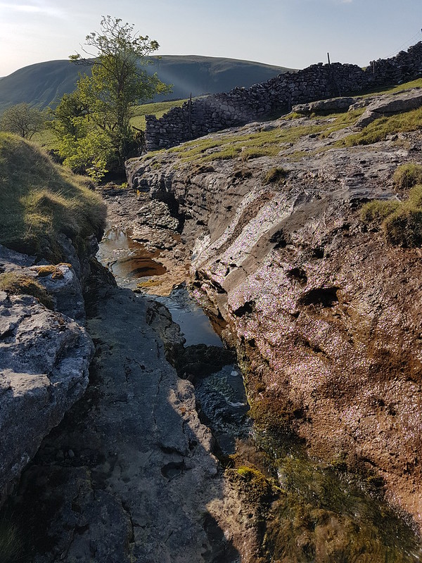
This was pathless going, but much easier than that had been by Uldale Gill. The stream gradually grew as it absorbed lots of other rivulets, at some point becoming Clouds Gill. I’ve come down these slopes a few times before, but always heading for Fell End Clouds, never sticking with the gill. As the terrain changed to limestone country, that brought unexpected bonuses. The stream began to appear and disappear underground.
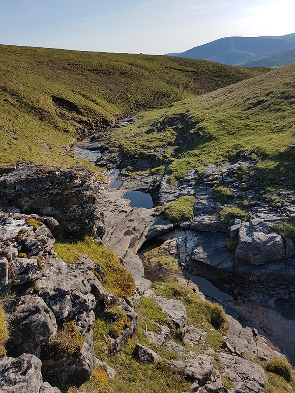
In some spots I could see the water flowing through a narrow channel to the left and below the exposed rocky riverbed. In other places the river had eroded large deep pots which were full of stagnant water. And also full of tadpoles.
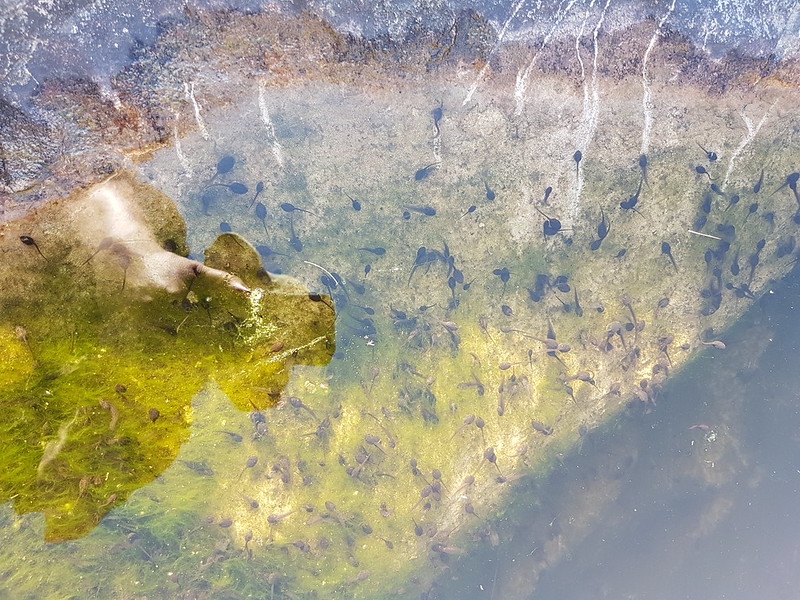
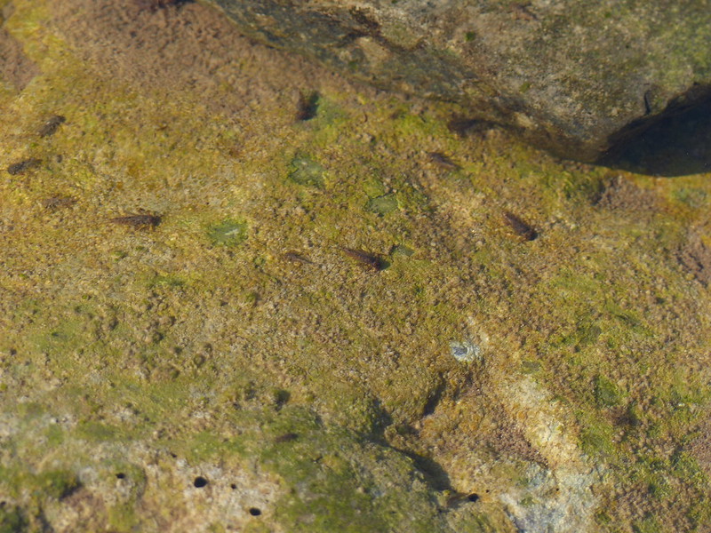
Many moons ago, I used to walk to school with friends. Our route took us across fields and via a small footbridge over Johnny’s Brook. Armed with coffee jars or buckets, we would collect frogspawn, tadpoles, frogs, sticklebacks and other unfortunate denizens of the brook and take our finds to school. There was an aquarium tank in one of our classrooms, I remember. Whether the aquarium was a result of our enthusiasm or its cause, I don’t recall. I do know that I’ve never seen tadpoles in this profusion before, pool after pool, deep or shallow, were full of them. But then suddenly – no more.

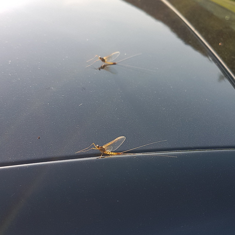
I’m assuming that this is a Mayfly, although my field guide describes them as ‘flimsy’ whereas this looked quite sturdy to me. Apparently, there are 47 different species in the UK. The winged stage of their lives lasts for just a couple of hours or up to a couple of days, depending on the species. The nymphs, living in the water, often live for a year or even two, although, again, that depends of the species.
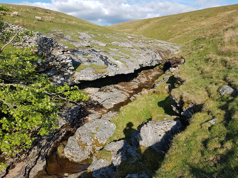
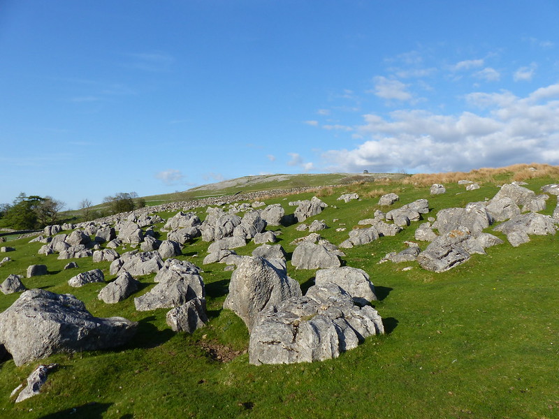
Limestone, of course, erodes in interesting ways. Here the stream had created a narrow gorge and a huge rock overhang.
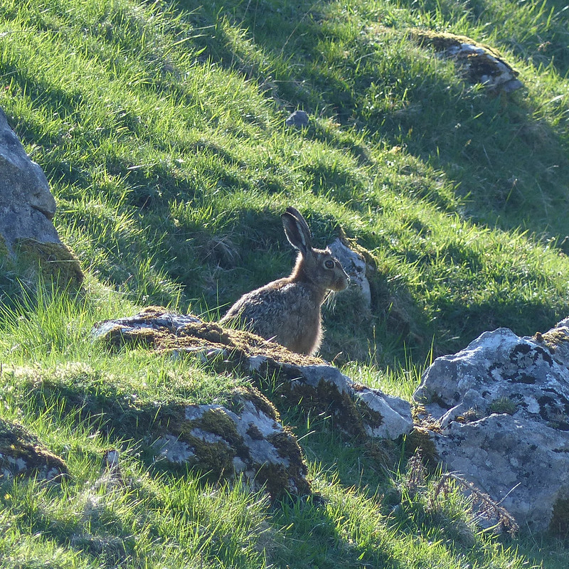
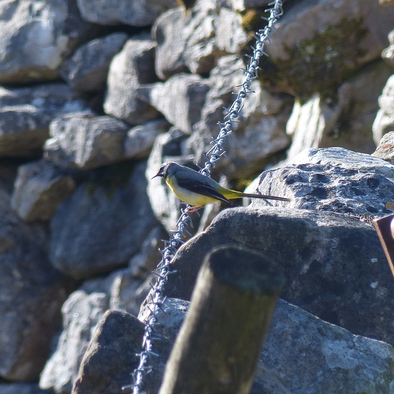
I’ve begun to think that certain creatures are emblematic of the landscapes of the Lune, particularly Curlews and Hares. Maybe Grey Wagtails as well.
I had planned to cross the valley and have a wander through the woods of Murthwaite Park, but it was getting late, so I just wandered along the minor road back to the car.
When I got back to the car it was covered with Mayflies. These did look flimsy.
There had been lots of cars parked along the road near the Cross Keys, presumably for the walk up to Cautley Spout and beyond, which is a very fine walk and another which is high on my ‘to do’ list. But I’d met a couple on Swarth Fell, another couple at the Nab and two blokes and their dog by the trig pillar on Wild Boar Fell, and that was it. On a sunny Saturday in May. I can’t think why Wild Boar Fell is not much more popular, but I’m not complaining!

Have spent quite a lot of time in that area recently. Hardly ever see a soul. Good mixture of gritstone and limestone scenery.
I fancy a wild camp at Sand Tarn.
Good shout. Margins quite boggy, but sure you could find a good spot.
I always assumed that the practice of leaving your mole catch on barbed wire was a Lancastrian/Cumbrian thing, but I’ve seen it down here in Devon as well. Having spoken to a mole catcher they always say they leave them by the field worked to show how many they catch and therefore how much to pay them, but surely they could just take them to the owner and show them. Some lovely photos on this walk and amazing that you think of the two rivers rising in the same valley but heading in opposite directions. Probably a good job you aren’t doing a Ure catchment project, sounds like a huge undertaking
I can certainly remember seeing dead moles on fences as a lad in rural Leicestershire. It does seem unduly barbaric, although it’s the killing of the moles first and foremost which is fault here, rather than the grisly trophies.
I find that I’ve become a bit obsessed with rivers and where they’re headed and how they’re fed. Mind – I’ve always been fascinated. In my teens I visited Bavaria with my German cousins and in short order we visited the supposed source of the Danube and I remember being impressed that other local rivers were flowing into the Rhine so doing something similar to the Ure and the Eden but on a whole different scale.
It’s a very good point you make – the Lune feels sort of manageable (although, in some ways completely unfinishable), even the Eden, which I don’t think is all that much longer, would be a much bigger undertaking I suspect.
Which reminds me – another of my hare-brained schemes: a long distance walk around Cumbria – Lune from sea to source, Eden from source to sea and then around the coast home. One day perhaps.
Like the sound of that last one, certainly manageable in 3-4 day chunks
Yeah – I have a lot of hare-brained schemes up my sleeve though – not really sure when I will fit them all in!
I like tracing river courses as well (although sources can be a little underwhelming!). I always find it fascinating that the Wye and the Severn have their sources about a mile apart but then follow completely separate routes until they meet again at the old Severn Bridge, where the Severn is massive channel and the Wye small in comparison.
Superb day out by the way and I’ve also often thought Sand Tarn would be a great wild campsite
I love maps of catchments with all the other detail stripped out – can’t say why they’re so appealing, but they are.
Yep – I’m with you on Sand Tarn, although I always seem to turn to the Lakes when I fancy a wild-camp.
That’s some walk over rough ground.
I don’t often follow routes with as much pathless walking as this one – it was very rewarding, but hard work at times.
I bet it was. Wild Boar fell is on my list of “hills to climb before I’m too knackered” but I don’t think I’ll follow your route 😉