


It seems a small thing, at first: a few words on a map. But Veronica Hemphill-Nichols still remembers the day in 2008 when she bought her first smartphone, opened Google Maps, and saw that her neighborhood, the Fruit Belt, was labeled “Medical Park” instead.
First, Hemphill-Nichols convened a meeting with city planners, who said they hadn’t requested the change. Then she complained to Buffalo Niagara Medical Campus officials, who said they hadn’t done it either. In the 11 years since, Fruit Belt residents and activists have waged a battle against a mysterious digital renaming they see as a potent symbol of gentrification.
“One of the main things we’ve been shouting at City Hall and at our councilman is that we want our name changed back,” Hemphill-Nichols said. “They took it from us and no one knew about it. This is the historical Fruit Belt – not the Medical Campus.”
People are also reading…
Until recently, the error repeated on dozens of popular websites and apps, from Zillow and Grubhub to TripAdvisor, Redfin, Zocdocs and Uber. The glitches go beyond the Fruit Belt: Digital maps of Buffalo frequently omit, replace or shrink well-known neighborhoods, from Kensington-Bailey to the Elmwood Village.
In many cases, these platforms have become so powerful and so removed from the neighborhoods they describe that even city officials claimed they were powerless to fix their errors. In reality, several companies, including Google, updated their maps in late February after The Buffalo News contacted them.
But the correction process can be complex and opaque. And the real source wasn't Google or Zillow or Grubhub, but an almost 20-year-old city planning document later picked up by tech companies that map neighborhoods. Navigation apps, social networks, direct marketers, real estate brokers and search engines have all bought neighborhood data from these firms. But in Buffalo, those data are flawed and two decades out of date, creating a digital view of the city that doesn’t line up with that of locals.
A threat to identity
In fairness, neighborhoods are flexible: They rarely have official boundaries in the United States. As a result, there is plenty of room for residents to argue about their shifting names and borders.
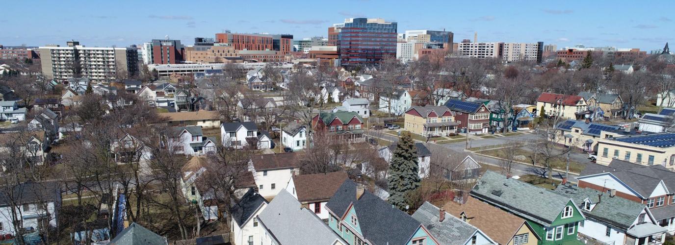
But as Hemphill-Nichols first told city officials in 2008, the Fruit Belt’s existence is not a matter of debate. One of the city’s oldest and poorest neighborhoods, it has appeared on official city maps for decades, bordered by Michigan and Jefferson avenues and Cherry and North streets.
With the growth of the Buffalo Niagara Medical Campus, residents have become even more protective of those borders. The expanding campus has caused rents to spike in the Fruit Belt, said Henry Taylor, a professor of urban studies and planning at the University at Buffalo, and land speculation and other development have pushed some longtime residents from their homes.
In that context, the sudden dominance of the term “Medical Park” – which has no documented historical or community usage – has become a point of anger and anxiety for many residents, including longtime community organizer Dennice Barr.
“We’re fighting for everything – including our name,” Barr said.
Fruit Belt residents also say that, since online maps began using the term “Medical Park,” they’ve seen it pop up in a range of other places. Barr said she believes the name change has “empowered developers.”
But city officials told residents they couldn’t control how global tech companies labeled Buffalo. They promised they had no role in the “Medical Park” misnomer.
“There is nobody in City Hall who would dare utter the phrase Medical Park anywhere near the Fruit Belt,” said Brendan Mehaffy, the executive director of the Office of Strategic Planning. "So I really can't tell you how this happened."
To Annette Lott, a community organizer who grew up in the Fruit Belt, the online misrepresentation of the Fruit Belt was a lot like the Medical Campus itself: It loomed over the Fruit Belt and cast a shadow on everything else.
“The Fruit Belt was the Fruit Belt for years,” Lott said. “Now all of a sudden, you live there in that community and it’s called Medical Park … and what you begin to lose is your identity as a community.”
"Real world implications"
That an online map could wield so much influence does not surprise Monica Stephens, a geographer at the University at Buffalo who studies online maps and misinformation. In a 2014 study, Stephens showed that two popular mapping sites, Google and OpenStreetMap, omitted businesses and landmarks of interest to women because the bulk of their creators were men. These maps have real power – and they’re not infallible, she said.
While the stakes are higher in the Fruit Belt, it’s not the only Buffalo neighborhood that online maps and related services appear to get wrong. These misrepresentations can vary by website, though most tend to have a few of them in common.
Among other errors, Google Maps excludes Kensington-Bailey and reduces Parkside to a tiny wedge east of the Buffalo Zoo. A 2017 city neighborhood map, developed with survey data and other feedback from residents, stretches Parkside over a large swath of North Buffalo, wrapping three sides of Delaware Park. And a survey conducted that same year by the University District Community Development Association found “Kensington-Bailey” is how residents self-identify the neighborhood southeast of University Heights, on the border of Cheektowaga.
A slew of other sites, including Zillow, HERE, Redfin and Apartments.com, have no listings for the Elmwood Village, Larkinville or the Lower West Side, which is commonly rechristened “Lakeview.” “University Heights” often appears as a sliver off the University at Buffalo's South Campus, and Zillow, Trulia and City Data still call Allentown “Allen.”
Such discrepancies can skew local search results, potentially hiding nearby businesses, and inflate or deflate home valuations, depending on where boundaries are set. Searching “University Heights restaurants,” for instance, yields cafes as far afield as Toronto and Ohio.
“That’s the power of the online map: That potential to highlight or not highlight something has real world implications,” said Matthew Zook, a University of Kentucky geographer. “It can be as simple as – do you go to that restaurant, or do you not know about it?”
Like most other mapping, travel and real estate websites, Google does not compile its neighborhood data in-house. A Google spokesperson would not specify where it gets that information, except to say that it sources neighborhood names from “authoritative third-party providers and public sources.”
There’s ample reason to believe that Google’s primary source – and, indeed, the source for many other digital services – is a database now owned by Pitney Bowes, the most significant commercial provider of U.S. neighborhood name and boundary information. Google has in the past licensed neighborhood records now owned by the firm, as have Microsoft, Mapquest and AT&T, according to press releases.
Four other sites with similar Buffalo maps also confirmed they use data Pitney Bowes later acquired. And the Buffalo News spoke to four additional industry sources who said the company is the primary provider of neighborhood names in commercial applications.
In Buffalo, those neighborhood names appear to be sourced from a 1999 report on city poverty and housing conditions. That document, which city planners say was retired at least a decade ago, contained a map of 54 neighborhoods that mirrors contemporary representations of Buffalo on sites such as Zillow and Google.

Its timeline matches up with the development of Pitney Bowes’ database, which two now-defunct companies – Urban Mapping and Maponics – began compiling in the early aughts.
“The year is very telling,” said Stephens, the UB geographer. “Probably that map was incorporated by some company around that time, and the data set was bought and bought and changed hands until it got to Google and other services.”
Generally speaking, said Emily Simmons, a spokesman for Pitney Bowes, the company’s Buffalo neighborhoods come from an inactive planning alliance and the city itself. While its database includes an entry for the Fruit Belt, Simmons added by email, it is coded as a smaller neighborhood within "Medical Park," and many Pitney Bowes clients choose not to display that level of data. ("We take input from all sources and attempt to represent names that are both official and when those differ from what many members of the community identify themselves with, we look to either place an alternate name and/or create another boundary at the appropriate level," Simmons said.)
A spokesman for Google, meanwhile, said the site was rolling out an update to rename “Medical Park,” in particular, to the “Fruit Belt.” In late February, Redfin, Tripadvisor, Zillow and Grubhub made similar fixes.
Google’s data sources generally provide “a comprehensive and up-to-date map,” the spokesperson added, “but when we’re made aware of errors, we work quickly to fix them.”
Mapping a better Buffalo
But for some Fruit Belt residents, that change came too late. India Walton, the co-founder of the Fruit Belt Community Land Trust, keeps screenshots of ads and social media posts that seem to use the term to promote a new vision for the neighborhood. Walton was specifically alarmed by a Zillow listing for a vacant lot in the “Medical Park,” not the Fruit Belt, asking a whopping $155,000. That’s more than entire houses command in the neighborhood.
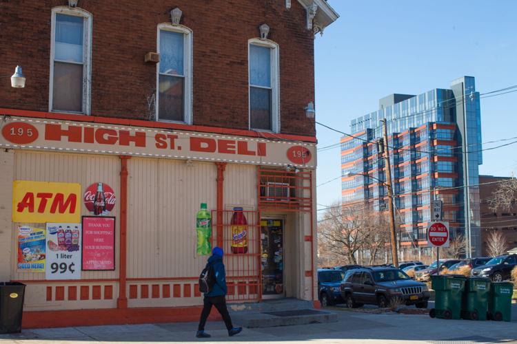
She and other residents were also outraged last year when a local realtor posted an Instagram selfie at the corner of High and Lemon streets with this caption: “Whether you call it the fruit belt or the medical park neighbourhood [sic], this is a great opportunity to be part of the buffalo renaissance!”
Walton now includes the image in a presentation she gives around the country about the dangers of gentrification. Neighborhoods need to shape their own identities in order to prosper, but have little power over digital apps and services, said Aaron Krolikowski, a local data scientist and geographer.
“We tend to self-identify our communities,” Krolikowski said. “If suddenly we become disconnected from that process, I think there’s a lot of questions that emerge about the ability of a community to determine its own future, in some cases.”
Google noted that users can complain to the site when they notice errors. On a desktop computer, the form can be found through the main menu and the “send feedback” button. But the company doesn’t always act on these reports, and the feature is all but unfindable to users with low or intermediate computer skills.
Said Barr, a Fruit Belt resident: “The fact is, I’m not very computer-literate. I wouldn’t know how to begin going about that.”
Officials at City Hall and the Medical Campus also said they could not recall anyone complaining from their offices.
But there have been other efforts to improve Buffalo’s digital representation, city-led and otherwise. Open Street Map, a global collaboration that invites users to map their own communities, has a strong contingent in Buffalo. The city also produced a consensus neighborhood map as part of the development of the Green Code, polling residents on what they called their neighborhoods.
Krolikowski, the Buffalo data scientist, said he would like to see Google and other services take more local knowledge into account, though that process might prove complex. The company could dedicate more resources to incorporating local maps, like the one produced for the Green Code, which is available on the city's open data portal. It could also directly ask users what they call their neighborhoods, a prompt the company already uses to collect crowd-sourced business information.
Until then, Buffalonians may have to settle with individual complaints and hope someone listens. For now, at least, the Fruit Belt is fixed – and that has buoyed residents.
“Some people, that name is all they have to be proud of,” Barr said. “It’s not fair to take that away from them.”


