
Aberdeen, Hilton, Lang Stane


Standing Stone (Prehistoric)
Site Name Aberdeen, Hilton, Lang Stane
Classification Standing Stone (Prehistoric)
Alternative Name(s) Aberdeen; Hilton House; Hilton School, Langstane; Hilton Drive; Hilton Secondary School; 97 Hilton Heights
Canmore ID 19997
Site Number NJ90NW 1
NGR NJ 92243 08352
Datum OSGB36 - NGR
Permalink http://canmore.org.uk/site/19997


- Council Aberdeen, City Of
- Parish Aberdeen
- Former Region Grampian
- Former District City Of Aberdeen
- Former County Aberdeenshire
NJ90NW 1 92243 08352
(NJ 9223 0836) Lang Stane (NR)
OS 6" map, (1928).
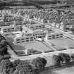
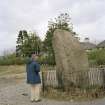
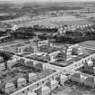
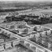
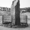
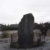
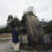
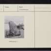
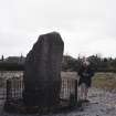
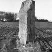
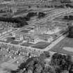
A free-standing block of granite, c.9 to 10 feet in height, which Dr Simpson believes to be a Bronze Age standing stone. It now stands in the grounds of Hilton School and may have been moved when the school was built (Anon 1949), but if so it was replaced in its original position (information from Dr W Douglas Simpson, Librarian, Aberdeen University). Anon 1949.
Visited by OS (JLD) 10 September 1952.
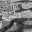
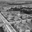
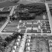
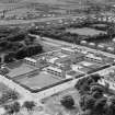
This standing stone is situated on a gentle ENE-facing slope at an altitude of about 80m OD. It stands within a school playground at adjacent to the gates onto Hilton Drive.
(Newspaper reference cited).
NMRS, MS/712/83, visited 11 January 1991.
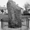
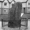
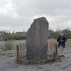
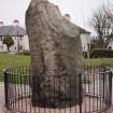
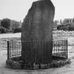
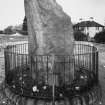
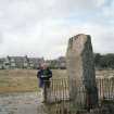
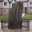
This large granite standing stone, which until recently stood within the grounds of Hilton School, now forms a landscape feature in a new housing development. It measures about 1.5m in breadth by 0.9m in thickness at ground-level and 2.95m in height, and its broad face is aligned WNW and ESE. A scar on its SSW corner suggests that the top of the stone has been broken off.
The stone, which is enclosed by narrow iron railings set on a circular plinth, is depicted on both the 1st and 2nd editions of the OS 6-inch map (Aberdeenshire, 1869, sheet lxxv; 1902, lxxv.NW).
Visited by RCAHMS (JRS), 19 June 2002.
(Name amended to 'Lang Stane, standing stone 25m ENE of 97 Hilton Heights' for purposes of Schedule).
Information from Historic Scotland: amendement dated 26 November 2008.

