Category:Clogher Hill fort
Jump to navigation
Jump to search
hillfort in Tyrone  | |||||
| Upload media | |||||
| Instance of | |||||
|---|---|---|---|---|---|
| Location | County Tyrone, Northern Ireland | ||||
 | |||||
Media in category "Clogher Hill fort"
The following 74 files are in this category, out of 74 total.
-
 "The Wart stone", Clogher Cathedral - geograph.org.uk - 5927842.jpg 1,024 × 685; 318 KB
-
 1882, Clogher - geograph.org.uk - 4570811.jpg 640 × 480; 163 KB
-
 A low hill, Clogher Tenements - geograph.org.uk - 4539567.jpg 640 × 480; 148 KB
-
 A4 Ballagh Road, Carryclogher - geograph.org.uk - 4539510.jpg 640 × 480; 158 KB
-
 A4 Ballagh Road, Clogher Tenements - geograph.org.uk - 5927865.jpg 1,024 × 685; 502 KB
-
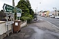
 A4 road, Clogher - geograph.org.uk - 4570803.jpg 640 × 480; 151 KB
-
 Ashfield Road, Carryclogher - geograph.org.uk - 4539504.jpg 640 × 480; 174 KB
-
 Augher Road, Clogher - geograph.org.uk - 4539130.jpg 640 × 480; 158 KB
-
 Augher Road, Clogher - geograph.org.uk - 4539132.jpg 640 × 480; 148 KB
-
 B168, Fintona Road - geograph.org.uk - 5927877.jpg 1,024 × 685; 428 KB
-
 Benchmark, Clogher - geograph.org.uk - 5927810.jpg 1,024 × 685; 342 KB
-
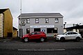
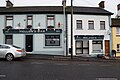
 Bogues Bar, Clogher - geograph.org.uk - 5927817.jpg 1,024 × 685; 393 KB
-
 Bridge along Tullybroom Road - geograph.org.uk - 5887686.jpg 1,024 × 685; 487 KB
-
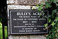
 Bully's Acre graveyard, Clogher - geograph.org.uk - 5887691.jpg 1,024 × 685; 599 KB
-

-

-
 Chopsticks - Clogher Valley Meats - geograph.org.uk - 5927798.jpg 1,024 × 685; 387 KB
-
 Clogher Cathedral (interior view) - geograph.org.uk - 5927856.jpg 1,024 × 685; 393 KB
-
 Clogher Cricket Club - geograph.org.uk - 4539513.jpg 640 × 480; 153 KB
-
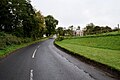
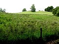 Clogher Demesne - geograph.org.uk - 4570495.jpg 640 × 480; 151 KB
-
 Clogher Hillfort - geograph.org.uk - 1033587.jpg 640 × 479; 75 KB
-
 Clogher Hillfort - geograph.org.uk - 156830.jpg 640 × 479; 109 KB
-
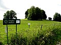 Clogher Hillfort - geograph.org.uk - 4570497.jpg 640 × 480; 172 KB
-
 Clogher Tenements - geograph.org.uk - 5927878.jpg 1,024 × 685; 504 KB
-
 Clogher Valley Credit Union Ltd - geograph.org.uk - 5928022.jpg 1,024 × 685; 367 KB
-
 Clogher Valley Sure Start - geograph.org.uk - 5927822.jpg 1,024 × 685; 354 KB
-
 Crest, Clogher Cathedral - geograph.org.uk - 5927979.jpg 1,024 × 770; 429 KB
-
 Dated keystone, Clogher - geograph.org.uk - 4633358.jpg 640 × 481; 157 KB
-
-
 Disused workhouse, Clogher (3) - geograph.org.uk - 4650745.jpg 640 × 480; 148 KB
-
 Entrance, Bully's Acre - geograph.org.uk - 5887690.jpg 1,024 × 685; 485 KB
-
 Entrance, Clogher Courthouse - geograph.org.uk - 4633357.jpg 640 × 480; 174 KB
-
 Famine pot, Terrew - geograph.org.uk - 5927968.jpg 1,024 × 685; 541 KB
-
 Fannin's Service Station and shop, Clogher - geograph.org.uk - 5927825.jpg 1,024 × 685; 398 KB
-
 Fintona Road - geograph.org.uk - 5927921.jpg 1,024 × 685; 433 KB
-
 Fintona Road, Clogher Tenements - geograph.org.uk - 5927868.jpg 1,024 × 685; 419 KB
-
 Fintona Road, Clogher Tenements - geograph.org.uk - 5927887.jpg 1,024 × 685; 456 KB
-
 Fintona Road, Terrew - geograph.org.uk - 5927893.jpg 1,024 × 685; 391 KB
-
 Former courthouse, Clogher - geograph.org.uk - 5927815.jpg 1,024 × 685; 373 KB
-
 Former Orange and Black Hall, Clogher - geograph.org.uk - 5927828.jpg 1,024 × 640; 111 KB
-
 Hall's Distemper notice, Clogher - geograph.org.uk - 5927993.jpg 1,024 × 601; 223 KB
-
 Johnny's Car Wash, Clogher - geograph.org.uk - 4633354.jpg 640 × 480; 153 KB
-
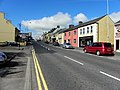
 Main Street, Clogher - geograph.org.uk - 5927800.jpg 1,024 × 685; 441 KB
-
 Main Street, Clogher - geograph.org.uk - 5927860.jpg 1,024 × 685; 443 KB
-
 Main Street, Clogher - geograph.org.uk - 5928017.jpg 1,024 × 685; 487 KB
-
 Mellon's Bar, Clogher - geograph.org.uk - 5927801.jpg 1,024 × 685; 386 KB
-
 Memorial grave, Clogher - geograph.org.uk - 5927862.jpg 1,024 × 685; 443 KB
-
 Mill Road, Terrew - geograph.org.uk - 5927966.jpg 1,024 × 685; 496 KB
-
 Mill Road, Terrew - geograph.org.uk - 5927973.jpg 1,024 × 685; 488 KB
-

-
 Nisa, Clogher - geograph.org.uk - 5927813.jpg 1,024 × 685; 368 KB
-
 Notice, Bully's Arce - geograph.org.uk - 5887689.jpg 1,024 × 685; 464 KB
-
 Orange and Black Hall, Clogher - geograph.org.uk - 5928001.jpg 1,024 × 651; 115 KB
-
 Period house, Clogher - geograph.org.uk - 5927814.jpg 1,024 × 725; 126 KB
-

-
 Pump, Clogher - geograph.org.uk - 4570814.jpg 640 × 480; 167 KB
-
 R A Noble ^ Co - Back in Time, Clogher - geograph.org.uk - 5927821.jpg 1,024 × 685; 387 KB
-
 Shops, Clogher - geograph.org.uk - 5928019.jpg 1,024 × 685; 417 KB
-
 St McCartan's Nursing Home, Clogher - geograph.org.uk - 5927984.jpg 1,024 × 685; 398 KB
-
 St McCartans Cathedral, Clogher - geograph.org.uk - 5927857.jpg 1,024 × 828; 110 KB
-
 Station Road, Clogher - geograph.org.uk - 5928011.jpg 1,024 × 685; 479 KB
-
 Station Road, Clogher Tenements - geograph.org.uk - 5887707.jpg 1,024 × 685; 487 KB
-
 Stone cross, Clogher Cathedral - geograph.org.uk - 5927835.jpg 1,024 × 685; 319 KB
-
 The Cathedral Hall, Clogher - geograph.org.uk - 4633359.jpg 640 × 480; 150 KB
-
 The Cathedral Hall, Clogher - geograph.org.uk - 5927808.jpg 1,024 × 685; 364 KB
-
 The Clogh-Oir or Golden Stone, Clogher Cathedral - geograph.org.uk - 5927845.jpg 1,024 × 685; 377 KB
-
 The Corner Shop, Clogher - geograph.org.uk - 5928015.jpg 1,024 × 685; 418 KB
-
 Tractor crosses the road, Clogher - geograph.org.uk - 4570801.jpg 640 × 480; 145 KB
-

-
 Ulster Bank, Clogher - geograph.org.uk - 5927819.jpg 1,024 × 685; 340 KB
-
 Vacant garage, Clogher - geograph.org.uk - 5928007.jpg 1,024 × 685; 357 KB
-
 Vacant pub. Clogher - geograph.org.uk - 5927834.jpg 1,024 × 685; 403 KB
-
 Valley Nursing Home, Ballymagowan - geograph.org.uk - 5887684.jpg 1,024 × 685; 430 KB
-
 Whitesides - W M Stockdale ^ Son, Clogher - geograph.org.uk - 5927831.jpg 1,024 × 685; 386 KB


_-_geograph.org.uk_-_5927856.jpg)


_-_geograph.org.uk_-_4650745.jpg)


