File:Santa Cruz topographic map-en.png
Jump to navigation
Jump to search
Size of this preview: 596 × 600 pixels. Other resolutions: 239 × 240 pixels | 477 × 480 pixels | 763 × 768 pixels | 1,018 × 1,024 pixels | 2,036 × 2,048 pixels | 3,189 × 3,208 pixels.
Original file (3,189 × 3,208 pixels, file size: 2.12 MB, MIME type: image/png)
Captions
Captions
Add a one-line explanation of what this file represents
| Description |
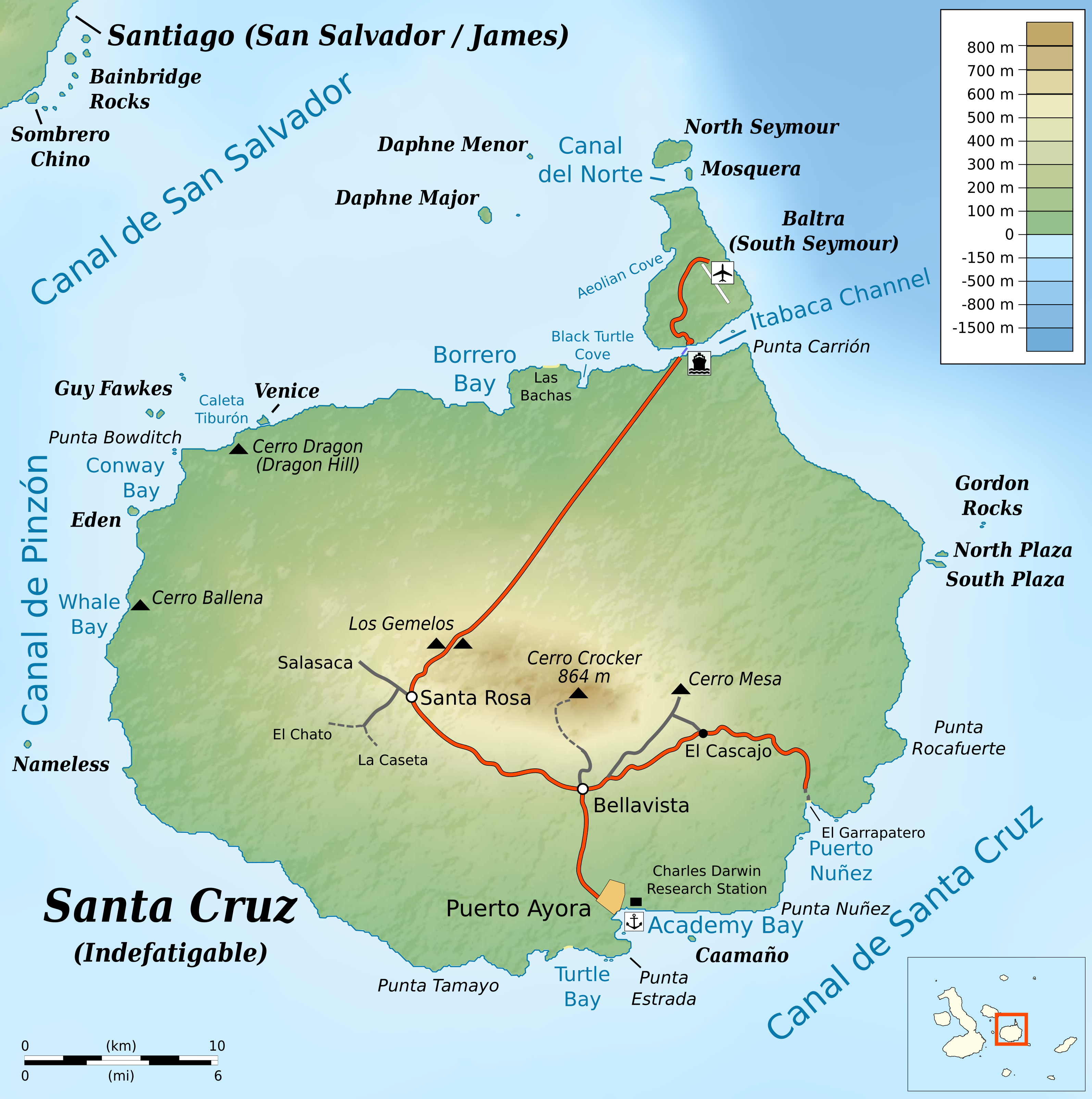
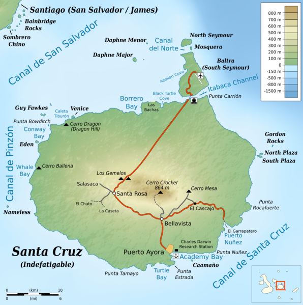
English: Topographic map of en:Santa Cruz Island (Galápagos)
cylindrical equidistant projection, central meridian -90° 30', standard parallel 0° |
|||||||
| Date | ||||||||
| Source |
own work, using: |
|||||||
| Author | Bamse | |||||||
| Permission (Reusing this file) |
|
|||||||
| Other versions |
|


File history
Click on a date/time to view the file as it appeared at that time.
| Date/Time | Thumbnail | Dimensions | User | Comment | |
|---|---|---|---|---|---|
| current | 21:02, 2 June 2016 | | 3,189 × 3,208 (2.12 MB) | Bamse (talk | contribs) | fix airport icon |
| 12:39, 2 June 2016 |  | 3,189 × 3,208 (2.12 MB) | Bamse (talk | contribs) | {{Information |Description ={{en|1=Topographic map of en:Santa Cruz Island (Galápagos)}} cylindrical equidistant projection, central meridian -90° 30', standard parallel 0° |Source =own work, using: * [[:File:Ecuador Galápagos Islan... |
You cannot overwrite this file.
File usage on Commons
The following 5 pages use this file:
File usage on other wikis
The following other wikis use this file:
- Usage on fr.wikipedia.org
- Usage on nl.wikipedia.org