Liste der Landschaftsschutzgebiete im Kreis Lippe
Zur Navigation springen
Zur Suche springen
Die Liste der Landschaftsschutzgebiete im Kreis Lippe enthält die Landschaftsschutzgebiete des Kreises Lippe in Nordrhein-Westfalen.
Liste[Bearbeiten | Quelltext bearbeiten]
| Bild | Nummer | Bezeichnung des Gebietes | Fläche in Hektar | WDPA-ID | Koordinaten | Datum der Verordnung |
|---|---|---|---|---|---|---|
 weitere Bilder weitere Bilder
|
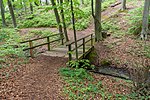
LSG-3818-0007 | LSG-Lipper Bergland mit Bega-Huegelland und westlichem Lipper Bergland sowie Ravensberger Huegelland mit Herforder Platten- und Huegelland | 6446,36 | 555589483 | Position | 2005 |

|
LSG-3818-0008 | Bocksieksbach / Finnebach | 5,35 | 555552803 | Position | 2005 |

|
LSG-3818-0009 | Schwaghofbachtal | 15,22 | 555552804 | Position | 2005 |

|
LSG-3818-0010 | Siek bei Krutheide | 1,78 | 555552805 | Position | 2005 |
| LSG-3818-0023 | Wüstener Bach | 29,32 | 555552818 | Position | 2005 | |
| LSG-3818-0024 | Siek bei Wüsten-Kätchenort | 4,24 | 555552819 | Position | 2005 | |
 weitere Bilder weitere Bilder
|
LSG-3819-0054 | LSG-Rinteln-Hamelner Weserbergland mit Vlothoer Weserdurchbruch und Rintelner Talweitung sowie Lipper Bergland mit Krankenhagener Kuppen, Heidelbecker Hoehen, Hohenhauser und Taller Bergland als großflaechiges Gebiet | 8198,25 | 555589502 | Position | 1999 |
| LSG-3819-0055 | LSG-Weseraue | 236,13 | 555552890 | Position | 1999 | |
| LSG-3819-0056 | LSG-lhmser Bruch l Grund | 32,20 | 555552891 | Position | 1999 | |
| LSG-3819-0057 | LSG-KallelOsterkallelWesterkalle | 222,30 | 555552892 | Position | 1999 | |
| LSG-3819-0058 | LSG-Heckenkomplex nordwestlich Kalldorf | 23,80 | 555552893 | Position | 1999 | |
| LSG-3819-0059 | LSG-Wiebesiek | 41,16 | 555552894 | Position | 1999 | |
| LSG-3819-0060 | LSG-Siek oestlich Kalldorf | 3,93 | 555552895 | Position | 1999 | |
| LSG-3819-0061 | LSG-Sieksystem suedlich Varenholz | 30,96 | 555552896 | Position | 1999 | |
| LSG-3819-0062 | LSG-Hanggruenland am Haiberg | 14,54 | 555552897 | Position | 1999 | |
| LSG-3819-0063 | LSG-Siek bei Faulensiek | 3,31 | 555552898 | Position | 1999 | |
| LSG-3819-0064 | LSG-Bentorfer Bach | 48,24 | 555552899 | Position | 1999 | |
| LSG-3819-0065 | LSG-Eichholzer Bach l Hegerbeke | 33,14 | 555552900 | Position | 1999 | |
| LSG-3819-0066 | LSG-Tiefental | 18,98 | 555552901 | Position | 1999 | |
| LSG-3819-0067 | LSG-Biotopkomplex westlich Heidelbeck | 32,77 | 555552902 | Position | 1999 | |
| LSG-3819-0068 | LSG-Talbereich bei Roentorf | 4,45 | 555552903 | Position | 1999 | |
| LSG-3819-0069 | LSG-Talbereich am Eichhof | 16,31 | 555552904 | Position | 1999 | |
| LSG-3819-0070 | LSG-Hanggruenland am Holzkamp | 2,11 | 555552905 | Position | 1999 | |
| LSG-3819-0071 | LSG-Gruenland-Heckenkomplex "Helle Grund" | 7,98 | 555552906 | Position | 1999 | |
| LSG-3819-0072 | LSG-Westorfer Bachtal | 5,59 | 555552907 | Position | 1999 | |
| LSG-3819-0073 | LSG-Talbereich zwischen Talle und Westorf | 6,42 | 555552908 | Position | 1999 | |
| LSG-3819-0074 | LSG-Lennebeke l Bueltenbach | 20,90 | 555552909 | Position | 1999 | |
| LSG-3819-0075 | LSG-Biotopkomplex am Kordhankensberg | 5,19 | 555552910 | Position | 1999 | |
| LSG-3819-0076 | LSG-Muehlbach und Stoeckerbach | 33,58 | 555552911 | Position | 1999 | |
| LSG-3819-0077 | LSG-Feldgehoelz suedlich Hellberg | 0,22 | 555552912 | Position | 1999 | |
| LSG-3820-0011 | LSG-Herrengraben | 25,66 | 555552913 | Position | 1999 | |
| LSG-3820-0013 | LSG-Wald-Gruenlandbereich bei Langewand | 21,16 | 555552914 | Position | 1999 | |
| LSG-3820-0014 | LSG-Talbereich nordoestlich Heidelbeck | 7,83 | 555552915 | Position | 1999 | |
 weitere Bilder weitere Bilder
|
LSG-3820-0015 | LSG-Oestliches Lipper Bergland | 6956,63 | 555552916 | Position | 2007 |
| LSG-3820-0016 | LSG-Wemke Bachtal | 49,48 | 555552917 | Position | 2007 | |
| LSG-3820-0017 | LSG-Silixer Bachtal | 40,23 | 555552918 | Position | 2007 | |
| LSG-3820-0018 | LSG-Gruenland-Gehoelzkomplex bei Kuekenbruch | 24,13 | 555552919 | Position | 2007 | |
| LSG-3820-0019 | LSG-Lassbachtal | 37,58 | 555552920 | Position | 2007 | |
| LSG-3820-0020 | LSG-Hamsterbachtal | 16,83 | 555552921 | Position | 2007 | |
| LSG-3820-0021 | LSG-Magergruenland am Heinrichsberg | 2,57 | 555552922 | Position | 2007 | |
| LSG-3820-0022 | LSG-Hanggruenland am Saalberg | 19,83 | 555552923 | Position | 2007 | |
| LSG-3820-0023 | LSG-Hanggruenland oestlich Rott | 40,39 | 555552924 | Position | 2007 | |
| LSG-3820-0024 | LSG-Noesingfelder Bachtal | 16,66 | 555552925 | Position | 2007 | |
 weitere Bilder weitere Bilder
|
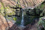
LSG-3820-0025 | LSG-Rickbachtal | 19,79 | 555552926 | Position | 2007 |
 weitere Bilder weitere Bilder
|
LSG-3820-0026 | LSG-Siek zwischen Wiemke und Fuetig | 19,31 | 555552927 | Position | 2007 |
| LSG-3820-0027 | LSG-Kollerbachtal | 29,35 | 555552928 | Position | 2007 | |
 weitere Bilder weitere Bilder
|
LSG-3917-0011 | LSG-Bielefelder Osning mit Teutoburger Wald und OsningVorbergen sowie Ravensberger Huegelland | 3313,02 | 555553013 | Position | 2001 |
| LSG-3917-0012 | LSG-Gruenlandkomplex bei Sauerland | 10,42 | 555553014 | Position | 2001 | |
| LSG-3917-0013 | LSG-Siek suedlich Nienhagen | 1,33 | 555553015 | Position | 2001 | |
| LSG-3917-0014 | LSG-Siek suedlich Gut Eckendorf | 3,34 | 555553016 | Position | 2001 | |
| LSG-3917-0015 | LSG-Sussieksbach und Wohlbrede | 8,74 | 555553017 | Position | 2001 | |
| LSG-3918-0001 | LSG-Siekbach | 6,62 | 555553031 | Position | 2001 | |
| LSG-3918-0002 | LSG-Heipker Bachtal | 35,04 | 555553032 | Position | 2001 | |
| LSG-3918-0003 | LSG-Bachsiek bei Hovedissen | 13,90 | 555553033 | Position | 2001 | |
| LSG-3918-0004 | LSG-Wald-Talbereich bei Krentrup | 4,39 | 555553034 | Position | 2001 | |
| LSG-3918-0005 | LSG-Tal des Eselbaches | 13,77 | 555553035 | Position | 2001 | |
| LSG-3918-0006 | LSG-Pansbach mit Kraehenholz und Hinnaksteich | 31,98 | 555553036 | Position | 2001 | |
| LSG-3918-0007 | LSG-Kleibusch | 1,08 | 555553037 | Position | 2001 | |
| LSG-3918-0008 | LSG-Evenhauser Holz | 3,57 | 555553038 | Position | 2001 | |

|
LSG-3918-0009 | Speckenbach | 20,35 | 555553039 | Position | 2005 |

|
LSG-3918-0010 | Voßsiek | 11,18 | 555553040 | Position | 2005 |
 weitere Bilder weitere Bilder
|
LSG-3918-0011 | LSG-Westliches und Südliches Lipper Bergland | 6881,05 | 555553041 | Position | 2009 |
| LSG-3918-0012 | LSG-Rhienbach | 8,49 | 555553042 | Position | 2009 | |
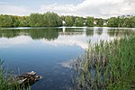
| LSG-3918-0013 | Landschaftsschutzgebiet Begaaue | 34,66 | 555553043 | Position | 2009 | |
 weitere Bilder weitere Bilder
|
LSG-3918-0041 | Landschaftsschutzgebiet Westliches Lipper Bergland, Ravensberger Hügelland und Bielefelder Osning | 4578,47 | 555589606 | Position | 2006 |
 weitere Bilder weitere Bilder
|
LSG-3918-0042 | LSG-Begaaue | 71,18 | 555553048 | Position | 2006 |
| LSG-3918-0043 | Landschaftsschutzgebiet Pottenhauser Bachtal | 7,87 | 555553049 | Position | 2006 | |
| LSG-3918-0044 | Landschaftsschutzgebiet Flugsanddüne bei Waddenhausen | 3,89 | 555553050 | Position | 2006 | |
| LSG-3919-0001 | LSG-Schiefenbrink | 7,91 | 555553051 | Position | 2009 | |
| LSG-3919-0002 | LSG-Oberlauf der Ilse | 6,79 | 555553052 | Position | 2009 | |
| LSG-3919-0003 | LSG-Welsdorfer Bach | 11,68 | 555553053 | Position | 2009 | |
| LSG-3919-0004 | LSG-Taller Bach | 15,32 | 555553054 | Position | 2009 | |
| LSG-3919-0005 | LSG-Istorfer Bach | 5,71 | 555553055 | Position | 2009 | |
| LSG-3919-0006 | LSG-Jaegerbach | 16,85 | 555553056 | Position | 2009 | |
| LSG-3919-0007 | LSG-Straenger Bach | 22,91 | 555553057 | Position | 2009 | |
| LSG-3919-0008 | LSG-Hellbach | 3,90 | 555553058 | Position | 2009 | |
| LSG-3919-0009 | LSG-Luher Bach | 90,35 | 555553059 | Position | 2009 | |
| LSG-3919-0010 | LSG-Sellsiekbach | 12,51 | 555553060 | Position | 2009 | |
| LSG-3919-0011 | LSG-Radsiekbach | 48,30 | 555553061 | Position | 2009 | |
 weitere Bilder weitere Bilder
|
LSG-3919-0012 | LSG-Maibolte | 9,80 | 555553062 | Position | 2009 |
| LSG-3919-0013 | LSG-Sugehohlbach | 9,36 | 555553063 | Position | 2009 | |
| LSG-3919-0014 | LSG-Biotopkomplex Hasenbrede | 6,55 | 555553064 | Position | 2009 | |
| LSG-3919-0015 | LSG-Thronsbach | 9,97 | 555553065 | Position | 2009 | |
 weitere Bilder weitere Bilder
|
LSG-3919-0016 | LSG-Linnebach | 33,70 | 555553066 | Position | 2009 |
| LSG-3919-0017 | LSG-Laubker Bach | 57,13 | 555553067 | Position | 2009 | |
| LSG-3919-0018 | LSG-Biotopkomplex Bieberg / Plattwiese | 23,28 | 555553068 | Position | 2009 | |
| LSG-3919-0019 | LSG-Untreu | 15,35 | 555553069 | Position | 2009 | |
| LSG-3919-0020 | LSG-Langenkampsbach | 13,66 | 555553070 | Position | 2009 | |
| LSG-3919-0021 | LSG-Tal suedlich Rieperturm | 3,53 | 555553071 | Position | 2009 | |
| LSG-3919-0022 | LSG-Luetter Bach | 39,37 | 555553072 | Position | 2009 | |
| LSG-3919-0023 | LSG-Haselbeke | 18,97 | 555553073 | Position | 2009 | |
| LSG-3919-0024 | LSG-Biotopkomplex suedlich des Romberges | 20,88 | 555553074 | Position | 1999 | |
| LSG-3919-0025 | LSG-Quelllauf noerdlich Henstorf | 2,31 | 555553075 | Position | 1999 | |
| LSG-3919-0026 | LSG-Biotopkomplex westlich Rentorf | 28,10 | 555553076 | Position | 1999 | |
 weitere Bilder weitere Bilder
|
LSG-3919-0027 | LSG-Gruenland - Heckenkomplex am Schanzenberg | 9,47 | 555553077 | Position | 1999 |
| LSG-3919-0028 | LSG-Gruenlandbereich suedoestlich Niedermeien | 12,28 | 555553078 | Position | 1999 | |
| LSG-3919-0029 | LSG-Quelllauf bei Kleikamp | 5,33 | 555553079 | Position | 1999 | |
| LSG-3919-0030 | LSG-Siek "Im Klee" | 5,91 | 555553080 | Position | 1999 | |
 weitere Bilder weitere Bilder
|
LSG-3919-0031 | LSG-Lipper und Pyrmonter Bergland | 8565,55 | 555553081 | Position | 2007 |
 weitere Bilder weitere Bilder
|
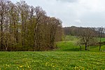
LSG-3919-0032 | LSG-Hillbachtal | 25,53 | 555553082 | Position | 2007 |
 weitere Bilder weitere Bilder
|
LSG-3919-0033 | LSG-Wald- und Gruenlandkomplex Hillentrup | 52,71 | 555553083 | Position | 2007 |
 weitere Bilder weitere Bilder
|
LSG-3919-0034 | LSG-Maiboltetal | 24,18 | 555553084 | Position | 2007 |
| LSG-3919-0035 | LSG-Luetter Bachtal | 3,20 | 555553085 | Position | 2007 | |
| LSG-3919-0036 | LSG-Taller Bachtal | 9,25 | 555553086 | Position | 1999 | |
| LSG-3919-0037 | LSG-Kuestergrund | 5,72 | 555553087 | Position | 1999 | |
| LSG-3919-0038 | LSG-Hagensiek l Grund | 24,24 | 555553088 | Position | 1999 | |
| LSG-3919-0039 | LSG-Biotopkomplex suedlich Hohenhausen | 2,48 | 555553089 | Position | 1999 | |
| LSG-3919-0040 | LSG-Gruenland-Heckenkomplex am Knueppelberg | 10,10 | 555553090 | Position | 1999 | |
| LSG-3919-0041 | LSG-Talbereich bei Hagen | 32,52 | 555553091 | Position | 1999 | |
| LSG-3919-0042 | LSG-Siekbereich des Hasselbaches | 9,81 | 555553092 | Position | 1999 | |
 weitere Bilder weitere Bilder
|
LSG-3919-0043 | LSG-Hanggruenland am Windberg | 20,22 | 555553093 | Position | 1999 |
| LSG-3919-0044 | LSG-Gruenland-Heckenkomplex suedlich Brosen | 22,72 | 555553094 | Position | 1999 | |
| LSG-3919-0045 | LSG-Feldgehoelz oestlich Bavenhausen | 1,65 | 555553095 | Position | 1999 | |
 weitere Bilder weitere Bilder
|
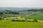
LSG-3919-0046 | LSG-Bungental/Schellental | 48,84 | 555553096 | Position | 1999 |
| LSG-3919-0047 | LSG-Quellsieke der Hasebeke | 4,44 | 555553097 | Position | 2005 | |
 weitere Bilder weitere Bilder
|
LSG-3920-0001 | LSG-Alter Sternberg | 29,09 | 555553098 | Position | 2007 |
| LSG-3920-0002 | LSG-Biotopkomplex Krusfeld | 7,36 | 555553099 | Position | 2007 | |
 weitere Bilder weitere Bilder
|
LSG-3920-0003 | LSG-Wald- und Gruenlandkomplex Muehlenberg | 37,54 | 555553100 | Position | 2007 |
| LSG-3920-0004 | LSG-Wald- und Gruenlandkomplex Huppigsberg | 111,80 | 555553101 | Position | 2007 | |
| LSG-3920-0005 | LSG-Doehmerbach | 4,95 | 555553102 | Position | 2007 | |
| LSG-3920-0006 | LSG-Dewesiek | 42,85 | 555553103 | Position | 2007 | |
| LSG-3920-0007 | LSG-Muehlingsbachtal und Pottkuhlenteich | 21,09 | 555553104 | Position | 2007 | |
| LSG-3920-0008 | LSG-Hecken- und Gruenlandkomplex Selberg-Friedenstal | 54,85 | 555553105 | Position | 2007 | |
| LSG-3920-0009 | LSG-Wald- und Gruenlandkomplex Marksberg | 43,23 | 555553106 | Position | 2007 | |
| LSG-3920-0010 | LSG-Wald- und Gruenlandkomplex Querental | 28,20 | 555553107 | Position | 2007 | |
| LSG-3920-0011 | LSG-Quellbereiche der Exter | 32,83 | 555553108 | Position | 2007 | |
| LSG-3920-0012 | LSG-Oestlingsbach | 13,24 | 555553109 | Position | 2007 | |
| LSG-3920-0013 | LSG-Dorotheental | 57,88 | 555553110 | Position | 2007 | |
| LSG-3920-0014 | LSG-Diepkebachtal | 20,71 | 555553111 | Position | 2007 | |
| LSG-3920-0015 | LSG-Hermsiek | 44,42 | 555553112 | Position | 2007 | |
| LSG-3920-0016 | LSG-Eichelbach | 37,44 | 555553113 | Position | 2007 | |
| LSG-3920-0017 | LSG-Hecken- und Gruenlandkomplex Bromberg | 11,18 | 555553114 | Position | 2007 | |
| LSG-3920-0018 | LSG-Hecken- und Gruenlandkomplex | 15,35 | 555553115 | Position | 2007 | |
| LSG-3920-0019 | LSG-Hecken- und Gruenlandkomplex Sonneborn | 47,63 | 555553116 | Position | 2007 | |
| LSG-3920-0020 | LSG-Wald- und Gruenlandkomplex Blomenstein | 15,19 | 555553117 | Position | 2007 | |
| LSG-3920-0021 | LSG-Siektal westlich Schwelentrup | 4,68 | 555553118 | Position | 2007 | |
| LSG-3920-0022 | LSG-Gruener Siek | 5,52 | 555553119 | Position | 2007 | |
| LSG-3920-0023 | LSG-Sieksystem bei Sturheide | 16,91 | 555553120 | Position | 1999 | |
| LSG-3920-0024 | LSG-Biotopkomplex am Windberg (Luedenhausen) | 7,49 | 555553121 | Position | 1999 | |
| LSG-3920-0025 | LSG-Talbereich nordoestlich Luedenhausen | 3,16 | 555553122 | Position | 1999 | |
| LSG-3920-0026 | LSG-Quelllaeufe im Wittsieker Holz | 19,50 | 555553123 | Position | 1999 | |
| LSG-3920-0027 | LSG-Biotopkomplex oestlich Luedenhausen | 14,07 | 555553124 | Position | 1999 | |
| LSG-3920-0028 | LSG-Biotopkomplex am Krubberg | 47,64 | 555553125 | Position | 1999 | |
| LSG-3920-0029 | LSG-Wald-Gruenlandbereich am Grennerberg | 4,22 | 555553126 | Position | 1999 | |
| LSG-3920-0030 | LSG-Bachtal oestlich Gruener Anger | 11,27 | 555553127 | Position | 2007 | |
| LSG-3920-0031 | LSG-Terrassenkulturlandschaft noerdlich Hohe Asch | 39,83 | 555553128 | Position | 2007 | |
| LSG-3920-0032 | LSG-Humme-Bachtal mit Dewesiek | 17,52 | 555553129 | Position | 2007 | |
| LSG-3920-0033 | LSG-Bachtal mit Gruenland-Gehoelzkomplex bei Hohensonne | 21,11 | 555553130 | Position | 2007 | |
| LSG-3920-0034 | LSG-Wald-Gruenlandkomplex suedlich Lassbruch | 57,42 | 555553131 | Position | 2007 | |
| LSG-3920-0035 | LSG-Scharpker Bachtal | 39,01 | 555553132 | Position | 2007 | |
| LSG-3920-0036 | LSG-Zulaeufe zur Alme | 12,97 | 555553133 | Position | 2007 | |
| LSG-3920-0037 | LSG-Bachtal bei Vogelsang | 3,36 | 555553134 | Position | 2007 | |
| LSG-3920-0038 | LSG-Wald-Gruenlandkomplex westlich Nalhof | 47,63 | 555553135 | Position | 2007 | |
| LSG-3920-0039 | LSG-Bachtal mit Hanggruenland zwischen Siekfeld und Vallentrup | 55,36 | 555553136 | Position | 2007 | |
| LSG-3920-0040 | LSG-Beberbachtal oestlich Schoenhagen | 13,78 | 555553137 | Position | 2007 | |
| LSG-3920-0041 | LSG-Wald-Gruenlandkomplex am Grennerberg | 1,16 | 555553138 | Position | 2007 | |
| LSG-3920-0042 | LSG-Beekebachtal | 39,13 | 555553139 | Position | 2007 | |
| LSG-3920-0043 | LSG-Nordhagenbachtal | 13,92 | 555553140 | Position | 2007 | |
| LSG-3920-0044 | LSG-Bachtal und Talhaenge zwischen Winterberg und Eimke | 79,54 | 555553141 | Position | 2007 | |
| LSG-3920-0045 | LSG-Heckenlandschaft suedlich Boesingfeld | 4,01 | 555553142 | Position | 2007 | |
| LSG-3920-0046 | LSG-Doehmerbachtal | 10,11 | 555553143 | Position | 2007 | |
| LSG-3921-0001 | LSG-Biotopkomplex Riddersgrund | 4,50 | 555553144 | Position | 2007 | |
 weitere Bilder weitere Bilder
|
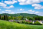
LSG-4017-0012 | LSG-Teutoburger Wald mit Brackweder Osning und Obere Senne mit Wistinghauser-, Haustenbecker- und Augustdorfer Senne und Ausläufern der Stukenbroker Lehmplatten | 1399,87 | 555589595 | Position | 1990 |
|
LSG-4017-0023 | LSG-Teutoburger Wald mit Lippischem Wald, Osning Kamm und östlichem Osning-Vorland | 1451,65 | 555553234 | Position | 2006 |
| LSG-4017-0029 | LSG-Steinbruch Menkhauser Berg | 1,29 | 555553235 | Position | 2006 | |
| LSG-4018-0001 | LSG-Windwehetal und Seitentaeler | 59,54 | 555553237 | Position | 2001 | |
| LSG-4018-0002 | LSG-Siekbachtal oestlich Grester Feld | 5,97 | 555553238 | Position | 2001 | |
| LSG-4018-0003 | LSG-Gruetebach oestlich Niederbarkhausen | 3,45 | 555553239 | Position | 2001 | |
| LSG-4018-0004 | LSG-Schafberg | 8,53 | 555553240 | Position | 2001 | |
| LSG-4018-0005 | LSG-Haferbachtal | 8,44 | 555553241 | Position | 2001 | |
| LSG-4018-0006 | LSG-Haferbach am Noelkenberg | 6,36 | 555553242 | Position | 2001 | |
| LSG-4018-0007 | LSG-Quellbereich an der Nordflanke des Toensberges | 6,49 | 555553243 | Position | 2001 | |
| LSG-4018-0008 | Landschaftsschutzgebiet Krebsbachtal | 10,52 | 555553244 | Position | 2006 | |
 weitere Bilder weitere Bilder
|
LSG-4018-0009 | Landschaftsschutzgebiet Siek- und Haferbachtal | 29,44 | 555553245 | Position | 2006 |
| LSG-4018-0010 | Landschaftsschutzgebiet Gruttbachtal | 24,38 | 555553246 | Position | 2006 | |
 weitere Bilder weitere Bilder
|
LSG-4018-0011 | Landschaftsschutzgebiet Sunder- und Bruchbachtal | 34,25 | 555560848 | Position | 2006 |
| LSG-4018-0012 | Landschaftsschutzgebiet Werreniederung | 63,91 | 555553248 | Position | 2006 | |
| LSG-4018-0013 | Landschaftsschutzgebiet Siek am Hellwegshof | 8,88 | 555553249 | Position | 2006 | |
| LSG-4018-0014 | Landschaftsschutzgebiet Rothenbachtal | 19,85 | 555553250 | Position | 2006 | |
| LSG-4018-0015 | Landschaftsschutzgebiet Webelsbusch | 2,16 | 555553251 | Position | 2006 | |
 weitere Bilder weitere Bilder
|
LSG-4018-0016 | Landschaftsschutzgebiet Hörster Bachtal | 29,02 | 555553252 | Position | 2006 |
| LSG-4018-0017 | Landschaftsschutzgebiet Retlager Bachtal | 12,15 | 555553253 | Position | 2006 | |

|
LSG-4018-0018 | Landschaftsschutzgebiet Wald- und Wiesenkomplex Münterburg | 79,09 | 555553254 | Position | 2006 |

|
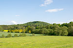
LSG-4018-0019 | Landschaftsschutzgebiet Hörster Egge | 53,50 | 555553255 | Position | 2006 |
 weitere Bilder weitere Bilder
|
LSG-4018-0020 | LSG-Suedliches Lipper Bergland mit Werrehuegelland und Detmolder Huegelland sowie Bielefelder Osning mit Pivitsheider Bergen | 6180,71 | 555589532 | Position | 2006 |
 weitere Bilder weitere Bilder
|
LSG-4018-0021 | LSG-Werretal | 210,80 | 555553257 | Position | 2006 |
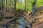
| LSG-4018-0022 | LSG-Retlager Bach | 14,69 | 555553258 | Position | 2006 | |
 weitere Bilder weitere Bilder
|
LSG-4018-0023 | LSG-Hasselbach | 20,27 | 555553259 | Position | 2006 |
 weitere Bilder weitere Bilder
|
LSG-4018-0024 | LSG-Heidenbach | 15,49 | 555553260 | Position | 2006 |
 weitere Bilder weitere Bilder
|
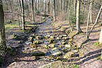
LSG-4018-0025 | LSG-Biotopkomplex am Viethberg | 33,18 | 555553261 | Position | 2006 |
| LSG-4018-0026 | LSG-Bachtal bei Krawinkel | 1,80 | 555553262 | Position | 2006 | |
| LSG-4018-0027 | LSG-Quellbereich Massiekbach | 13,27 | 555553263 | Position | 2006 | |
| LSG-4018-0028 | LSG-Biotopkomplex Hilgenstuhl | 13,97 | 555553264 | Position | 2006 | |
| LSG-4018-0029 | LSG-Retlager Bachtal | 0,27 | 555553265 | Position | 2006 | |
 weitere Bilder weitere Bilder
|
LSG-4018-0030 | LSG-Heidenbach | 14,98 | 555553266 | Position | 2006 |
| LSG-4019-0001 | LSG-Echternbach | 36,94 | 555553267 | Position | 2009 | |
| LSG-4019-0002 | LSG-Vorderbach | 12,22 | 555553268 | Position | 2009 | |
| LSG-4019-0003 | LSG-Biotopkomplex Wiembecker Driften | 16,73 | 555553269 | Position | 2009 | |
| LSG-4019-0004 | LSG-Bruchbach | 16,75 | 555553270 | Position | 2009 | |
| LSG-4019-0005 | LSG-Krebsbach | 19,63 | 555553271 | Position | 2009 | |
| LSG-4019-0006 | LSG-Moorsiek | 9,20 | 555553272 | Position | 2009 | |
 weitere Bilder weitere Bilder
|
LSG-4019-0007 | LSG-Hahnberg | 71,47 | 555553273 | Position | 2006 |
| LSG-4019-0008 | LSG-Stenderbusch | 2,75 | 555553274 | Position | 2006 | |
| LSG-4019-0011 | LSG-Linnebach | 18,82 | 555553275 | Position | 2006 | |
 weitere Bilder weitere Bilder
|
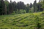
LSG-4019-0012 | LSG-Buchenwald-Obstwiesenkomplex in Hedderhagen | 1,43 | 555553276 | Position | 2006 |
 weitere Bilder weitere Bilder
|
LSG-4019-0013 | LSG-Biotopkomplex am Rotenberg | 15,40 | 555553277 | Position | 2006 |
| LSG-4019-0014 | LSG-Gruenland-Heckenkomplex suedlich Lossbruch | 20,44 | 555553278 | Position | 2006 | |
| LSG-4019-0015 | LSG-Bachlauf oestlich Lossbruch | 18,04 | 555553279 | Position | 2006 | |
| LSG-4019-0016 | LSG-Krebsbach | 4,10 | 555553280 | Position | 2006 | |
 weitere Bilder weitere Bilder
|
LSG-4019-0017 | LSG-Bachtaeler westlich Biesen | 17,27 | 555553281 | Position | 2006 |
 weitere Bilder weitere Bilder
|
LSG-4019-0018 | LSG-Bachtal noerdlich Bremke | 8,22 | 555553282 | Position | 2006 |
| LSG-4019-0019 | LSG-Biotopkomplex bei Vosshagen | 4,01 | 555553283 | Position | 2006 | |
| LSG-4019-0020 | LSG-Biotopkomplex noerdlich Jerxen | 8,14 | 555553284 | Position | 2006 | |
 weitere Bilder weitere Bilder
|
LSG-4019-0021 | LSG-Sylbecke | 42,01 | 555553285 | Position | 2006 |
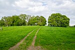
| LSG-4019-0022 | LSG-Brokerbach | 30,99 | 555553286 | Position | 2006 | |
|
LSG-4019-0023 | LSG-Almberg | 16,67 | 555553287 | Position | 2006 |
| LSG-4019-0024 | LSG-Bremker Bach | 13,12 | 555553288 | Position | 2006 | |
 weitere Bilder weitere Bilder
|
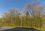
LSG-4019-0025 | LSG-Mosebecke | 65,23 | 555553289 | Position | 2006 |
 weitere Bilder weitere Bilder
|
LSG-4019-0026 | LSG-Scherenbruch | 7,45 | 555553290 | Position | 2006 |
| LSG-4019-0027 | LSG-Biotopkomplex am Hiddeser Berg | 16,01 | 555553291 | Position | 2006 | |
 weitere Bilder weitere Bilder
|
LSG-4019-0028 | LSG-Woerbke / Diestelbach | 50,20 | 555553292 | Position | 2006 |
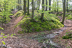 weitere Bilder weitere Bilder
|
LSG-4019-0029 | LSG-Wedasch | 25,92 | 555553293 | Position | 2006 |
| LSG-4019-0030 | LSG-Quelllaeufe des Daemischbaches | 6,75 | 555553294 | Position | 2006 | |
| LSG-4019-0031 | LSG-Siekbach | 14,06 | 555553295 | Position | 2006 | |
 weitere Bilder weitere Bilder
|
LSG-4019-0032 | LSG-Buchenwald / Obstwiesenkomplex bei Hedderhagen | 9,15 | 555553296 | Position | 2006 |

|
LSG-4019-0033 | LSG-Wiembecke | 16,58 | 555553297 | Position | 2006 |
| LSG-4019-0034 | LSG-Strangbach/Buchholz | 47,64 | 555553298 | Position | 2006 | |
 weitere Bilder weitere Bilder
|
LSG-4019-0035 | LSG-Refers Siek | 10,97 | 555553299 | Position | 2006 |
 weitere Bilder weitere Bilder
|
LSG-4019-0036 | LSG-Lipper Bergland mit Blomberger Hoehen, Detmolder Huegelland und Blomberger Becken sowie Bachtaeler und Gruenlandbereiche der Blomberger Hoehen und Blomberger Becken | 7336,64 | 555589484 | Position | 2005 |
| LSG-4019-0037 | LSG-Niedernkamp und Grabenbreite | 2,95 | 555553301 | Position | 2005 | |
 weitere Bilder weitere Bilder
|
LSG-4019-0038 | LSG-Kulturlandschaftskomplex Hagendonop | 66,76 | 555553302 | Position | 2005 |
| LSG-4019-0039 | LSG-Bachtal Thebenbreite | 0,65 | 555553303 | Position | 2005 | |
| LSG-4019-0040 | LSG-Nebental der Marpe nordwestlich Luedersdorf | 3,68 | 555553304 | Position | 2005 | |
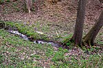 weitere Bilder weitere Bilder
|
LSG-4019-0041 | LSG-Bachtal am Luedershof | 3,75 | 555553305 | Position | 2005 |
| LSG-4019-0042 | LSG-Birksiek westlich Dalborn | 4,21 | 555553306 | Position | 2005 | |
| LSG-4019-0043 | LSG-Wald im Bereich Eggeland | 9,81 | 555553307 | Position | 2005 | |
| LSG-4019-0044 | LSG-Talsystem bei Bruentrup | 13,06 | 555553308 | Position | 2005 | |
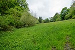 weitere Bilder weitere Bilder
|
LSG-4019-0045 | LSG-Tal westlich Schling | 6,51 | 555553309 | Position | 2006 |
| LSG-4019-0051 | LSG-Bachniederungen und Talrandzonen noerdlich Wehren | 48,77 | 555553310 | Position | 1997 | |
| LSG-4019-0052 | LSG-Werretal oestlich Bad Meinberg | 16,40 | 555553311 | Position | 1997 | |
 weitere Bilder weitere Bilder
|
LSG-4019-0053 | LSG-Werretal westlich Bad Meinberg | 38,08 | 555553312 | Position | 1997 |
| LSG-4020-0001 | LSG-Biotopkomplex Kleiner Hagen | 3,96 | 555553313 | Position | 2007 | |
| LSG-4020-0002 | LSG-Steinkensbachtal | 28,20 | 555553314 | Position | 2007 | |
| LSG-4020-0003 | LSG-Grießebach | 56,81 | Position | 2007 | ||
| LSG-4020-0004 | LSG-Papenquellbachtal | 9,86 | 555553316 | Position | 2007 | |
 weitere Bilder weitere Bilder
|
LSG-4020-0005 | LSG-Selbecke | 19,53 | 555553317 | Position | 2007 |
| LSG-4020-0006 | LSG-Hahnebach | 34,81 | 555553318 | Position | 2007 | |
| LSG-4020-0008 | LSG-Gruenlandbereich bei Obersiebenhoefen | 0,87 | 555553320 | Position | 2005 | |
| LSG-4020-0009 | LSG-Liethbachtal | 29,76 | 555553321 | Position | 2005 | |
 weitere Bilder weitere Bilder
|
LSG-4020-0010 | LSG-Siek westlich Reelkirchen | 9,26 | 555553322 | Position | 2005 |
| LSG-4020-0011 | LSG-Bach-Eschenwaelder am Puellenberg | 4,58 | 555553323 | Position | 2005 | |
| LSG-4020-0012 | LSG-Tal der Donope | 25,5 | 555553324 | Position | 2005 | |
| LSG-4020-0013 | LSG-Koellerberg | 9,84 | 555553325 | Position | 2005 | |
| LSG-4020-0014 | LSG-Oberes Marpetal | 28,28 | 555553326 | Position | 2005 | |
| LSG-4020-0015 | LSG-Tal noerdlich Riechenberg | 7,46 | 555553327 | Position | 2005 | |
| LSG-4020-0016 | LSG-Talbereich der Diestelbachaue mit Nebentaelern | 66,27 | 555553328 | Position | 2005 | |
| LSG-4020-0017 | LSG-Auenbereich westlich Nabberg | 8,42 | 555553329 | Position | 2005 | |
| LSG-4020-0018 | LSG-Talbereich bei Klus | 6,71 | 555553330 | Position | 2005 | |
| LSG-4020-0019 | LSG-Gruenlandbereich am Ackerrott | 4,62 | 555553331 | Position | 2005 | |
| LSG-4020-0020 | LSG-Gruenlandbereich am Mossenberg | 5,75 | 555553332 | Position | 2005 | |
| LSG-4020-0021 | LSG-Hainbach suedoestlich von Istrup | 6,28 | 555553333 | Position | 2005 | |
| LSG-4020-0022 | LSG-Talabschnitt westlich von Blomberg | 3,20 | 555553334 | Position | 2005 | |

|
LSG-4020-0023 | LSG-Talbereich oestlich des Sportplatzes Blomberg | 6,33 | 555553335 | Position | 2005 |
| LSG-4020-0024 | LSG-Siekgraben westlich Drawenberg | 3,73 | 555553336 | Position | 2005 | |
| LSG-4020-0025 | LSG-Rosensiek und Bocksgrund suedlich Istrup | 14,71 | 555553337 | Position | 2005 | |
 weitere Bilder weitere Bilder
|
LSG-4020-0026 | LSG-Lipper Bergland mit Steinheimer Becken, Blomberger Hoehen, Sabbenhauser Mulde und Schwalenberger Hoehen | 2798,90 | 555589485 | Position | 1994 |
| LSG-4020-0027 | LSG-Fauler Siek | 1,25 | 555553339 | Position | 1994 | |
| LSG-4020-0028 | LSG-Blutbachtal | 16,50 | 555553340 | Position | 1994 | |
| LSG-4020-0029 | LSG-Feldkuhle im Siekfeld | 0,14 | 555553341 | Position | 1994 | |
| LSG-4020-0030 | LSG-Talbereich im Siekfeld | 1,20 | 555553342 | Position | 1994 | |
| LSG-4020-0031 | LSG-Diestelbachtal | 32,21 | 555553343 | Position | 1994 | |
| LSG-4020-0032 | LSG-Am Bohnenbachtal suedlich Stammhof | 2,64 | 555553344 | Position | 1994 | |
| LSG-4020-0033 | LSG-Ellernbachtal | 10,99 | 555553345 | Position | 1994 | |
| LSG-4020-0034 | LSG-Toellengrund | 27,59 | 555553346 | Position | 1994 | |
| LSG-4020-0035 | LSG-Duddenloch suedoestlich Blomberg | 15,66 | 555553347 | Position | 2005 | |
 weitere Bilder weitere Bilder
|
LSG-4020-0036 | LSG-Butterbachtal mit Gruenlandkomplex am Puengelsberg | 12,20 | 555553348 | Position | 2005 |
| LSG-4020-0037 | LSG-Quellbereich mit Feuchtgebiet Im Sundern westlich Mossenberg | 1,59 | 555553349 | Position | 2005 | |
| LSG-4020-0038 | LSG-Siekbereich am Buschkamp | 2,30 | 555553350 | Position | 2005 | |
| LSG-4020-0039 | LSG-Bachtal bei Brunsiek | 7,23 | 555553351 | Position | 2005 | |
| LSG-4020-0040 | LSG-Gruenlandbereich suedlich Freismissen | 8,88 | 555553352 | Position | 2005 | |
| LSG-4020-0041 | LSG-Bachtal nordwestlich Belle | 13,19 | 555553353 | Position | 1997 | |
| LSG-4020-0042 | LSG-Steinbruch am Drostenberg | 1,71 | 555553354 | Position | 1997 | |
| LSG-4020-0043 | LSG-Ellernbach | 2,61 | 555553355 | Position | 1997 | |
| LSG-4020-0044 | LSG-Hanggruenland an Kruegers Berg suedoestlich Reelkirchen | 7,38 | 555553356 | Position | 2005 | |
 weitere Bilder weitere Bilder
|
LSG-4021-0001 | LSG-Pyrmonter Bergland sowie südliches Lipper Bergland | 5299,38 | 555553357 | Position | 2005 |
 weitere Bilder weitere Bilder
|
LSG-4021-0002 | LSG-Winzenberg | 11,00 | 555553358 | Position | 2005 |

|
LSG-4021-0003 | LSG-Halbtrockenrasen auf der Kuppe des Hamberges | 0,96 | 555553359 | Position | 2005 |
| LSG-4021-0004 | LSG-Eschenbach | 0,29 | 555553360 | Position | 2005 | |
| LSG-4021-0005 | LSG-Osterberg | 20,22 | 555553361 | Position | 2005 | |
 weitere Bilder weitere Bilder
|
LSG-4021-0006 | LSG-Gruenlandtal am Suedhang des Schildberges | 19,83 | 555553362 | Position | 2005 |
 weitere Bilder weitere Bilder
|
LSG-4021-0007 | LSG-Uhlensenbach | 29,19 | 555553363 | Position | 2005 |
| LSG-4021-0008 | LSG-Gruenland-Hecken-Komplex am Humberg | 20,70 | 555553364 | Position | 2005 | |
| LSG-4021-0009 | LSG-Gruenland am Osthang des Humberges | 4,62 | 555553365 | Position | 2005 | |
 weitere Bilder weitere Bilder
|
LSG-4021-0010 | LSG-Tal am Suedhang des Humberges | 16,04 | 555553366 | Position | 2005 |
| LSG-4021-0011 | LSG-Oberer Kirchberg | 13,55 | 555553367 | Position | 2005 | |
| LSG-4021-0012 | LSG-Dallensenbach | 36,69 | 555553368 | Position | 2005 | |
| LSG-4021-0013 | LSG-Bachtal suedlich Mittelberg | 5,18 | 555553369 | Position | 2005 | |
| LSG-4021-0014 | LSG-Bachtal noerdlich Doerenberg | 18,67 | 555553370 | Position | 2005 | |
| LSG-4021-0015 | LSG-Bachlaeufe suedwestlich Blankenburg | 31,44 | 555553371 | Position | 2005 | |
 weitere Bilder weitere Bilder
|
LSG-4021-0016 | LSG-Seitentaeler der Woermke | 8,98 | 555553372 | Position | 2005 |
 weitere Bilder weitere Bilder
|
LSG-4021-0017 | LSG-Doerenberg | 12,62 | 555553373 | Position | 2005 |
| LSG-4021-0018 | LSG-Bachtal suedlich Finkenborn | 26,78 | 555553374 | Position | 2005 | |
 weitere Bilder weitere Bilder
|
LSG-4021-0019 | LSG-Luedenberg | 10,34 | 555553375 | Position | 2005 |
| LSG-4021-0020 | LSG-Muldental noerdlich Sabbenhausen | 7,04 | 555553376 | Position | 2005 | |
| LSG-4021-0021 | LSG-Gruenland-Hecken-Komplex am Schwalenberger Wald | 0,95 | 555553377 | Position | 2005 | |
| LSG-4021-0022 | LSG-Gruenland am Schwalenberger Wald | 28,91 | 555553378 | Position | 2005 | |
| LSG-4021-0023 | LSG-Seitental der Woermke oestlich Elbrinxen | 4,62 | 555553379 | Position | 2005 | |
| LSG-4021-0024 | LSG-Gruenland-Hecken-Komplex oestlich Elbrinxen | 17,76 | 555553380 | Position | 2005 | |
| LSG-4021-0025 | LSG-Ilsenbach suedoestlich Elbrinxen | 3,34 | 555553381 | Position | 2005 | |
| LSG-4021-0026 | LSG-Bachtal westlich Rauher Kopf | 5,37 | 555553382 | Position | 2005 | |
| LSG-4021-0027 | LSG-Bachlauf suedoestlich Sabbenhausen | 3,20 | 555553383 | Position | 2005 | |
| LSG-4021-0028 | LSG-Bachtal bei Woerderfeld | 20,87 | 555553384 | Position | 2005 | |
| LSG-4021-0029 | LSG-Klingenbachtal | 5,45 | 555553385 | Position | 1994 | |
| LSG-4021-0030 | LSG-Gruenlandbereich westlich Spielberg | 1,27 | 555553386 | Position | 1994 | |
| LSG-4021-0031 | LSG-Tal- und Hangbereiche bei Harzberg | 17,85 | 555553387 | Position | 1994 | |
| LSG-4021-0032 | LSG-Tal- und Hangbereiche bei Elbrinxer Glashuette | 6,09 | 555553388 | Position | 1994 | |
| LSG-4021-0033 | LSG-Rosenborn | 0,23 | 555553389 | Position | 1994 | |
| LSG-4021-0034 | LSG-Gruenlandkomplex Suentruper Holz | 14,66 | 555553390 | Position | 2005 | |
| LSG-4021-0035 | LSG-Hainbach zwischen Woehren und Istrup | 16,78 | 555553391 | Position | 2005 | |
 weitere Bilder weitere Bilder
|
LSG-4021-0036 | LSG-Gruenlandtaeler noerdlich und suedlich Eschenbruch | 50,74 | 555553392 | Position | 2005 |
| LSG-4021-0044 | LSG-Luergrund | 5,61 | 555553393 | Position | 1994 | |
| LSG-4021-0045 | LSG-Steinbachtal | 19,39 | Position | 1994 | ||
| LSG-4021-0046 | LSG-Bachtaeler und Quellbereiche im Stadtwald Luegde | 66,94 | Position | 1994 | ||
| LSG-4022-0001 | LSG-Huenkergrund | 16,88 | 555553396 | Position | 2005 | |
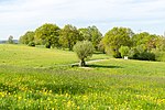 weitere Bilder weitere Bilder
|
LSG-4118-0001 | LSG-Egge-Gebiet und Lipper Bergland mit Bielefelder Osning, Paderborner Hochflaeche und Hellwegboerden | 8169,23 | 555589439 | Position | 1997 |

|
LSG-4119-0001 | LSG-Heckenlandschaft am Galgenberg | 11,32 | 555553484 | Position | 1997 |
 weitere Bilder weitere Bilder
|
LSG-4119-0002 | LSG-Bergheide auf der Vogeltaufe | 11,22 | 555553485 | Position | 1997 |
| LSG-4119-0003 | LSG-Gruenland-Gebuesch-Waldkomplex nordwestlich Horn | 22,01 | 555553486 | Position | 1997 | |
| LSG-4119-0004 | LSG-Oberes Wiembecketal | 5,47 | 555553487 | Position | 1997 | |
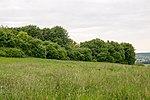 weitere Bilder weitere Bilder
|
LSG-4119-0005 | LSG-Heckenlandschaft Bellenberg-Nord | 78,75 | 555553488 | Position | 1997 |
| LSG-4119-0006 | LSG-Kerbtal suedwestlich Bellenberg | 4,15 | 555553489 | Position | 1997 | |
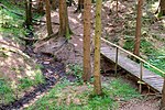 weitere Bilder weitere Bilder
|
LSG-4119-0007 | LSG-Krebsbachtal | 40,77 | 555553490 | Position | 1997 |
 weitere Bilder weitere Bilder
|
LSG-4119-0008 | LSG-Zangenbachtal | 57,72 | 555553491 | Position | 1997 |
 weitere Bilder weitere Bilder
|
LSG-4119-0009 | LSG-Heckenlandschaft suedlich Horn | 11,44 | 555553492 | Position | 1997 |
 weitere Bilder weitere Bilder
|
LSG-4119-0010 | LSG-Hecken-Gruenlandkomplex suedoestlich Horn | 11,35 | 555553493 | Position | 1997 |

|
LSG-4119-0011 | LSG-Silberbachtal | 61,18 | 555553494 | Position | 1997 |
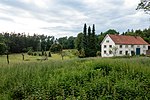 weitere Bilder weitere Bilder
|
LSG-4119-0012 | LSG-Forsthaus Nassesand | 3,30 | 555553495 | Position | 1997 |
 weitere Bilder weitere Bilder
|
LSG-4119-0013 | LSG-Hecken-Gruenlandkomplex noerdlich Kohlstaedt | 5,93 | 555553496 | Position | 1997 |
 weitere Bilder weitere Bilder
|
LSG-4119-0014 | LSG-Hecken-Gruenlandkomplex nordoestlich Kohlstaedt | 12,86 | 555553497 | Position | 1997 |
 weitere Bilder weitere Bilder
|
LSG-4119-0015 | LSG-Oberes Strothetal | 23,05 | 555553498 | Position | 1997 |
| LSG-4119-0016 | LSG-Hellebecke-Niederung | 16,73 | 555553499 | Position | 1997 | |
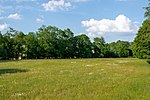 weitere Bilder weitere Bilder
|
LSG-4119-0017 | LSG-Unteres Strothetal | 15,76 | 555553500 | Position | 1997 |
 weitere Bilder weitere Bilder
|
LSG-4119-0018 | LSG-Bachniederung nordoestlich Schlangen | 10,94 | 555553501 | Position | 1997 |
 weitere Bilder weitere Bilder
|
LSG-4119-0019 | LSG-Heckenlandschaft suedlich Kohlstaedt | 91,75 | 555553502 | Position | 1997 |
 weitere Bilder weitere Bilder
|
LSG-4119-0020 | LSG-Unteres Emkental | 33,90 | 555553503 | Position | 1997 |
 weitere Bilder weitere Bilder
|
LSG-4119-0021 | LSG-Schlänger Bachtal | 20,89 | 555553504 | Position | 1997 |
 weitere Bilder weitere Bilder
|
LSG-4119-0022 | LSG-Langes Tal | 25,39 | 555553505 | Position | 1997 |
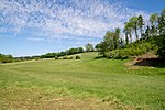 weitere Bilder weitere Bilder
|
LSG-4119-0023 | LSG-Durbeketal | 21,52 | 555553506 | Position | 1997 |
 weitere Bilder weitere Bilder
|
LSG-4119-0024 | LSG-Tal- und Hangbereich noerdlich Kempen | 10,06 | 555553507 | Position | 1997 |
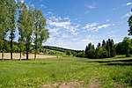 weitere Bilder weitere Bilder
|
LSG-4119-0025 | LSG-Gruenlandbereich suedlich Kempen | 10,89 | 555553508 | Position | 1997 |
 weitere Bilder weitere Bilder
|
LSG-4119-0026 | LSG-Suedholz | 25,44 | 555553509 | Position | 1997 |
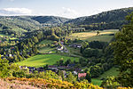 weitere Bilder weitere Bilder
|
LSG-4119-0027 | LSG-Wiese am Hangstein | 4,89 | 555553510 | Position | 2006 |
 weitere Bilder weitere Bilder
|
LSG-4119-0028 | LSG-Hangwiese Steinbrink | 7,94 | 555553511 | Position | 2006 |
 weitere Bilder weitere Bilder
|
LSG-4119-0029 | LSG-Magerwiesen und -weiden am Niedersachsenweg | 3,02 | 555553512 | Position | 2006 |
| LSG-4120-0001 | LSG-Emmertal suedwestlich Noltehof | 44,18 | 555553516 | Position | 1994 | |
| LSG-4120-0002 | LSG-Bennersiek | 6,98 | 555553517 | Position | 1994 | |
| LSG-4120-0003 | LSG-Baerental | 28,04 | 555553518 | Position | 1994 | |
| LSG-4120-0004 | LSG-Tal am Kerrensberg | 4,64 | 555553519 | Position | 1994 | |
| LSG-4120-0005 | LSG-Bueckeburger Riesen | 22,46 | 555553520 | Position | 1994 | |
| LSG-4120-0006 | LSG-Talsystem des Breitenhauptbaches | 13,18 | 555553521 | Position | 1994 | |
| LSG-4120-0016 | LSG-Talzug mit Hecken-Gruenlandkomplex noerdlich Vahlhausen | 15,99 | 555553522 | Position | 1997 | |
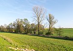 weitere Bilder weitere Bilder
|
LSG-4120-0017 | LSG-Beller Holz und Niederbeller Bachtal | 41,05 | 555553523 | Position | 1997 |
| LSG-4120-0018 | LSG-Hagensiek | 0,15 | 555553524 | Position | 1997 | |
| LSG-4120-0019 | LSG-Bachniederung suedlich Belle | 12,09 | 555553525 | Position | 1997 | |
 weitere Bilder weitere Bilder
|
LSG-4120-0020 | LSG-Napte bei Woebbel | 0,56 | 555553526 | Position | 1997 |
| LSG-4120-0021 | LSG-Mergelkuhle oestlich Billerbeck | 1,23 | 555553527 | Position | 1997 | |
 weitere Bilder weitere Bilder
|
LSG-4120-0022 | LSG-Buschenberg | 3,00 | 555553528 | Position | 1997 |
| LSG-4121-0001 | LSG-Wiesental bei Kortenberg | 6,30 | 555553529 | Position | 2005 | |
| LSG-4121-0002 | LSG-Hammelbachverlauf im Gruenland | 29,98 | 555553530 | Position | 2005 | |
 weitere Bilder weitere Bilder
|
LSG-4121-0003 | LSG-Bachtal westlich Rischenau | 6,74 | 555553531 | Position | 2005 |
 weitere Bilder weitere Bilder
|
LSG-4121-0004 | LSG-Bachtal noerdlich Biesterfeld | 19,94 | 555553532 | Position | 2005 |
 weitere Bilder weitere Bilder
|
LSG-4121-0005 | LSG-Oberlauf des Ilsenbach suedlich Rischenau | 11,51 | 555553533 | Position | 2005 |
| LSG-4121-0006 | LSG-Hammelbachverlauf im Wald | 10,81 | 555553534 | Position | 2005 | |
| LSG-4121-0007 | LSG-Rote Kuhle | 1,23 | 555553535 | Position | 2005 | |
| LSG-4121-0008 | LSG-Lakenbach | 23,58 | 555553536 | Position | 2005 | |
| LSG-4121-0009 | LSG-Hecken-Gruenland-Brache-Komplex noerdlich Niese | 22,84 | 555553537 | Position | 2005 | |
| LSG-4121-0010 | LSG-Feuchtwiese am Bentberg | 1,23 | 555553538 | Position | 2005 | |
| LSG-4121-0011 | LSG-Magerweiden-Hecken-Komplex noerdlich Koeterberg | 8,71 | 555553539 | Position | 2005 | |
| LSG-4121-0012 | LSG-Niesetal und Boenekenbach | 14,51 | 555553540 | Position | 2005 | |
| LSG-4121-0013 | LSG-Niesetal oestlich der Ortschaft Niese | 22,18 | 555553541 | Position | 2005 | |
| LSG-4121-0014 | LSG-Magdalenquelle | 4,66 | Position | 1994 | ||
| LSG-4121-0015 | LSG-Steffensborn | 3,36 | Position | 1994 | ||
| LSG-4121-0016 | LSG-Jakobigrund | 28,35 | Position | 1994 | ||
| LSG-4121-0029 | LSG-Tal- und Hangbereiche bei Brakelsiek | 32,16 | 555553545 | Position | 1994 | |
| LSG-4121-0030 | LSG-Kraemergrund und Henzenberg | 20,87 | 555553546 | Position | 1994 | |
 weitere Bilder weitere Bilder
|
LSG-4121-0031 | LSG-Lippebachtal | 41,03 | 555553547 | Position | 1994 |
| LSG-4121-0032 | LSG-Talbereich oestlich der Niese | 2,23 | 555553548 | Position | 1994 | |
 weitere Bilder weitere Bilder
|
LSG-4121-0033 | LSG-Burgberg | 5,96 | 555553549 | Position | 1994 |

|
LSG-4121-0034 | LSG-Talbereiche westlich Hoffeld | 9,71 | 555553550 | Position | 1994 |
 weitere Bilder weitere Bilder
|
LSG-4121-0035 | LSG-Talbereich am Sperlberg | 0,68 | 555553551 | Position | 1994 |
| LSG-4121-0036 | LSG-Westerberg | 13,47 | 555553552 | Position | 1994 | |
| LSG-4122-0001 | LSG-Muehlenberg bei Hummersen | 6,05 | 555553553 | Position | 2005 | |
| LSG-4122-0002 | LSG-Lonau-Bach | 7,77 | 555553554 | Position | 2005 |
Siehe auch[Bearbeiten | Quelltext bearbeiten]
Weblinks[Bearbeiten | Quelltext bearbeiten]
Commons: Landschaftsschutzgebiete im Kreis Lippe – Sammlung von Bildern, Videos und Audiodateien