![]() Topic
Topic
Seafloor Mapping
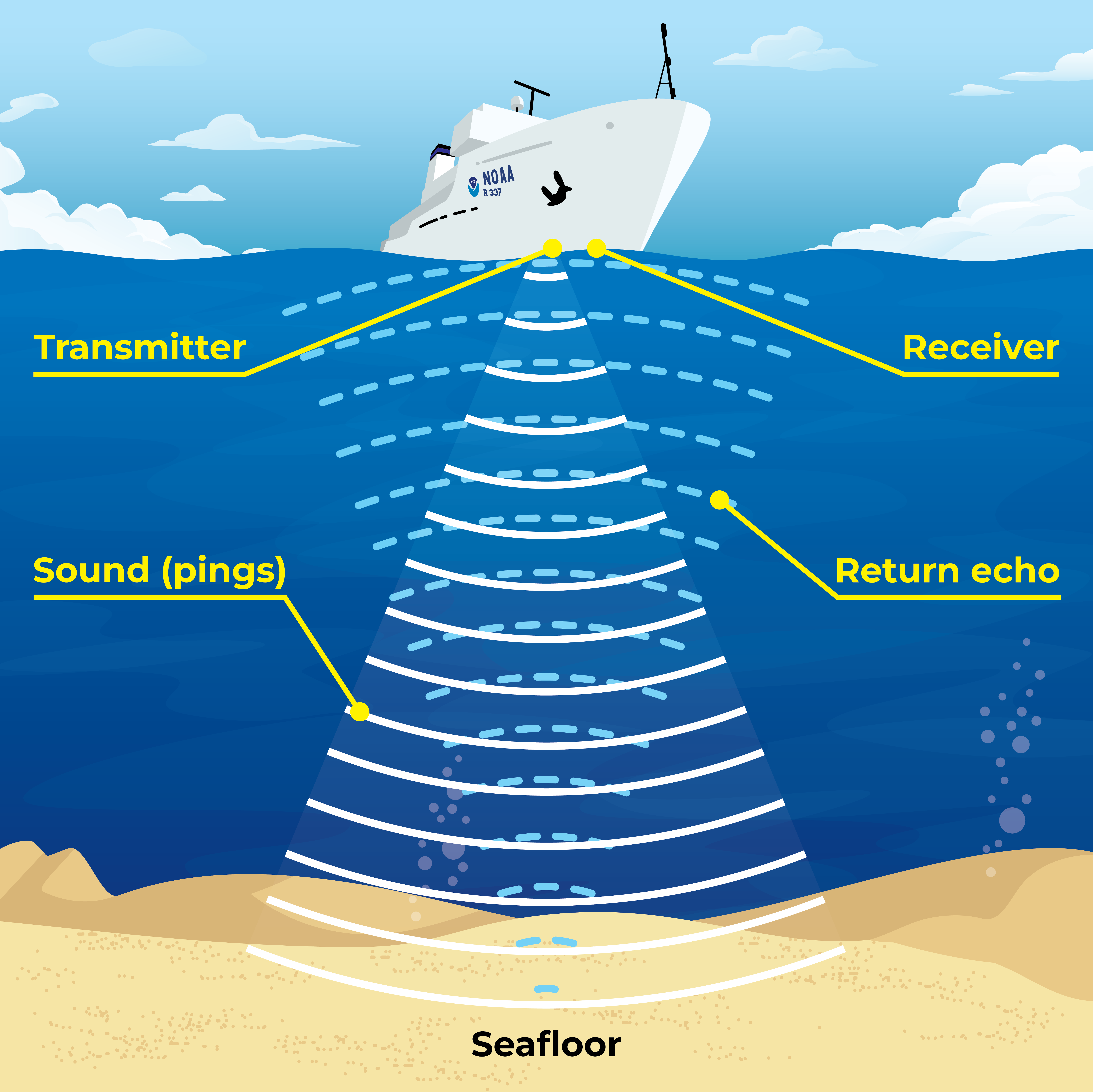
Sonar: Seeing with Sound
SONAR, short for SOund NAvigation and Ranging, is a tool used to explore the ocean and locate objects underwater. Scientists use modern sonar technologies to develop nautical charts, locate underwater hazards for navigation, search for and identify objects in the water column or on the seafloor, and to map the seafloor itself. Click the link to the right to learn more about how explorers “see” the seafloor with sound in a print-friendly fact sheet provided by NOAA Ocean Exploration.