The history, archaeology and wildlife of the Eastern Moors by Dave Torr
Neolithic and Bronze Age Period.
The Neolithic period stretches from approximately 4500 to 2200 BC. The Neolithic period is also sometimes referred to as the new Stone Age. The archaeology of Big Moor and Gardoms Edge, date from the late Neolithic and through to the early Bronze Age. Pollen analysis on the Easter Moors, suggest that settlement began on there around 1700 BC.
The climate was beginning to get warmer and wetter, which saw the dawn of more settled farming communities rather than the earlier tribal traditions. The pollen record for the Eastern Moors shows that up to 3000BC, mixed oak forest with a lot of alder in the wetter parts, had replaced earlier pine trees and the forest cover was almost complete.
Chambered barrows and henges began to appear on the limestone plateaus of the White Peak. Flint and chert tools were found on the moors of the Upper Derwent Valley
Our forefathers certainly left their mark upon the moors of the Peak District, Big Moor and Gardoms Edge, have some of the best preserved archaeology sites in the whole of the Peak District.
Barbrook One stone circle
GR SK27857558.
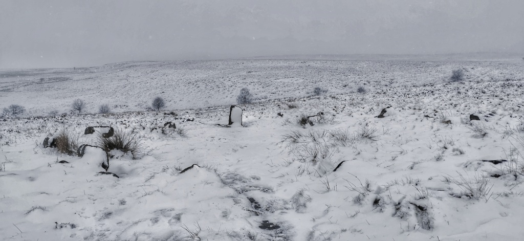
If we start on Big Moor, and enter by the white gate, and walk along the old waterboard track for approximately 200m, look to your right, you should notice some raised stones, this is known as Barbrook One. This is one of the best naturally preserved embanked stone circles within the Peak District. It is constructed of twelve standing stones with possibly one missing in the gap to the north-east. It is approximately 19m in diameter. The tallest of the stones is set in the SW corner and approximately 1.05m tall, and is aligned to the midwinter sunset.
The Duke of Rutland had the circle excavated by his gamekeeper in the 19th century, this is probably the reason for the uneven ground. There were a few small finds and sadly no records survive.
These days it can offer a space for quite contemplation, especially on a summers evening listening to the Meadow Pippets and Skylarks, and with the setting sun in the west, over towards White Edge and the Neolithic settlement of Swines Stye, it is possible to go back in time and imagine the settlement on the skyline.
The tallest standing stoneLooking west towards the circle and Swine Sty.
Burial Cairn
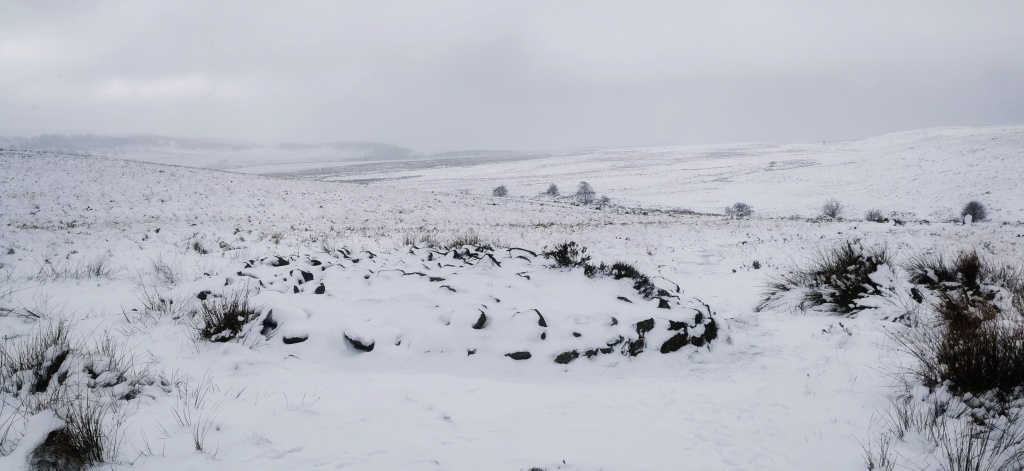
Above here you will see a large burial cairn, this is just one of many that stretch all along this part of the moor. It is the largest on the moor and has been excavated several times. It was first excavated properly in the 1960s where a funeral vessel containing the cremated bones of a child were found inside. Other fragments discovered, were some broken pottery and other cremated bones. It was probably someone of great standing within the community as all the other cairns are quite small in comparison. Stones with cup and ring details etched into them were also found within the structure, these now reside in the Sheffield Museum. There are at least sixty cairns and a couple of barrows within this area of Big Moor alone. Most now are just hummocks, but several still have the original character. One was found to have a stone axe within, which was identified as from the Langdale Pikes area of the Lake District, which had an industry of the manufacturing of stone items. Continue your journey into the past by travelling on the footpath leading from the cairn, in a northerly direction, taking note of the numerous burial cairns, you will soon come to Barbrook Two.
Cairn
Barbrook Two
SK27750 75825
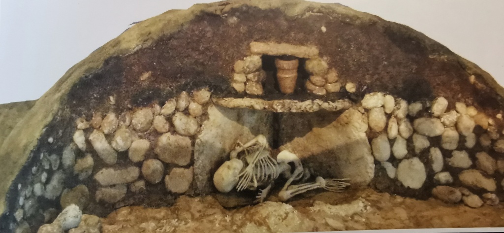
This stone circle must be one of the most altered stone circles in the Peak District if not the British Isles. It has a raised bank around its 14.5m diameter. Originally constructed with an entrance in the NE which was later infilled with a cairn covering a stone filled burial pit.
There were originally a ring of ten main stones set around the circumference, now only nine remain. Within the circle there is a small burial cist with the lid removed. Unfortunately the cist has been used as a fire place, damaging the stones. A larger cairn was once prominent within the circle which was excavated in 1962 and a collared urn along with flint knife and scraper.
Over time, it has suffered from quite numerous amateur excavations. The first notable recorded excavations were by Samuel Mitchell in 1850. He also excavated Barbrook One. Nothing was recorded as being found in their total of ten excavations.
Two burials were found by George David Lewis in 1962, the records reside in the Sheffield City Museum.
In 1989 the stone circle was finally restored by John Barnatt to something resembling what it would have been when first constructed. According to Carbon Dating, the circle dates from 2120 to 1690 BC.
Barbrook Two
Burial Cist
SK2751976570
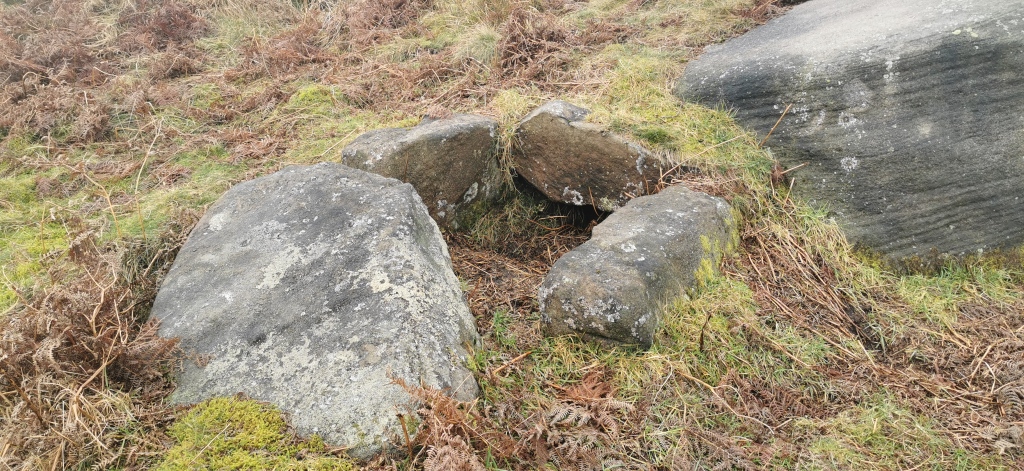
I stumbled across this burial cist several years ago, and is of one of only two free standing cists in the Peak District, the other being on Gibbet Moor. Comprised of three upright slabs with a large displaced capstone, I think the other upright slab that formed the fourth stone, is trapped under the heavy capstone lid. it is placed against a large flat lying boulder.
Burial Cist
Barbrook Three
SK28330 77290
This is the largest of the stone circles, but the most elusive to spot. It is sited on the northern perimeter of Big Moor. It is approximately 2.0m wide, with a diameter of 29.5m. Twenty one stones surround it, with around twenty five originally. There is also archaeological evidence of small cairns around it, but these are difficult to see.
Stoke Flat Stone Circle.
SK24958 76784
Sited just off the Froggatt Edge track, this stone circle was excavated by the Duke of Rutland, who uncovered cremation remains and an urn. Thomas Bateman, ” the barrow king”, was a prominent antiquarian from the 19th century. He recorded, seven upright stones and finds of pottery sherds and flints.
Swine Stye
SK27039 75140
There is plenty of archaeological evidence of a Neolithic settlement at Swine Stye, including a complex arrangements of yards, garden plots and/or small fields associated with settlements. There is evidence of 130 buildings or dwellings. Excavation of one of the hut dwellings revealed the stone footings of a dwelling that had probably been built of timber and roofed with a thatch of turves. It was 20ft in diameter and had replaced an earlier larger timber building, which was identified by its postholes.
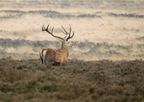
There are also sites of clearance cairns, indicating the cultivation of this area. It is also naturally sheltered by the scarp of White Edge. There is extensive evidence of cultivated fields all around Swine Sty. Excavations from this area have shown up bits of pottery, stone scrapers and evidence of production of cannel coal rings. It is hard to imagine in these days what life must have been like for the late Neolithic and early Bronze Age farmers and their families. Brutal in the winters but idyllic in the summers. Small fields of crops, no bigger than modern day gardens, with livestock grazing in the clearance fields. Adults looking east would have been greeted with the sight of the stone circles, and the burial cairns, where their ancestors resided in peaceful tranquility. Wolves would still be common place, causing round the clock watchers over the livestock.
Gardoms Edge
SK27247 72942
Named after the Gardoms family of Far End and Bubnell.
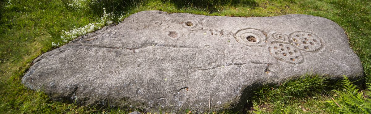
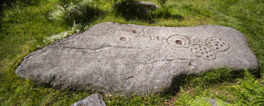
The crowning glory of the finds on Gardoms, must be the late Neolithic early Bronze Age, rock art known as, “cup and ring’ decoration, thought to originate from the Neolithic period through to the early Bronze Age. This is one of the best preserved examples of cup and ring art in the Peak District. It is an ongoing debate regarding its exact date and purpose. They are usually found in the north of England alongside important paths, perhaps as signs or markers of territories.
Ring and Cup stone on Gardoms edge
The original stone has been removed and replaced by a resin replica.
The Three Men of Gardoms Edge.
SK27494 73214
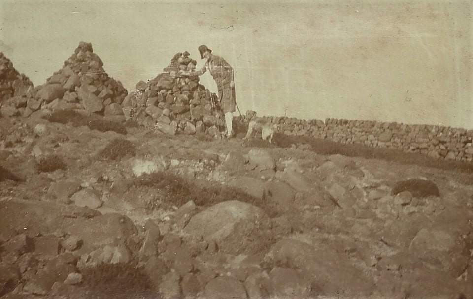
Three cairns commonly known as the, ” three men” are thought to be just clearance cairns. There is, like a lot of things, a myth surrounding them. The story goes they were constructed to commemorate three shepherds that perished in the snow.
Miss Hollingworth and her dog Rip 1925, (the three men)
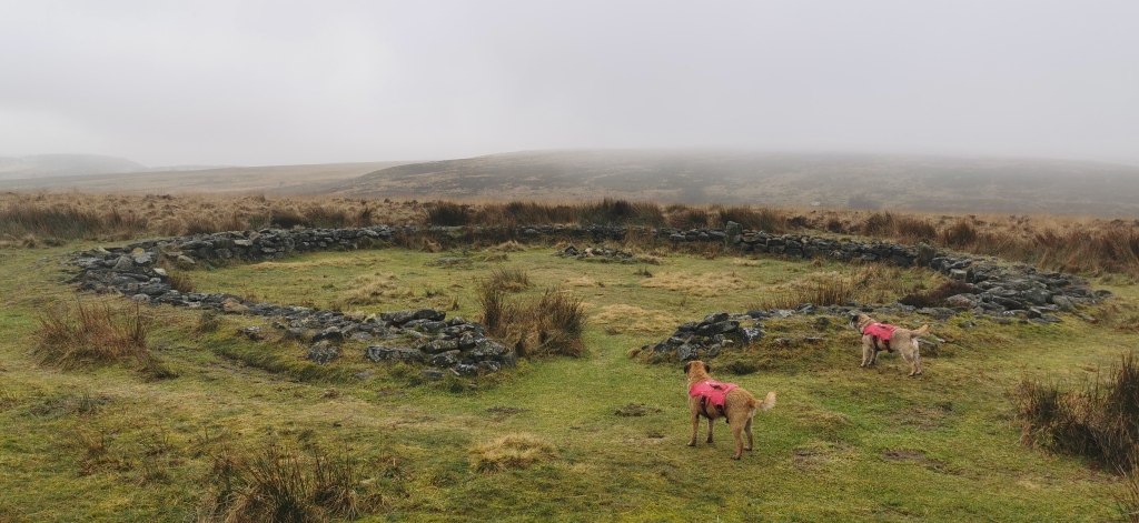
Another feature nearby to the rock art, is the enclosure. Sometimes referred to as the, “British Settlement or village”. This was an enclosure, probably to keep cattle in rather than humans. It runs for almost six hundred metres forming a gentle curve that meets the cliffs to enclose the high point of the edge. It can be traced for almost its entire length, a short section at the southern end is missing due to ploughing and cultivation.
Acknowledgments.
Alan Jaques and the Miss Hollingworth collection.
Sheffield Museums.
The Peak District Moors. David Hey.
The Stone Circles of the Peak District, Byron Machin.
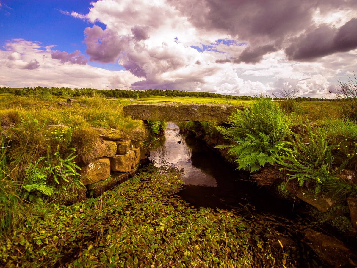
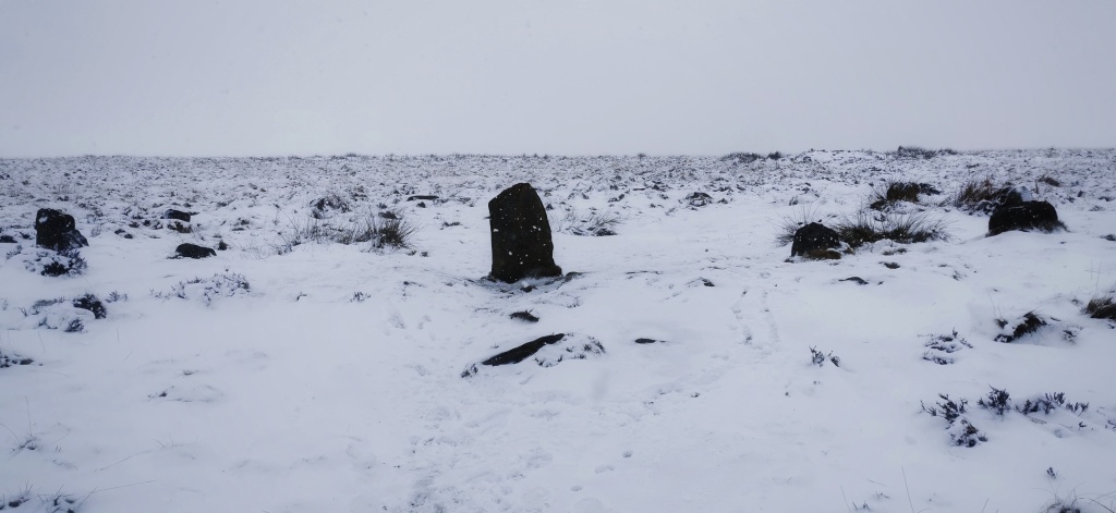
At the Northern end of Big Moor, (above) you will find near to Barbrook Bridge on the Owler Bar to Fox House road,(SK275781) the first of the two Clapper bridges which ford at this point the infant Barbrook. There are no markings on the bridge or the Stoop stone but it is an ancient bridleway with numerous Holloways which can still be traced through the thick heather.
It is known to exist in the 18th century and at that time called Stone bridge and in the Baslow boundary of 28/8/1812 called Ancient bridge. Holloways from this point came across Totley Moor from Beauchief Abbey and Sheffield then either up towards Froggatt Pole, Longshaw, Padley to Hathersage onwards. Another route goes via Hurkling stone, (meaning crouching stone) White Edge guide stoop, Stoke Flat, Froggatt and Tideswell. The other Major route would take you up to Lady’s Cross and Haywood to Grindleford.
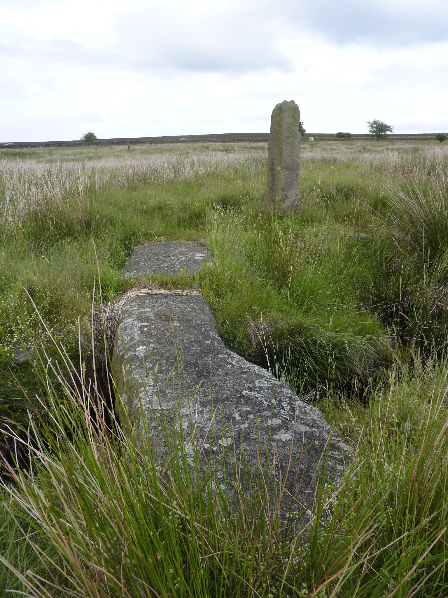
The second of the ancient bridleway bridges, (below) is inscribed, “H 1777” on one of the slab sides…

Great stuff Dave, thank you
LikeLike