
Size of this PNG preview of this SVG file: 800 × 549 pixels. Other resolutions: 320 × 220 pixels | 640 × 439 pixels | 1,024 × 703 pixels | 1,280 × 879 pixels | 2,560 × 1,757 pixels | 1,129 × 775 pixels.
Original file (SVG file, nominally 1,129 × 775 pixels, file size: 690 KB)
| This is a file from the Wikimedia Commons. Information from its description page there is shown below. Commons is a freely licensed media file repository. You can help. |
Summary
| Description |
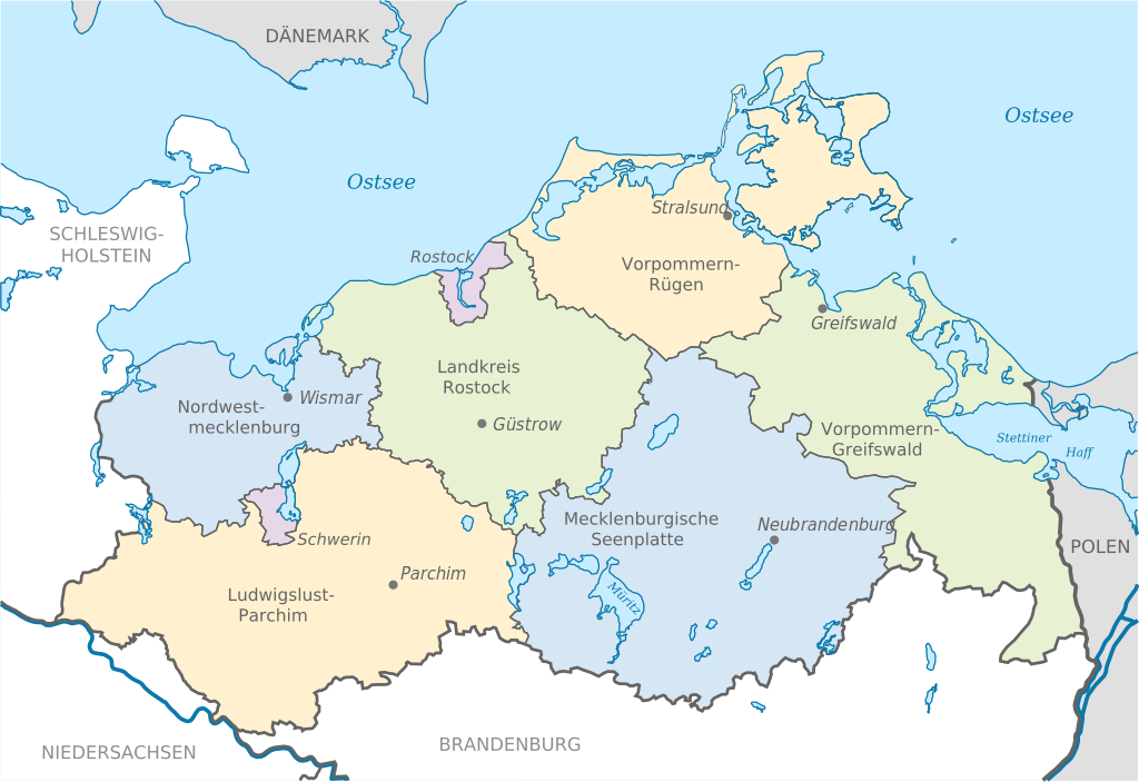
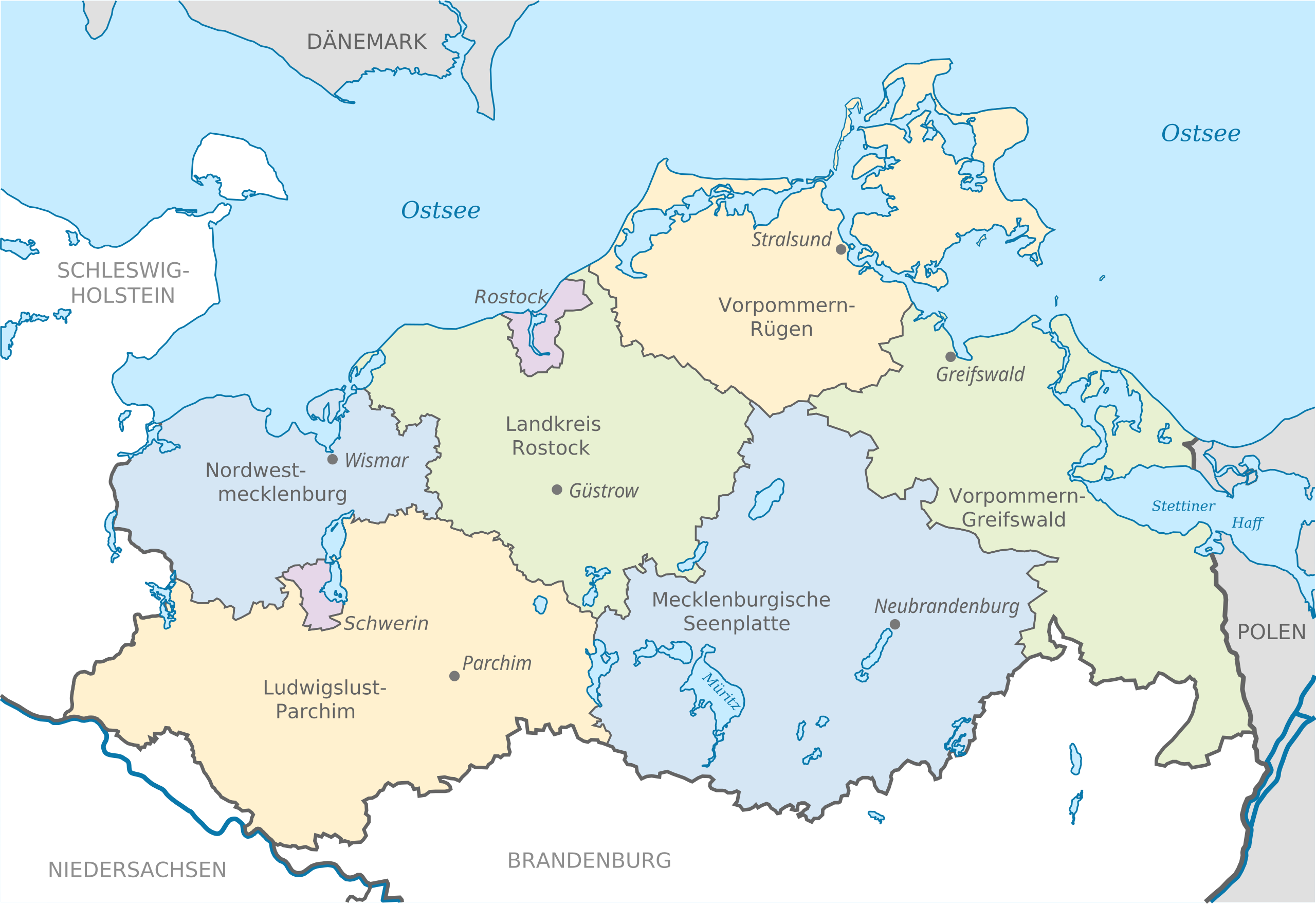
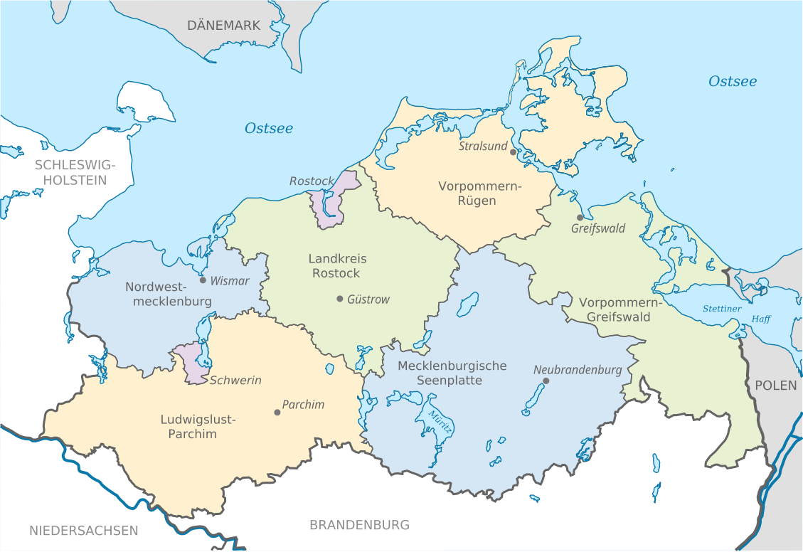
Deutsch: Karte mit Lage der Landkreise und Kreisstädte in Mecklenburg-Vorpommern, Deutschland nach der Kreisgebietsreform 2011.
English: Locator map of counties with district capitals in Mecklenburg-Vorpommern, Germany after county reorganization 2011. |
| Date | |
| Source | Own work, based on: File:Mecklenburg-Vorpommern districts 2011 colored labeled Meck-Pomm-border.svg, TUBS |
| Author | Schiwago/TUBS |
Licensing
Schiwago, the copyright holder of this work, hereby publishes it under the following licenses:

|
Permission is granted to copy, distribute and/or modify this document under the terms of the GNU Free Documentation License, Version 1.2 or any later version published by the Free Software Foundation; with no Invariant Sections, no Front-Cover Texts, and no Back-Cover Texts. A copy of the license is included in the section entitled GNU Free Documentation License. |
This file is licensed under the Creative Commons Attribution-Share Alike 3.0 Unported license.
Attribution: Schiwago
- You are free:
- to share – to copy, distribute and transmit the work
- to remix – to adapt the work
- Under the following conditions:
- attribution – You must give appropriate credit, provide a link to the license, and indicate if changes were made. You may do so in any reasonable manner, but not in any way that suggests the licensor endorses you or your use.
- share alike – If you remix, transform, or build upon the material, you must distribute your contributions under the same or compatible license as the original.
You may select the license of your choice.
File history
Click on a date/time to view the file as it appeared at that time.
| Date/Time | Thumbnail | Dimensions | User | Comment | |
|---|---|---|---|---|---|
| current | 09:14, 15 January 2014 | | 1,129 × 775 (690 KB) | Schiwago | =={{int:filedesc}}== {{Information |Description= {{de|Karte mit Lage der Landkreise und Kreisstädte in Mecklenburg-Vorpommern, Deutschland nach der Kreisgebietsreform 2011.}} {{en|Locator map of cou... |
File usage
The following pages on the English Wikipedia use this file (pages on other projects are not listed):
Global file usage
The following other wikis use this file:
- Usage on de.wikipedia.org
- Usage on fr.wiktionary.org