

The lure of stone circles - Long Meg and Her Daughters, Mayburgh Henge, and Castlerigg, Cumbria
The lure of stone circles - Long Meg and Her Daughters, Mayburgh Henge, and Castlerigg, Cumbria
Why are we drawn to stone circles? Three sites map out ancient patterns of Cumbrian life - and lead us to wonder what relics of our time we will leave behind

I explore the weird and wonderful in the English landscape and write about it every couple of weeks. If this sounds like something that would interest you, why not subscribe? Or, if you’re already subscribed, consider recommending to a friend to whom it might also bring joy?
The road passes straight through Long Meg and her Daughters. Driving out of Salkeld, you turn at the sign: ‘Long Meg ½ mile, Druids circle ½ mile.’ Evidence that this monument, too, has fallen victim to a long tradition of misinterpreting Neolithic or Bronze Age monuments as the work of the later Iron Age Druids. These astronomer-priests loomed large in the 18th and 19th century antiquarian imagination, probably because they, thanks to Tacitus and Caesar, are the only pre-Roman Britons about whom we have any written record. Gory details from this corpus have acquired a mythical status: see The Wicker Man for an example.

Long Meg, the leaning red sandstone to the right, and her daughters
Long Meg is a monument much older: the megaliths loom through the gap between hedges, and then, you suddenly barrel into the circle’s centre, the silent sentinels unravelling, marching up the hill towards their mistress. We are careful not to park within the circle, only half-joking about fairies and spirits. The monument is on the private land of Longmeg farm just to the north, which is perhaps why, for at least a few minutes when we arrive, the circle is eerily quiet: just the spinning of crows below the clouds and the watch of gloomy cows. Wordsworth summed up the ambiance:
A weight of awe, not easy to be borne,
Fell suddenly upon my spirit — cast
From the dread bosom of the unknown past
When first I saw that family forlorn…..
— William Wordsworth
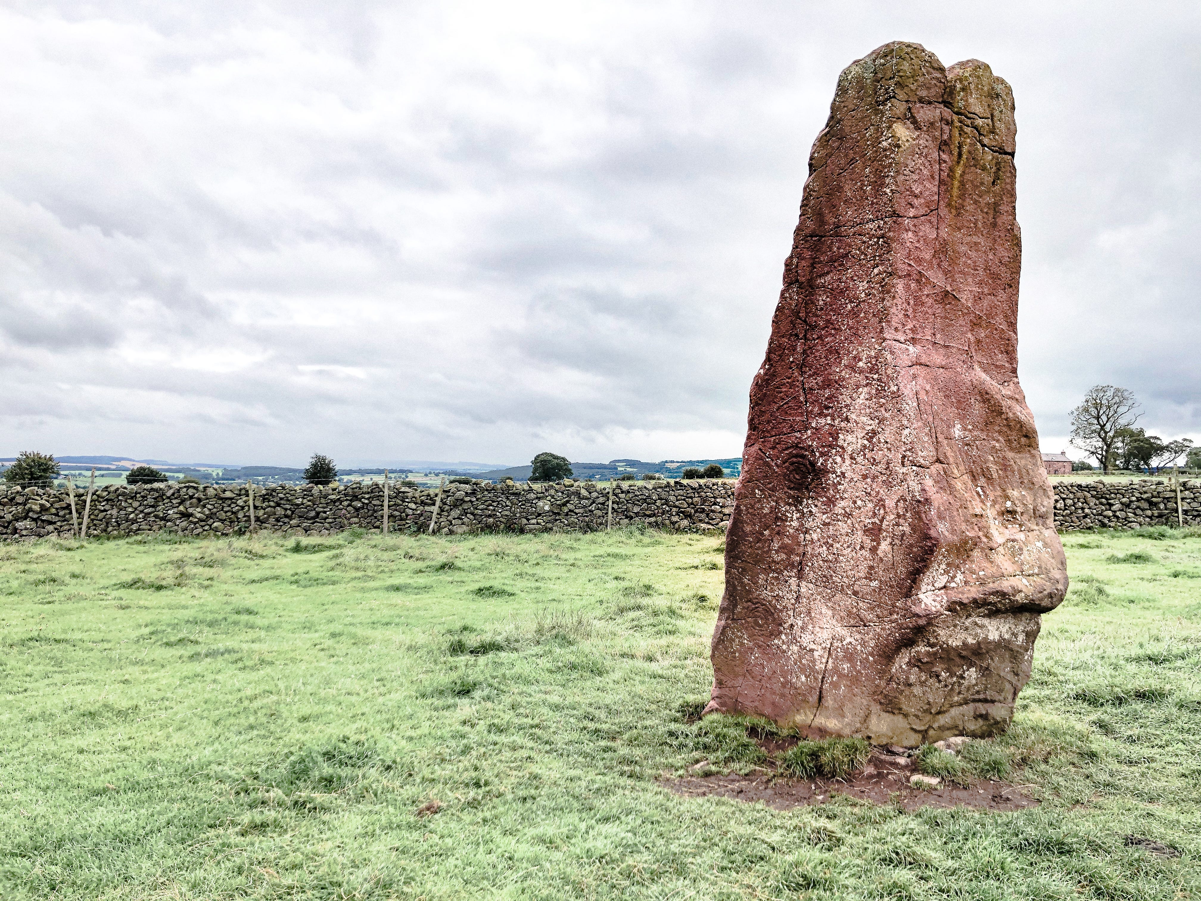
Long Meg, red sandstone dragged from the nearby River Eden. Carvings are clearly visible on the face.
Climbing the hill to Long Meg herself — a giant red sandstone towering on the crest of the hill outlying the circle to the south west — the purple ribbon of the Pennines unfurls, today topped with mist like icing on a cake. She was hauled from the River Eden, and a huge cursus, or processional avenue, now no longer visible, once led from here to a cliff at the edge of the river. She is one of a complex of several monuments locally that are ranged alongside or at the confluence of rivers, suggesting, for Neolithic people, the spiritual significance of water.
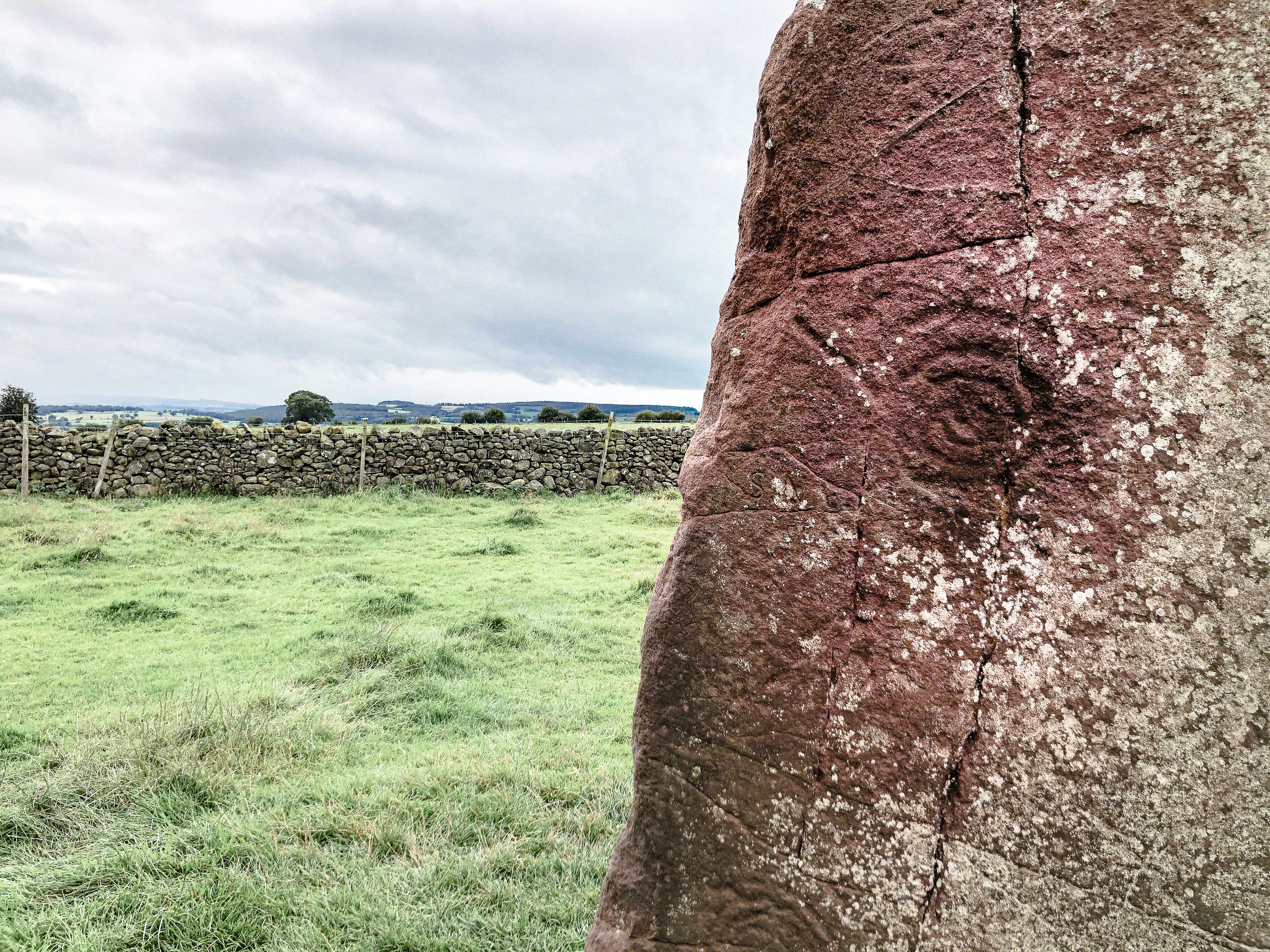
Close up of carvings on Long Meg’s face.
As you walk close and she towers over, carvings appear on the face towards the circle: pulsing spirals and whorls, big enough to fit a hand, and, towards the top, strange geometric figures. The rest of the stones are local rhyolite, glacial erratics, and blue-grey; there are also four quartzite stones which stand out white, at the four corners of the ‘compass’ formed by Long Meg.

The ‘daughters’, Long Meg in the background.
Long Meg has all the greatest hits of stone circle myths going for it. Mediaeval legend states that Meg is a witch, turned to stone along with her cronies by a passing sorcerer — the appropriately named Michael Scot — from Scotland. Some have suggested the name comes from Meg of Meldon, who lived in the early 17th century, although she came from a distant town in Northumberland. Another common legend states the stones are impossible to count: if you succeed in doing so correctly, and put your ear to Long Meg, she will whisper to you. Similar versions of both myths apply to the Rollright Stones in Oxfordshire, several hundred miles away. A final, familiar story tells of a landowner who tried to dynamite Long Meg, believing treasure lay beneath, but he and his men were forced to run and seek shelter when a vast storm struck.
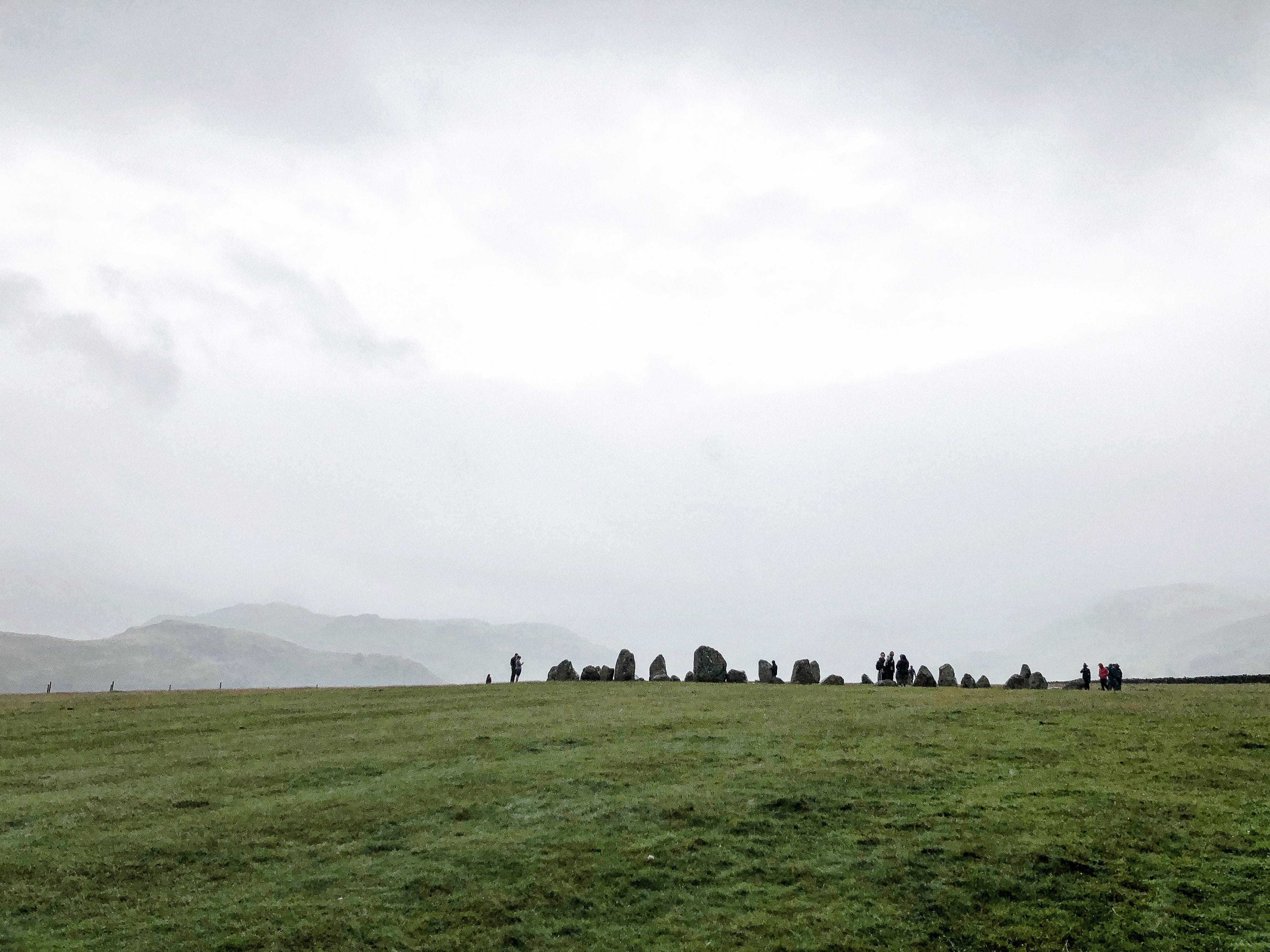
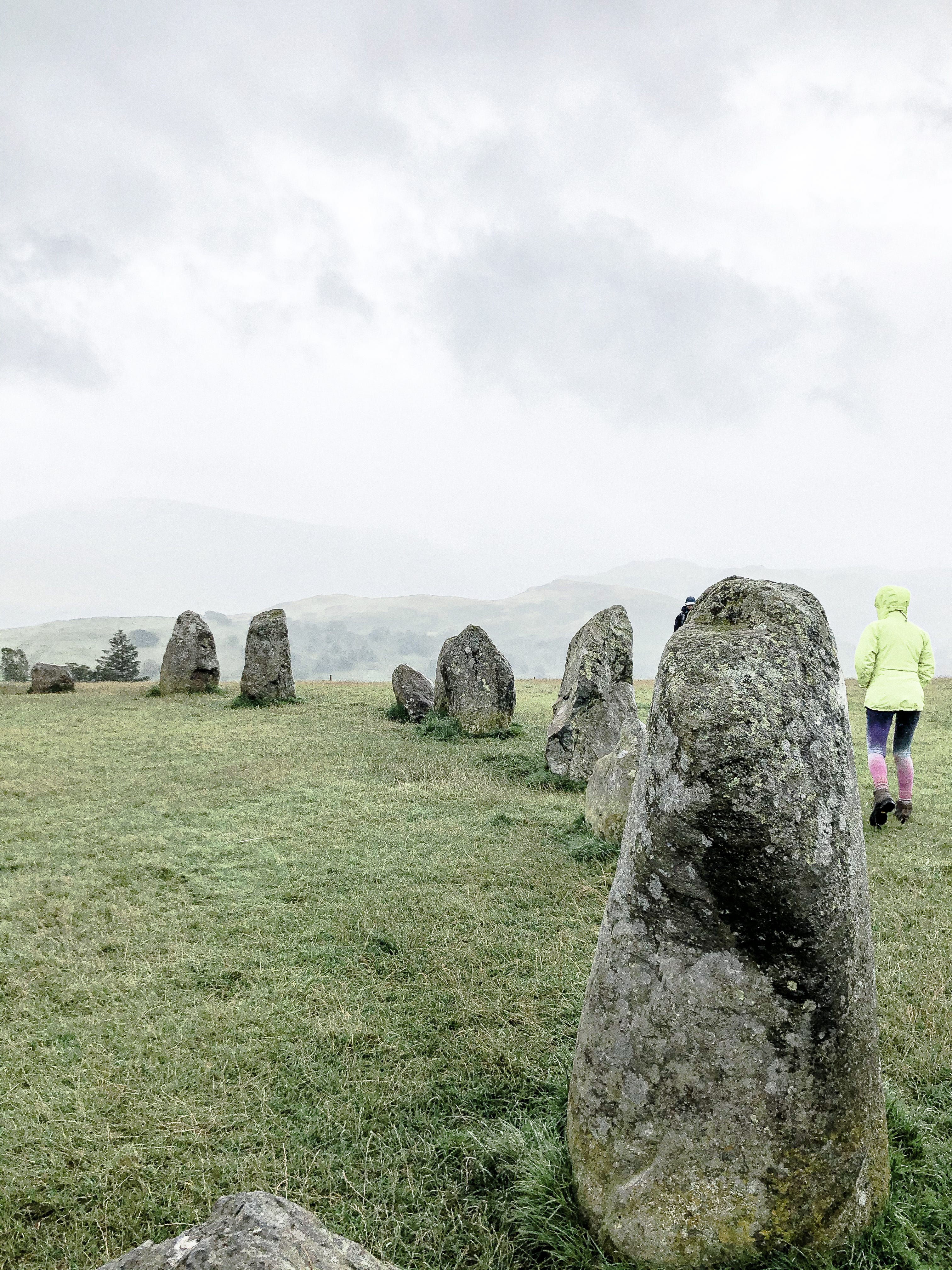
Castlerigg stone circle, near Keswick.
Long Meg’s relative obscurity is probably the reason her owner doesn’t want to sell her to English Heritage. It contrasted with our earlier visit to Castlerigg near Keswick: complete with single scoops and Flakes from the ice-cream van, and rain-lashed staycation crowds. This circle is compact enough to drink in all in one, set on its little elevated table in the dramatic natural amphitheatre of mountains: Helvellyn, Skiddaw, Grassmoor and Blencathra.
Castlerigg: the view down the valley in the mist.
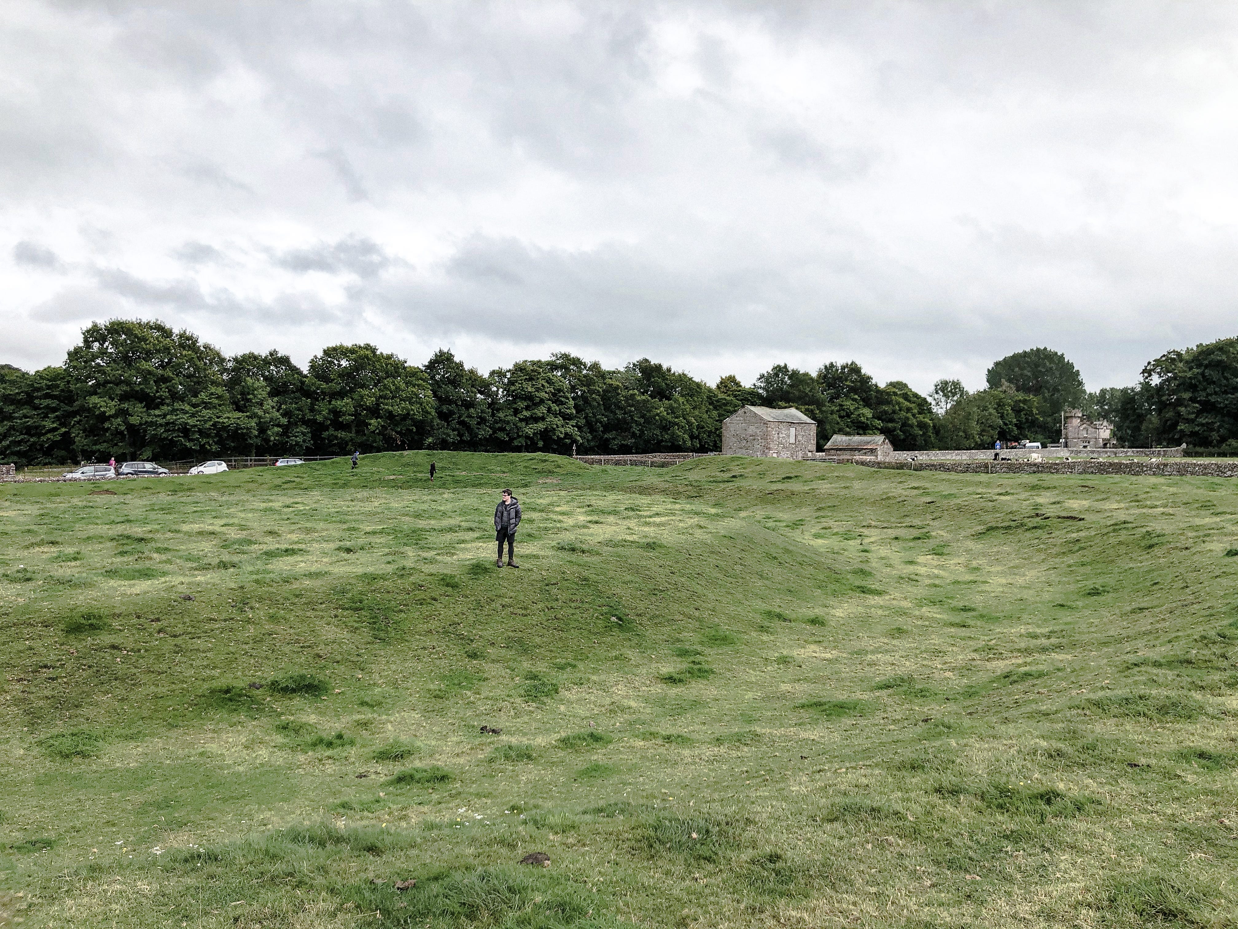
Unlike other stone circles in Britain, this monument has been treated with unusual respect: all 40 of the stones documented in the 18th century by William Stukeley are still standing, and mediaeval plough-furrows stop just short, though many large gaps in the circle suggest there may have originally been more. Like many local circles, theories suggest it may have been a meeting place for those looking to trade axes from the famous flint quarry on top of Pike O’Stickle: an activity that also had ritual aspects, ceremonially deposited axes being common in all parts of Britain.

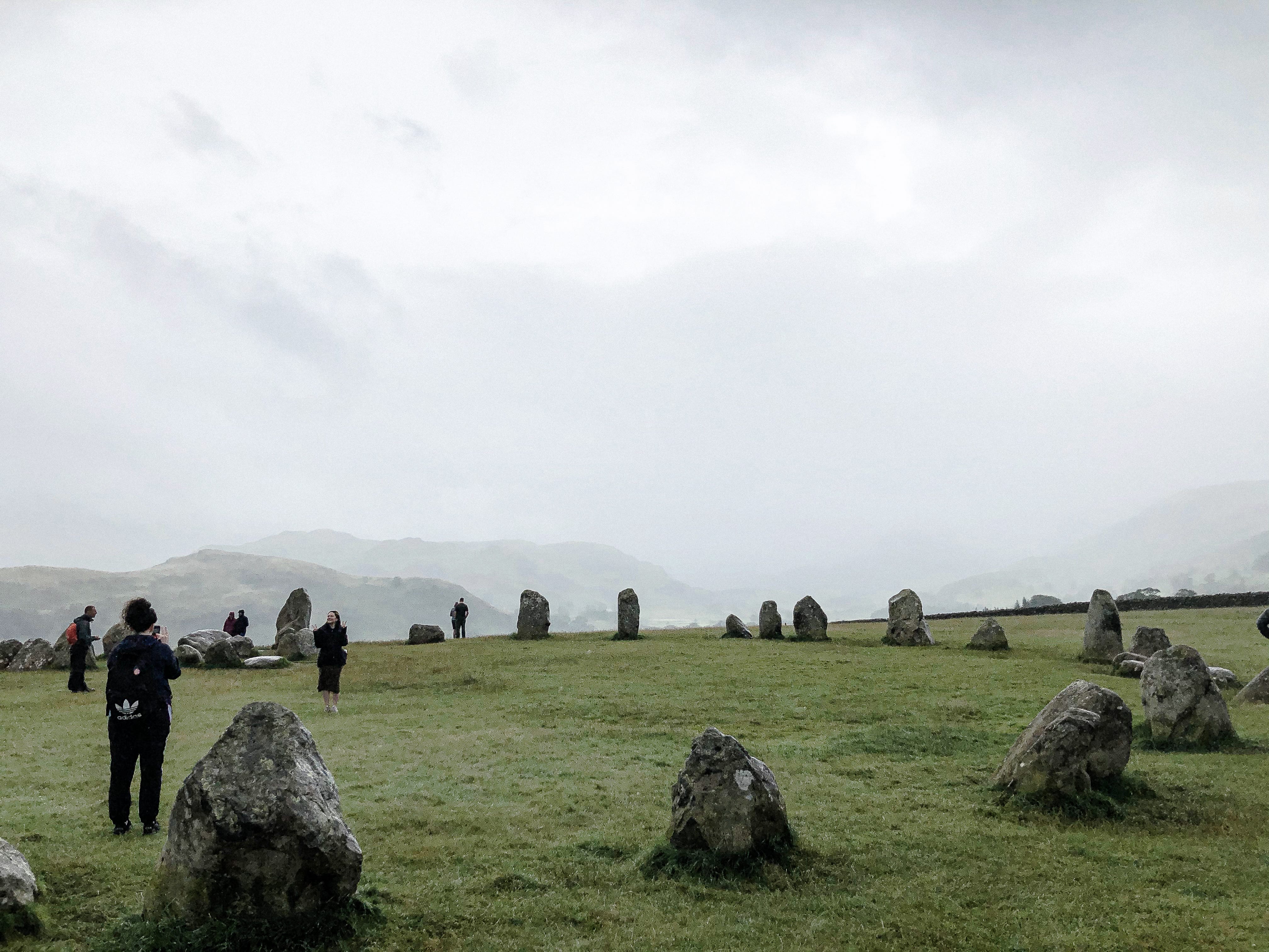
Strange oblong formation of stones protruding into the circle’s eastern end at Castlerigg.
Here, it is easy to imagine the prehistoric aspect: the misty view down to the valley, with its river, low-lying mountain scrub and pasture. Once again, we are upstream of the confluence of two rivers, and in the eastern corner is a rare rectangular enclosure, facing the sunrise. Stukeley thought this was a burial place, but he was wrong: there is no evidence to suggest this, but also no good competing theories.
Close up of stones at Castlerigg.
As a group we thirst for explanation, none of which are forthcoming from the information boards: but they cannot be blamed, and this is surely part of the appeal. Driving away, we wonder what of our civilisation will survive. What would someone make of the ruins of Legoland, or the Shard? There is almost no answer to this question. In some ways, ours is the more fragile ruin: we live in the age of virtual records, where backwards compatibility is a problem for data formats created less than twenty years ago (VCRs, floppy disks). The iPhone, given its material quality, is likely to be preserved; but still, what will this lump of worked metal and silicone mean to someone who digs it up and cannot turn it on, access the software that gives it its function? In the absence of written culture, it is the same for us when we look at a stone circle: we have lost the ‘software’ — the social, cultural and emotional ‘programmes’ — that encoded the hardware with meaning and purpose.

View of Mayburgh Henge from the road.
Perhaps in an effort to answer this question the Eden Arts Council made the at time controversial decision to plant a new ‘Millennium Stone’, with overt Christian symbolism and imagery, on what could be mistaken as a slip road for the M6. In fact, as you approach, a huge moundlike structure reveals itself beyond the bank of trees. This is Mayburgh Henge: strangely remote and invisible from the road, although alongside one of the country’s busiest motorways.
Inside Mayburgh henge, with the bare pebbles that make up the banks visible, and central standing stone.
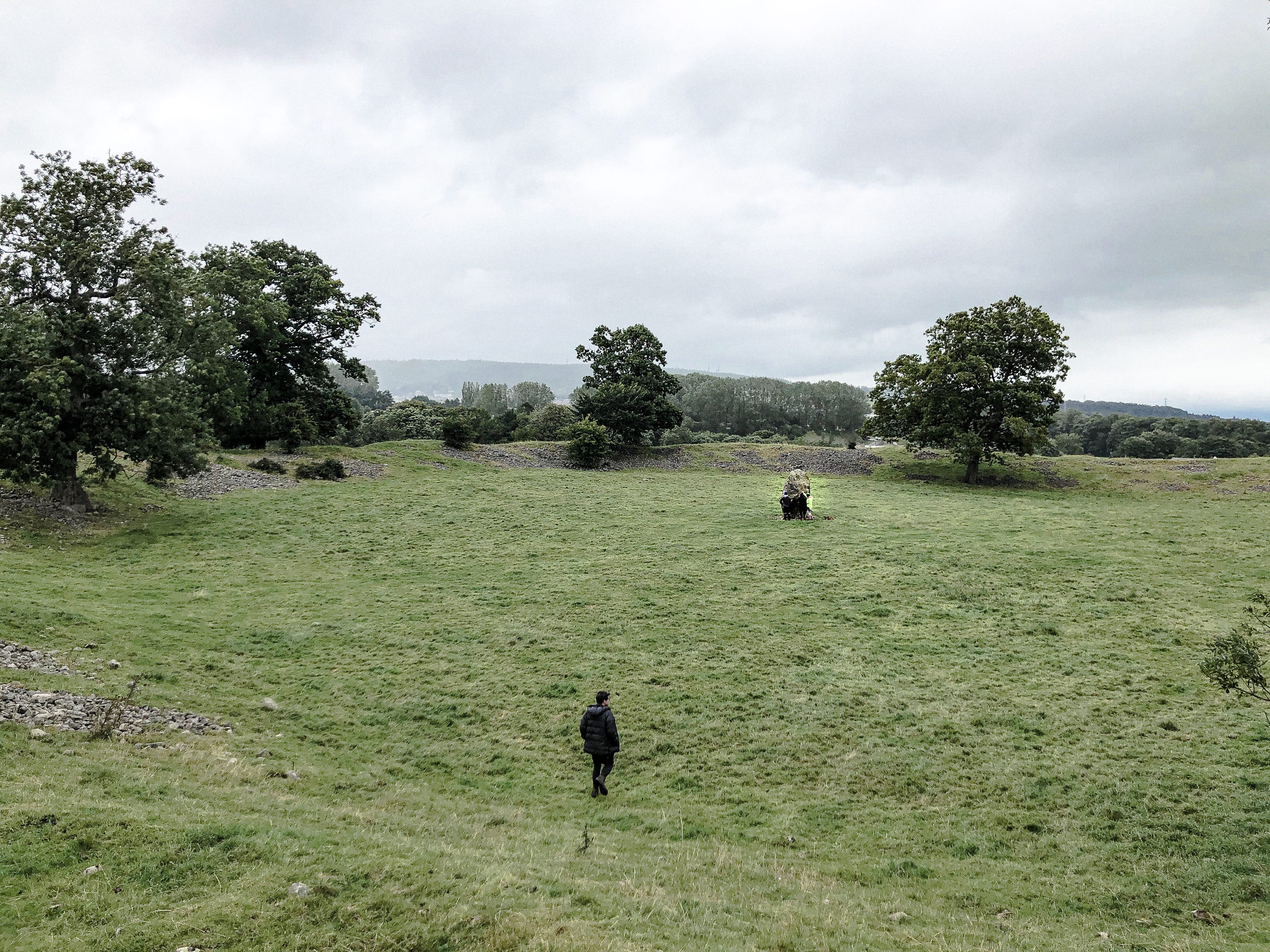
Scaling the bank reveals a vast ritual amphitheatre, centred on a now lone standing stone. (It was once one of four, facing each other in a square enclosure.) Stumbling down, you trip on cobbles, visible all around on bare patches where the turf hasn’t encroached. These were all dredged, tonnes and tonnes of them, from the nearby River Lowther, to form the banks: in some places over six and a half metres in height. In the middle, there is a strange peace, the motorway barely audible.
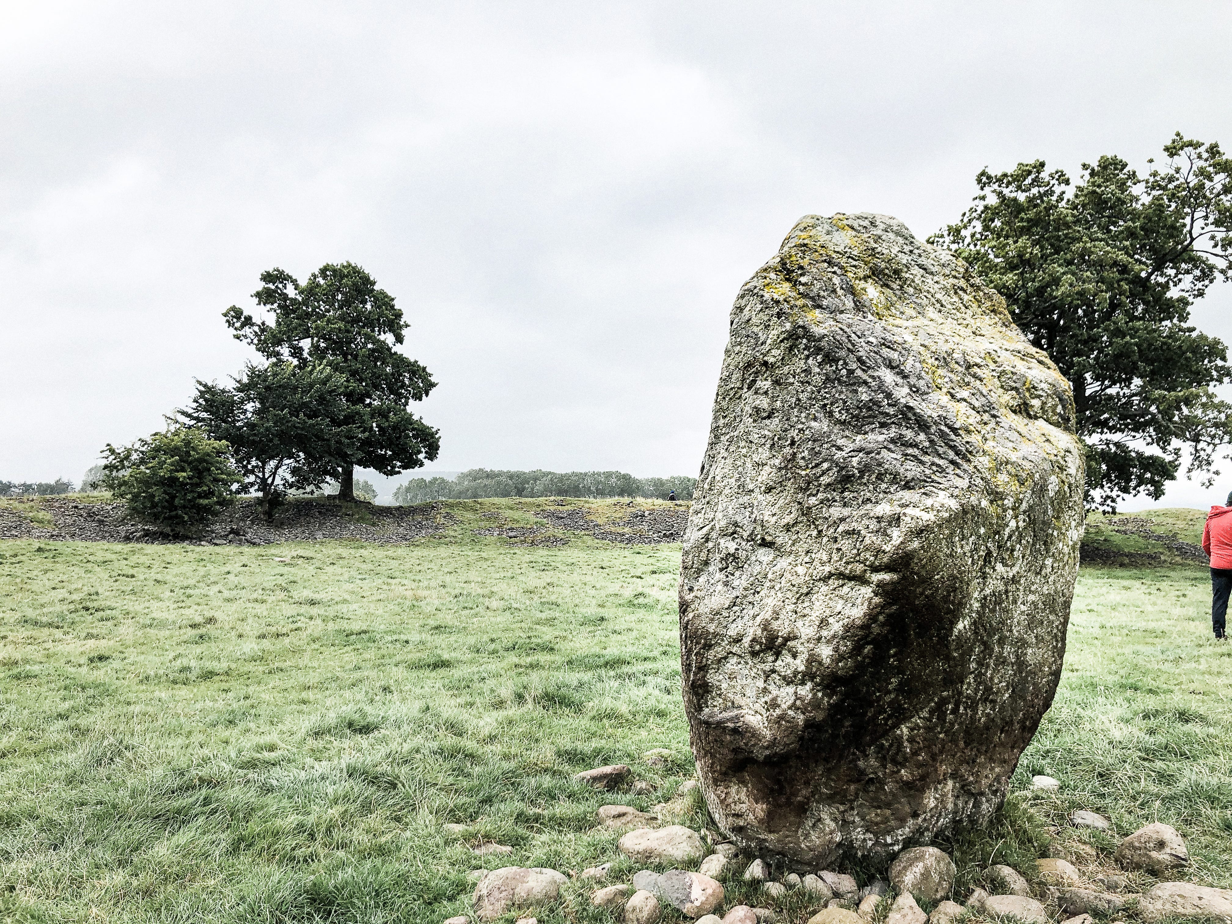
Mayburgh Henge’s central standing stone.
You can’t help wondering what use the local youth make of this, for updated versions of the seasonal rituals that once gave this place its pedigree. Only Blencathra is visible above the rampart’s edge, and in the indentation of the eastern entrance, aligned with the rising sun, the Pennines and the path leading to King Arthur’s Round Table.

King Arthur’s Round Table, an earthwork henge a few hundred metres from Mayburgh. The junction of the A6 and B3520 is just behind, cutting off the circle’s northwestern entrance.
This sister henge, just a few hundred metres away — which of course, has nothing to do with King Arthur — is an enclosed bank and ditch in a field alongside the busy intersection of the A6 and B3520. The site was disturbed in the 18th and 19th centuries, apparently to make way for a tea garden. Once again clear is the importance of water: the two henges were possibly connected by a nearby spring, noted by Stukeley. From the top of the Mayburgh bank you can see the nearby confluence of the Rivers Eamont and Lowther; the modern crossroads suggest this has probably been a junction for centuries.
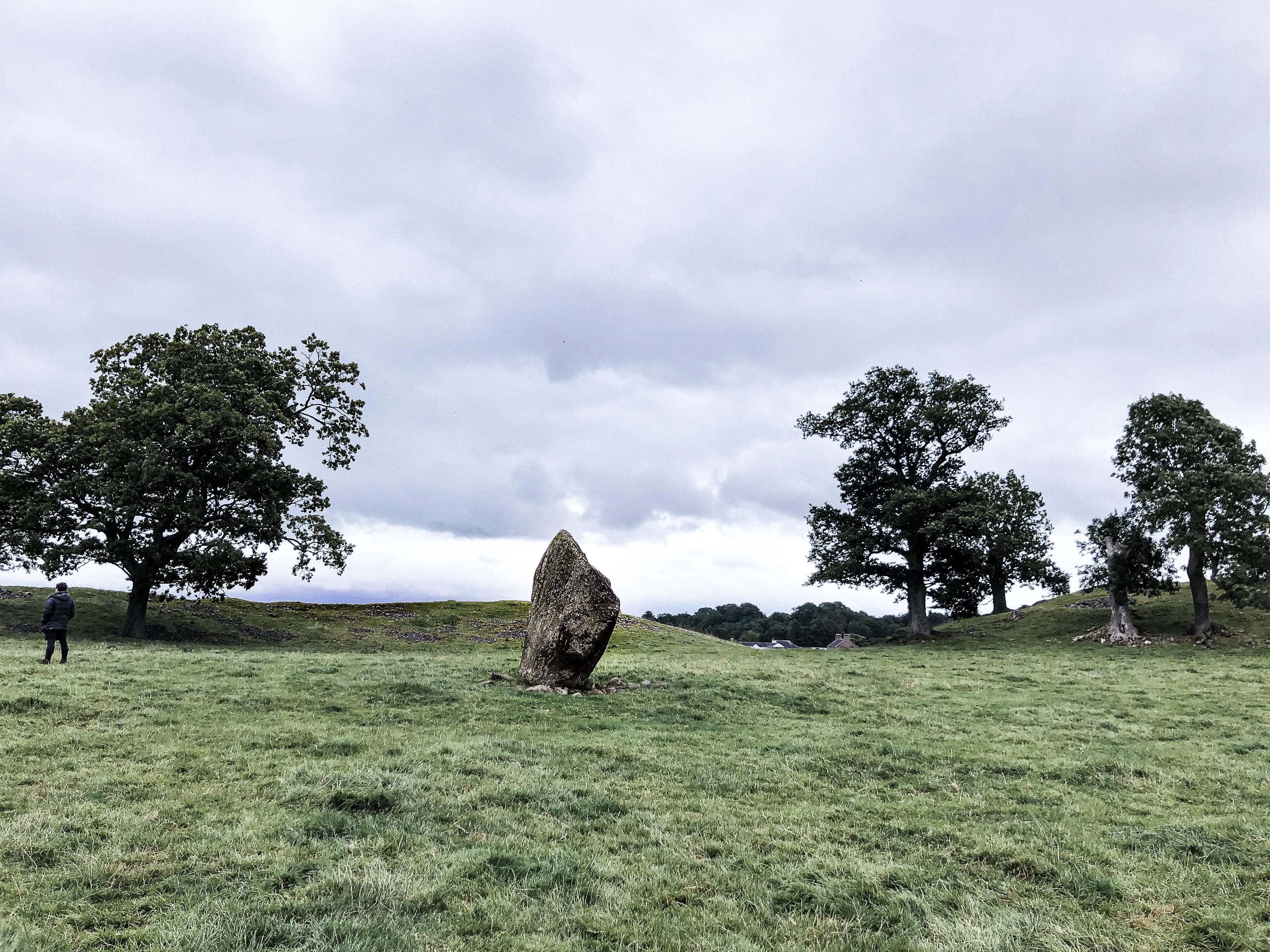
Standing stone at the centre of Mayburgh Henge, looking towards the entrance and the path leading to King Arthur’s Round Table.
Indeed, Barrowclough theorises that sites in the area were clustered around communication routes: the ‘avenue’ of megaliths near Shap, running to the east of the River Lowther; the Long Meg complex running along the Eden to the north, and this cluster, sitting at the convergence of it all: at what could be an ancient crossing of both rivers at Eamont Bridge. The site hasn’t been excavated, but the presence of stone axes indicates a Late Neolithic to Early Bronze Age date, and similar theories about it being on a trade route for axes from Great Langdale.
The wide ditch at King Arthur’s Round Table.
Eden council’s ultimately successful efforts to install the ‘Millennium Stone’ nearby stirred up one of the more grisly Mayburgh myths: Clarke, in his 1789 Survey of the Lakes, tells that the central megaliths “were blasted and removed by order of a person who seems to have been at that time the farmer of this place: one of the men employed in the work having hanged himself, and the other turning lunatic, has given a fair opening to vulgar superstition, to impute these misfortunes to their sacrilege in defacing what they suppose was formerly a place of eminent sanctity.”
Serves them right, you might think.
I hope you enjoyed this week’s adventure! Please send me your comments, feedback and recommendations for places to visit… is there somewhere in your area that deserves a little more attention? You can comment directly on this post, or reach me on Twitter or Instagram: I’d love to hear from you.
If you enjoyed reading, please consider subscribing, or sharing this newsletter with a friend.
Sincerely,
Ruth
For this piece I am indebted to the site information available from English Heritage, as well as the research of others, summarised in the following articles and books:
On Long Meg and Her Daughters, an archived web article from the apparently defunct local website Brampton Online.
On the controversy surrounding the Millennium Stone and legends of what became of those who disturbed Mayburgh Henge, Robert WE Farrah’s article in Northern Earth.
On the interrelated placement of all of the monuments in this area along possible ancient routes that run at or near water, David Barrowclough’s Prehistoric Cumbria.