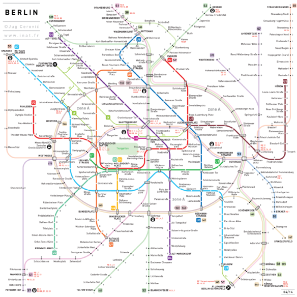
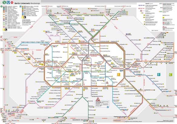
Earlier this week, I heard about the architect Jug Cerovic who re-shaped various maps of the underground, including the London Tube. After I briefly took a view on his new design for the U-Bahn Netzspinne (the Map of the Berlin Underground), I only noticed a few minor changes. For example, the Ring-Bahn is a circle shape now – which is mostly an aesthetic difference. Secondly, the Tiergarten park is shown on the map. I’m unsure about the reason for this, but it comes as a bit redundant to me. At last, which is the only mistake of a certain importance in the new design, is the new scale of the S3. It looks like Erkner is not much further than Schöneweide. Don’t get me wrong, I also encourage people to visit the outskirts of the German capital – but I won’t lie about the distances!
 However, this post is not meant to be a critique. Cerovic doesn’t even have the goal to replace the U-Bahn Netzspinne. The news about this, just made me realise that I’ve once been looking for old versions of these public transportation maps earlier. It reveals a long history of trams, being replaced by an expending underground. Names have changed from Reichskanzlerplatz to Adolf-Hitler-Platz and back to Reichskanzlerplatz before it was named Theodor-Heuss-Platz. A turbulent era for the U-Bahn started when the Berlin Wall was build in August 1961. The ‘Underground Wall’ turned various East Berlin stations into ghost stations. East-German maps of the public transport don’t even show the existence of West Berlin. All summed up: a serious thrill!
1896: Another horse-drawn trolley

1914. When most of the public transport was still Hochbahn (above-ground railway)

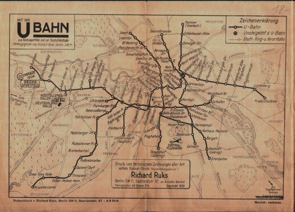
1936. Notice the ‘Adolf-Hitler-Platz’ and the ‘Horst-Wessel-Platz’.
1947. Stations marked with a cross were damaged in World War II & out of use.

1966. West Berlin’s map. White stations are East Berlin. Stations with a cross are on a Western line but in Eastern territory; the so-called ghost stations.

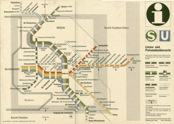
1984. East German, only S-Bahn stations.
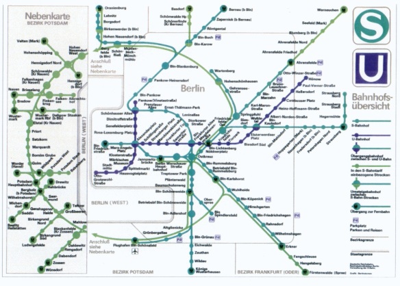
1988. East German. Notice the way of ignoring the existence of West Berlin.


Very interesting. Im another geek of undergrounds!