First timer? In this formerly once-a-day blog (and now pretty much a once-every-four-or-five days blog), I have my computer select a random latitude and longitude that puts me somewhere in the continental United States (the lower 48). I call this “landing.” I keep track of the watersheds I land in, as well as the town I land near. I do some internet research to hopefully find something of interest about my landing location. To find out more about A Landing A Day (like who “Dan” is) please see “About Landing” above. To check out some recent changes in how I do things, check out “About Landing (Revisited).”
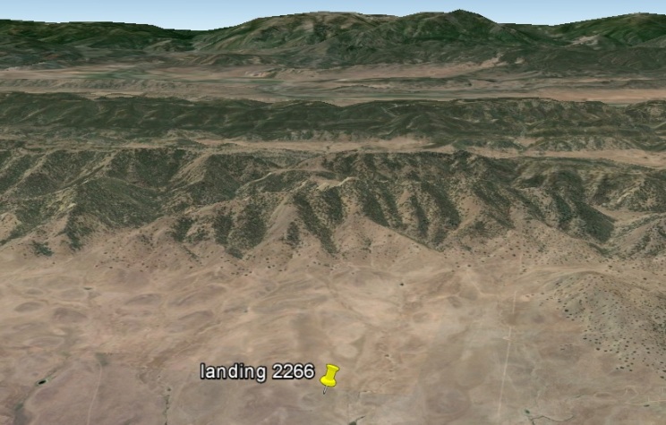
Landing number 2266; A Landing A Day blog post number 696.
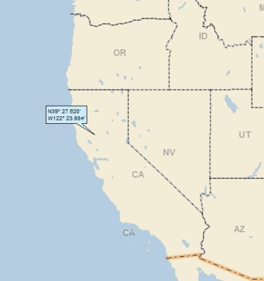
Dan: Although this is my third California landing since I changed my random lat/long methodology 50 landings ago, CA is big enough that it was US (under subscribed), so my Score went down (from 829 to 807, a new record low). Clueless about my crazy first sentence? Check out the tab “About Landing (Revisited).”
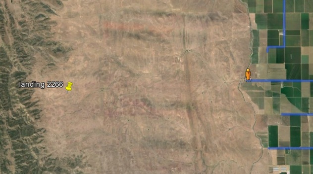
Here’s my regional landing map:
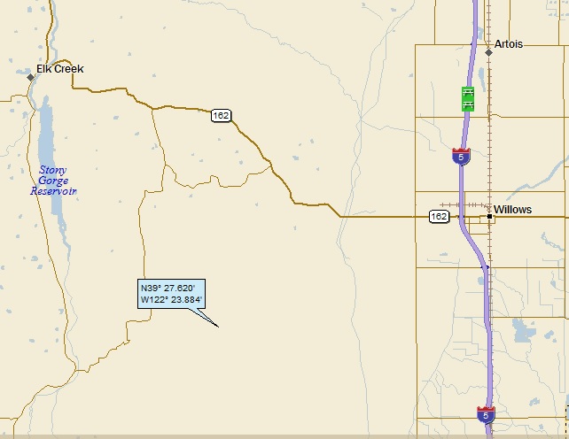
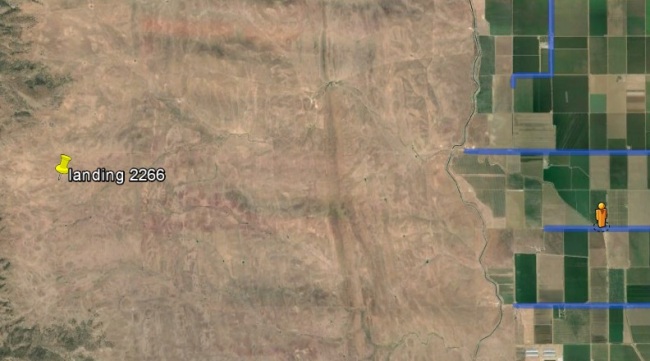
And my local landing map:
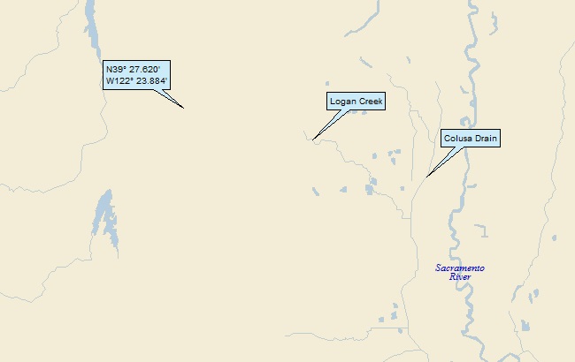
My streams only map shows that I landed in the watershed of Logan Creek, on to the Calusa Drain, and then eventually to the Sacramento River (23rd hit). Of course, the Sacramento empties into San Francisco Bay (34th hit):
It’s time for my Google Earth (GE) spaceflight on in to Northern California. Click HERE, enjoy the trip, then hit your back button.
Here’s an oblique GE shot looking west past my landing:
I landed in a desolate patch of real estate – the closest GE SV is about five miles away:
Here’s what the orange dude sees:
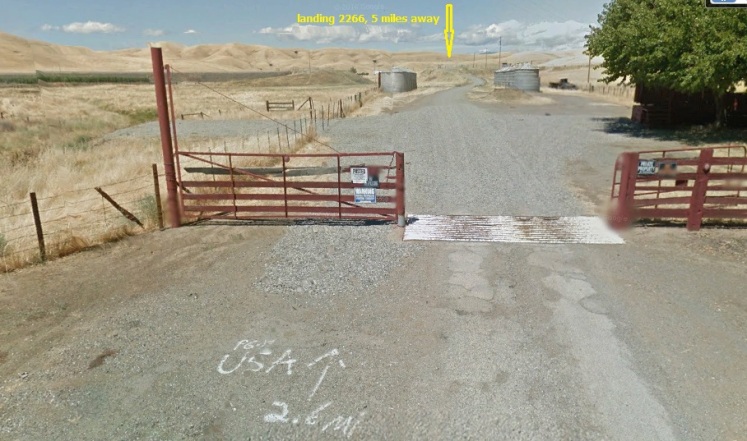
What’s that 2.6 miles away?
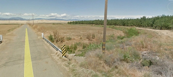
As for my drainage, I traced it on GE, and found the nearest SV shot from a bridge over a “stream”:
Here’s what the orange dude sees (which I’ll call a tributary of Logan Creek):
I had three towns to check out – Willows, Elk Creek & Artois. No surprise – based on the title of this post – Artois (pop 295) was the winner of the “what town do I feature?” contest.
In French, Artois would be pronounced something like are-TWAH. But I suspect that the locals pronounce it differently. I did some checking, and sure ‘nuf – they don’t use the French pronunciation. I found a chat-room style internet conversation on Ancestry.com where they concluded that Artois is pronounced “Our Toys” by the locals. I think they’re being a little too cute; I’ll bet it’s more like Are Toys.
So anyway, the town’s original name was Germantown, but was changed in 1918 to Artois. According to Wiki:
Local belief is that a World War I troop train stopped to water at Gemantown and a riot ensued when the troops took offense at the name. The town was then renamed after the battles of Artois.
Note that it’s not the battle of Artois; rather it’s the battles of Artois. Here’s the story:
The first battle of Artois (December 17, 1914 – January 13, 1915) was one of the early battles between the French and Germans. It was an attempt by the French to break a trench / barbed wire warfare stalemate, and it was unsuccessful. Neither side “won.”
The second battle of Artois was a much bigger deal (May 9, 1915 – June 18, 1915). The French were joined by the British in an attempt to push back the Germans and capture a key rail supply line. Once again, the effort failed. Although no territory was gained by either side, the Germans won the war of attrition. Here’s what Wiki says about casualties (injuries + deaths):
French sources put casualties at 102,500 of whom 35,000 were killed. There were another 37,500 casualties incurred in secondary operations. According to German sources, there were also 32,000 British casualties and 73,072 German casualties.
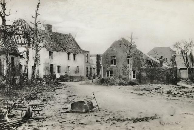
Unbelievable. Here’s a picture of a French village caught in the crossfile (from WWIBattlefields.co.uk):
And then there’s the third battle of Artois (September 15 – October 25, 1915). This battle was similar to the second in terms of objective – i.e., capturing German railways. Same old, same old. Neither side “won,” and no significant territory was won or lost by either side. Here are the grim casualty figures (including a nearby, associated battle):
French: 48,230
German: 51,100
British: 61,700
It’s hard to fathom. There were hundreds of thousands of soldiers living in trenches, facing off across “no man’s land,” a sea of barbed wire. Some general makes a decision, the word comes down to local commanders, and thousands and thousands of young men were ordered to advance. And for what????
It turns out that the Artois region of France is famous for another reason, much closer to my interests than WWI. From Wiki:
The name “Artois” stems from the ancient province in France where the method of boring artesian wells was first adopted. [I assume that artesian could be loosely translated as “of Artois.”]
I searched for a geologic cross-section that shows exactly what an artesian well is and how it happens. The state of Minnesota has an excellent one. Here ‘tis:
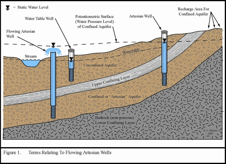
A couple of important points:
- A “confining layer” consists of an impermeable soil or rock like clay or shale (water can’t flow through it).
- An aquifer consists of a permeable soil or rock like sand, limestone or sandstone (water can flow through this rock relatively easily).
- The recharge zone is where infiltrating rainfall and snowmelt can flow down through permeable soil into an aquifer.
- Although not labeled as such, the dashed line under the recharge area is also a water table.
Take a deep breath, and you’ll be able to figure out the differences between a water table well, an artesian well and a flowing artesian well – and how each of these three comes to be. Don’t care? Stick with shallow breaths . . .
Wiki says this about artesian wells:
Artesian wells were named after the former province of Artois in France, where many artesian wells were drilled by Carthusian monks from 1126.
What a very specific date! I wonder how Wiki can be so sure that the first artesian well was drilled in 1126?
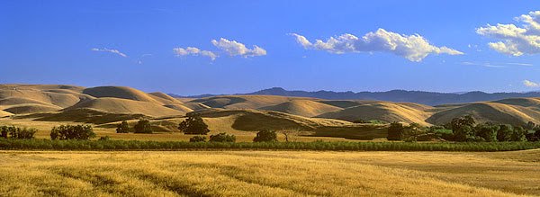
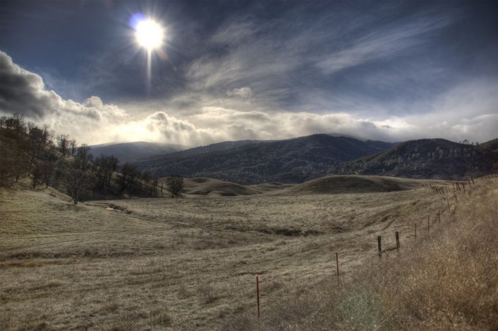
Time for some GE Panoramio shots. First this by A Dunn Photography (taken about 5 miles NE of my landing):
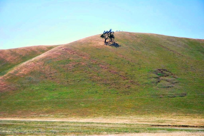
And this one by Hank Hansen, appropriately entitled “Solitary Tree” (taken about 7 miles north):
I’ll close with this by genomexp, taken about 15 miles NW:
That’ll do it . . .
KS
Greg
© 2016 A Landing A Day
S
