Steinfeld
Steinfeld is a municipality in the district of Vechta, in Lower Saxony, Germany. It is situated approximately 16 km southwest of Vechta, and 40 km northeast of Osnabrück.Photo: Wikimedia, Public domain.
Notable Places in the Area
Signalberg
Peak
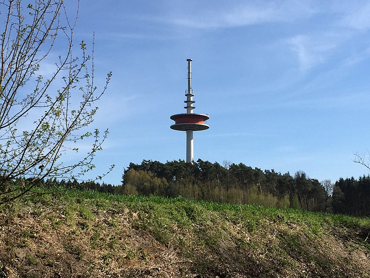
Photo: Markus.lueers, CC BY-SA 4.0.
The Signalberg is, at 146 m above sea level, the highest elevation in the Damme Hills and Oldenburg Münsterland. Signalberg is situated 4 km south of Steinfeld.
Localities in the Area
Holdorf
Village

Photo: ThomasPusch, CC BY-SA 3.0.
Holdorf is a municipality in the district of Vechta, in Lower Saxony, Germany. Holdorf is situated 6 km west of Steinfeld.
Steinfeld
- Type: Town with 10,300 residents
- Description: municipality in Vechta district, Lower Saxony, Germany
- Categories: non-urban municipality in Germany and locality
- Location: Vechta, Lower Saxony, Germany, Central Europe, Europe
- View on OpenStreetMap
Latitude
52.5874° or 52° 35' 15" northLongitude
8.2171° or 8° 13' 1" eastPopulation
10,300Elevation
58 metres (190 feet)Open Location Code
9F4CH6P8+XROpenStreetMap ID
node 240059823OpenStreetMap Feature
place=townGeoNames ID
6553002Wikidata ID
Q693942Steinfeld Satellite Map
© OpenStreetMap, Mapbox and Maxar
Also Known As
- Afrikaans: Steinfeld
- Albanian: Steinfeld
- Arabic: Steinfeld, Lower Saxony
- Aragonese: Steinfeld
- Arpitan: Steinfeld
- Asturian: Steinfeld
- Basque: Steinfeld
- Bavarian: Steinfeld
- Breton: Steinfeld
- Catalan: Steinfeld
- Cebuano: Steinfeld
- Chechen: Штайнфельд (Ольденбург)
- Chechen: Штайнфельд
- Chinese: Steinfeld, Lower Saxony
- Chinese: 斯坦費爾德
- Corsican: Steinfeld
- Croatian: Steinfeld
- Czech: Steinfeld
- Danish: Steinfeld
- Dutch: Steinfeld
- English: Steinfeld (Oldenburg)
- English: Steinfeld, Lower Saxony
- Esperanto: Steinfeld
- Estonian: Steinfeld
- Finnish: Steinfeld
- French: Steinfeld
- Friulian: Steinfeld
- Galician: Steinfeld
- German: Steinfeld
- German: Steinfeld (Oldenburg)
- Hungarian: Steinfeld
- Icelandic: Steinfeld
- Ido: Steinfeld
- Indonesian: Steinfeld
- Interlingua: Steinfeld
- Interlingue: Steinfeld
- Irish: Steinfeld
- Italian: Steinfeld (Oldenburg)
- Japanese: シュタインフェルト
- Kongo: Steinfeld
- Korean: 슈타인펠트
- Ligurian: Steinfeld
- Limburgan: Steinfeld
- Lithuanian: Steinfeld
- Lombard: Steinfeld
- Low German: Steinfeld
- Luxembourgish: Steinfeld
- Malagasy: Steinfeld
- Malay: Steinfeld, Lower Saxony
- Malay: Steinfeld
- Min Nan Chinese: Steinfeld
- Minangkabau: Steinfeld
- Narom: Steinfeld
- Neapolitan: Steinfeld
- Norwegian Bokmål: Steinfeld
- Norwegian Nynorsk: Steinfeld
- Occitan (post 1500): Steinfeld
- Persian: شتاینفلد (نیدرزاکسن)
- Persian: شتاینفلد
- Picard: Steinfeld
- Piemontese: Steinfeld
- Polish: Steinfeld
- Portuguese: Steinfeld
- Romanian: Steinfeld
- Romansh: Steinfeld
- Russian: Штайнфельд
- Sardinian: Steinfeld
- Scots: Steinfeld
- Scottish Gaelic: Steinfeld
- Serbian: Steinfeld
- Serbian: Štajnfeld
- Serbian: Штајнфелд
- Serbo-Croatian: Steinfeld
- Sicilian: Steinfeld
- Slovak: Steinfeld
- Slovenian: Steinfeld
- Spanish: Steinfeld
- Swahili: Steinfeld
- Swedish: Steinfeld (Oldenburg)
- Swedish: Steinfeld
- Swiss German: Steinfeld
- Tatar: Штайнфельд (Ольденбург)
- Tatar: Штайнфельд
- Turkish: Steinfeld
- Ukrainian: Штайнфельд
- Uzbek: Steinfeld
- Uzbek: Стеинфелд
- Venetian: Steinfeld
- Vietnamese: Steinfeld
- Vlaams: Steinfeld
- Volapük: Steinfeld
- Walloon: Steinfeld
- Waray (Philippines): Steinfeld
- Welsh: Steinfeld
- Wolof: Steinfeld
- Zulu: Steinfeld
- 03460008
- Steinfeld, Vechta
Other Places Named Steinfeld
Localities in the Area
- OndrupHamlet
- HaskampHamlet
- SchemdeHamlet
- HolthausenHamlet
- HarpendorfHamlet
Landmarks in the Area
- Sankt Johannes BaptistChurch
- Rathaus Gemeinde SteinfeldTown hall
- Hallenbad SteinfeldSwimming pool
- FalkenstadionStadium
- FreibadWater park
Escape to a Random Place
Discover other destinations in the world.
About Mapcarta. Thanks to Mapbox for providing amazing maps. Data © OpenStreetMap contributors and available under the Open Database License. Text is available under the CC BY-SA 4.0 license, excluding photos, directions and the map. Description text is based on the Wikipdia page Steinfeld. Photo: Wikimedia, Public domain.