Centignano
Centignano is a locality in Vignanello, Viterbo, Lazio and has about 65 residents. Centignano is situated nearby to the locality Sudano and the hamlet Maregnano.Notable Places in the Area
Vignanello railway station
Railway station
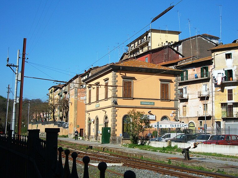
Photo: Croberto68, CC BY-SA 3.0.
Vignanello railway station is situated 2½ km southwest of Centignano.
Vallerano railway station
Railway station

Photo: Croberto68, CC BY-SA 3.0.
Vallerano railway station is situated 3 km southwest of Centignano.
Sanctuary of the Madonna del Ruscello, Vallerano
Church

Photo: Tulumnes, CC BY-SA 4.0.
The Sanctuary of the Madonna del Ruscello, also known as Santa Maria del Ruscello or the Santuario di Maria Santissima del Ruscello dei Donatori di Sangue is a Baroque-style, Roman Catholic church located on Piazza A. Sanctuary of the Madonna del Ruscello, Vallerano is situated 3½ km southwest of Centignano.
Localities in the Area
Vallerano
Village
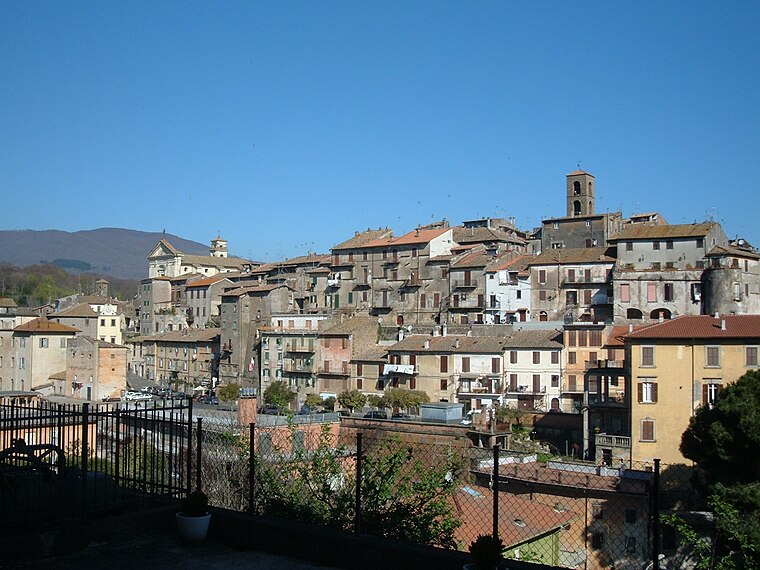
Photo: Croberto68, CC BY-SA 3.0.
Vallerano is a comune in the Province of Viterbo in the Italian region of Latium, located about 60 kilometres northwest of Rome and about 13 kilometres southeast of Viterbo. Vallerano is situated 3½ km southwest of Centignano.
Vasanello
Village
Vasanello is a comune in the Province of Viterbo in the Italian region Lazio, located about 80 kilometres north of GRA and about 27 kilometres east of Viterbo. Vasanello is situated 4 km northeast of Centignano.
Canepina
Village

Photo: Lucafo75, CC BY-SA 4.0.
Canepina is a comune in the Province of Viterbo in the Italian region of Latium, located about 60 kilometres northwest of Rome and about 11 kilometres southeast of Viterbo. Canepina is situated 6 km west of Centignano.
Centignano
- Type: Locality with 65 residents
- Description: human settlement in Italy
- Category: human settlement
- Location: Vignanello, Viterbo, Lazio, Central Italy, Italy, Europe
- View on OpenStreetMap
Latitude
42.39823° or 42° 23' 54" northLongitude
12.29959° or 12° 17' 59" eastPopulation
65Elevation
335 metres (1,099 feet)Open Location Code
8FJJ97XX+7RGeoNames ID
8959833Wikidata ID
Q18455414Centignano Satellite Map
© OpenStreetMap, Mapbox and Maxar
Also Known As
- Basque: Centignano
- Catalan: Centignano
- Cebuano: Centignano
- Chechen: Чентиньяно
- Czech: Centignano
- Danish: Centignano
- Dutch: Centignano, Viterbo
- Finnish: Centignano
- French: Centignano
- Indonesian: Centignano
- Italian: Centignano
- Norwegian Bokmål: Centignano
- Norwegian Nynorsk: Centignano
- Occitan (post 1500): Centignano
- Polish: Centignano
- Portuguese: Centignano
- Romanian: Centignano
- Serbian: Centignano
- Serbian: Чентињано
- Serbo-Croatian: Centignano, Viterbo
- Slovak: Centignano
- Slovenian: Centignano
- Spanish: Centignano
- Swedish: Centignano
- Tagalog: Centignano
- Tatar: Чентиньяно
- Turkish: Centignano
- Waray (Philippines): Centignano
Localities in the Area
- SudanoLocality
- MaregnanoHamlet
- VignanelloLocality, 3 km southwest
- Sant'EutizioHamlet, 3½ km northwest
- ValleranoLocality, 3½ km southwest
Landmarks in the Area
- Castello RuspoliCastle
- Castello Orsini di VasanelloCastle, 4½ km northeast
- Oasi WWF Pian Sant'AngeloPark, 5 km southeast
- Palazzo Chigi6 km northwest
- Monte FestoMountain, 7 km southwest
Popular Destinations in Viterbo
Discover Viterbo, Tarquinia, Civita Castellana and Montefiascone.
Escape to a Random Place
Discover other destinations in the world.
About Mapcarta. Thanks to Mapbox for providing amazing maps. Text is available under the CC BY-SA 4.0 license, excluding photos, directions and the map. Photo: Sailko, CC BY-SA 3.0.