Caer Allt-goch
Caer Allt-goch is an archaeological site in Geneu'r Glyn, Ceredigion, Wales. Caer Allt-goch is situated nearby to the peak Bryn-yr-eithin and the archaeological site Iron Age Camp.Notable Places in the Area
Caer Lletty-llwyd
Archaeological site
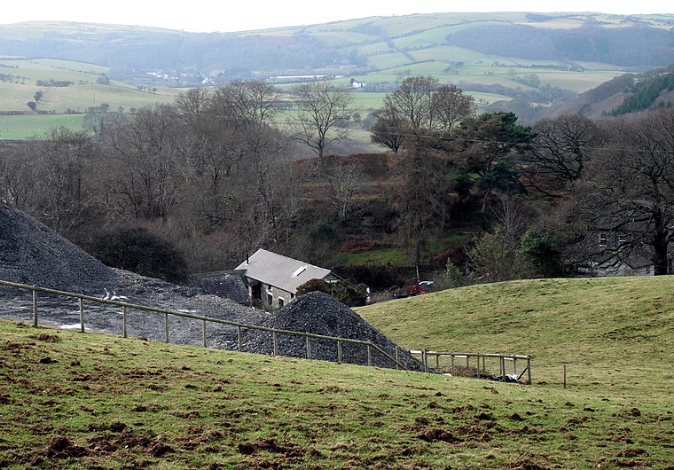
Photo: Chris Denny, CC BY-SA 2.0.
Caer Lletty-llwyd is an archaeological site situated 3,300 feet east of Caer Allt-goch.
Ysgol Tal-y-bont
School

Photo: PKwicipics, CC BY-SA 3.0.
Ysgol Tal-y-bont is a school situated 1¼ miles northeast of Caer Allt-goch.
The Black Lion Hotel
Pub

Photo: Llywelyn2000, CC BY-SA 3.0.
The Black Lion Hotel is a pub situated 1 mile northeast of Caer Allt-goch.
Localities in the Area
Tal-y-bont
Village

Photo: Eddie Webster, CC BY-SA 2.0.
Tal-y-bont is a village in Ceredigion, Wales, located on the A487 road about halfway between Aberystwyth and Machynlleth.
Penybont
Hamlet
Penybont is a small village in the community of Genau'r-glyn, Ceredigion, Wales, which is 77.6 miles from Cardiff and 178.8 miles from London.
Caer Allt-goch
- Type: Archaeological site
- Description: hillfort in Ceredigion
- Categories: contour fort, historic site, tourist attraction and tourism
- Location: Geneu'r Glyn, Ceredigion, Mid Wales, Wales, United Kingdom, Britain and Ireland, Europe
- View on OpenStreetMap
Latitude
52.47638° or 52° 28' 35" northLongitude
-4.00241° or 4° 0' 9" westOpen Location Code
9C4QFXGX+H2OpenStreetMap ID
way 680527128OpenStreetMap Feature
historic=archaeological_siteWikidata ID
Q13126464Caer Allt-goch Satellite Map
© OpenStreetMap, Mapbox and Maxar
Also Known As
- Welsh: Caer Allt-Goch
- Caer Allt goch
In the Area
Caer Allt-goch is situated close to the forest Coed Dolgau and the peak Banc Ty-hen.
Landmarks
- The White LionPub, 1 mile northeast
- Coed CwmcaeForest
- Coed Bryngwyn mawrForest
- Caer Pwll-glasPeak
- Talybont Play AreaPlayground, 1¼ miles northeast
- Caer Pwll-GlasArchaeological site, 1¼ miles south
Other Places
- MaesnewyddFarm, 2,400 feet southeast
- Riverside Caravan And Camping ParkCampsite, 2,900 feet southwest
- GlanfredFarm, 3,300 feet southwest
- HenllysResidence, 3,500 feet west
- DolgwiailHouse, 1 mile southwest
- Cil-y-deriHouse, 1 mile southwest
Popular Destinations in Ceredigion
Escape to a Random Place
Discover the archaeological sites Tomba a grotticella a Doppio Cerchio di Murgia Timone in Matera, Italy and Gotorlekua in Basque Country, Spain.
About Mapcarta. Thanks to Mapbox for providing amazing maps. Data © OpenStreetMap contributors and available under the Open Database License. Text is available under the CC BY-SA 4.0 license, excluding photos, directions and the map. Photo: Traveler100, CC BY-SA 3.0.