Abinger Manor
Abinger Manor is a building in Abinger, Mole Valley, England. Abinger Manor is situated close to the church St James, Abinger and The Abinger Hatch Public House.Notable Places in the Area
Goddards
Building

Photo: stevecadman, CC BY-SA 2.0.
Goddards is a Grade II*-listed house in Abinger Common, Surrey, England. Goddards is situated 2,800 feet southeast of Abinger Manor.
St Mary The Virgins Church
Church
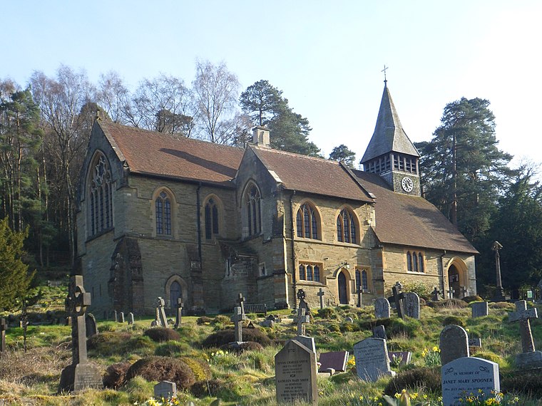
Photo: Hassocks5489, CC0.
St Mary The Virgins Church is situated 1 mile south of Abinger Manor.
Wotton House
Hotel
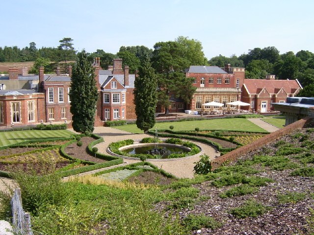
Photo: Barry Pearce, CC BY-SA 2.0.
Wotton House is a hotel, wedding venue, conference centre and former country house in Wotton near Dorking, Surrey, England. Wotton House is situated 4,200 feet northeast of Abinger Manor.
Localities in the Area

Friday Street
Hamlet

Photo: Richard Slessor, CC BY-SA 2.0.
Friday Street is a hamlet on the gentle lower north slope of Leith Hill in Surrey, England.
Holmbury St Mary
Village

Photo: Mike Peel, CC BY-SA 4.0.
Holmbury St Mary is a village in Surrey, England centered on shallow upper slopes of the Greensand Ridge.
Abinger Manor
- Type: Building
- Location: Abinger, Mole Valley, Surrey, South East England, England, United Kingdom, Britain and Ireland, Europe
- View on OpenStreetMap
Latitude
51.20187° or 51° 12' 7" northLongitude
-0.40697° or 0° 24' 25" westOpen Location Code
9C3X6H2V+P6OpenStreetMap ID
way 690152690OpenStreetMap Feature
building=yesAbinger Manor Satellite Map
© OpenStreetMap, Mapbox and Maxar
Landmarks in the Area
- St James, AbingerChurch, 340 feet east
- The Abinger Hatch Public HousePub, 590 feet east
- Mesolithic pit dwelling siteArchaeological site, 730 feet west
- TumulusArchaeological site, 1,200 feet east
- Townhurst WoodForest
Places in the Area
- Surrey Hills All Saints Primary SchoolSchool, 730 feet northeast
- SuttonBuilding, 2,000 feet west
- Raikes FarmFarm, 2,200 feet northwest
- Friday Street TurningBus stop, 2,600 feet southeast
Escape to a Random Place
Discover other buildings in the world.
About Mapcarta. Thanks to Mapbox for providing amazing maps. Data © OpenStreetMap contributors and available under the Open Database License. Text is available under the CC BY-SA 4.0 license, excluding photos, directions and the map. Photo: Wikimedia, CC0.