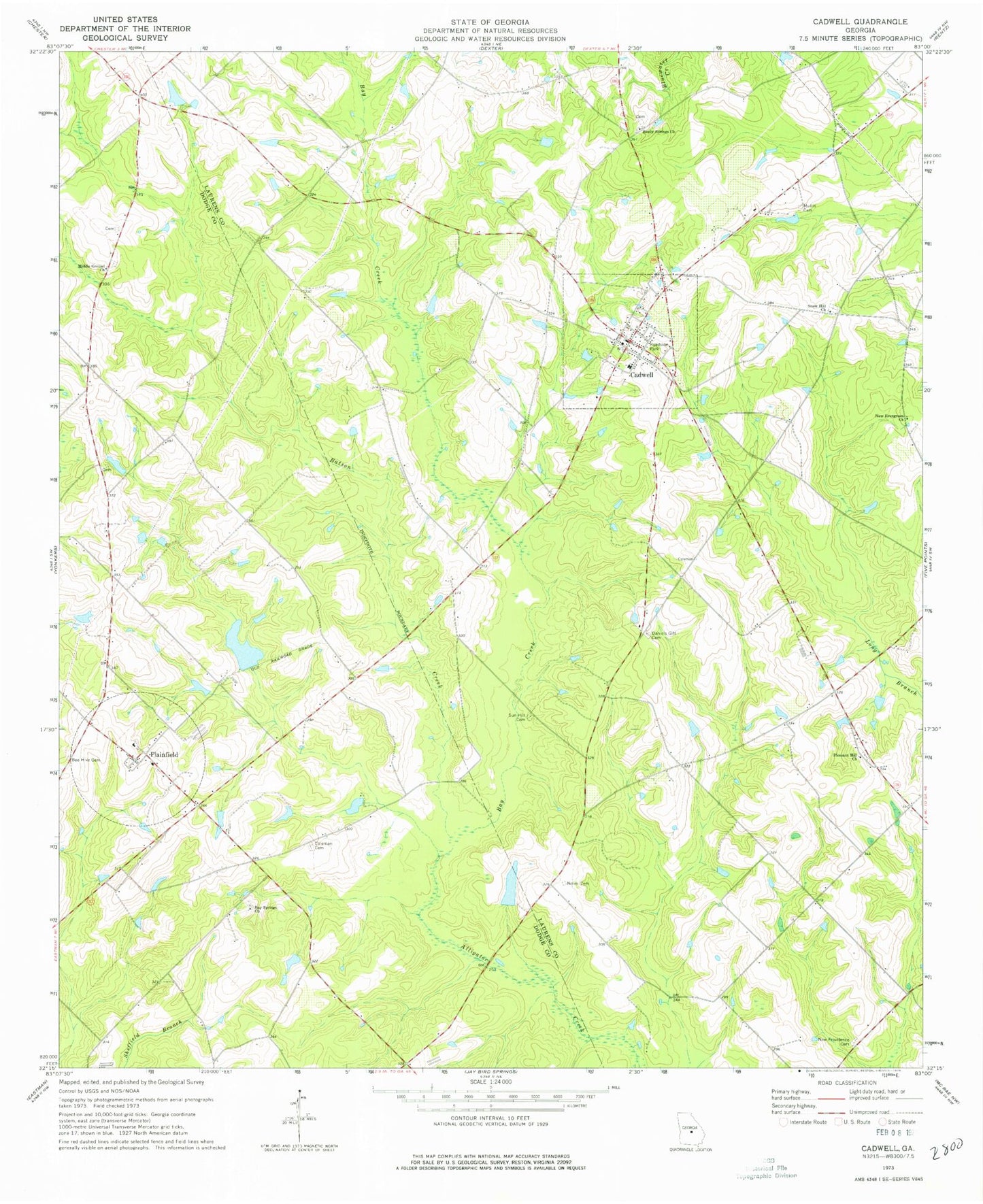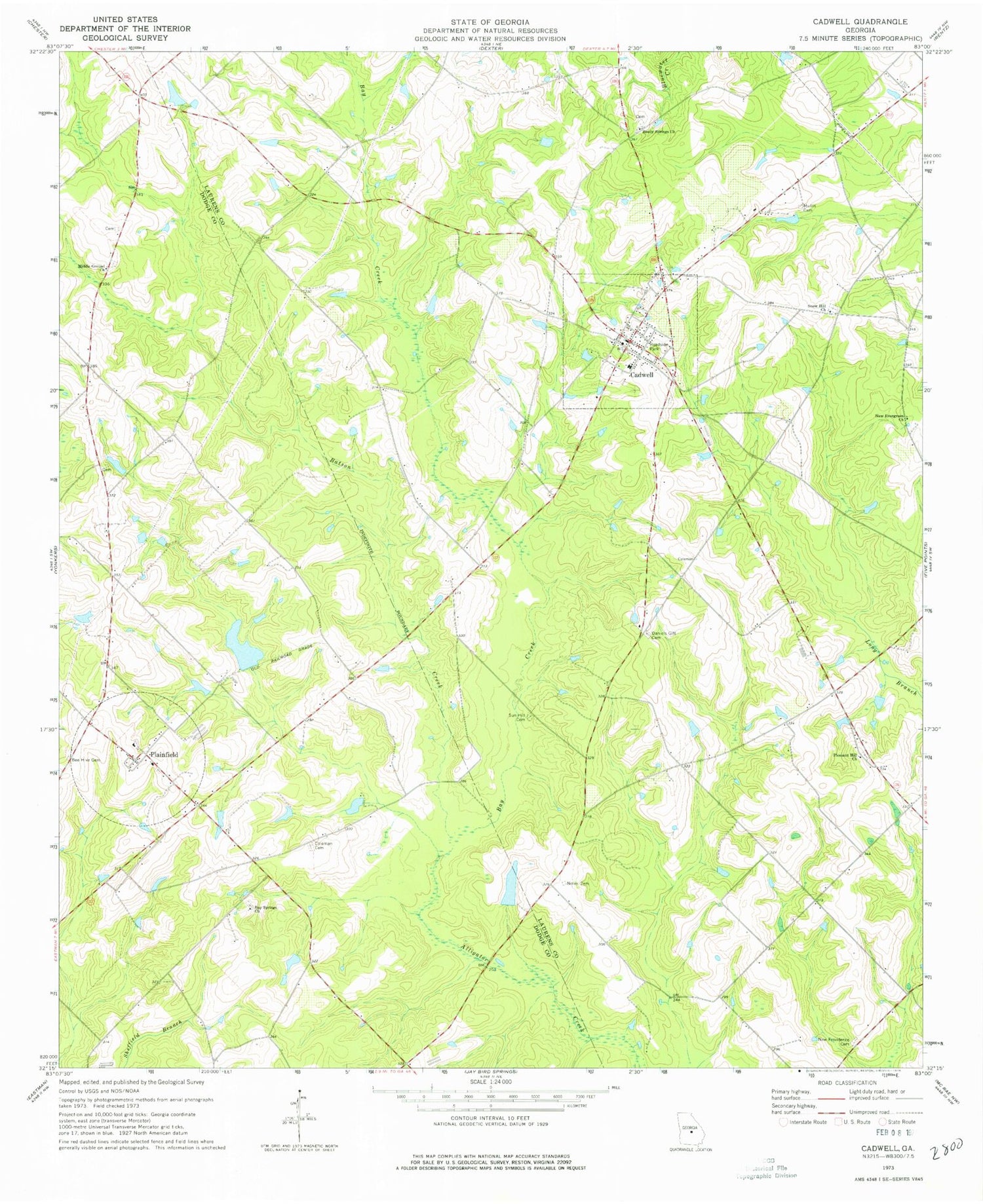
MyTopo
Classic USGS Cadwell Georgia 7.5'x7.5' Topo Map
Couldn't load pickup availability
Historical USGS topographic quad map of Cadwell in the state of Georgia. Map scale may vary for some years, but is generally around 1:24,000. Print size is approximately 24" x 27"
This quadrangle is in the following counties: Dodge, Laurens.
The map contains contour lines, roads, rivers, towns, and lakes. Printed on high-quality waterproof paper with UV fade-resistant inks, and shipped rolled.
Contains the following named places: Batson, Batson Baptist Church, Batson Creek, Batson School, Bay Creek, Bay Springs Church, Bee Hive Cemetery, Beehive, Bryan Lake, Bryan Lake Dam, Cadwell, Cadwell Division, Cadwell Post Office, Cadwell School, Central Probation Detention Center, Coleman Cemetery, Daniels Gift Cemetery, Drench Grove Church, Ellistor School, Horne, Jones Pond, Jones Pond Dam, Joseph Mullis Cemetery, Laurens County Fire Department Station 12, McCollogh Pond, McCollogh Pond Dam, Middle Grounds Church, Mukerson, New Evergreen Church, New Providence Cemetery, Noles Cemetery, Plainfield, Plainfield Baptist Church, Plainfield Volunteer Fire Department, Pleasant Hill Church, Reedy Springs Church, Snow Hill Church, Sun Hill Baptist Church, Sun Hill Cemetery, Town of Cadwell, Whittle Lake, Whittle Lake Dam, ZIP Code: 31009