MyTopo
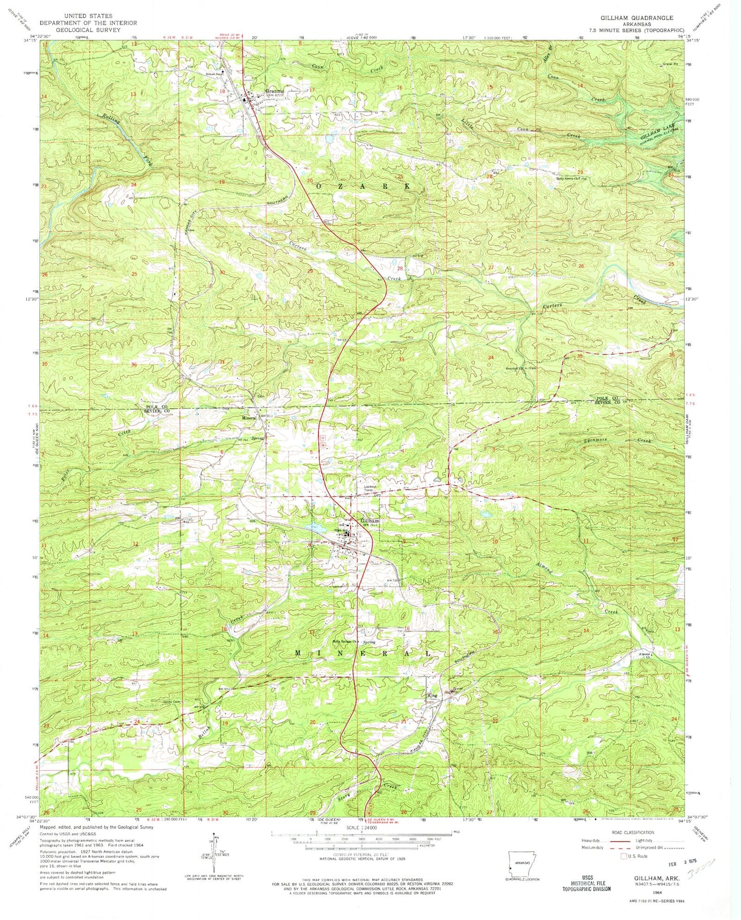
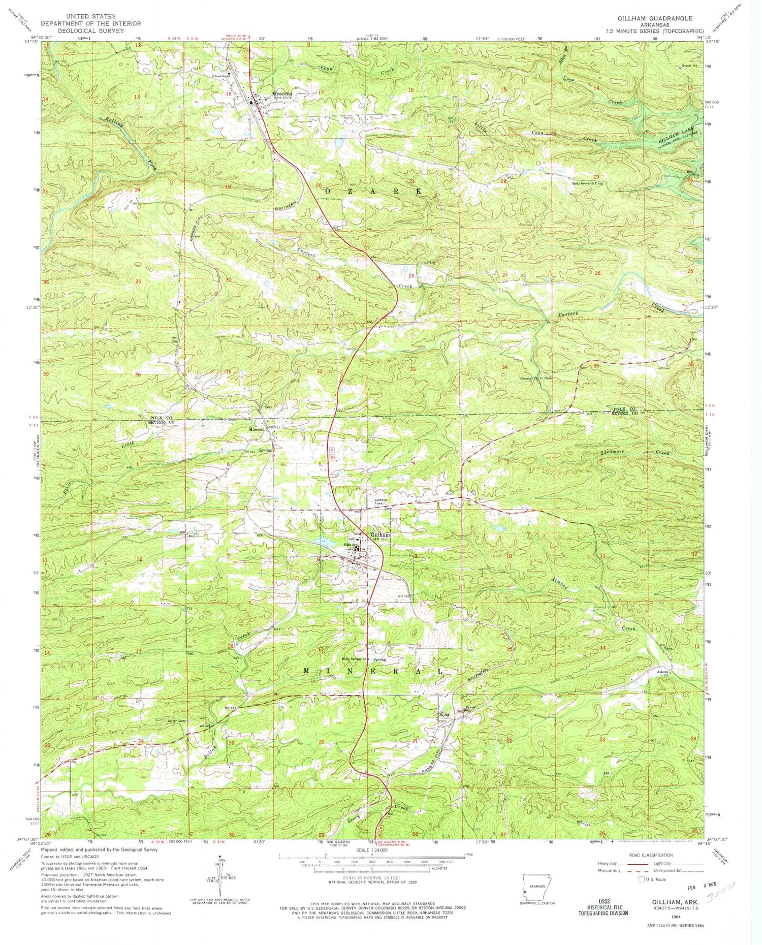
Classic USGS Gillham Arkansas 7.5'x7.5' Topo Map
Couldn't load pickup availability
Historical USGS topographic quad map of Gillham in the state of Arkansas. Map scale may vary for some years, but is generally around 1:24,000. Print size is approximately 24" x 27"
This quadrangle is in the following counties: Polk, Sevier.
The map contains contour lines, roads, rivers, towns, and lakes. Printed on high-quality waterproof paper with UV fade-resistant inks, and shipped rolled.
Contains the following named places: Aeration Lake, Allen Branch, Almond Church, Antioch, Antioch School, City of Grannis, Fairview, Fairview School, Gillham, Gillham Cemetery, Gillham High School, Gillham Lake, Gillham Lake Dam, Gillham Post Office, Gillham Volunteer Fire Department, Grannis, Grannis Baptist Church, Grannis Cemetery, Grannis Fire Station 1, Grannis Police Department, Grannis Post Office, Holly Grove, Holly Grove Cemetery, Holly Grove Missionary Baptist Church, Holly Grove School, Holly Springs Church, King, Land Processing Lake Dam, Little Coon Creek, Mineral, Mineral Cemetery, Overturf Cemetery, Overturf Church, Overturf School, Ozark School, School Number 47, Spring Hill School, Town of Gillham, Township of Mineral, Valley Cemetery, Valley School, ZIP Codes: 71841, 71944