MyTopo
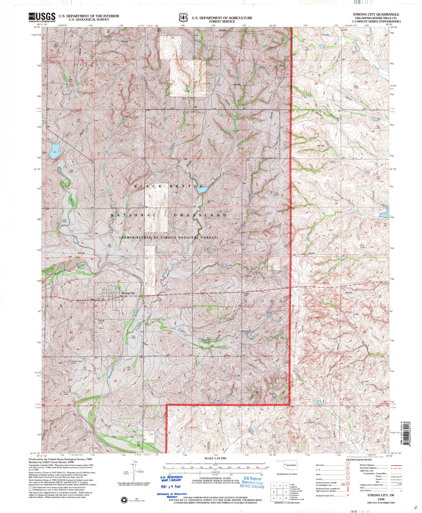
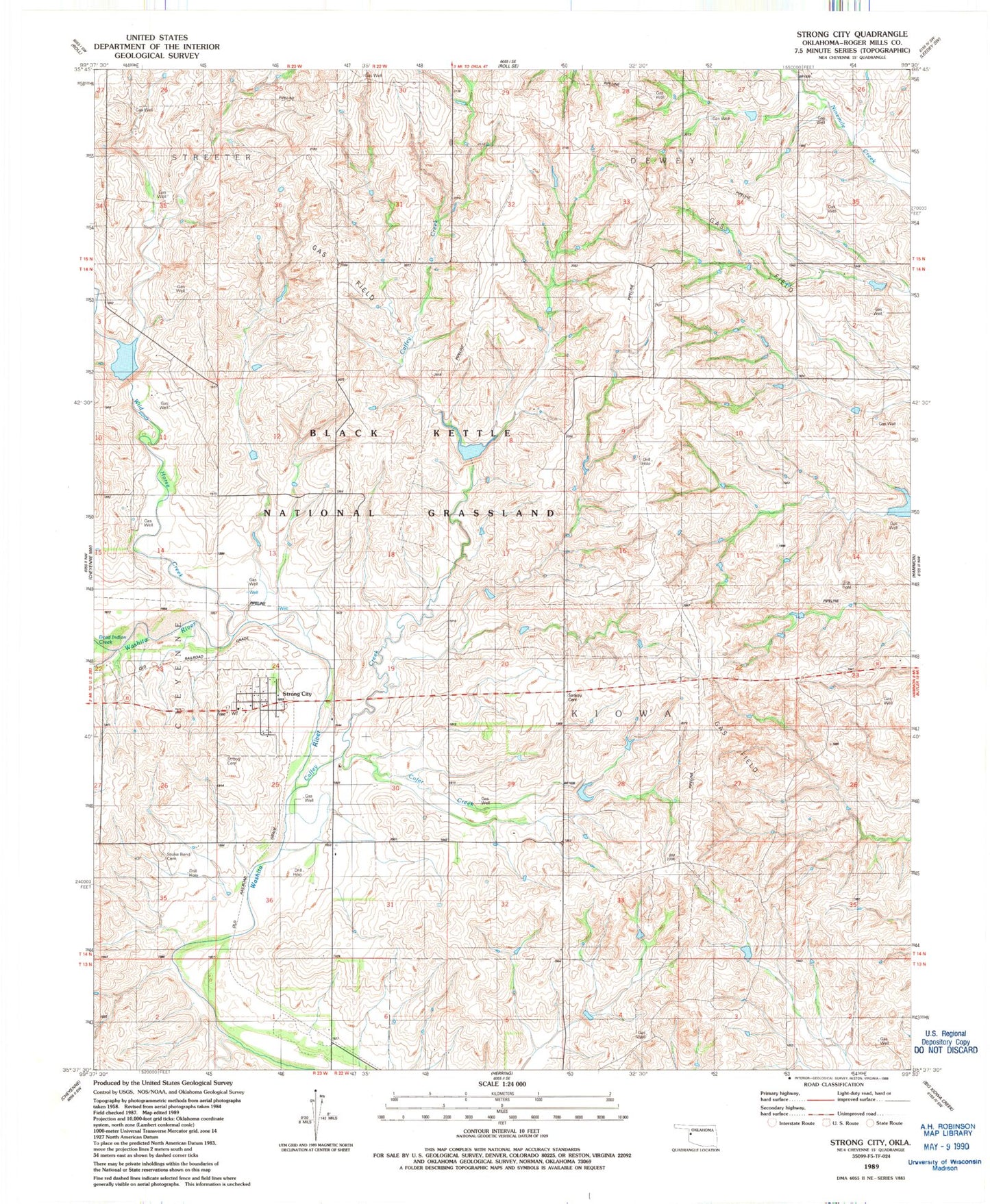
Classic USGS Strong City Oklahoma 7.5'x7.5' Topo Map
Couldn't load pickup availability
Historical USGS topographic quad map of Strong City in the state of Oklahoma. Map scale may vary for some years, but is generally around 1:24,000. Print size is approximately 24" x 27"
This quadrangle is in the following counties: Roger Mills.
The map contains contour lines, roads, rivers, towns, and lakes. Printed on high-quality waterproof paper with UV fade-resistant inks, and shipped rolled.
Contains the following named places: C Wickham Number 1 Dam, C Wickham Number 1 Reservoir, Caffey Creek, Chapel Hill Cemetery, Cofer Creek, Dead Indian-Wildhorse Site 1 Dam, Dead Indian-Wildhorse Site 1 Reservoir, Dead Indian-Wildhorse Site 2 Dam, Dead Indian-Wildhorse Site 2 Reservoir, Dead Warrior Creek, Mine Mile Creek Site 14 Reservoir, Nine Mile Creek Site 1 Dam, Nine Mile Creek Site 1 Reservoir, Nine Mile Creek Site 13 Dam, Nine Mile Creek Site 13 Reservoir, Nine Mile Creek Site 14 Dam, Nine Mile Creek Site 15 Dam, Nine Mile Creek Site 15 Reservoir, Nine Mile Creek Site 2 Dam, Nine Mile Creek Site 2 Reservoir, Nine Mile Creek Site 4 Dam, Nine Mile Creek Site 4 Reservoir, Nine Mile Creek Site 5 Dam, Nine Mile Creek Site 5 Reservoir, Nine Mile Creek Site 6 Dam, Nine Mile Creek Site 6 Reservoir, Quartermaster Site 7 Dam, Quartermaster Site 7 Reservoir, Quartermaster Site 8 Dam, Quartermaster Site 8 Reservoir, Quartermaster Site 9 Dam, Quartermaster Site 9 Reservoir, R Wickham Number 3 Dam, R Wickham Number 3 Reservoir, Snakey Bend Cemetery, Strong City, Strong City Cemetery, Strong City Fire Department, Town of Strong City, Wagoner Cemetery, Wild Horse Creek