
MyTopo
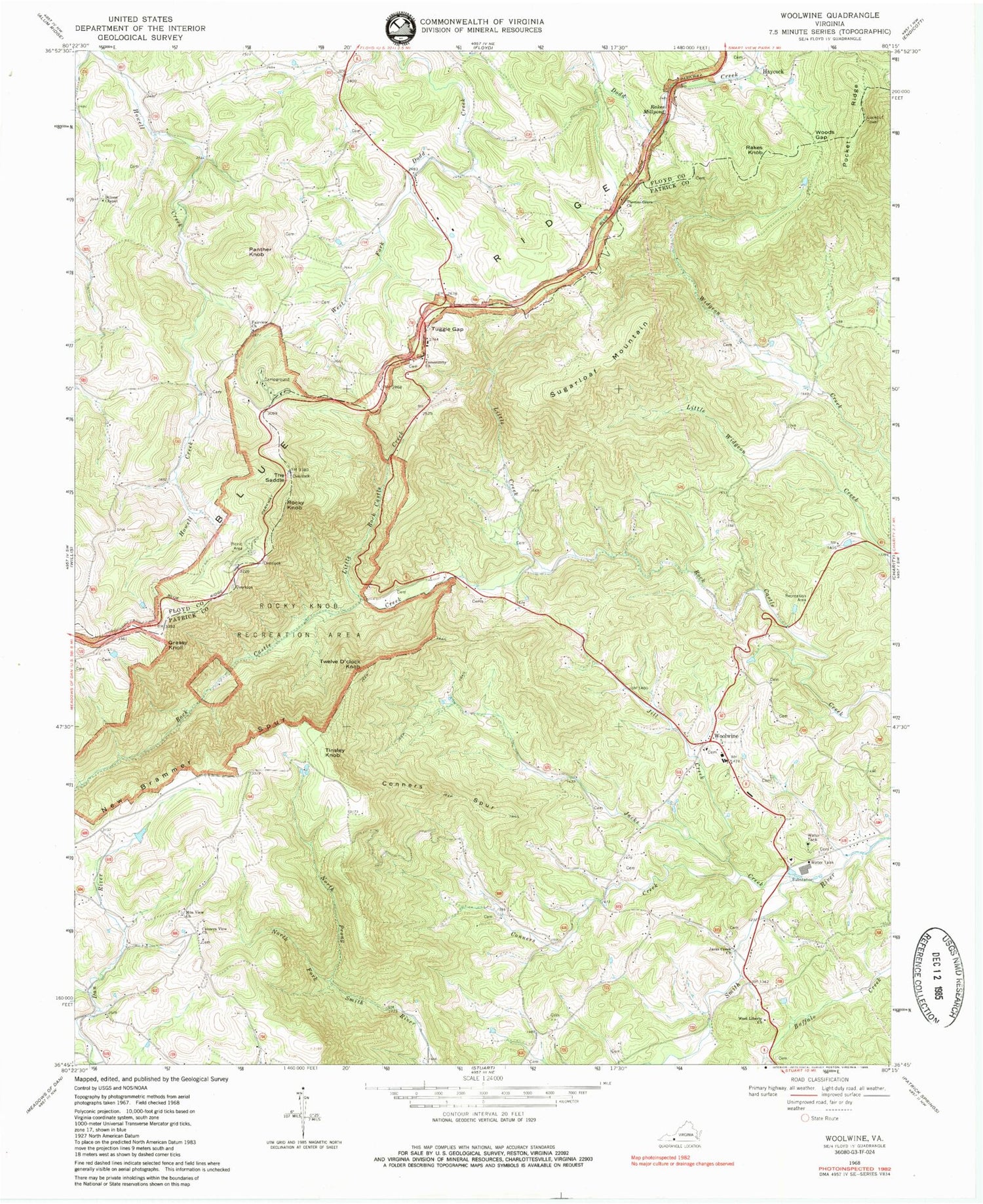
Classic USGS Woolwine Virginia 7.5'x7.5' Topo Map
Couldn't load pickup availability
Historical USGS topographic quad map of Woolwine in the state of Virginia. Typical map scale is 1:24,000, but may vary for certain years, if available. Print size: 24" x 27"
This quadrangle is in the following counties: Floyd, Patrick.
The map contains contour lines, roads, rivers, towns, and lakes. Printed on high-quality waterproof paper with UV fade-resistant inks, and shipped rolled.
Contains the following named places: Conners Creek, Conners Spur, Conners View Church, Dillons Chapel, Fairview Church, Jacks Creek, Jacks Creek Church, Jill Creek, Little Creek, Little Rock Castle Creek, Mountain View Church, New Brammer Ridge, North Prong Smith River, Panther Knob, Pocket Ridge, Rakes Knob, Rakes Millpond, Rocky Knob, Rocky Knob Recreation Area, Sugarloaf Mountain, The Saddle, Thomas Grove Church, Tuggle Gap, West Liberty Church, Woods Gap, Twelve O'Clock Knob, Rakes Mill Dam, Braswells Dam, Conners View Cemetery, Mountain View Cemetery, Woolwine Elementary School, Woolwine United Methodist Church, Grassy Knoll, Haycock, Tinsley Knob, Woolwine, Jack's Creek Covered Bridge, Woolwine Volunteer Fire Department, Smith River Rescue Squad, Tuggles Gap, Woolwine Post Office


