MyTopo
Manilla Indiana US Topo Map
Couldn't load pickup availability
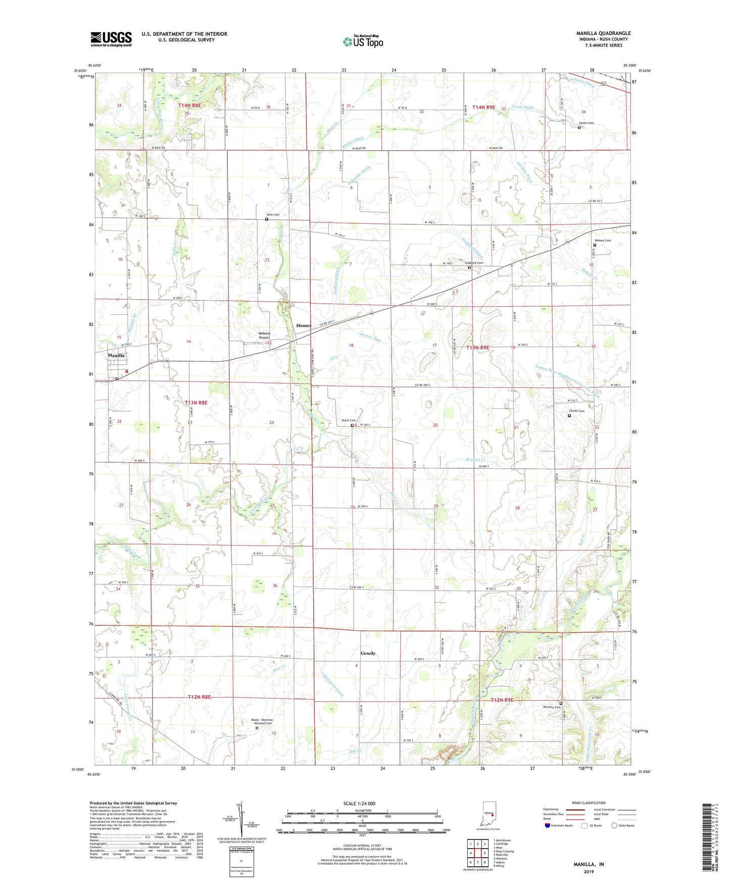
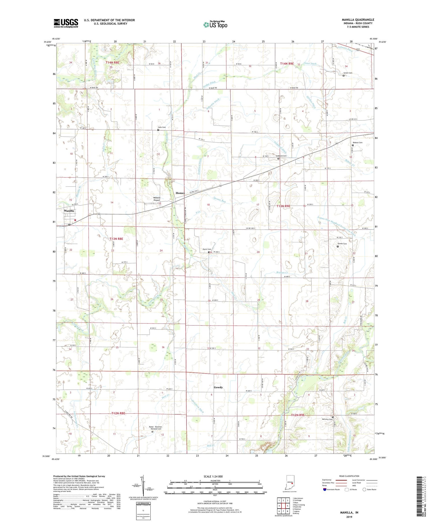
2019 topographic map quadrangle Manilla in the state of Indiana. Scale: 1:24000. Based on the newly updated USGS 7.5' US Topo map series, this map is in the following counties: Rush. The map contains contour data, water features, and other items you are used to seeing on USGS maps, but also has updated roads and other features. This is the next generation of topographic maps. Printed on high-quality waterproof paper with UV fade-resistant inks.
Quads adjacent to this one:
West: Rays Crossing
Northwest: Morristown
North: Carthage
Northeast: Mays
East: Rushville
Southeast: Milroy
South: Adams
Southwest: Waldron
Contains the following named places: Arbuckle Ditch, Beaver Meadow Creek, Bebout Cemetery, Bebout Creek, Big Flat Rock Church, Blue River Church, Bob Creek, Branan Creek, Deer Creek, Ditch Creek, Gates Ditch, Goddard Cemetery, Goddard Ditch, Gordon Ditch, Gowdy, Green Cemetery, Hodge Ditch, Homer, Homer Run, Hurst Cemetery, Johnson Ditch, Logan Nine Hundred Forty-Five Ditch, Manilla, Manilla Census Designated Place, Manilla Elementary School, Manilla Post Office, Manilla Volunteer Fire Department, McCarty Cemetery, McCorkle Quarry, McGinnis Ditch, Mud Creek, Ormes Cemetery, Radar - Bowman - Worland Cemetery, Sells Cemetery, South Creek, Summer Post Office, Township of Walker, Webster Airport, ZIP Codes: 46146, 46150