Grayson Highlands State Park
Southwest Virginia
Before we begin, I want to note as I continue to post these detailed trip ideas that I am not advocating for anything that would go against public health guidance in this serious COVID time. As long as you are able to do these trips safely, I hope these posts are a useful tool in helping as many people as possible participate in healthy outdoor activities. Being able to continue to be outside during this time, even by myself, has been incredibly important for me. I hope others will benefit from this as much as I have. Which is why I continue to post these ideas that anyone can take on their own even before I officially launch Hackman Guided Adventures next year — once it’s safe to gather in groups again.
Exploring nature alone might not only be the safest option right now but it can also be an incredibly healing, introspective, and rewarding experience. It can quiet the noise of the industrialized world that constantly bombards us through all our screens. It can allow you to think deeply; give you time to journal and write your thoughts; read your favorite book. And while there are more risks from hiking and camping solo it can be done safely if you are well prepared and plan accordingly.
In fact, this blog describes one trip I took by myself just a few weeks ago and — it — was — amazing!

Grayson Highlands State Park and Mount Rogers National Recreation Area are right next to each other in southwest Virginia and combine to form an oasis of outdoor activities near two of Virginia’s highest peaks — Mount Rogers (5,728 ft) and Whitetop Mountain (5,518 ft).
At 4,502 acres, Grayson Highlands State Park offers “scenic views of alpine-like peaks more than 5,000 feet high. Facilities include a visitor center, campgrounds, and hiking trails leading to waterfalls and overlooks. Scenic horse trails and a horse camping area with electric and water hookups, stables and parking for trailers are available. The park provides year-round access to the Appalachian Trail and the Virginia Highlands Horse Trail.”
At 200,000 acres of national forest land, the Mount Rogers National Recreation Area (NRA) “features four Congressionally designated wilderness areas; the Virginia Creeper Trail; the Mount Rogers Scenic Byway which traverses over 50 miles offering views of the National Recreation Area and open rural countryside; the 5,000 acre Crest Zone featuring elevations over 4,000 feet, large rock formations, and a mixture of mountain balds and spruce-fir forests; a herd of wild, free-ranging ponies; and the highest elevated road in the state of Virginia leading to the summit of Whitetop Mountain.”
Five Things You’ll Learn From This Post:
- Where and how to see wild ponies!
- Easiest way to the top of Virginia’s highest peak.
- How to A) car camp and B) backpack in the region.
- Where to do some killer mountain bike trail riding along the VA Creeper Trail.
- More information about one of the Appalachian Trail’s most famous towns — Damascus, VA — and the TRAIL DAYS FESTIVAL!
*BONUS: Quick introduction to Wilderness Areas!

Step 1: The Route

Southwest Virginia is in a locational sweet spot within a day’s drive from the DC region and many points in NC, TN, KY, OH and even IN and GA. For an extended weekend trip it’s also a great launching point to many other mountain ranges, national forests and recreation areas, and other outdoor points of interest in VA and NC, Asheville, the Blue Ridge Parkway, the Great Smoky Mountains and more.
Coming from DC as I always am, I took 81 most of the way only losing cell service a little when I got close to the park. It’s a straight forward drive with many opportunities for food and fuel. Just make sure you stock up on water before you enter the “highlands” if you’re spending the weekend. Although there are places to resupply within 15–20 min of the park so you’re never going to get “stranded” if you run out of something.
Step 2: Grayson Highlands State Park vs Mount Rogers National Recreation Area — Where to Camp?!
For this trip, I choose the state park for a number of reasons. For one, I was camping solo and there are more people, more facilities, and very easy and well set up car camping sites with firepits and picnic tables. (For a refresher on how I differentiate between “car camping” and backpacking, visit this post: here.)
There’s a fee for the state park but I was easily able to register for a campsite the day I arrived. There’s really nothing else for me to describe here. You get a very easy to follow map when you arrive at the entrance station, you register and pay your fee to the nice park ranger, you park your car (Chestnut Hollow Campground), put the tent up, light the fire, crack a beer, and sigh a wonderful sigh of relief at being in the great outdoors!
Mount Rogers National Recreation Area is a much larger area than Grayson Highlands State Park and it is on federal public land / national forest land which, as I’ve written about extensively in other Hackman Guided Adventure Posts, is an inherently more “primitive” camping experience. Although, Mount Rogers NRA does include 3 rental cabins and 11 campgrounds, four of which are set up for horseback riders.
Mount Rogers NRA allows camping, picnicking, sight-seeing, bird watching, trout fishing, hunting, hiking, bicycling, horseback riding, cross-country skiing, and swimming. There are over 500 miles of trails in the area, including 60 miles of the Appalachian Trail, 18 miles of the Virginia Creeper Trail, and 67 miles of the Virginia Highland Horse Trail. Over one million visitors come to Mount Rogers every year (credit USFS).
But the main reason I decided on Grayson Highlands was because of the ponies!

Step 3: The Ponies!
I arrived Grayson Highlands State Park early enough in the day that even before heading to the campground, I parked the car at Massie Gap so I could hike around and play with the ponies (at a safe distance).

This is clearly the biggest draw to this area for most people. I’m not going to lie — it’s awesome and I have more photos than I know what to do with. These also are NOT your nappy / salt-water / aggressively biting wild horses of Assateague Island on the Maryland shore. Those horse kind of suck… no offense. The Grayson Highland ponies are adorable, small, very curious (don’t get too close!) and beautiful mountain-highland-creatures that roam around an environment they seem to thoroughly enjoy.
You’ll see them almost immediately after entering the Wildburn Ridge area from Massie Gap parking lot.


Head through the gate and along the Rhododendron Trail climbing gradually as you go. The trail will widen out to a big open plateau on either side. Within minutes, individual ponies and/or packs of them will be right there, freely grazing.
From here, there are amazing vistas from the grassy Appalachian Balds — mountain summits or crests covered primarily by thick vegetation of native grasses or shrubs occurring in areas where heavy forest growth would be expected. Endless mountain ridgelines are visible in all directions from your vantage point of around 5,000 feet. This is George Washington and Jefferson National Forest and it extends the entire length of Virginia (even spilling into WV and KY). At 1.8 million acres, these forests form one of the largest areas of public land in the East. (Check out some of my other posts for additional awesome trip ideas throughout these two forests!)
A little further up the Rhododendron Trail, a side trail to the right will take you over to some exposed rocks that are fun to free climb and from which you can enjoy additional photogenic views.
Step 4: Summiting Mount Rogers, Virginia’s Highest Mountain
Chasing ponies up the Rhododendron Trail, you’ll be halfway up Mount Rogers before you even realize it. Only about a mile up the trail from Massie Gap, you’ll come to your first juncture with the Appalachian Trail. You can take the AT Southbound 3.8 miles to Mount Rogers Summit from here — white blazes, very easy to follow — or you can cross over the AT and continue up the Rhododendron Trail, which begins to parallel the Horse Trail North, for a short cut.


If you do things correctly, you’ll eventually get to this sign. Again, this is only about 1–1.5 miles from Massie Gap and from here only about 3 more miles to the top of Mount Rogers for about an 8-mile round trip hike total. This is by far the quickest route description you’re going to find. Although, I always recommend having physical maps with you and other forms of trail descriptions just in case (AllTrails, Hiking Upward, USFS Maps, always good options).
You will link up with the Appalachian Trail again, per the sign, and will take the Mt. Rogers Spur Trail the rest of the way to the summit.
***ALWAYS BRING A HEAD LAMP just in case you run out of daylight. An 8+ mile hike with ~1,000+ feet of elevation gain can be challenging and last longer than you realize. There are a bunch of side trails and the crowds thin out the further into the Mount Rogers NRA you get so you don’t want to get lost in the dark.
It’s fun to see the difference as you go, though, between the invisible state park boundary and the national recreation area. Quickly, you can feel like you have this high, backcountry world all to yourself!
Backpacking option:
Somewhere early on hiking up the Rhododendron Trail, you’ll enter the Mount Rogers National Recreation Area (exiting the state park) and will see various backcountry camp sites near the trail and indicated by stones people have piled up around fire pits. You can camp anywhere — as usual on USFS lands which offer fantastic backcountry camping accessibility — as long as you don’t have more than 10 people in your group. This is bear habitat and water sources are limited in the high country so be prepared. Leave No Trace and adequately store any food in tight / waterproof bags or bear cannisters so you don’t have any unwanted visitors in the night.
Usually you can also camp along the Appalachian Trail at a safe distance off the trail itself— usually 60 feet or so, depending on exactly where you are. There is also the Thomas Knob Appalachian Trail Shelter near the Mt. Rogers summit Spur trail.
Here’s a great map of the area from the USFS website: map. As you can see, the summit of Mount Rogers and the surrounding area are all within the Mount Rogers NRA and are also within the Lewis Fork Wilderness Area.
QUICK INTRODUCTION TO WILDERNESS AREAS:
Congressionally designated wilderness areas are my absolute favorite places to explore! They are designed to protect the pristine natural character of an area.
According to the USDA / USFS, “The National Wilderness Preservation System is a network of over 109 million acres of public land comprised of more than 760 wilderness areas administered for the American people by the federal government. These are special places where nature still calls the shots. Places where people like you, with an appetite for adventure, can find a sense of true self-reliance and experience solitude. They are final holdout refuges for a long list of rare, threatened, and endangered species, forced to the edges by modern development. They are the headwaters of critical, life-infusing rivers and streams. They are places where law mandates above all else that wildness be retained for our current generation, and those who will follow.” (Credit: USDA/USFS)
This description of wilderness alone gets my blood flowing! Some of the most spectacular places I’ve been in the mid-Atlantic (and elsewhere) are designated wilderness areas including Dolly Sods Wilderness in West Virginia. You can also still hike, backpack, and enjoy many activities in wilderness areas you just have to be sure to check the rules and regulations of wherever you’re going.
On Mount Rogers, the Lewis Fork Wilderness was established in 1984 and is 6,076 acres (larger than all of Grayson Highlands State Park btw) of high-elevation hardwoods, Red Spruce, and Frazier Fir. For a detailed map of just the Lewis Fork Wilderness along with excellent descriptions, click: here.
Federal public land management in the US can be a bit like the movie Inception — wilderness areas (Lewis Fork), within National Recreation Areas (Mount Rogers NRA), within national forests (GW & Jefferson Ntl Forests)… And then many have state parks (Grayson Highlands) or national parks (Shenandoah) or national park service units (Blue Ridge Parkway) nearby… But it’s not hard to navigate all this once you get the hang of it and you’ll notice for yourself slight differences in how each of these areas look and feel depending on the different levels of protections / activities allowed. It’s pretty amazing that we have this in our country. These are our public lands and they belong to all of us. Protected public lands are an American legacy we should all be proud of.
This post isn’t about wilderness or backpacking though, so I won’t spend more time on it but there are many additional sources you can look up for information on backpacking in Lewis Fork Wilderness and Mount Rogers NRA. Make sure you read all rules and regulations and are fully prepared.

Other Points of Interest in the Region:
- Whitetop Mountain Auto Road and Observation Site
The second-highest peak in Virginia is much easier to summit than the first. In fact, there’s a road that goes up to panoramic summit views. This is about 30 min from Grayson Highlands State Park and all information can be found on the USFS website: here.
2. The Virginia Creeper National Recreation Bike Trail
According to the VA Tourism website, “the 34.3-mile Virginia Creeper Trail was named after the steam engine that crept up the rails into the Iron Mountains. Also, a plant called the “Virginia Creeper” grew along its tracks. By the 1970s, many railroads were abandoned. And in 1986, the Rails-to-Trails Conservancy began converting old railroad beds into trail systems for hikers and bikers.”

The Virginia creeper trail is trail riding heaven. Multiple route options can be found on the VA Is For Lovers Website but the most popular option is to rent a bike from a company in Damascus that will shuttle you to the top of the trail at Whitetop Station about 17 miles away. This is right next to the NC border. From Whitetop, it’s an easy ride downhill through incredibly beautiful forests and over picturesque bridges.
There is an excellent website I highly recommend for all things Virginia Creeper: https://www.vacreepertrail.org/
3. Damascus, Virginia — One of the Appalachian Trail’s Most Famous Towns
Damascus is about an hour from Grayson Highlands State Park. As already mentioned, it’s a popular starting point for the VA Creeper Trail. The Appalachian Trail also runs right through the heart of this little mountain town and Damascus has FULLY embraced the AT culture and outdoor recreation tourism. Each year, the town of 800 hosts a 3-day trail party knows as “Trail Days” that can bring in as many as 10,000 additional people.
I’ve been to three Trail Days festivals and they are a BLAST! Current Appalachian Trail thru hikers, previous finishers, and general outdoor lovers like myself all congregate together for an amazing time that’s hard to explain but so fun. This article does a good job summing it up: “TRAIL DAYS TURNS A TINY APPALACHIAN TRAIL TOWN INTO ONE BIG, SWEATY PARTY.”
Of course, Trail Days did not occur in 2020 but hopefully it will return in 2021 when things are safer. Stay tuned for more posts on this and other trips soon!
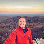
Will Hackman, Hackman Guided Adventures
Be sure to follow Will on Instagram @Hackman.Will and Facebook for more updates and adventures and subscribe to this blog to ensure you don’t miss future posts on: Backpacking | Camping | Mountaineering | Cycling | Bike Touring | Photography | Birding | Yoga | Meditation | Paddling | Water Sports | Writing Retreats | & Wilderness 101s!