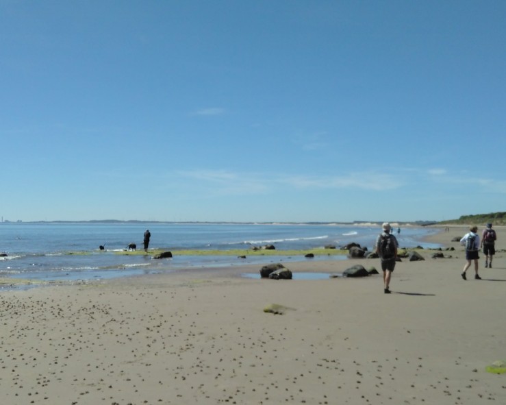
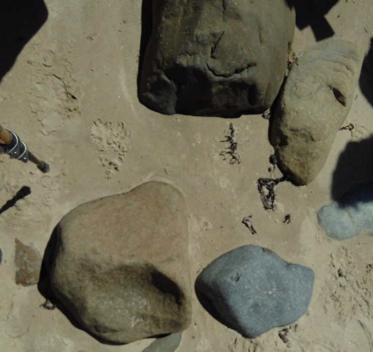
Low Hauxley Beach at low tide showing a cluster of boulders mostly whinstone, poitioned possibly for shore protection. Low Hauxley Shore is an SSSI and shows fascinating Quaternary features such as an extensive layer of woody peat resting on Late Devension glacial till, overlain with blown sand containing buried soil horizons. Over the last 5000 years the geology illustrates environmental, coastal and archaeological changes.
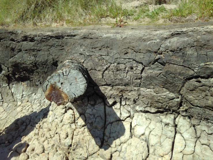
Below is a peat layer dating to 7400- 7100 years before the present. The tree trunk is in situ. Trees present at that time from pollen analysis: Birch, Pine, Willow, Hazel, Alder. Beneath the peat is brown Glacial till.
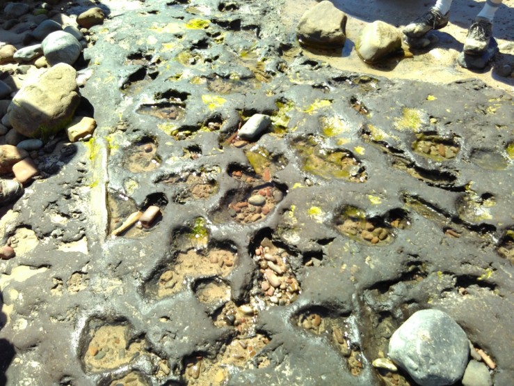
Further down the shore on a wave cut platform this peat layer revealed fossil footprints of human, horse and Wild Boar tracks. Humans were thought to have been here as early as 10,000 BP as nomadic hunter gatherers. These footsteps in the peat date from a period after this, when the sea level was lower and land wooded. They are now subject to tidal erosion.
The view below shows how the peat accumulated in hollows between outcropping bedrock sandstone. The join in the sand near the left hand side is the edge of a recently filled in archaeological investigation. Various colours of Boulder clay are exposed between.
A closer view of the Glacial Boulder till shows its rough pebbly texture and an edge between the grey/green softer slate till.
The till seemed to come in various colours, grey/brown below.
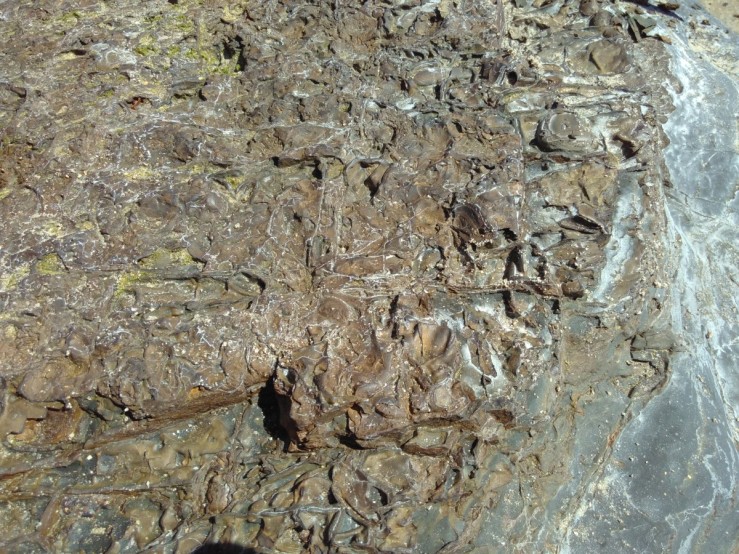
Some was lighter brown in colour and showed surface cracking. The streaky pattern of grey/blue till is indicative of watery conditions under the ice suggestive of faster moving but thinner ice.
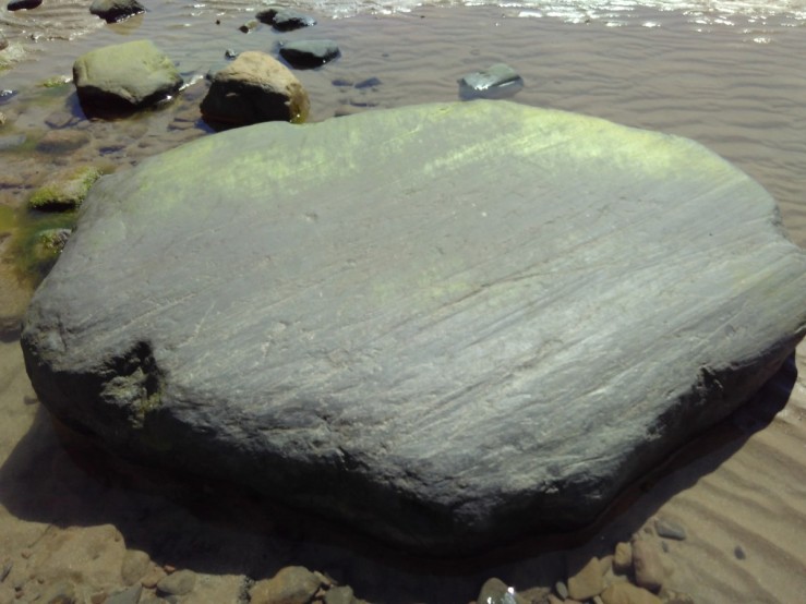
A large boulder clearly displaying striations indicative of ice movement. The direction was from North to South at that point.
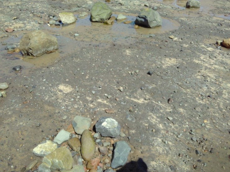
Loose rocks on the beach were probably dropped here by glaciers and indicated the types of bedrock dragged here. Whin Stone, Sandstone, Carboniferous Limestone and Red Sandstone imply some of the variety present.
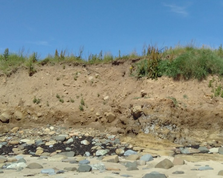
The underlying sandstone bedrock is visible below in the profile below. Significantly there is no peat layer and the glacial till contains larger boulders.
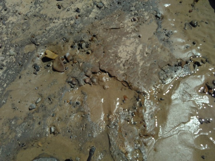
They grey mud streaks are evidence of soil formation above the till. Gley soils have greyish or bluey-grey colours with orange mottling. Of secondary origin they gradually replace those inherited from the parent material. They result from the absence or very low levels of oxygen when iron compounds are changed chemically from their usual brown colours to bluey grey in this case.
Sand dunes formed above peat layers on three separate occasions. The photo below reveals darker peat levels interspersed with lighter coloured sandy layers.
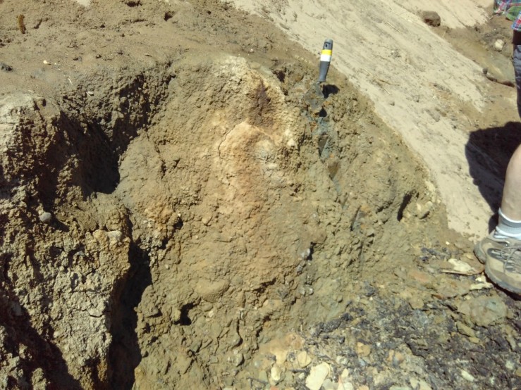
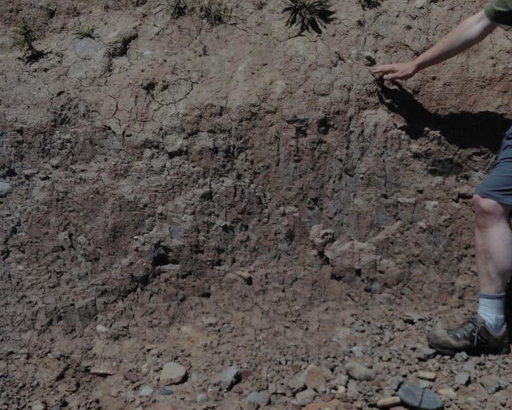
Although much can be dated and interpreted from the dunes there are gaps or unconformities where erosion or other changes have obscured the succession. This layer of cracked iron containing material outcropped on the beach above a strata of slaty deposit. It was crumbly to the touch and looked rusty brown.
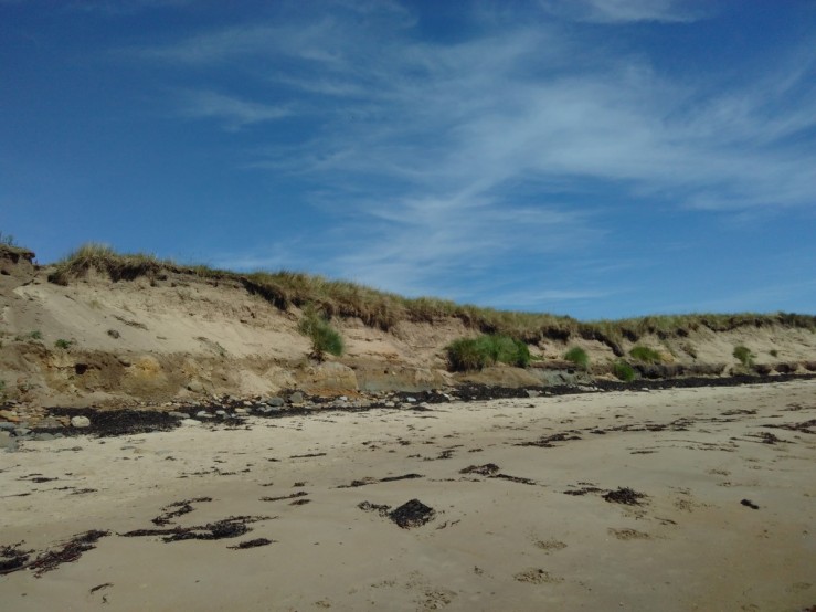
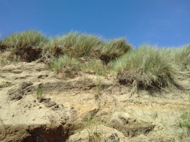
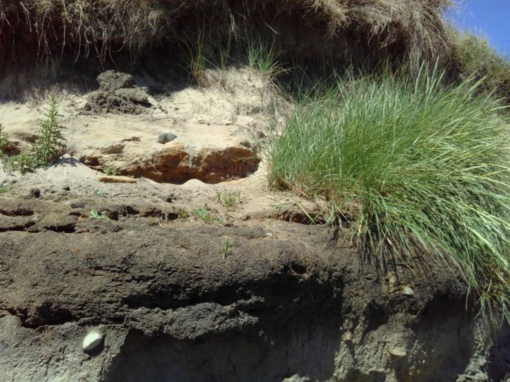
Rapid erosion from the sea is a feature of this area of the Northumbrian coast. Although vegetation is important to the formation and stabilization of the dunes, it also falls victim to undermining in winter storms as this slipped clump of Marram Grass reveals.
Surprisingly a large caterpillar had fallen onto the dune slopes and was laboriously climbing up to the top. It proved to be a the caterpillar of the Drinker Moth (Euthrix potatoria) which tends to a coastal distribution in the Northumberland.


Reference for Archaeology: Low Hauxley Excavation Report
