
How to walk onto Worms Head, Rhossili, Gower | Detailed Hike Guide with Vlog
Walk Type: Out and back
Distance: 4.5 miles
Difficulty: Moderate
Car park: Rhossili national trust car park, SA3 1PP
Nearest watering hole: Worms Head Hotel, opposite the car park
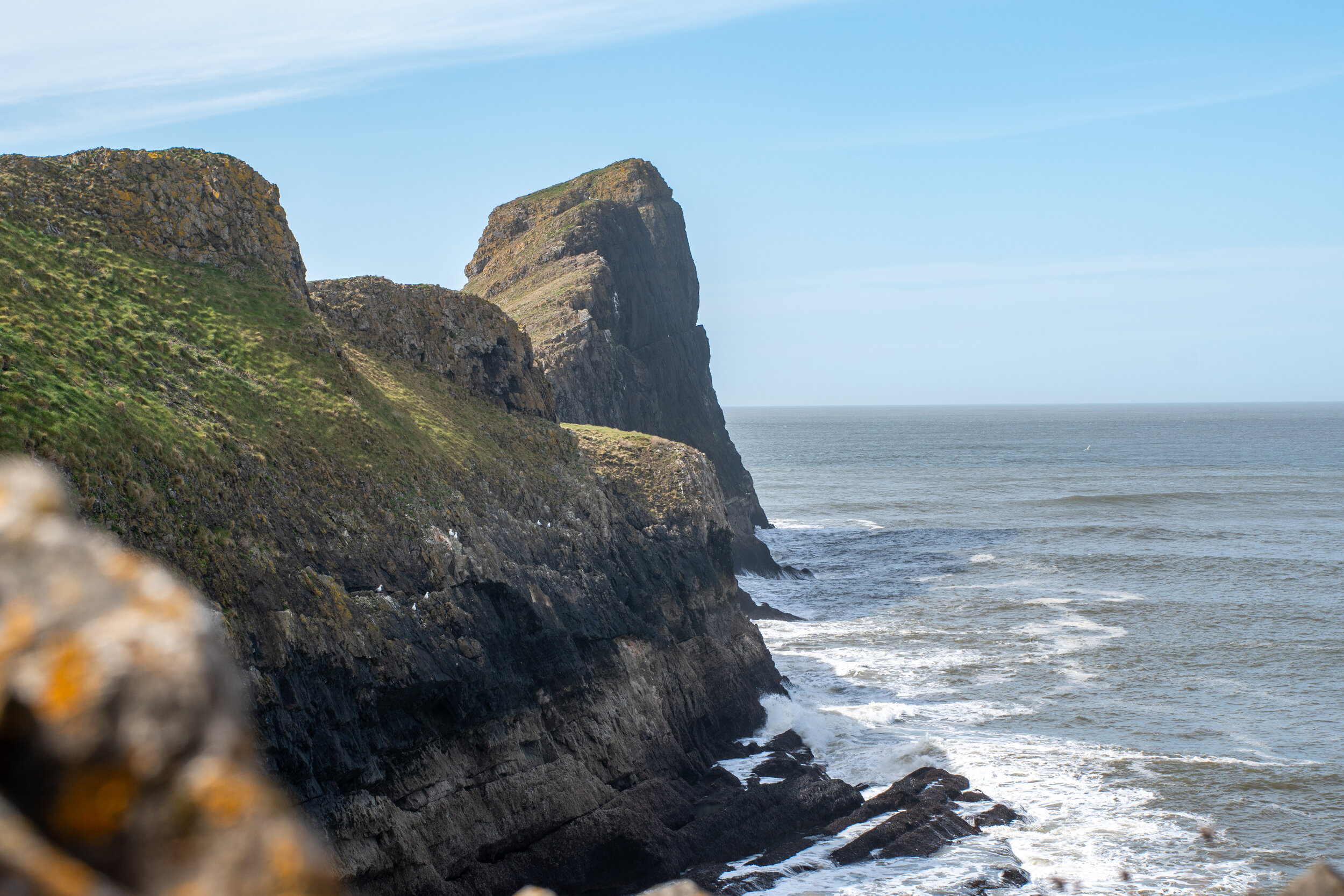
A challenging, yet spectacular coastal walk from Rhossili village out to the tip of Worms head, a giant sea-serpent shaped headland that marks the most westerly point of the Gower Peninsula.
The hike is my favourite on the Gower, not only because of the stunning coastal scenery but also because of the sense of adventure that comes with hiking onto a tidal island shaped like a mythical Dragon.

Why is it called Worms Head?
The tidal island is named after the Norse word 'Wurm' which means 'dragon', as Viking Invaders thought that the prominent coastal feature was shaped like a giant, sleeping sea-serpent.
In addition to its prominent shape, there is also a large blowhole on the outer head of the Worm, which is said to create a loud booming and hissing noise during stormy weather. This further convinced the Norse people that the island was a sleeping dragon.

Things to know before attempting the hike
In order to reach the Worm, you have to cross a rocky causeway which is only accessible 2.5 hours either side of low tide.
This gives hikers a 5-hour window to reach the tip of the worm and get back to the mainland without becoming Chuck Nolan for 10 hours (Tom Hanks character on Castaway).
The hike starts at National Trust car Park in Rhossili. From here It is approximately 1.3 km (20-minute walk) to the old coastguard station on the Headland.
From the old coastguard station, It is a further 2.3km to the tip of the Worm. The terrain can be slightly tricky at times and for the more surefooted hikers, this should take between 45-60 minutes (one way).
I would make sure you have a minimum of two hours to complete and enjoy this hike and I’d recommend heading down an hour or two before low tide.
Tide times can be found online and will be displayed at the National trust centre next to the car park and at the old coastguard station. Please check the times before attempting the walk and don’t be ‘that guy’ who gets stuck on the island.
Hiking boots aren't necessary however I would recommend stable trainers will as you have to navigate some rocky, uneven terrain.

Where to park
Parking is available at the large national trust car park in Rhossili (postcode: SA3 1PP). It costs £3.00 for 3 hours or £6 for all day. This car park is also serviced by the 118 bus which runs from the Quadrant Bus Station in the centre of Swansea.
The route
From the car park, take a left past the National Trust centre and follow the path that alongside Rhossilis rugged cliffs for 1.3 km until you reach the old coastguard lookout.


From the coastguard station follow the path down the hill and onto the causeway.
The 700m causeway consists of rocky reef and small rock pools and should take between 10-20 minutes to cross. There is no specific route but I would recommend sticking to the right-hand shoreline. Take caution when crossing as the rocks can slippery and are covered in sharp barnacles.
After crossing the causeway you will have reached the inner head and will be greeted by a national trust sign and a bell (which I presume has been put there for any idiot who ends up getting trapped.


From here you have three options which all end up at the same location.
Climb up onto the 47m high inner head before dropping back down the other side, from here you'll have fantastic views back towards the mainland.
Follow the path to the left of the Inner head, a bit boring but it is the easiest route.
Follow the faint path around to the right. This is quite tricky but will give you the opportunity to potentially spot some seals.
After navigating the inner head, you’ll reach the trickest part of the crossing, a 70m stretch of jagged rocks, separated by a series of cracks which can be difficult to navigate.
The surefooted amongst you won’t find this section tough but for others, it will take a little longer than you think. Again there is is no specific route and you simply have to pick and weave your way through.

The trickiest section of the hike, a 70m section of uneven, jagged rocks.
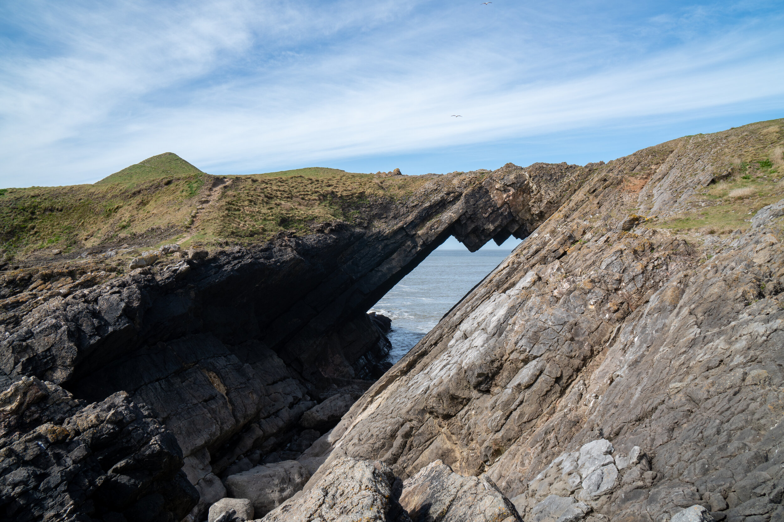
Shortly after this tricky section, you will reach the wonderful Devil's Bridge, a natural rock bridge leading to the outer head.
Cross over the bridge onto the outer head and follow one of the two paths for 100m towards the tip. You will then have one final 30m rocky section to cross before making your approach to the tip of the worm.

The devils bridge, which separates the outer head from the inner head.
The final section of the hike up onto the tip of the Worm requires a little bit of scrambling.
The first 20m of the ascent is relatively easy and doesn’t require using your hands. However, the final 10m of the climb requires the use of all four limbs and may prove difficult for some people.
Once on the tip, take the time to admire the views before making the journey back to the mainland.

The final rocky section that links the outer head to the Tip

The Steep scramble up to the tip of the Worm

Find me on Instagram


I hope you found this guide useful, if you did and tackled the walk, let me know in the comments below.
For more travel, & photography inspiration around Wales check out my in-depth guides to each of my favourite regions below.