Share

Scan the QR code and open PeakVisor on your phone
Scan the QR code and open PeakVisor on your phone
Laguna Pueblo (Western Keres: Kawaika [kʰɑwɑjkʰɑ]) is a federally recognized tribe in the US state of New Mexico. Laguna lies in the foothills of nearby Mount Taylor. The highest peak in the region is Blue Water Mesa at 7,644 feet (2,330 m) tall while the most prominent is Petoch Butte with 755 feet (230 m) of prominence.

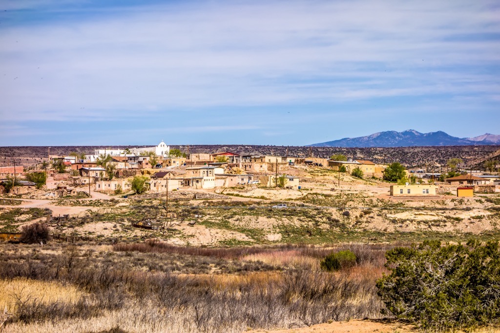
Laguna Pueblo is a federally recognized tribe located in the west central region of the US state of New Mexico. The name “Laguna” is Spanish for small lake, given to the Pueblo due to the small lake on the reservation formed by an ancient dam.
The reservation spans roughly 500,000 acres (202,343 ha), situated 45 miles (72 km) west of Albuquerque. Terrain spans across Cibola, Valencia, Bernalillo and Sandoval counties.
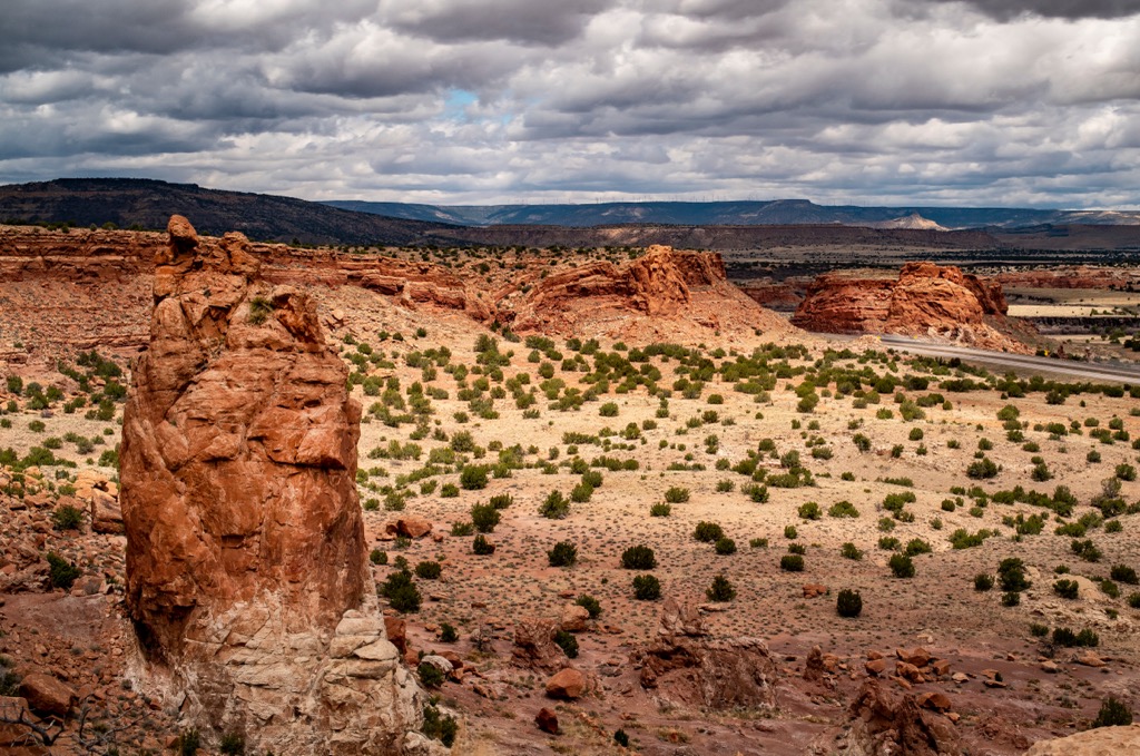
Rio San Jose cuts across the reservation in an east to west direction with a small lake being located just north of the river. While sections of the reservation are relatively flat, mountains, ridgelines, and mesas can be found throughout the surrounding region.
Changes in elevation are quite steep, rising from the desert floor up to the summit of some of the highest peaks in the area. There are six main villages throughout Laguna Pueblo; Laguna, Mesita, Paguate, Seama, Paraje, and Encinal.

The Laguna Pueblo lies within the Rio San Jose river basin. In the southeastern corner of the Laguna Reservation, the Rio San Jose flows into the Rio Puerco.
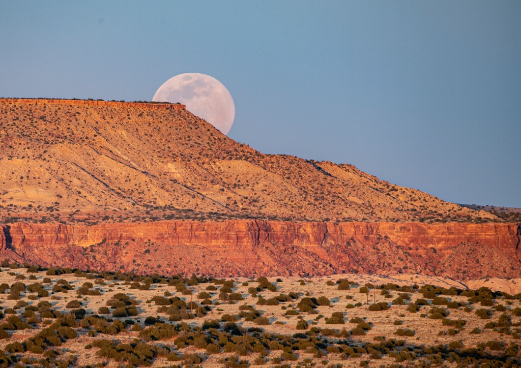
Terrain is similar to that found throughout western New Mexico. Mount Taylor lies directly northwest of the reservation along with the North San Mateo Mountains, marking the highest peaks in the surrounding Cibola National Forest.
Additionally, the Laguna Pueblo is located near numerous areas for outdoor recreation. Sections of Cibola National Forest are located north, west, and south of the reservation. The Petaca Pinta Wilderness Study Area is to the south while the Cebolla Wilderness, El Malpais National Monument, Canyons Wilderness Study Area, and West Malpais Wilderness are to the southwest.
The Laguna Pueblo is situated near the southwestern edge of the Colorado Plateau with the North San Mateo Mountains extending to the north.
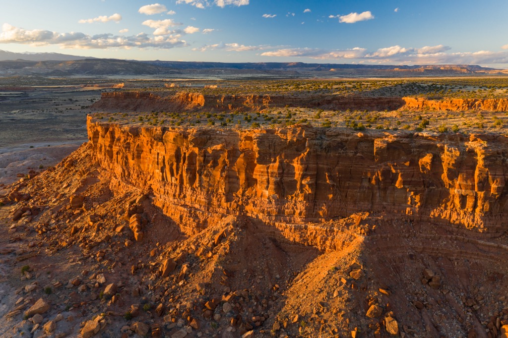
The Colorado Plateau is known for being geologically stable, having experienced minimal amounts of folding and thrusting over the 600 million years. The plateau was slowly thrust upwards, which has helped preserve the distinct layers of rock in the region.

As the plateau was uplifted further, erosion washed away the softer rocks in the region, leaving behind a multitude of mesas. Just northwest of the Laguna Pueblo lies Mount Taylor, the tallest peak in the North San Mateo Mountains.
Mount Taylor is thought to be between 3.3 and 2.5 million years old and is part of an expansive volcanic field. Rather than having been formed by one eruption, the peak has taken shape through the series of repeated volcanic activity.
The surrounding volcanic field consists primarily of basalt. South of the range lies the Rio Grande Rift. Lava fields located to the south help showcase the geological history of the surrounding region.
Major peaks that are located within the area include Blue Water Mesa, Petoch Butte, Mesa Redonda, and Flower Mountain.

Despite the extreme desert terrain, a variety of both flora and fauna thrive in the region surrounding the Laguna Pueblo.
The mountainous terrain helps support populations of Douglas fir, aspen, and Engelman spruce. Mid-elevations in the surrounding mountains are populated by pinyon pine, juniper, and ponderosa pine. The lowest spots feature some grass and shrub coverage along with oak trees.
Common mammals in the region include deer, bobcat, elk, rabbit, coyote, foxe, mountain lion, and black bear. Various bird species, including species of falcons, eagles, hawks, and owls, inhabit the surrounding forests and canyons.
Human history in the region dates back over 10,000 years through the Indigenous peoples of the area. This historical culture is still present through the Puebloan peoples of the Laguna, Zuni, Acoma, and Navajo. This area in particular marks part of the ancestral homelands of the Laguna Pueblo.
This region is thought to have been the boundary between the Ancestral Pueblo people which traditionally lived to the north and the Mogollon cultures which traditionally lived to the south.
Navajo people began inhabiting the region during the late 1500’s, with the Acoma and Zuni Pueblos often being raided by groups of Navajo people. These Ancestral Puebloans had an emphasis on hunting, gathering, and some farming.
In 1540, a Spanish expedition led by Francisco Vasquez de Coronado passed through the region, marking the first recorded contact between the Laguna Pueblo and people of European descent. When Spaniards revisited the region in 1599, their presence resulted in the Acoma Massacre where 500 people from the Acoma Pueblo were killed.

A royal decree in 1620 led to the construction of Spanish civil offices in the Pueblos of the region. As tension between the two groups increased, the surrounding Pueblos joined forces in 1680 to form the Pueblo Revolt. Those who left during this time went on to form the Laguna Pueblo.
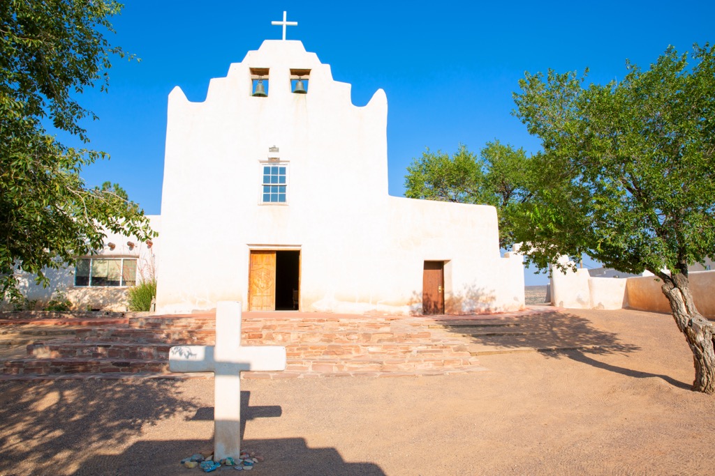
The Pueblo Revolt lasted from 1680 to 1696, with the Spanish constructing the Mission San José de la Laguna at the site of the old Pueblo in 1699. The site of the old Pueblo is now known as Old Laguna. The arrival of infectious diseases drastically affected the Pueblos as the Indigenous peoples had no natural immunity to the illnesses.
The construction of railroads through the region during the nineteenth century quickly increased the population of the surrounding region. The Laguna Pueblo fought to protect their traditional way of life though this was met with continued resistance by the US government. After being repeatedly attacked, harassed, and even killed, the Indigenous peoples were forced onto reservations.
Today the Laguna Pueblo is home to around 7,700 residents who live in the communities of Laguna, Mesita, Paguate, Seama, Paraje, and Encinal. People are allowed to visit Laguna Pueblo though photography and videography is generally not allowed.

There are numerous hiking areas surrounding Laguna Pueblo. Here a few spots to check out on your next visit to the region:
The Mt. Taylor Ranger District of Cibola National Forest lies just northwest of the Laguna Pueblo. Here hikers can explore Mount Taylor along with other ridgelines in the North San Mateo Mountains, offering views of the Laguna Pueblo and surrounding terrain.

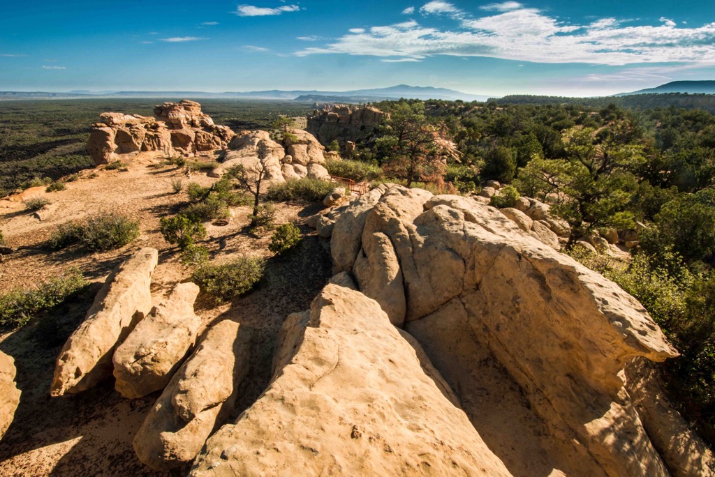
The El Malpais National Monument lies southwest of the Laguna Pueblo. The terrain is marked by a dramatic volcanic landscape featuring cinder cones and lava flows amidst other volcanic features. The monument lies within the Zuni-Bandera volcanic field, which marks the second largest volcanic field in the entire Basin and Range Province.

Looking for a place to stay near the Laguna Pueblo? Here are some of the best cities and villages to check out in the region.
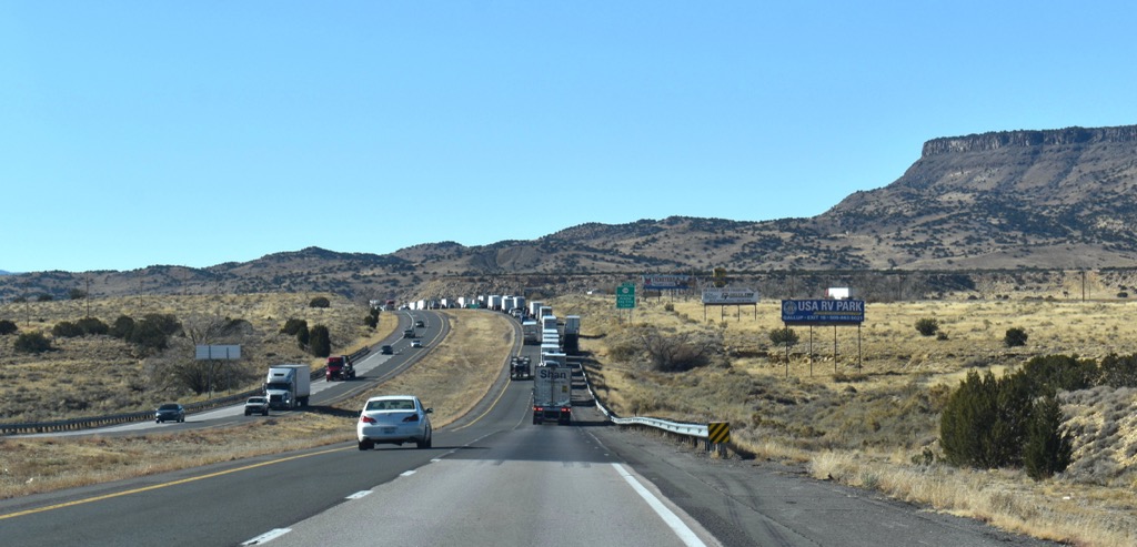
The city of Grants lies west of the Laguna Pueblo and is home to 9,200 residents. Situated along Route 66, Grants Main Street is full of local shops and restaurants that showcase the history of the region.
Grants has a long history of mining and is nicknamed the “Uranium Capital of the World”, with uranium still being mined until the 1980s. Besides exploring the natural beauty of the region, visitors can learn more about Grants by visiting Grants Mining Museum and the Western New Mexico Aviation Heritage Museum.

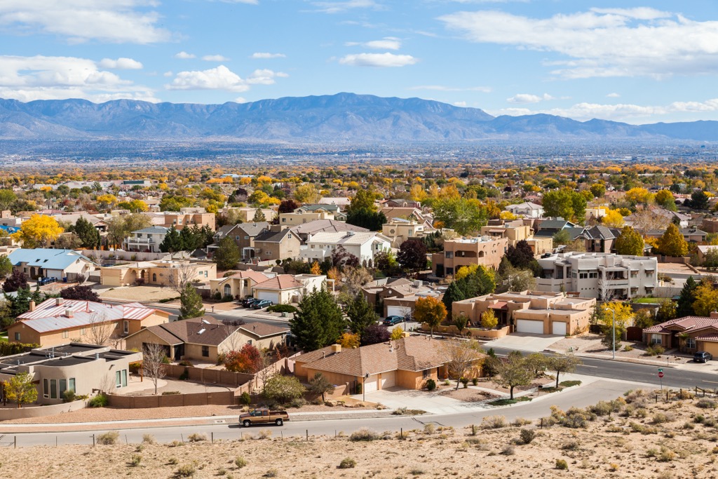
Albuquerque lies less than an hour's drive east of Laguna Pueblo. With a population of 560,000 people, Albuquerque marks the most populated city in the state of New Mexico.
As an economic hub for the surrounding region, the city is often hosting events and festivals. The annual International Balloon Fiesta, which takes place every October, marks the world’s largest gathering of hot air balloons. To learn more about the history of the region, visitors can check out the New Mexico Museum of Natural History located in the city.
During the winter months, both locals and visitors in the region can enjoy the Sandia Peak Ski Area, which is located just outside the city. At the ski area lies the Sandia Peak Tramway, which marks one of the longest tramways in the world, leading to the summit of Sandia Peak.


Explore Laguna Pueblo with the PeakVisor 3D Map and identify its summits.