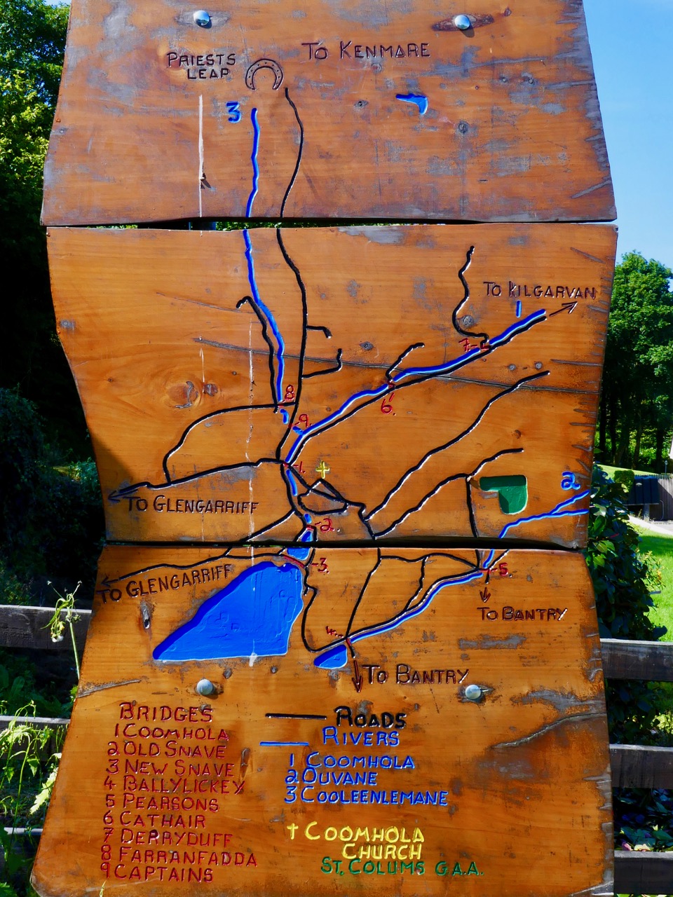
Last week Finola reported on a journey over the mountains on the ‘Priest’s Leap’ road from Kenmare, Co Kerry to Bantry, in West Cork. We received a fusilade of comments from readers who told us we hadn’t seen half of what there is to be found on this road so, on the very first day of September, we were off again, this time getting a different perspective by travelling the other way. Before we left Bantry we had to find the very spot where the priest – being pursued by soldiers – landed after he and his horse leapt off the highest summit of the road which has been named after him.
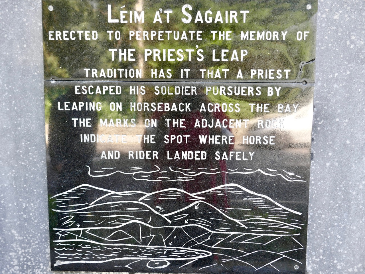
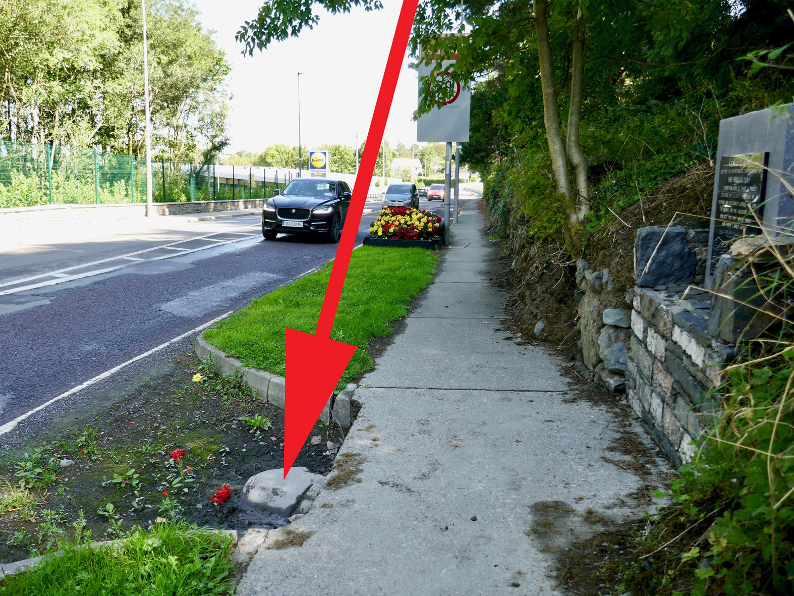
It’s great that this stone has been left untouched by the modern roadmakers, so that all can see the hoof marks to this day. I calculated that, 400 years ago, the priest was airborne for a distance of some 12 kilometres as the crow (or horse!) flies – considerably more than some of those early aviators of the 20th century were credited with!
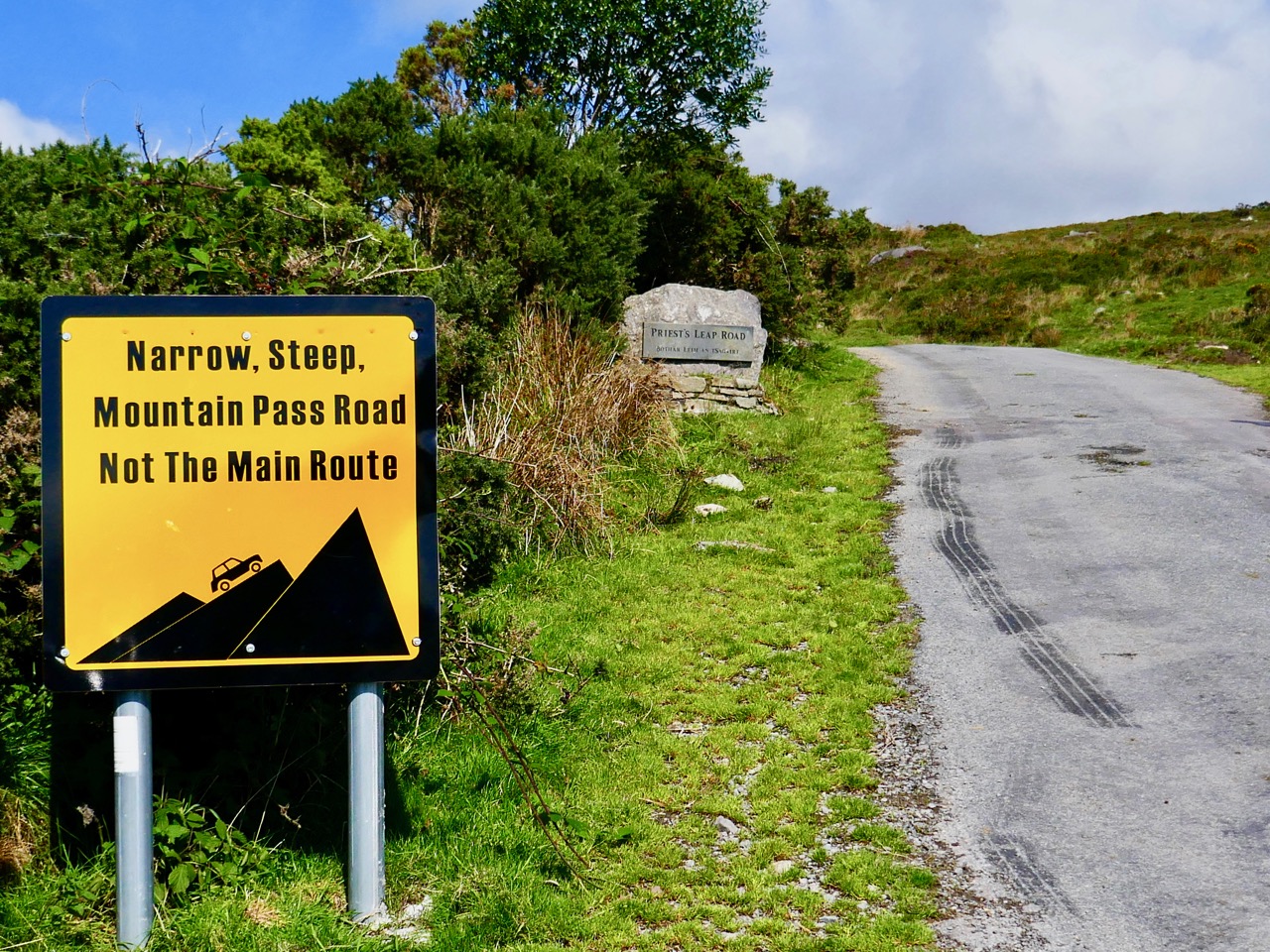
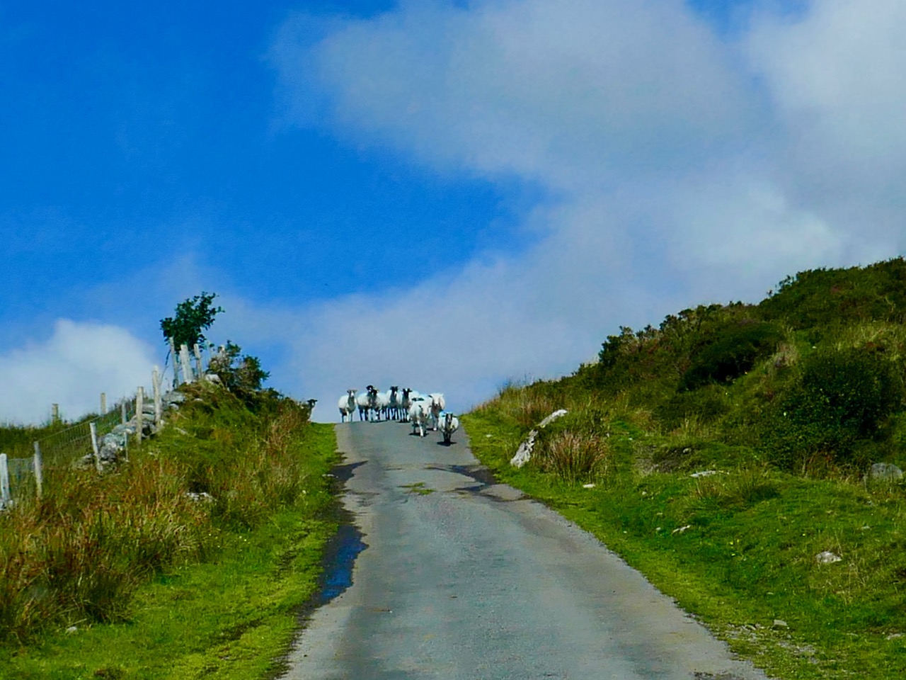
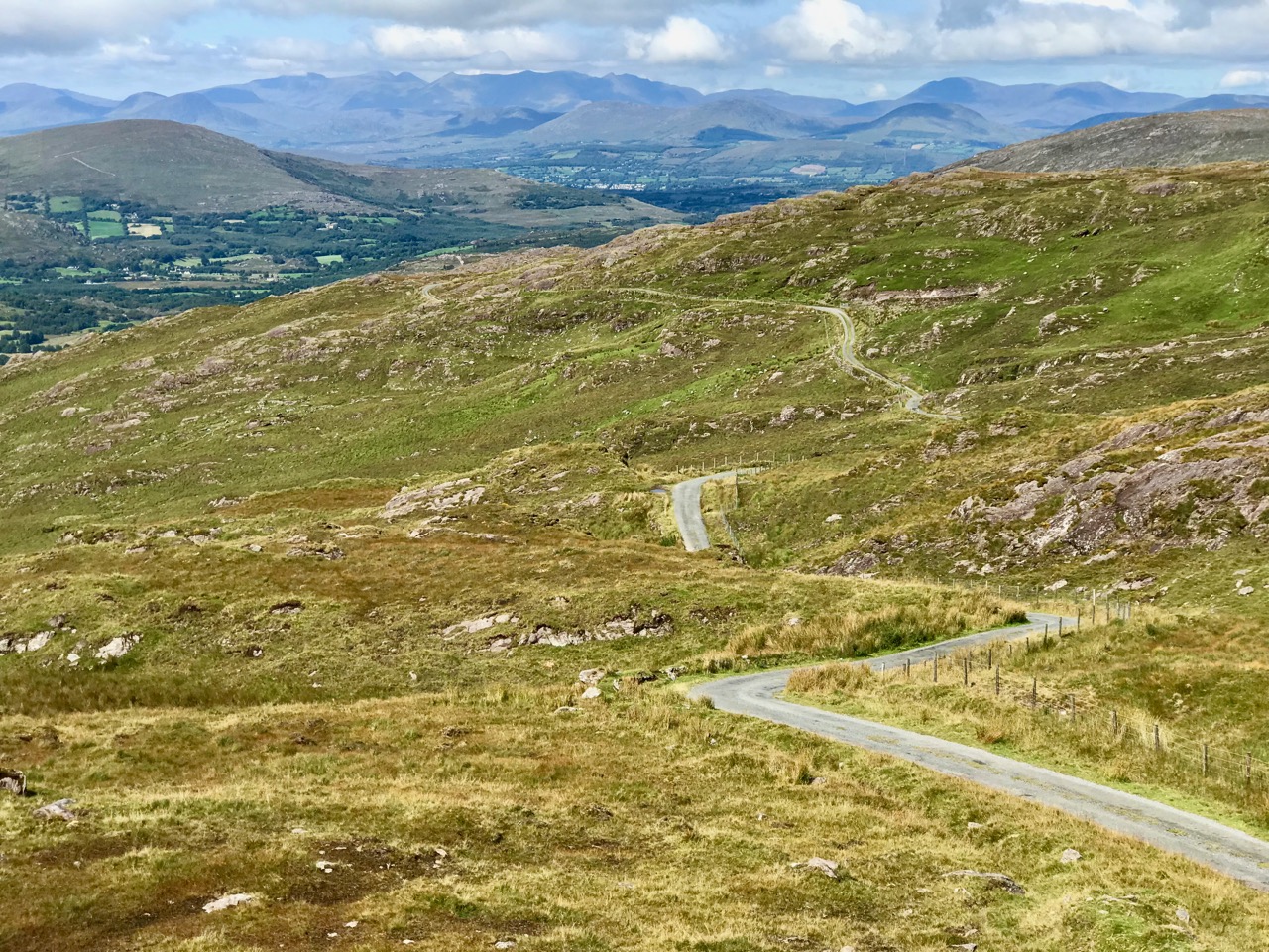
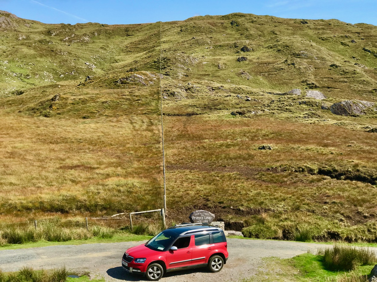
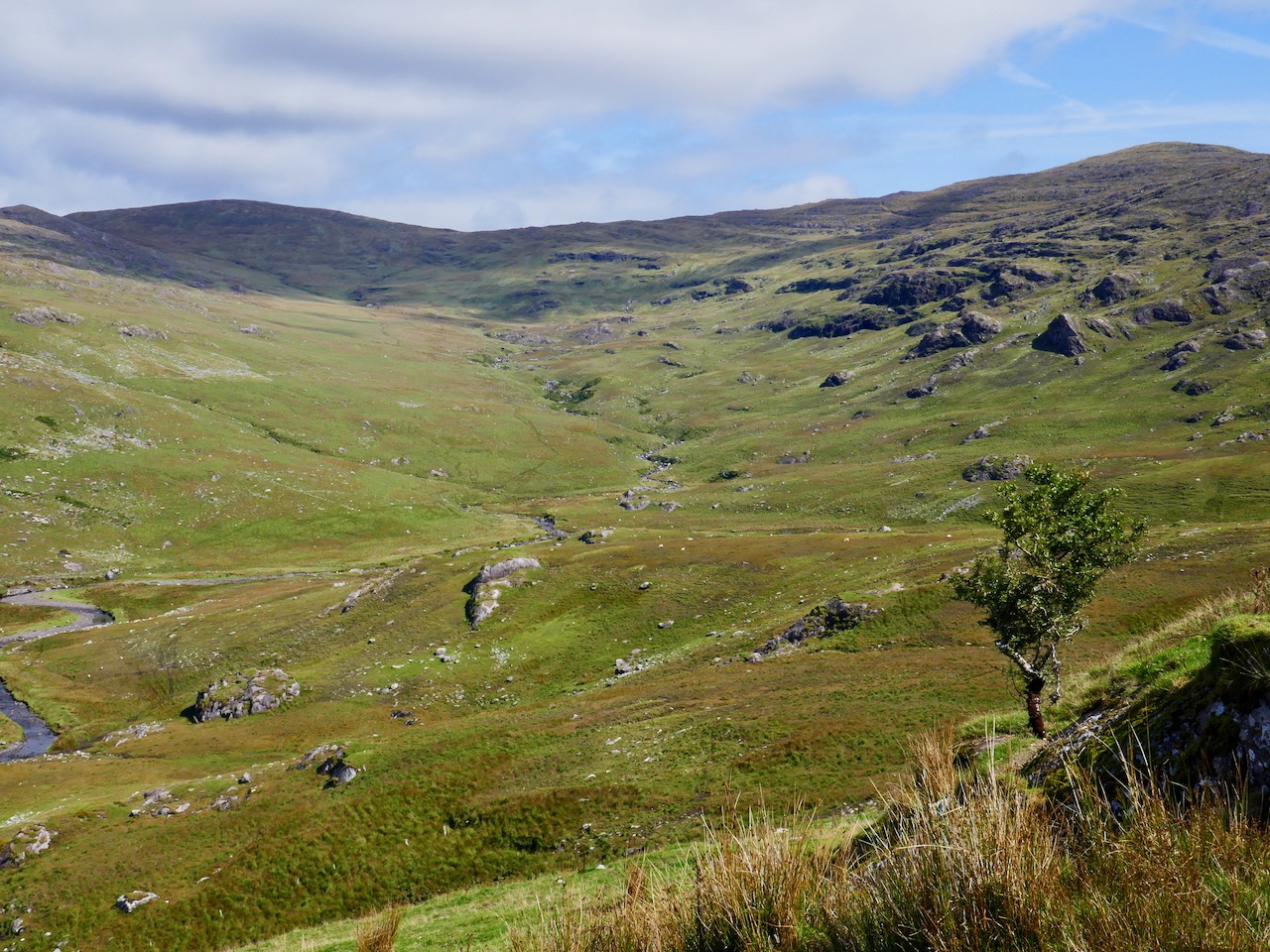
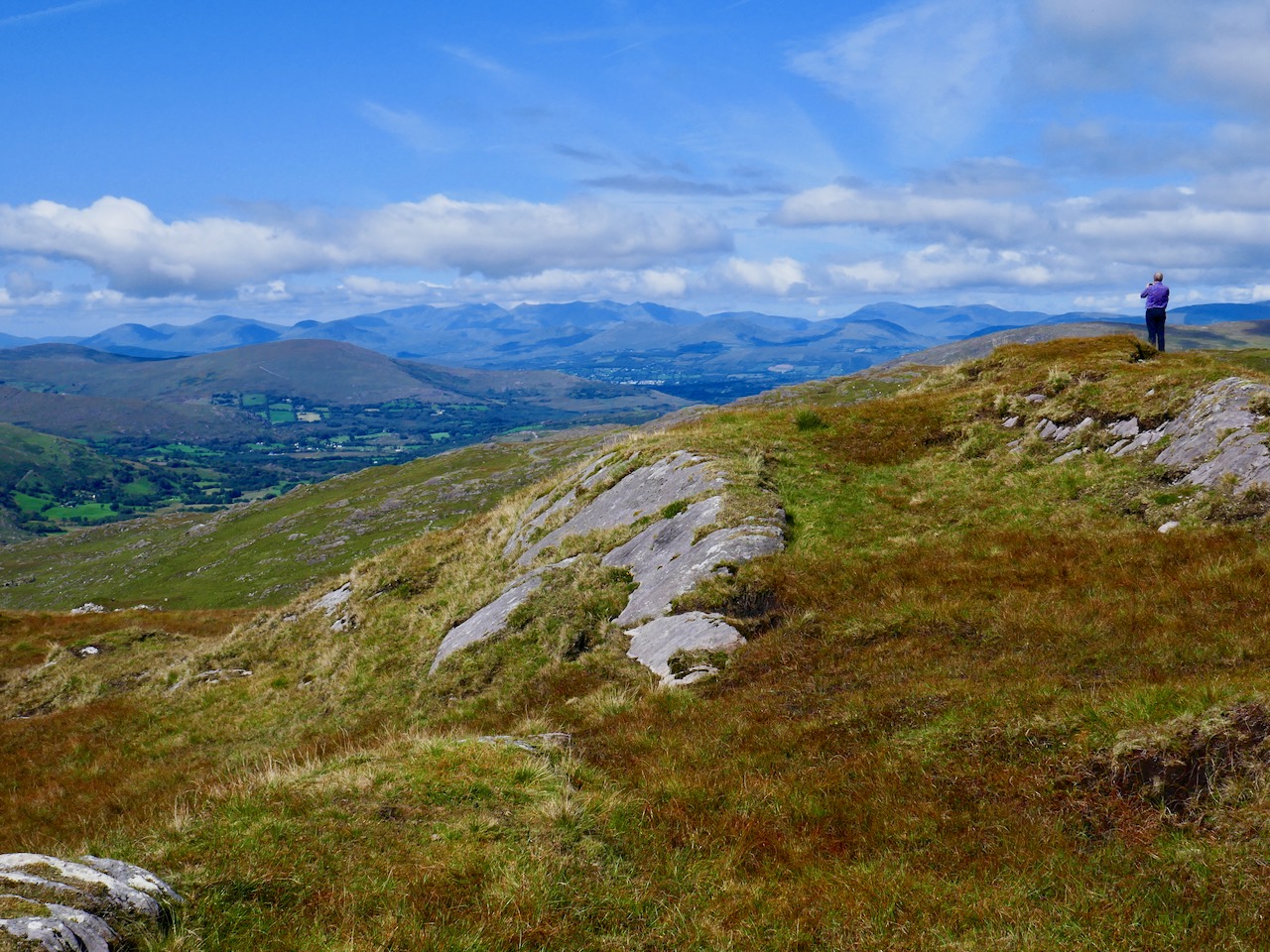
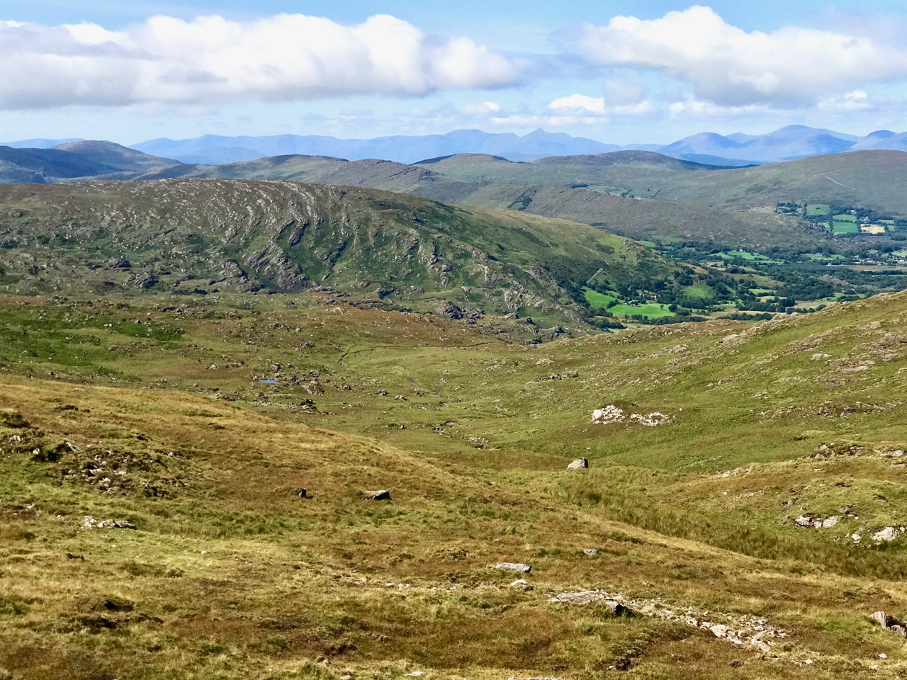
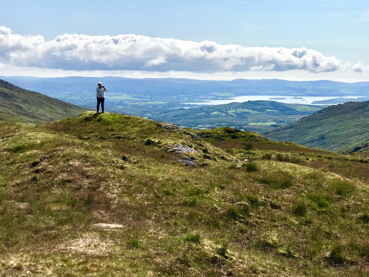
If you are not of a nervous disposition, and don’t mind travelling a narrow, single-track mountain road for some 15 kilometres, probably sharing it only with a few sheep, then to pass over this route is one of Ireland’s most spectacular experiences. Choose your day, though: we were lucky to have hot sun and clear views the whole way. If you survive it to the top, you are right on the Cork – Kerry border: in the photo below, the fence going on up the hill is exactly on that border line (and the point at which the priest and his horse took off is to the right of it at the peak). Stop and look around: the views in every direction are stunning.
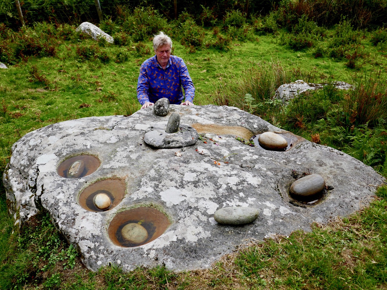
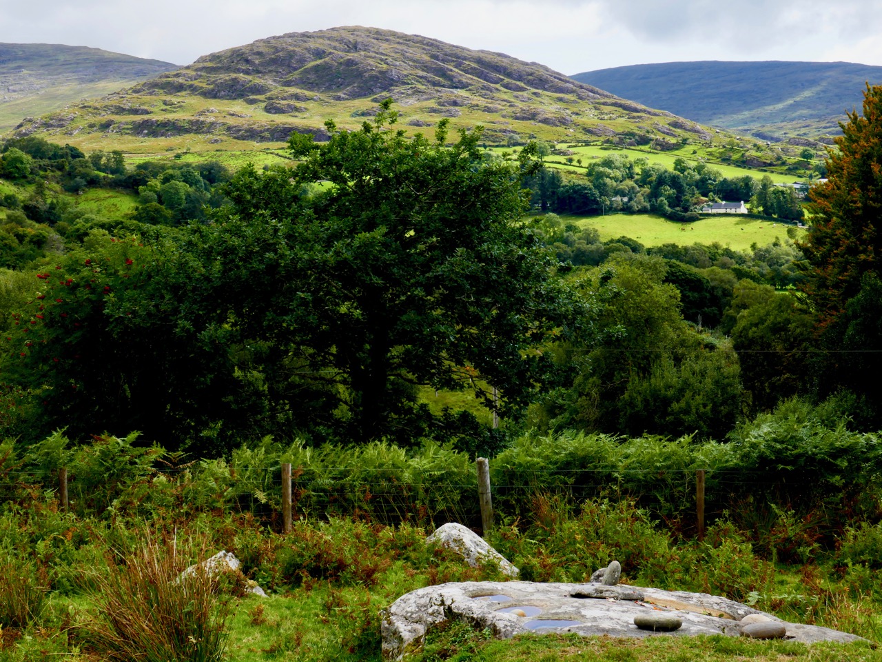
After we crossed the border into Kerry we came downhill and stopped again at the remote, picturesque Feaghna burial ground in the townland of Garranes. On our last visit we were completely unaware of the existence of an unusual archaeological site nearby – one which has a number of traditions associated with it.

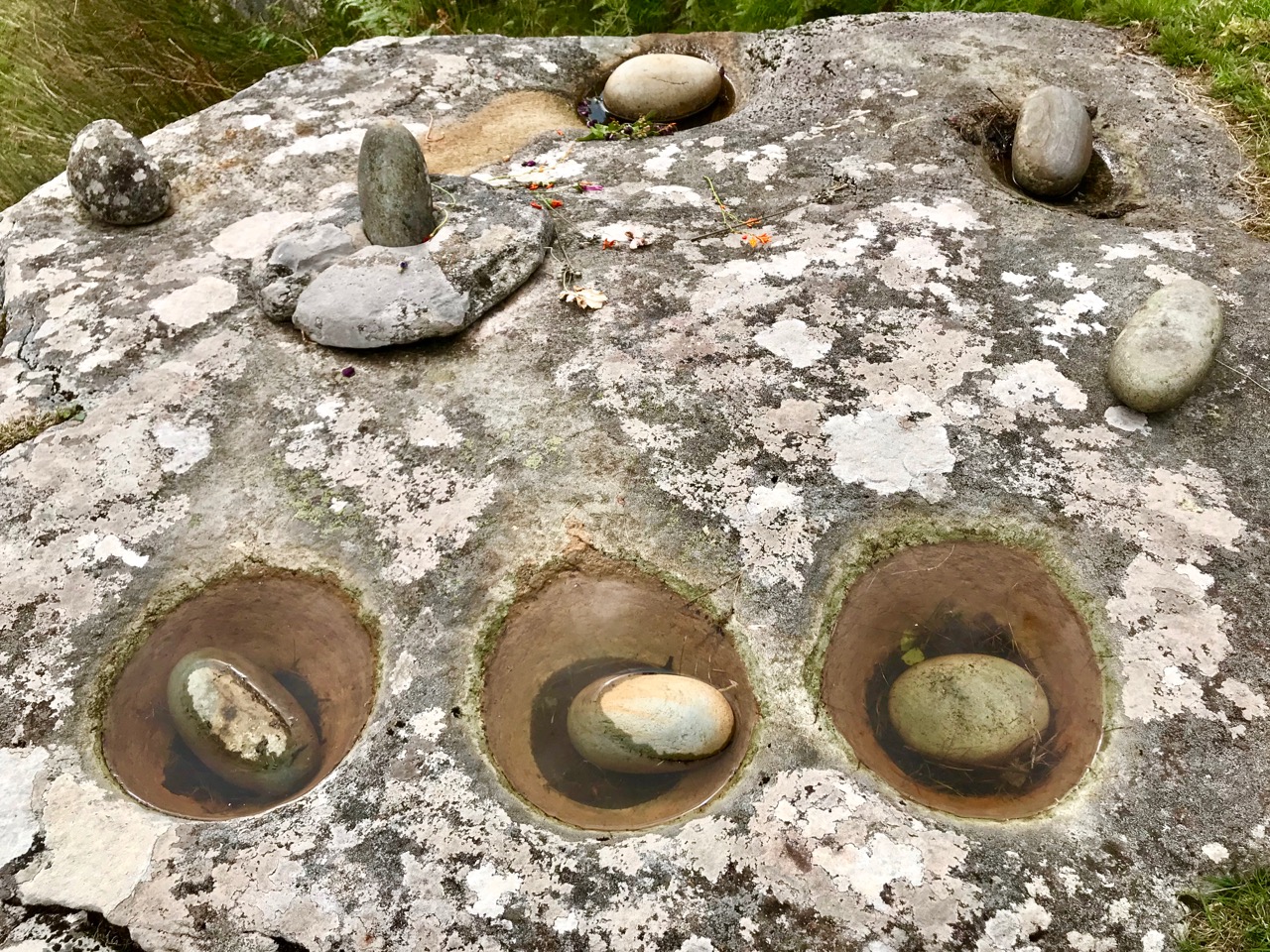
Popularly known as the ‘Rolls of Butter’ this site is technically a ‘Bullaun Stone’. These are fairly widespread over Ireland, but their original function is not known for sure. Here’s a summary from the National Monuments Service:
. . . The term ‘bullaun’ (from the Irish word ‘bullán’, which means a round hollow in a stone, or a bowl) is applied to boulders of stone or bedrock with hemispherical hollows or basin-like depressions, which may have functioned as mortars. They are frequently associated with ecclesiastical sites and holy wells and so may have been used for religious purposes. Other examples which do not appear to have ecclesiastical associations can be found in bedrock or outcrop in upland contexts, often under blanket bog, and are known as bedrock mortars. They date from the prehistoric period to the early medieval period . . .

A drawing by the 19th century antiquarian W F Wakeman of a Bullaun Stone at Killinagh in Co Cavan. Here, the stones are known as ‘cursing stones’ – a term also applied by some commentators to the Feaghna site at Garranes. Interestingly, the Cavan site is also referred to as ‘St Brigid’s Stones’, while the Rolls of Butter are associated with the local saint, Fiachna. Beliefs – stories – are, of course, as fascinating as any archaeological evidence, and have to be investigated. Here, they abound – and are best learned from local sources: in this link folklorist Matt Sullivan has put together an entertaining selection of local opinion about the Rolls of Butter.
A few years ago I wrote a post covering some bullauns, ‘cursing stones’ and ‘curing stones’ – but at that time I wasn’t aware of these examples just a mere priest’s leap away from our own home.
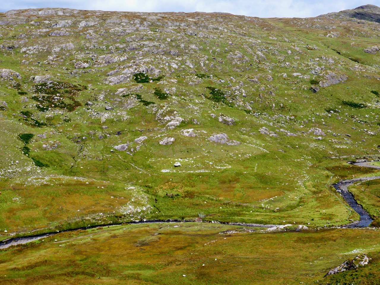
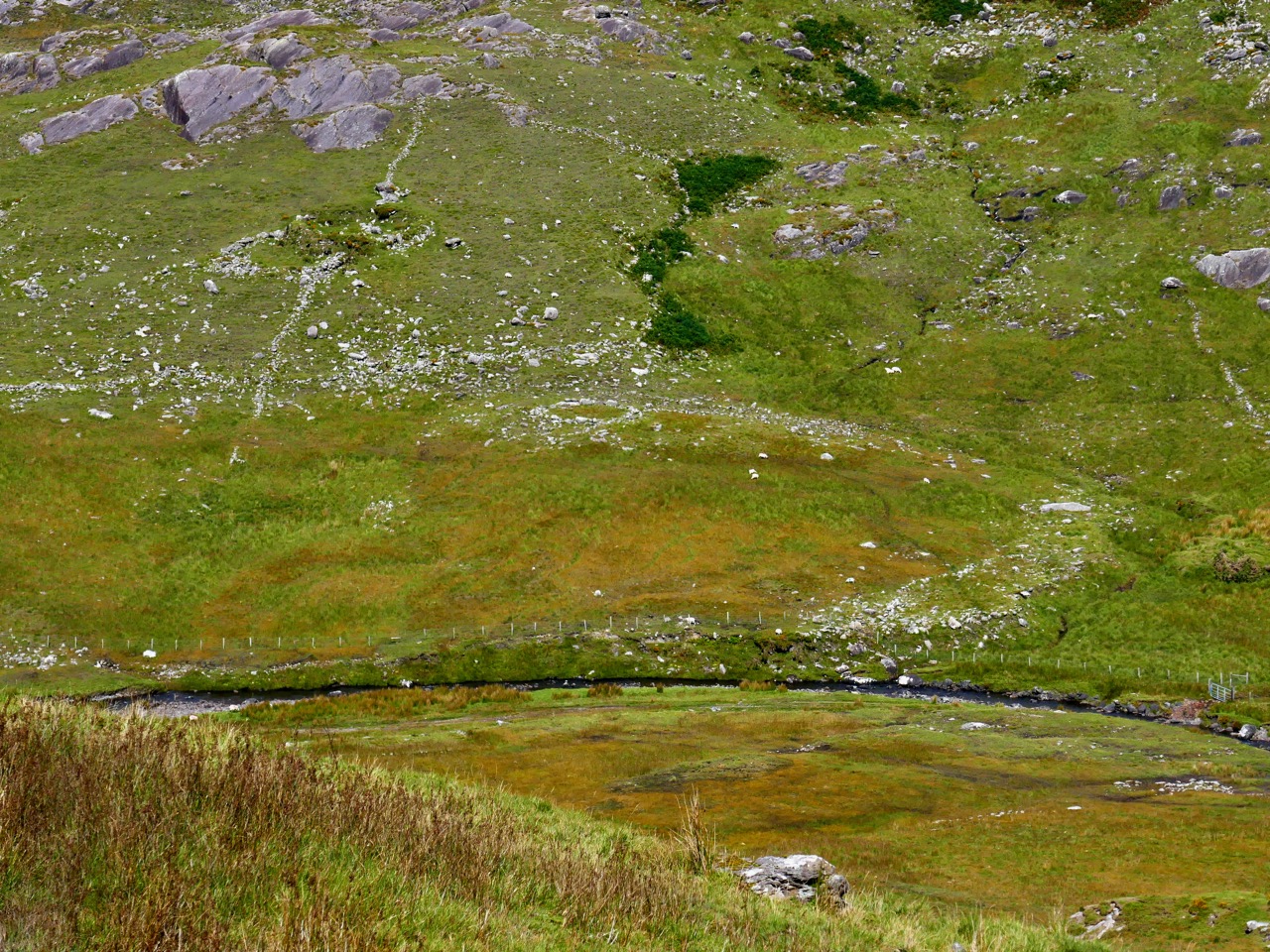
There is much more archaeology and history in this mountainous country: here (above) in the townland of Erneen, the view from the road across one of the many remote glens shows up former enclosures and ‘hut sites’, which the National Monuments Service describes thus:
. . . A structure, usually discernible as a low, stone foundation or earthen bank enclosing a circular, oval or subrectangular area, generally less then 5m in maximum dimension. The remains are generally too insubstantial to classify as a house but the majority probably functioned as dwellings. These may date to any period from prehistory (c. 8000 BC – AD 400) to the medieval period (5th-16th centuries AD) . . .
It’s intriguing to think that these beautiful natural landscapes which appear so lonely to us were occupied hundreds – perhaps thousands – of years ago. It’s likely that they have changed very little over all that time: history is clearly set out for us as we travel over this ancient way.
The days are shortening, and we still didn’t have time to explore everything the Priest’s Leap road has to reveal. We’ll be back again before too long – in search of more stories.