Copyright: Paul Blades. Original available at Megalithic Portal.
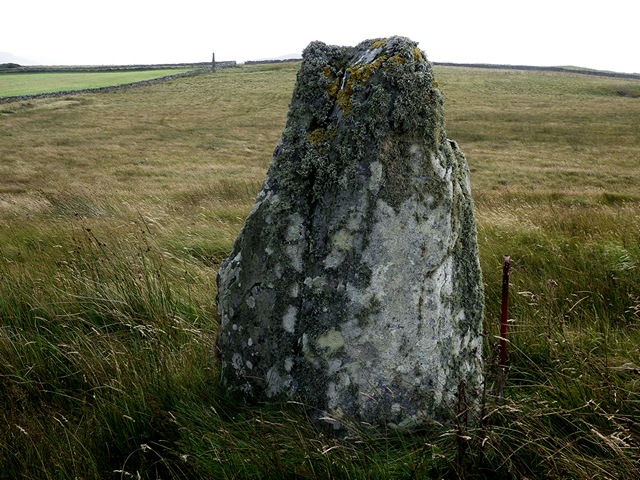
A probable single stone row measuring 215m long, including two large orthostats situated in a shallow valley with restricted views of the sea to the west. A third stone described in the 18th century no longer survives. The southern stone stands 4.9m tall and the northern one 1.78m high. The row is orientated NNE to SSW.
Location
| Scotland Islay Argyll & Isles NR 22103 67399 Lat 55.81965901 Long -6.43830435 |
Map showing the location of Ballinaby stone row.
Characteristics
| Type: Single | Length: 215m |
| No. of stones: 3 | Size of stones: Only large |
| Orientation: 27° | Altitude: 37m |
| Upper end: – | Lower end: – |
| Straight (Yes or No) : Not Known | Sea View: Yes |
| Context: – | |
| Notes: | |
Other Information
| Public Access: Yes |
| Land Status: – |
| Scheduled Ancient Monument: No |
Identification
Category: Probable. Although only two stones now survive, a third stone is described at this location by Thomas Pennant in 1776. According to Pennant, the stones were roughly equidistant which means that the “lost” one may have stood mid way between the remaining stones or it could have been around 215m on the same alignment to the north or south. Given the local topography it is most likely that it would have stood between the surviving stones or to the north. Given these uncertainties a probable interpretation seems most fitting.
Typology
This stone row is of Type S8. Information on this form of stone row and other rows of this type is available here.
Photographs
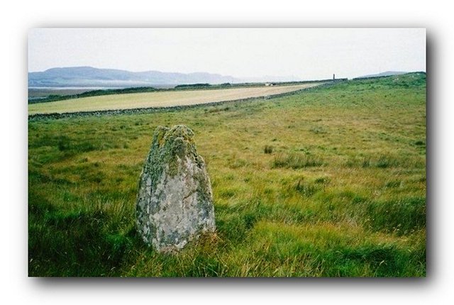
Looking north east along the row.
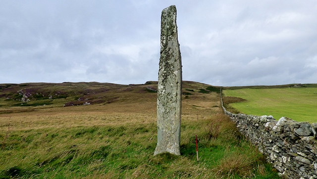
The southern stone. View from south (Scale 1m).
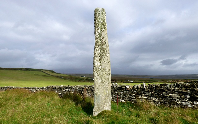
The southern stone. View from south west (Scale 1m).
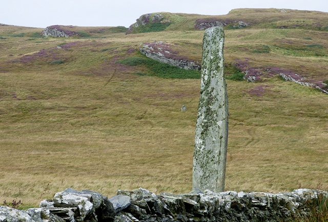
The northern stone (1.78m high) in the foreground and tall stone beyond. View from north (Scale 1m).
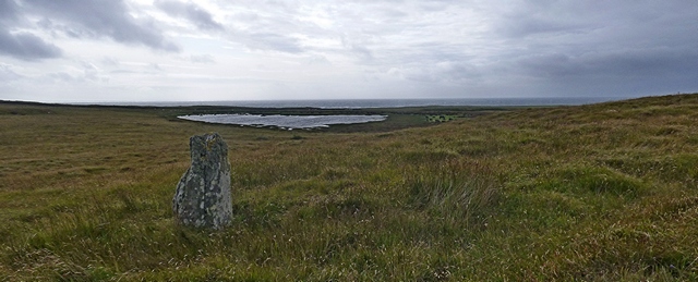
The northern stone and sea view. View from east.
Landscape Reveals
Visibility during the field visit was poor, but despite it was clear that the position of the row within a shallow valley offered landscape reveals. Views towards the interior of Islay open up as you walk south,whilst by contrast the restricted views of the sea to the south west decrease.
Access Information
Car parking is available at NR 21145 66400. From here go through the gate and follow the track to NR 21112 66727. Take the path leading to the right. Despite the substantial height of the southern stone it is not visible until you get fairly close to the row.
Online Resources
Megalithic Portal Modern Antiquarian Canmore Canmore Stones of Wonder
Other References
Burl, A., 1993, From Carnac to Callanish – The prehistoric rows and avenues of Britain, Ireland and Brittany, Yale University Press, New York and London, pg. 223.
Pennant, T., 1776, A Tour in Scotland; MDCCLXXII, 2. London, pg. 224
Timeline
VISITED:- 19th August 2017
FIRST PUBLISHED:- 2nd February 2016
LAST UPDATED:- 4th January 2018
