Southern end of the alignment. View from south ( Scale 1m).
A double stone row measuring 295m long, including at least 54 mainly medium-sized and some small stones situated on a south facing slope with restricted views that include a glimpse of the sea. The row is orientated north east to south west and leads upslope from a cairn at the south west end to a blocking stone. Much of the row is buried below a later field bank, but despite this its original form is apparent. There are several other stone rows, cairns and prehistoric settlements in the vicinity.
Location
| England Devon Dartmoor SX 56988 71381 Lat 50.524686 Long -4.01893 |
Map showing the location of Black Tor (Stanlake) stone row.
Simplified plan of the Black Tor (Stanlake) stone alignment. Historic field banks shown grey.
(Source: Meavy Valley Archaeology).

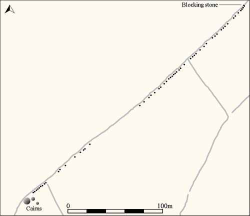
Map showing the position of Black Tor (Stanlake), other stone rows and sites.
Characteristics
| Type: Double | Length: 295m |
| No. of stones: 54 | Size of stones: Small and medium |
| Orientation: 51° | Altitude: 344m |
| Upper end: Blocking stone | Lower end: Cairn |
| Straight (Yes or No) : No | Sea View: Yes |
| Context: Cairns and prehistoric settlement | |
| Notes | |
Other Information
| Public Access: Yes |
| Land Status: National Park |
| Scheduled Ancient Monument: Yes |
Identification
Category: Plausible. Although overlooked by Emmett, D.D. no doubts have been expressed regarding the prehistoric interpretation of this row.
Typology
This stone row is of Type D10. Information on this form of stone row and other rows of this type is available here.
Photographs
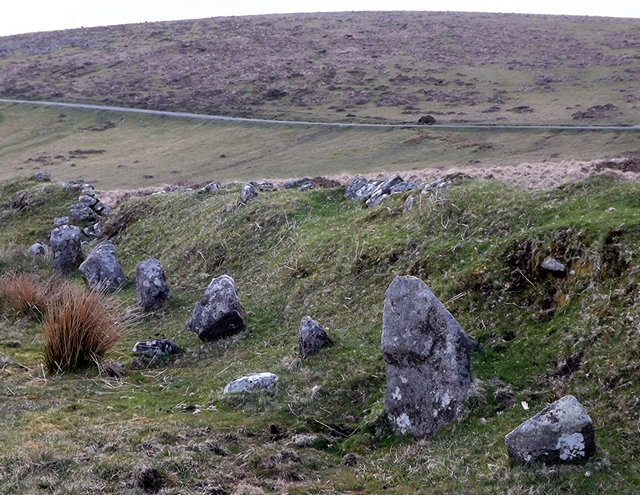
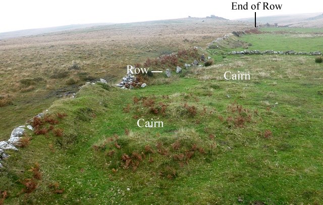 Stone row leading towards the cairn at south western end of the row. View from above and south west.
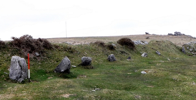
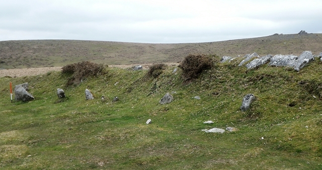
Small cairn near the south western end of the row. View from the south.
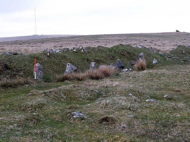
The south western end of the row. The row is partly buried by a later historic field boundary which completely covers the north western line of stones. View from above and south west (Scale 1m).
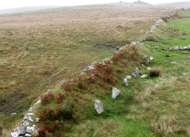
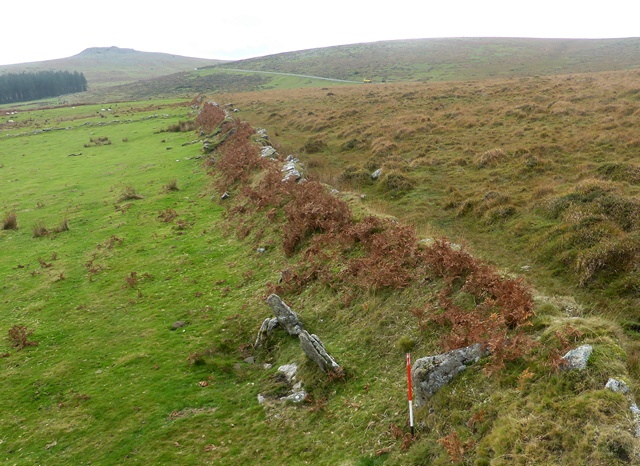
Along this length the row has been almost entirely swallowed up by the later field boundary (Scale 1m).
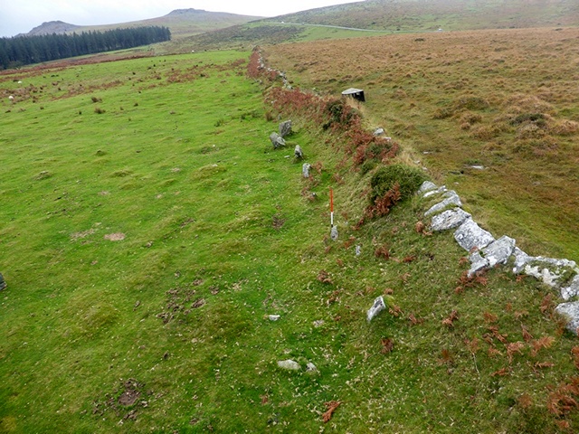
The south western end of the row with Black Tor beyond. For many years this row was dismissed as being part of the field boundary and not of prehistoric date. View from south (Scale 1m).
The south western end of the row. View from the north east.
At this point midway along the row it almost completely submerged below the later field boundary (Scale 1m).
Row of stones partly buried by the later field boundary. View from above and north east (Scale 1m).

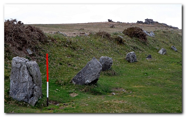
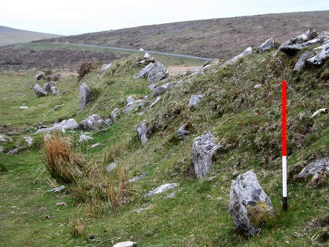
Blocking stone at the north eastern end of the row indicates that this stone is of the double row variety. It is very unlikely to be a coincidence that the historic boundary wall follows the row so precisely. The row probably formed a legal boundary in the historic period and the builders of the bank would have used it to define where their new field could be created. View from south west (Scale 1m).
Looking south west along the row. The north western side of the alignment is buried beneath a later historic boundary bank. The blocking stone stands next to the ranging pole and indicates that the row is of the double variety (Scale 1m).
Access Information
Limited car parking is available at SX 56746 71434. Take care crossing the road then make your way across open moorland to the row.
Online Resources
Megalithic Portal Modern Antiquarian PastScape Historic Environment Record
Prehistoric Monuments of Dartmoor Prehistoric Dartmoor Walks Meavy Valley Archaeology
Other References
Burl, A., 1993, From Carnac to Callanish – The prehistoric rows and avenues of Britain, Ireland and Brittany, Yale University Press, New York and London, pg. 214.
Butler, J., 1994, Dartmoor Atlas of Antiquities – Vol. 3 – The South-West, Devon Books Exeter, pgs. 47-8.
Emmett, D.D., 1979, ‘Stone Rows: the Traditional View Reconsidered’, In Prehistoric Dartmoor in its Context ,Devon Archaeological Society, 94 – 114.
Timeline
VISITED:- 23rd March 2013, 2nd April 2013 and 20th October 2014
FIRST PUBLISHED:- 15th January 2016
LAST UPDATED:- 22nd November 2020
