Some moorland stones

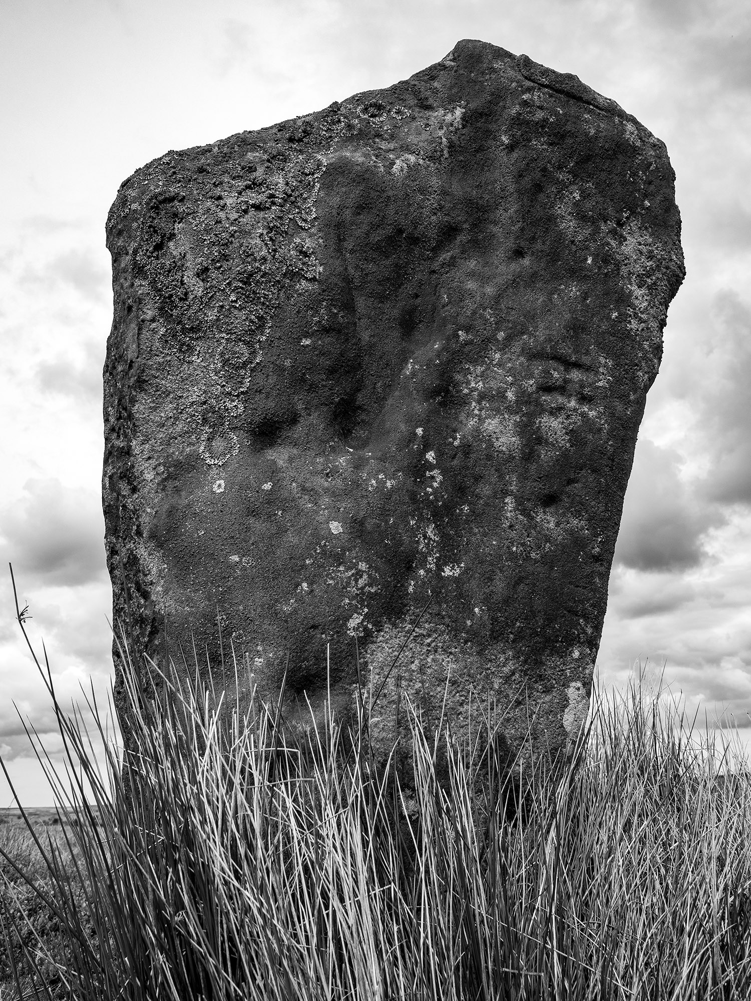
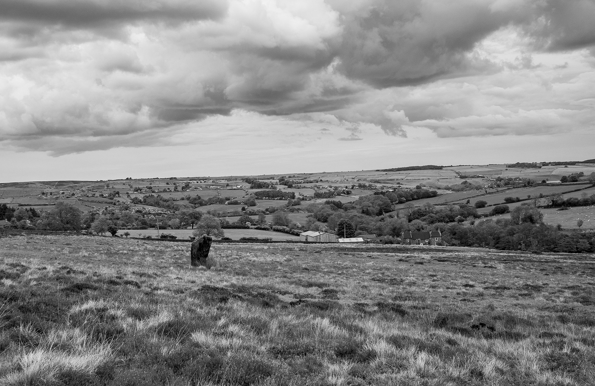
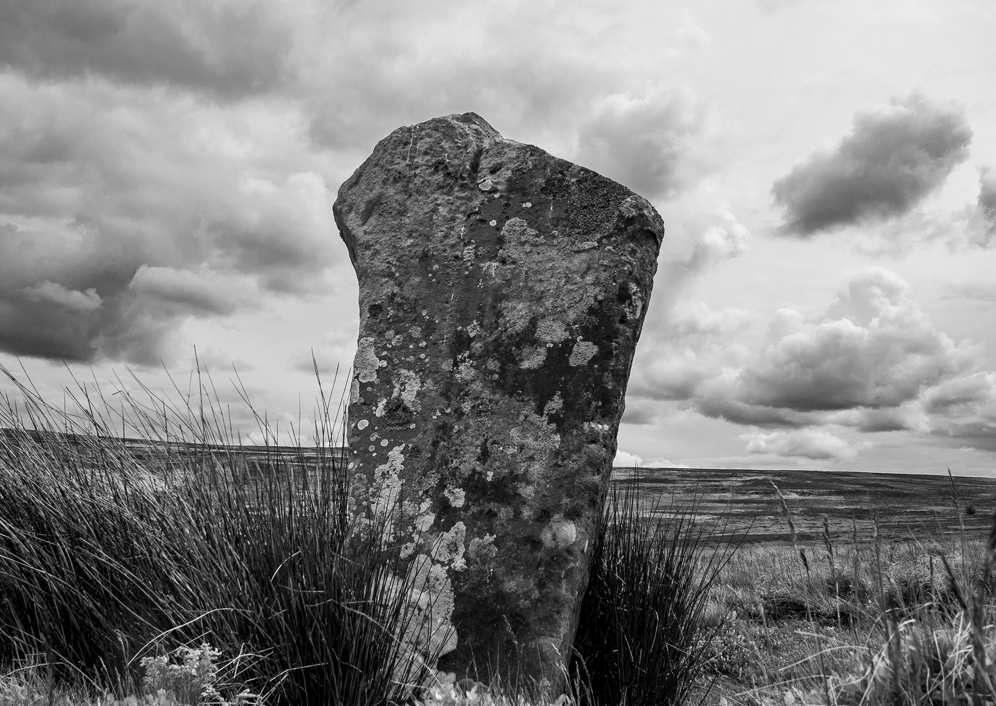
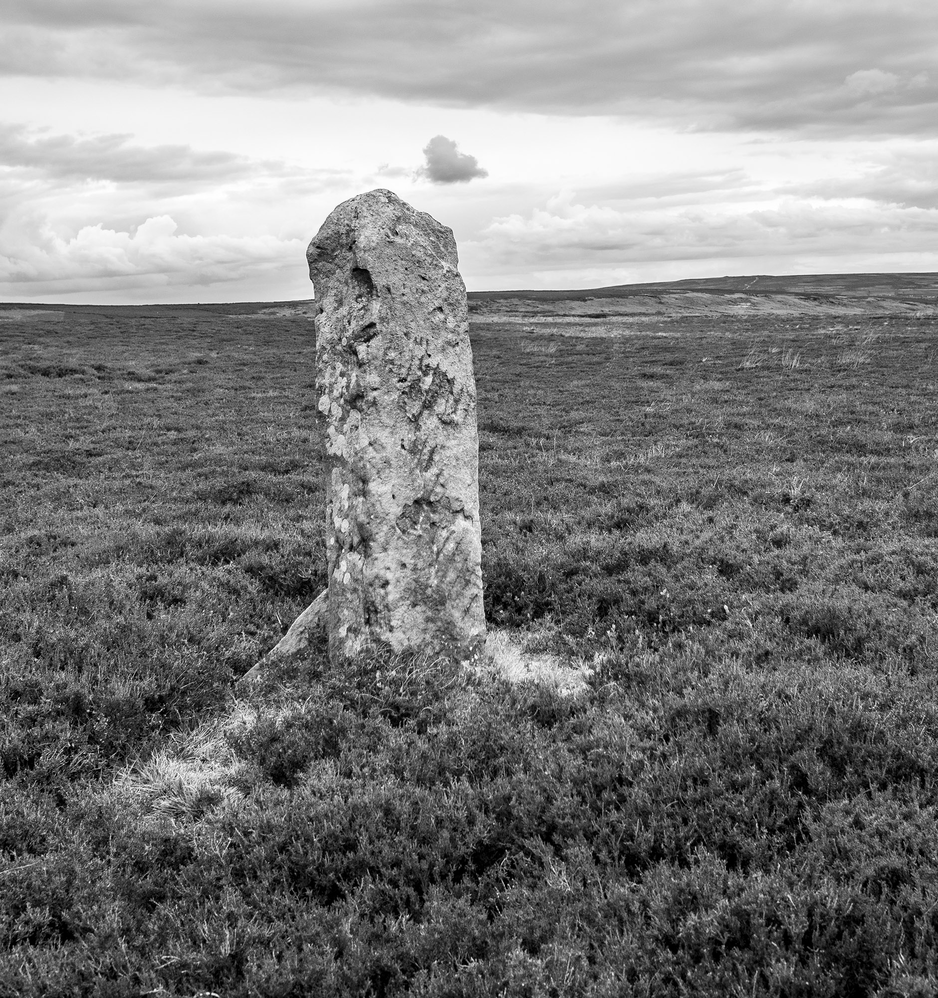
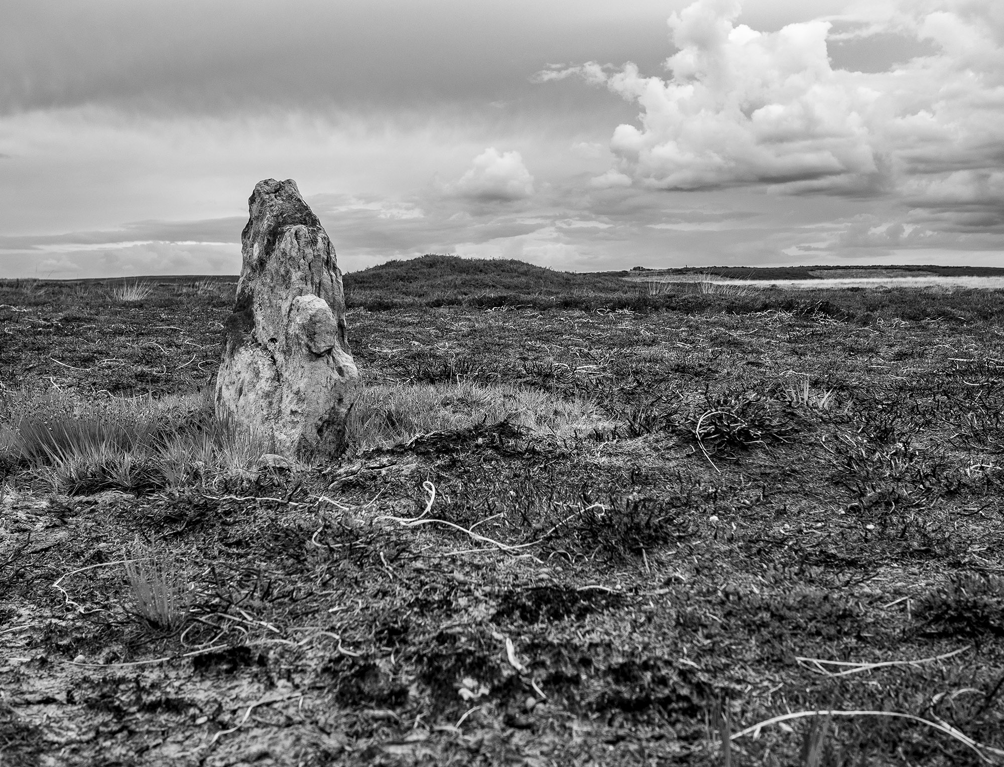
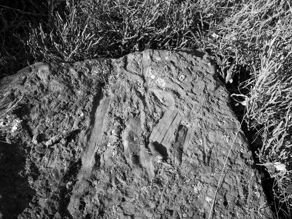
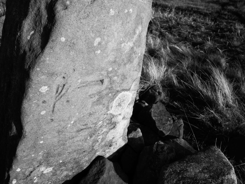
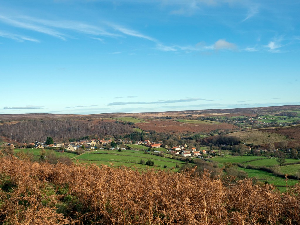
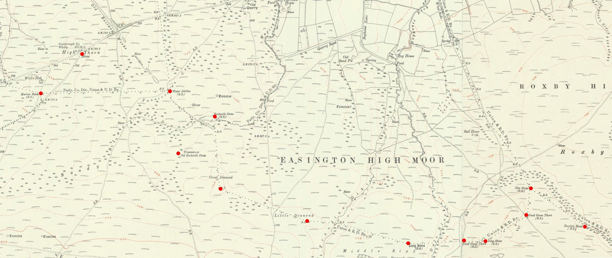
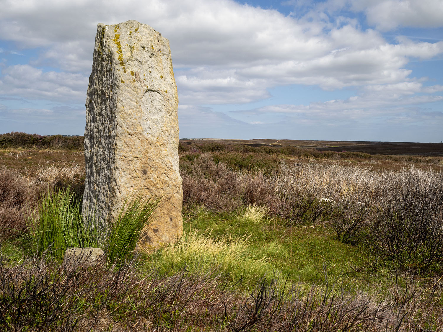
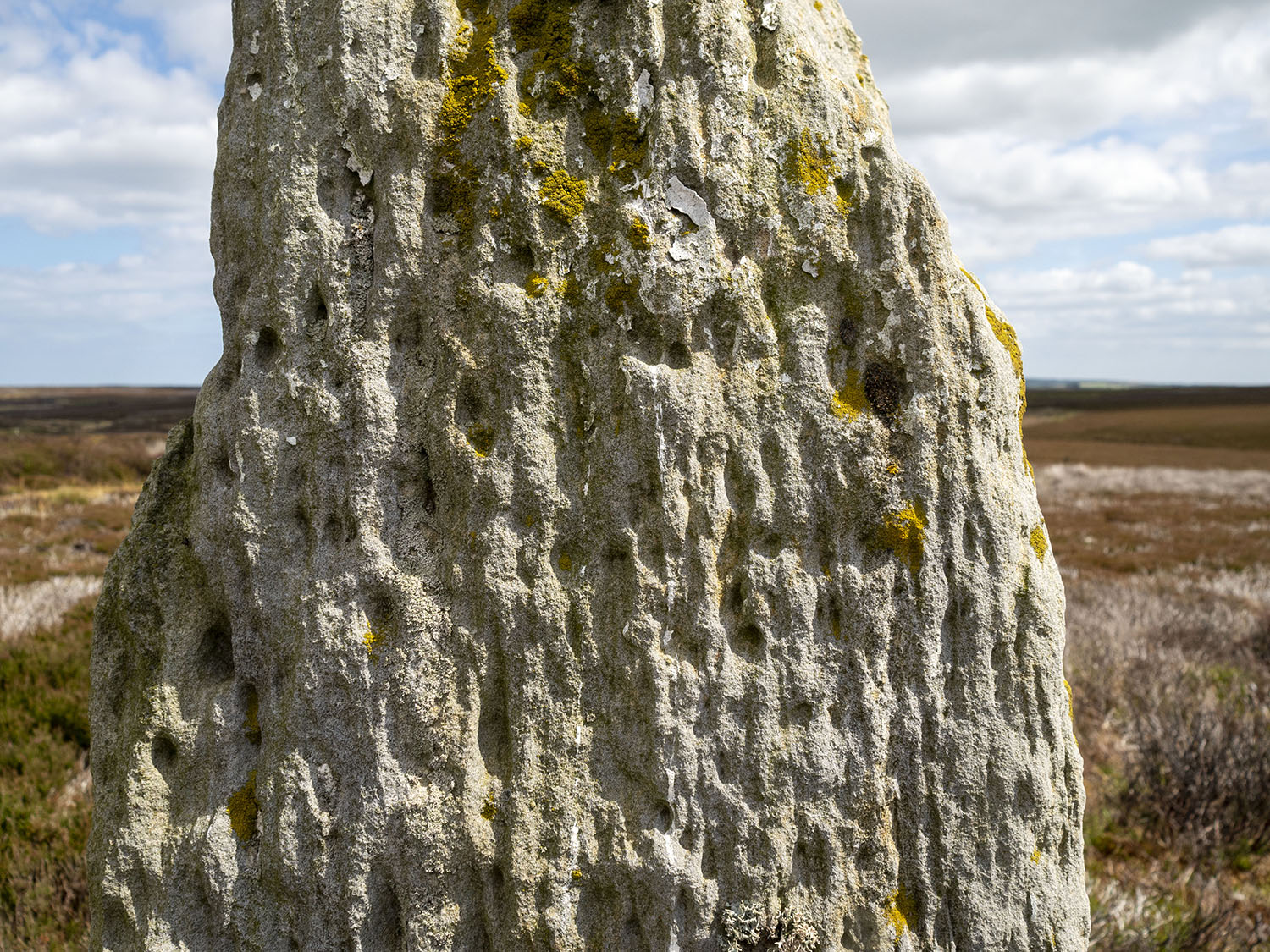
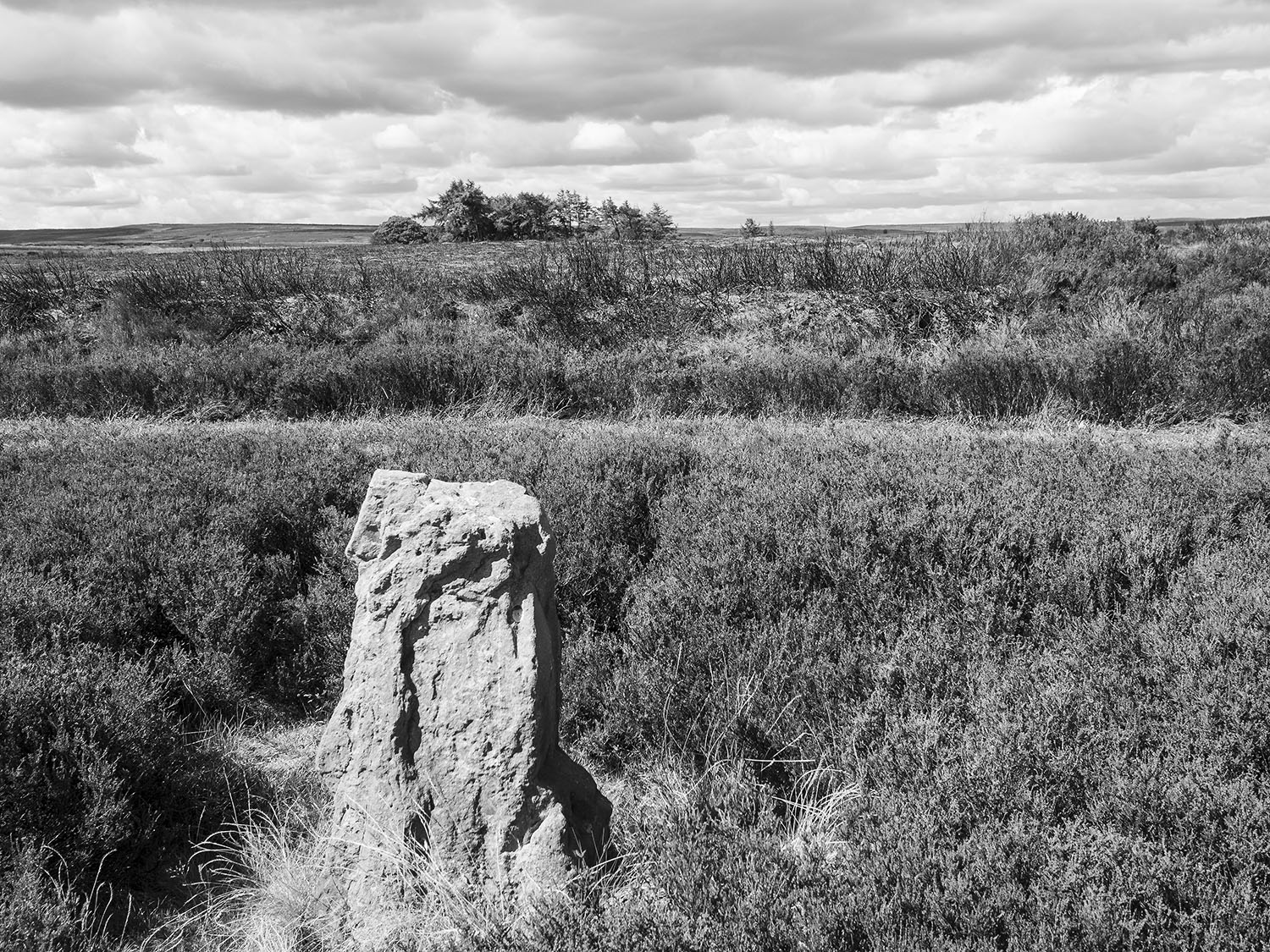
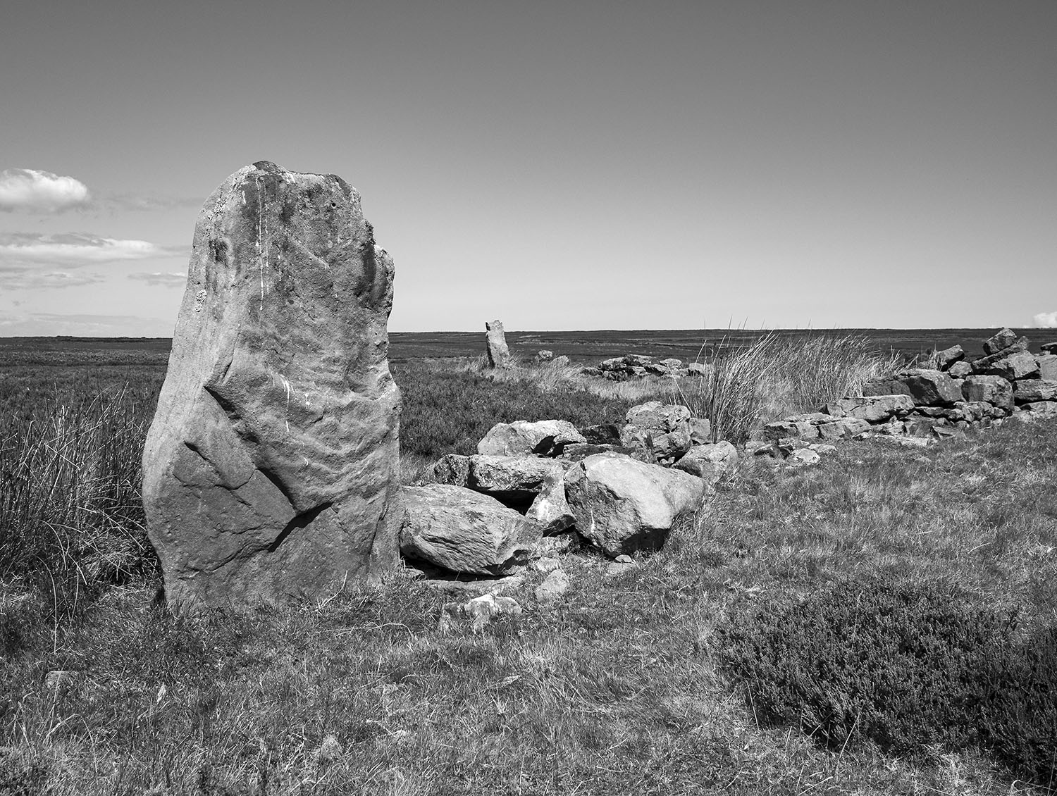
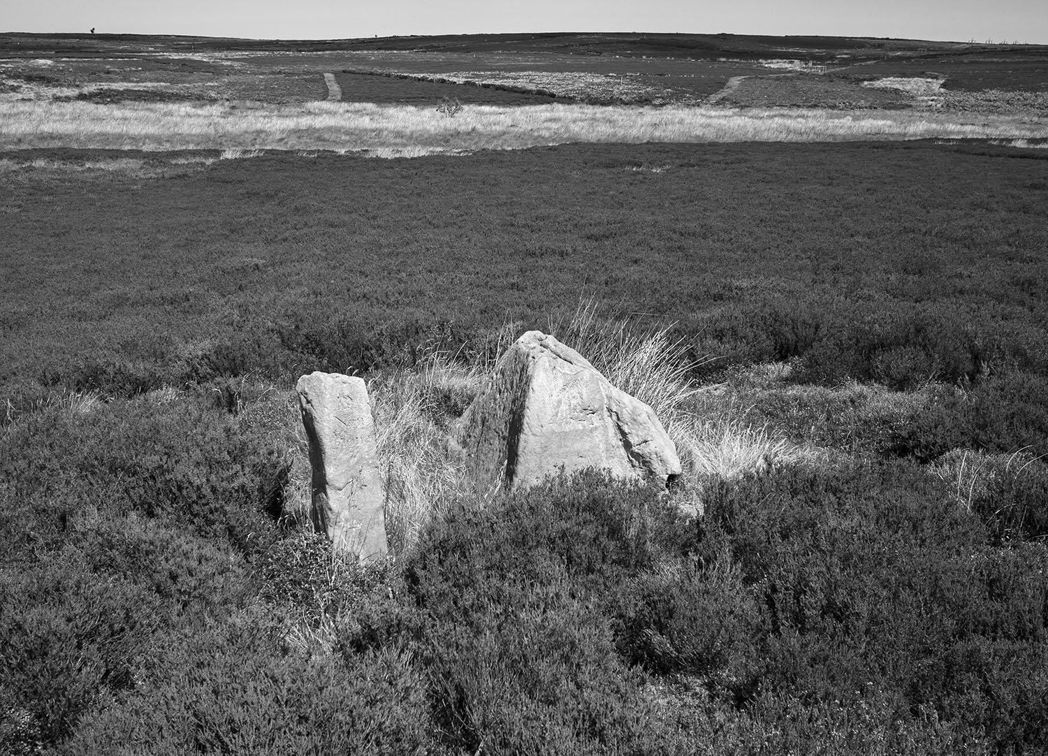
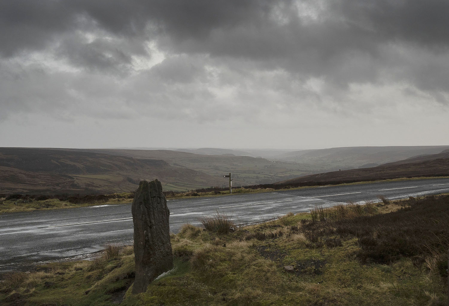
I took a trip over to Glaisdale to visit one on my favourite North York Moors standing stones. This rarely visited, tall, beautiful stone is one of a pair of upright stones located on Glaisdale Swang

Swang – a boggy stretch of land.

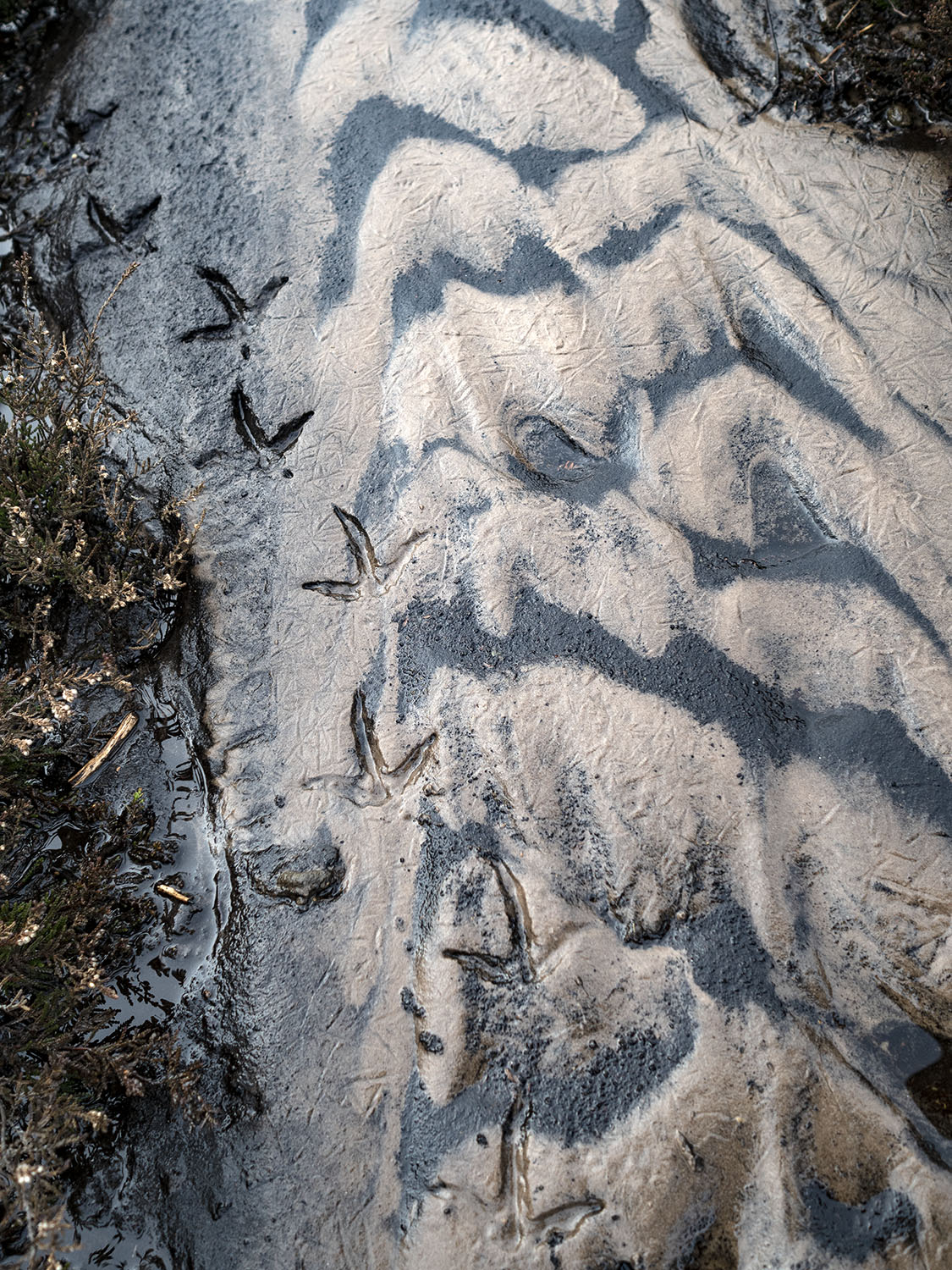
When I arrive at the stone I’m confronted by an anxious pheasant hen who starts running in circles around me, a tactic designed to distract me while her brood of chicks scatter for the shelter of the nearby heather.

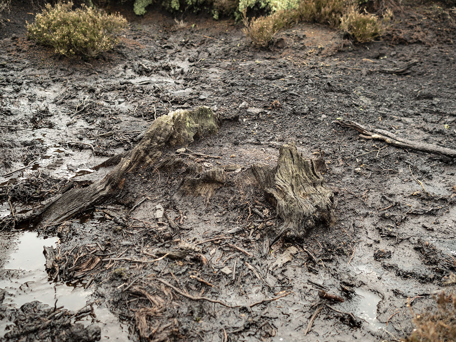
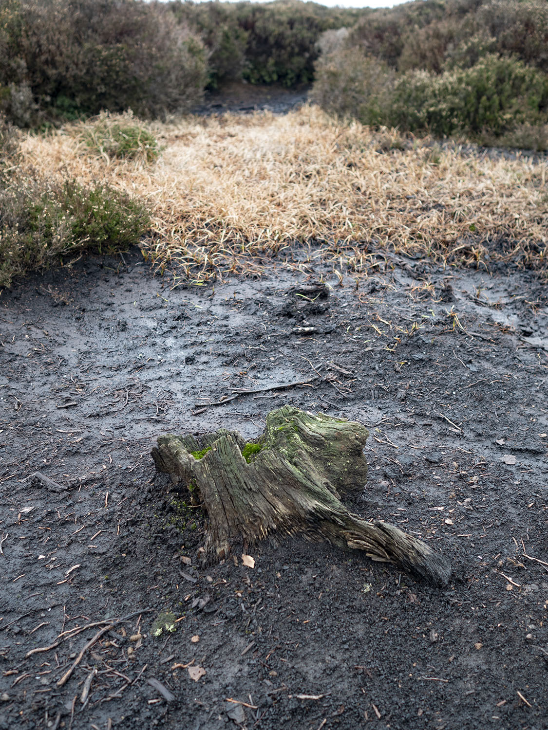
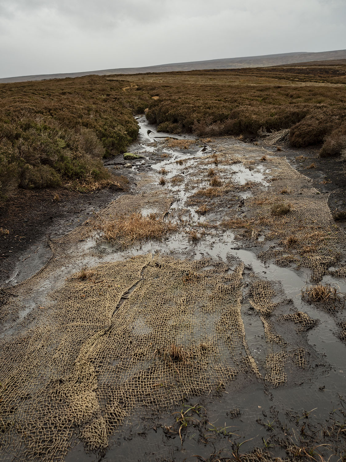
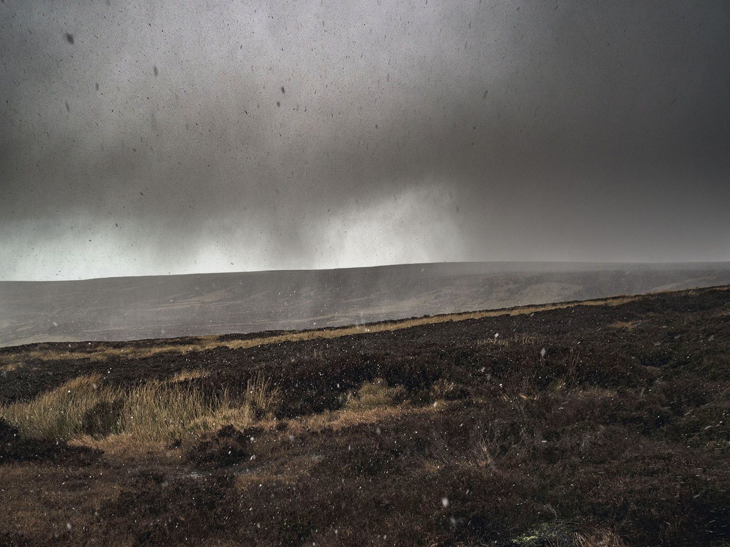
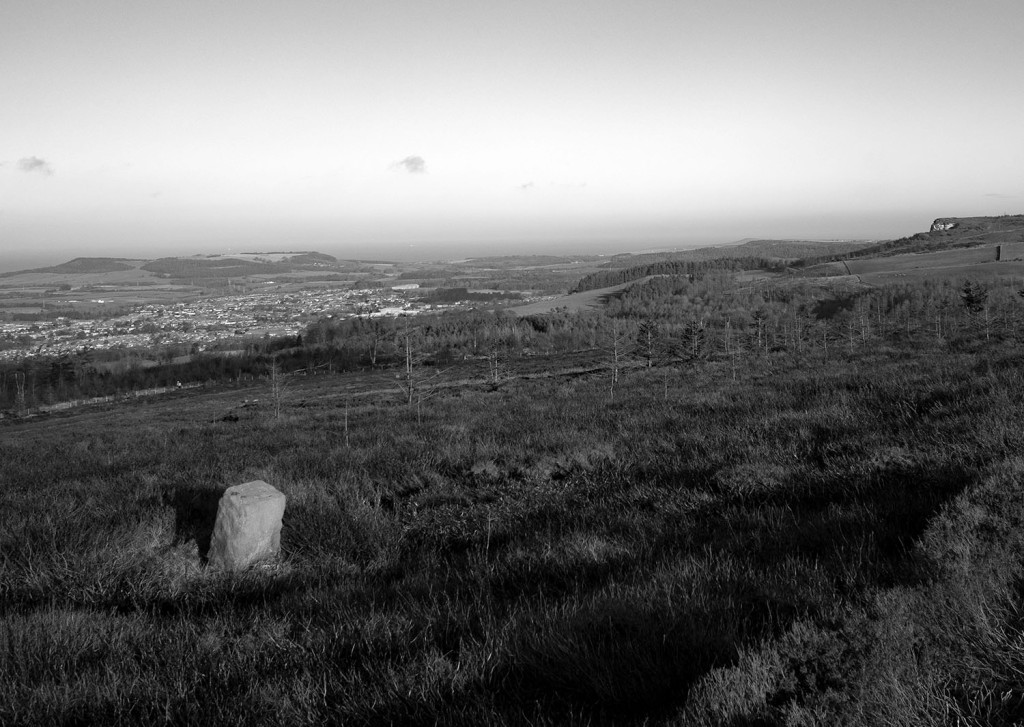
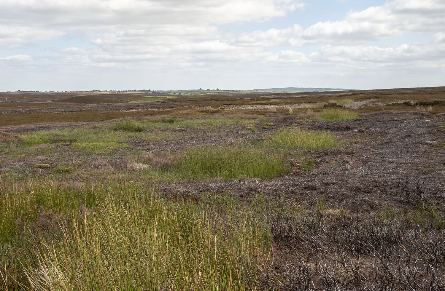
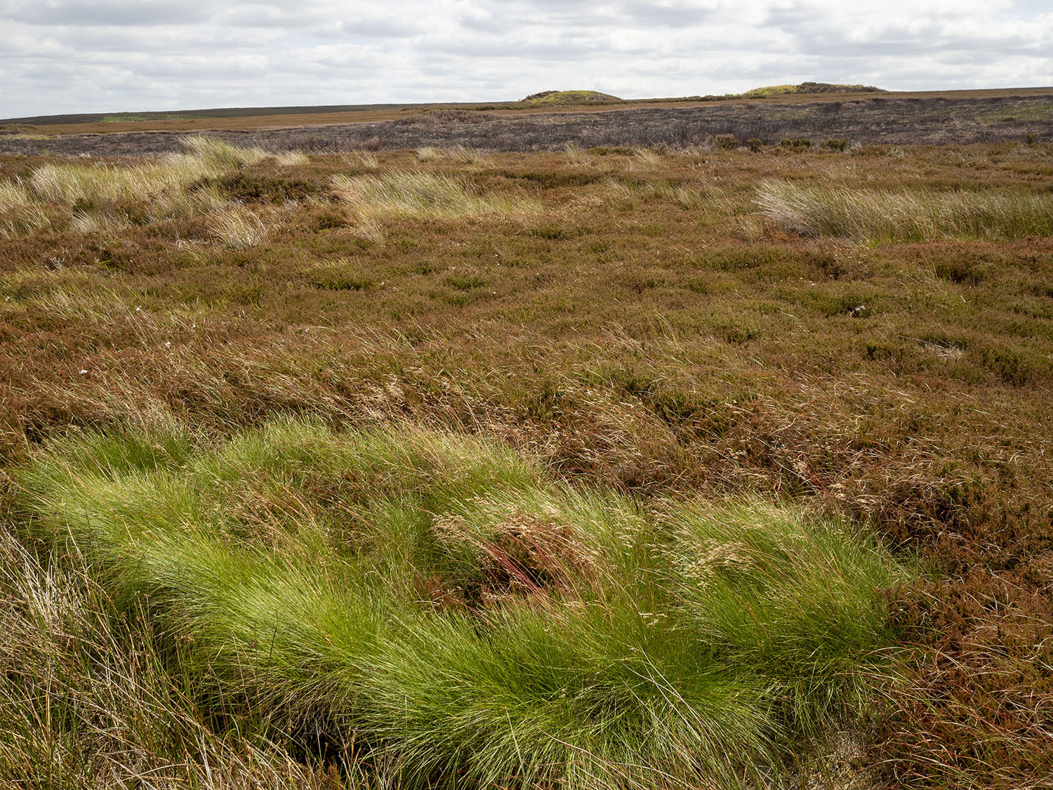
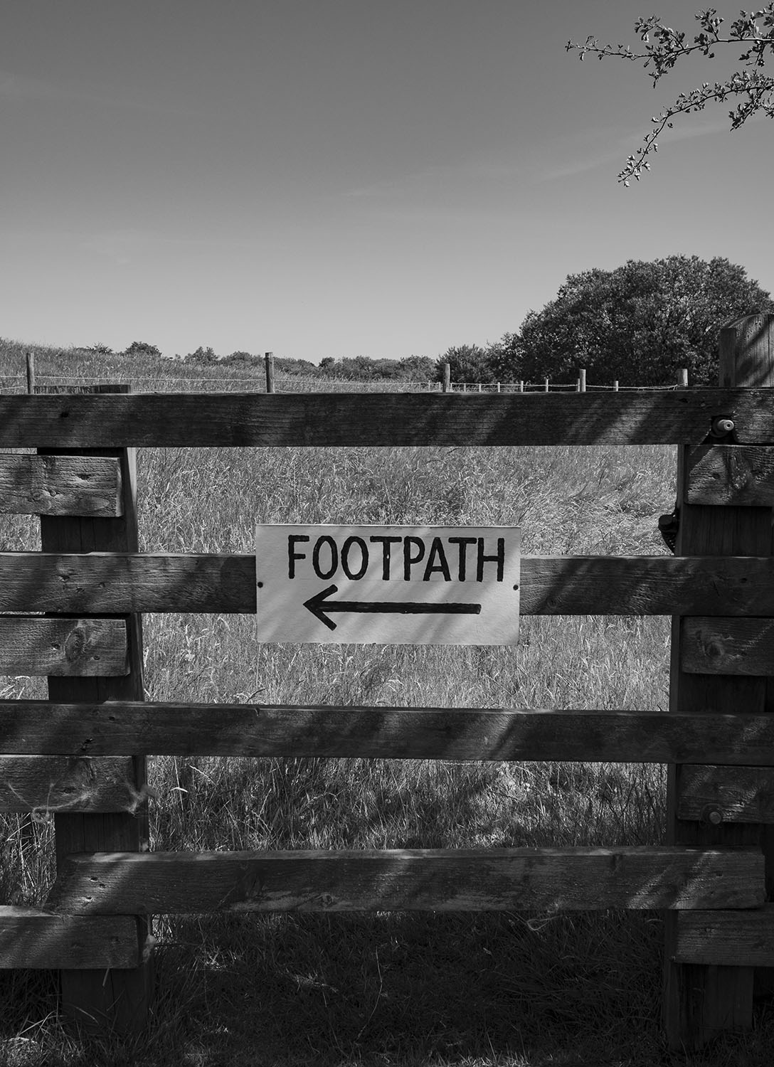
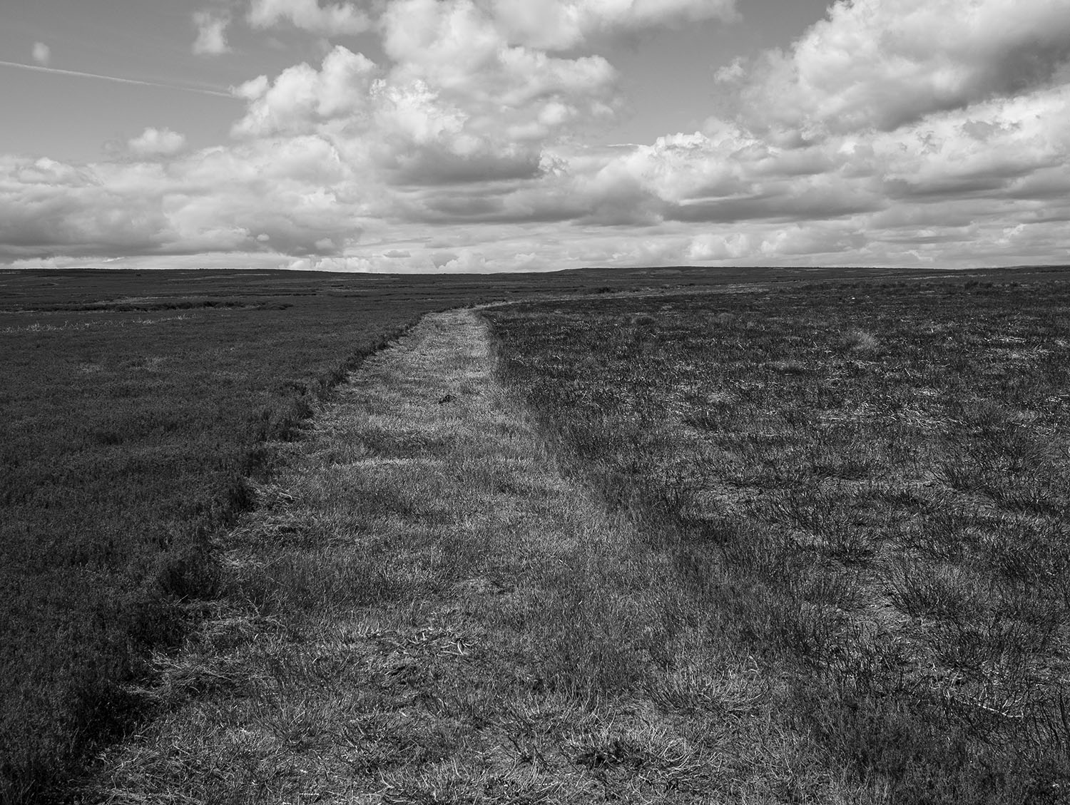
I can see another stone on the moor edge in the distance, I know that this will probably be a guide stone but probably isn’t good enough, I head for the higher ground. The ground is marshy, so I zig zag my way up the narrowing valley following the lush green carpet of bilberry which tends to grow on the better drained ground. Curlews and lapwings rise in alarm and noisily track my progress as I move from one birds territory to another. Towards the top of the swang, a large hare breaks cover.

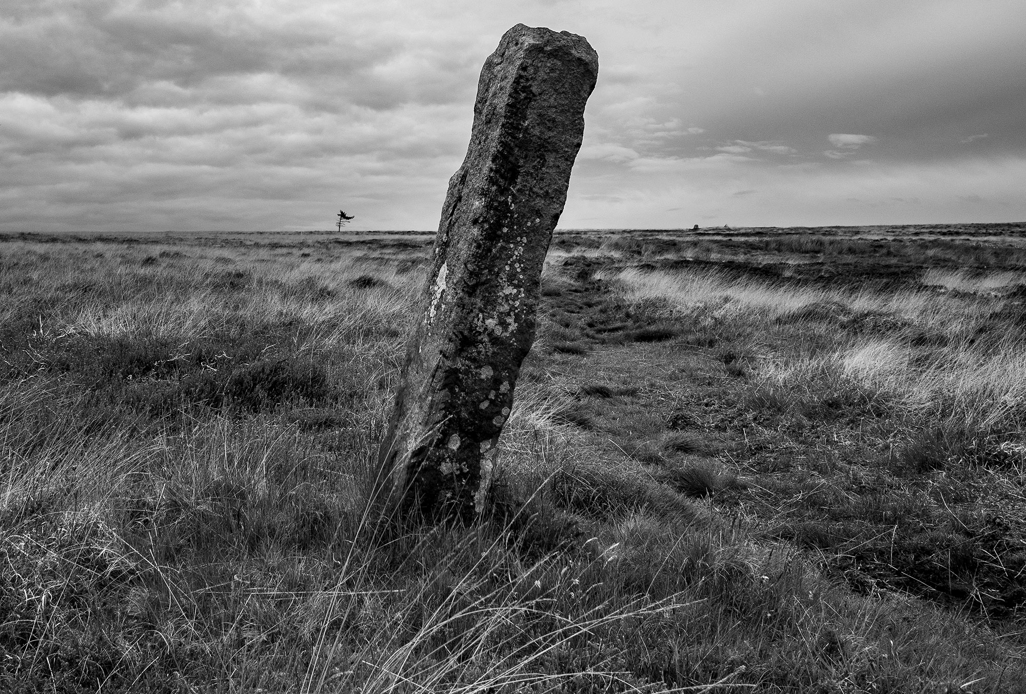
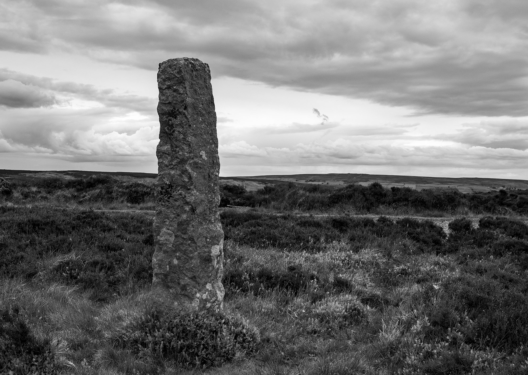
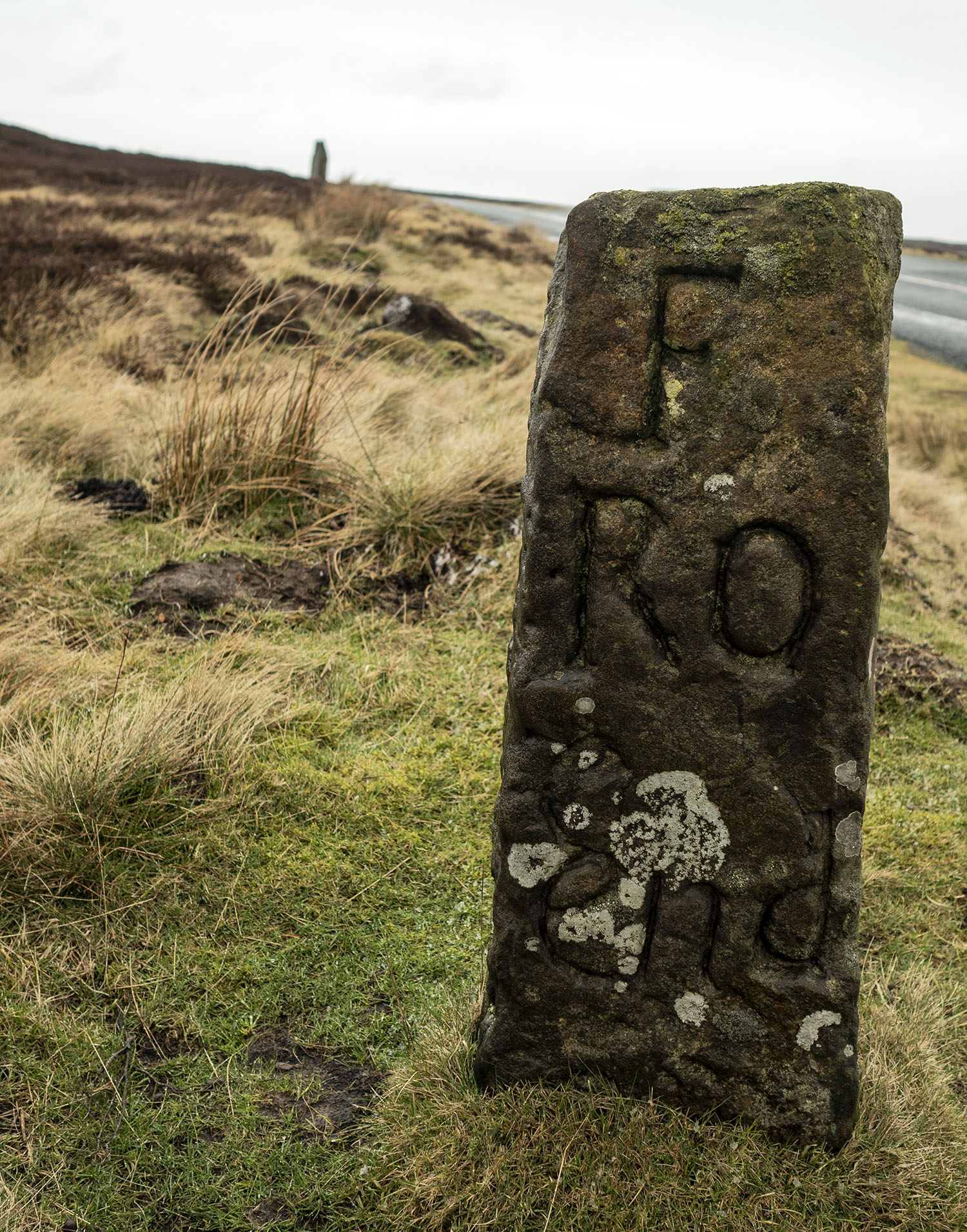
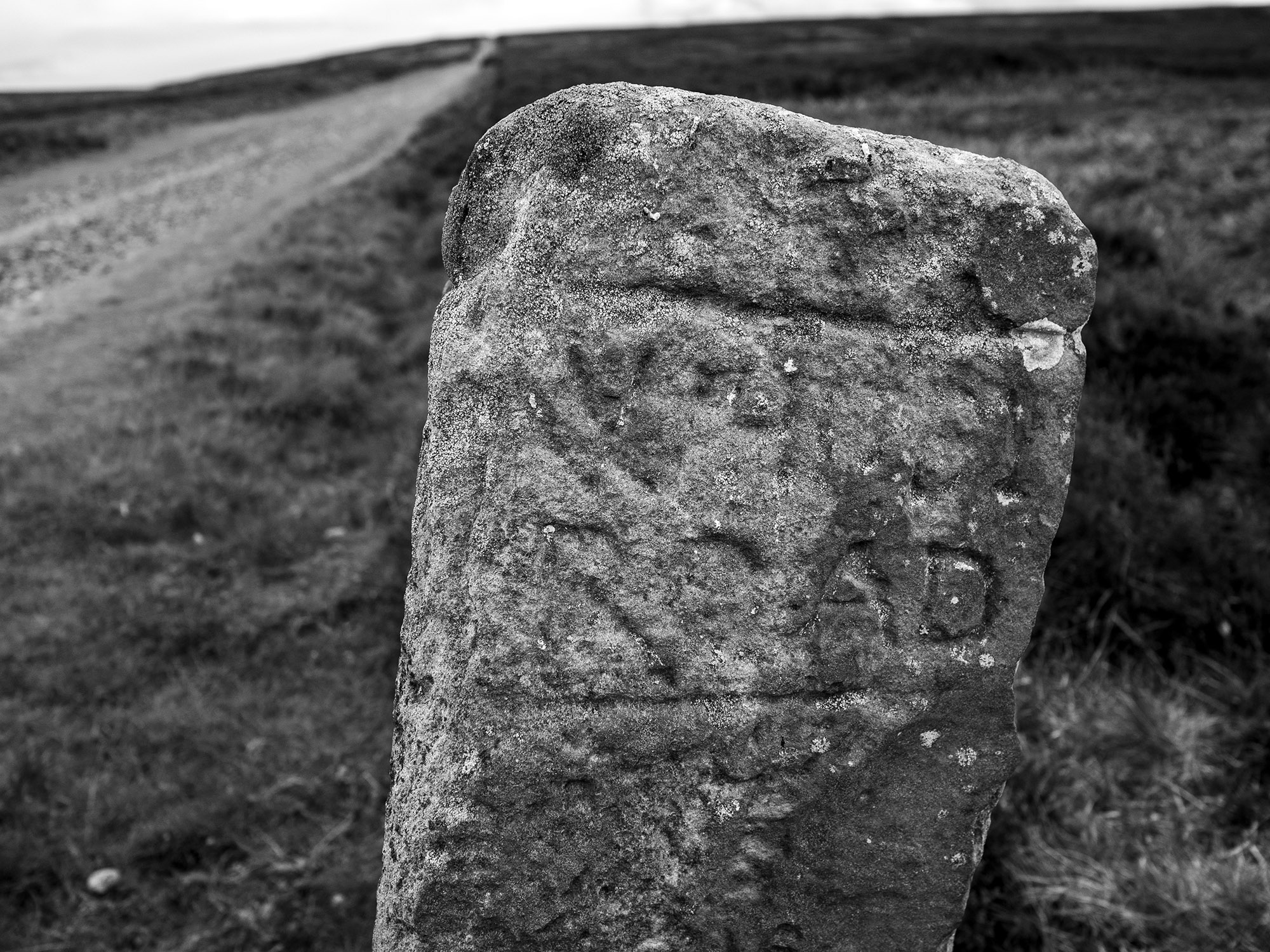
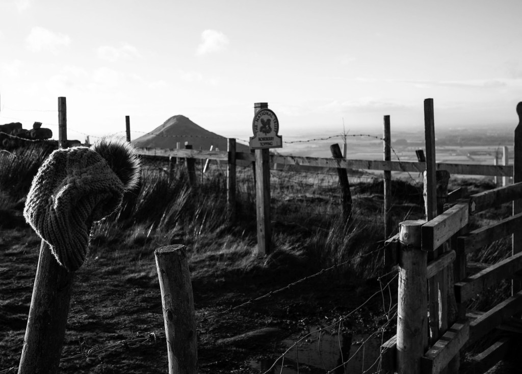
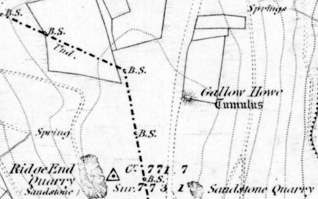
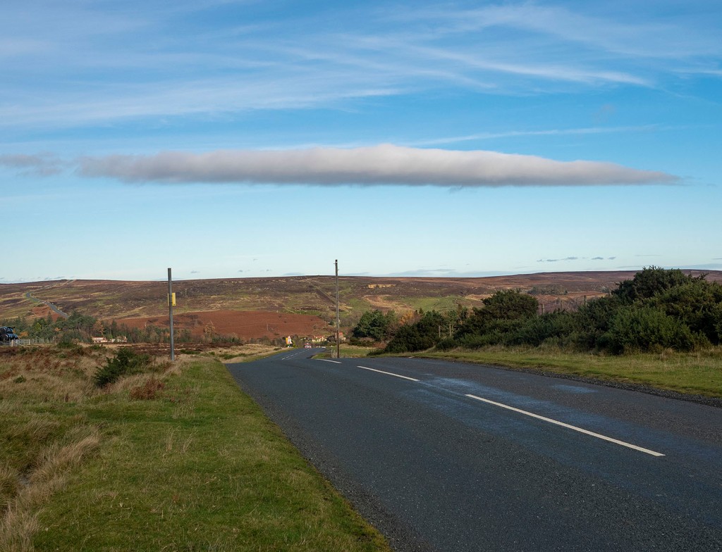
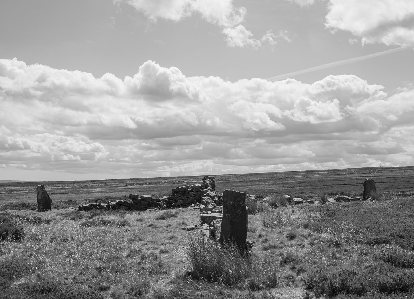
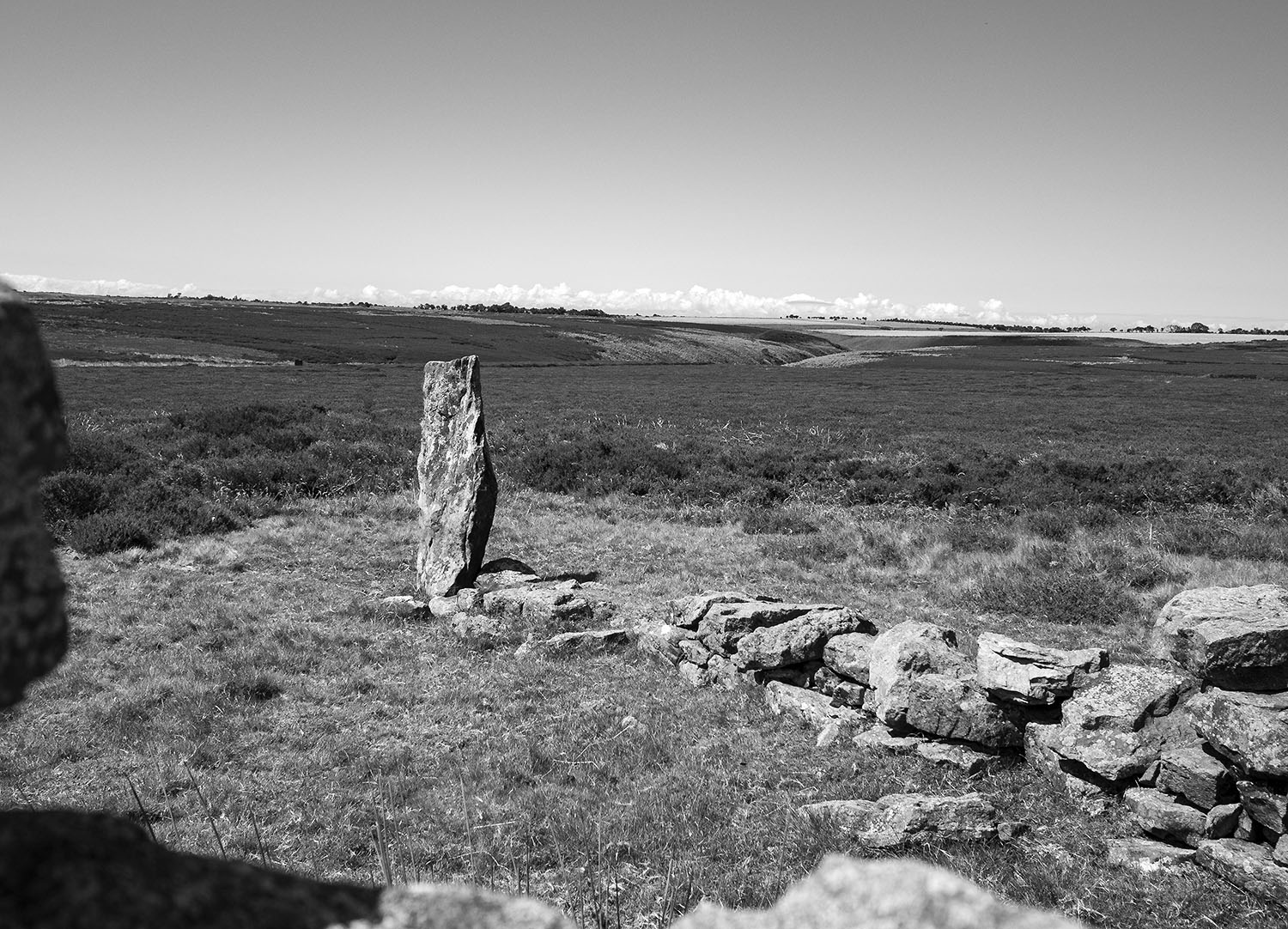
As I move onto the high moor guide stones mark the track. Many of these stones date to the 18th century, others may possibly be far older. On October 2nd, 1711, the Justices sitting at Northallerton ordered that guide posts should be erected throughout the North Riding.

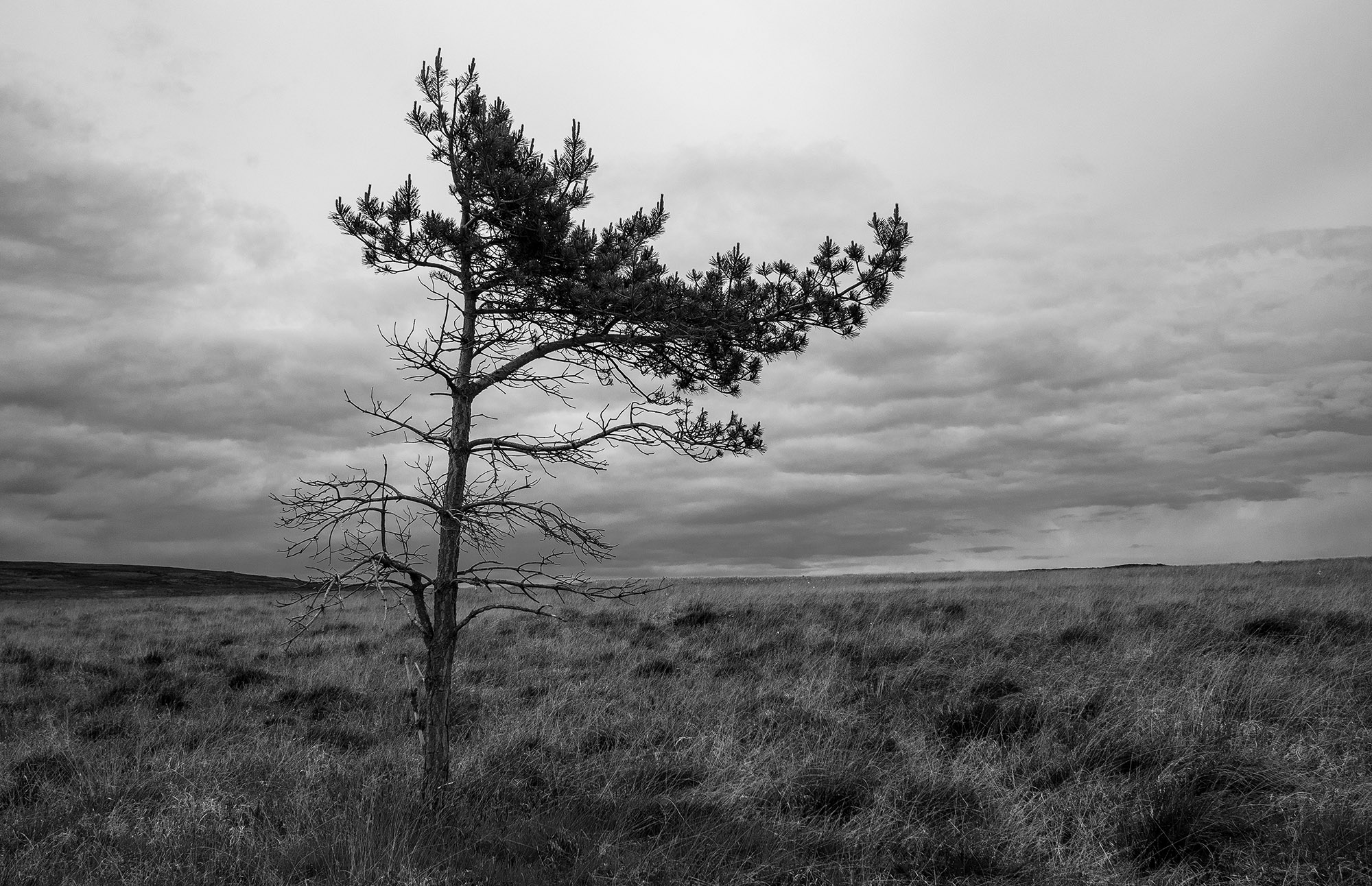
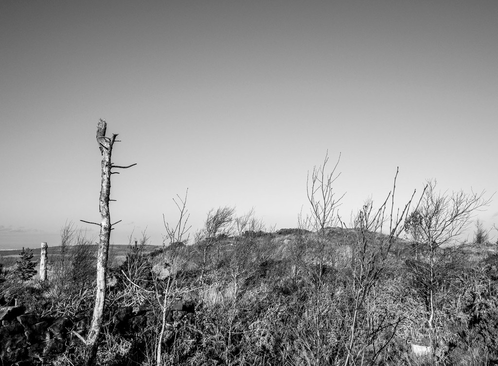
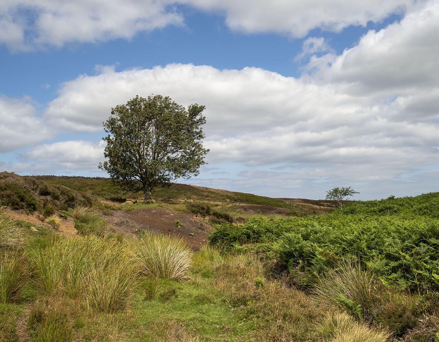
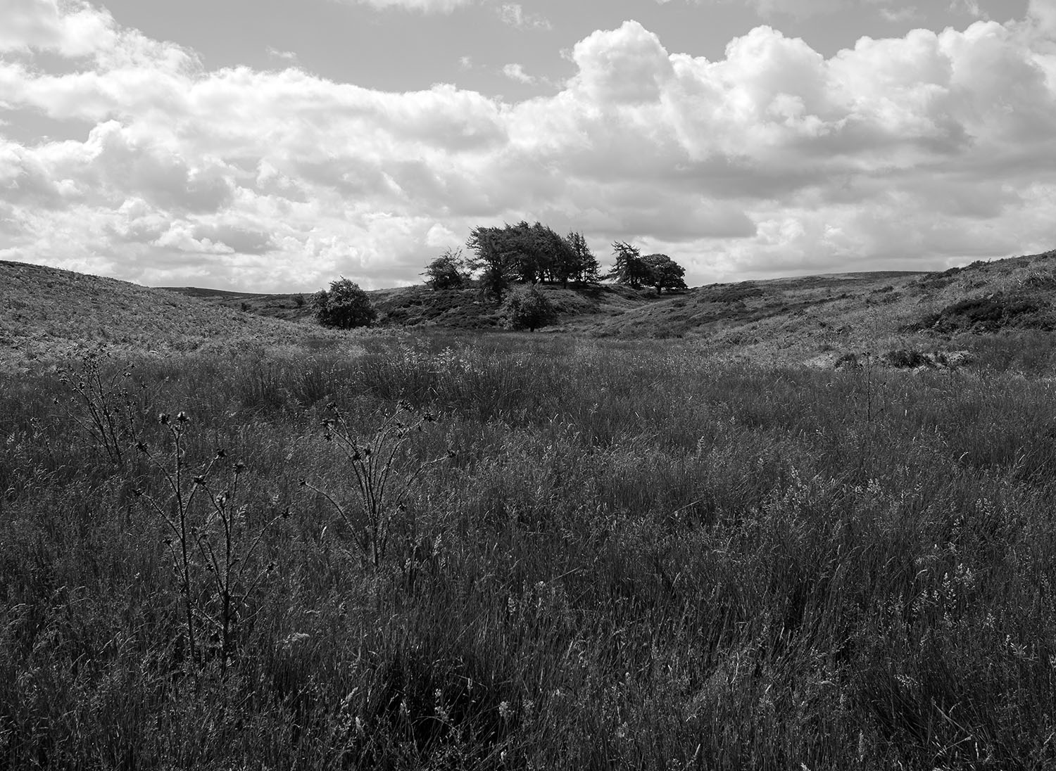
A solitary pine tree on the moor top, its branches indicate the direction of the prevailing winds.

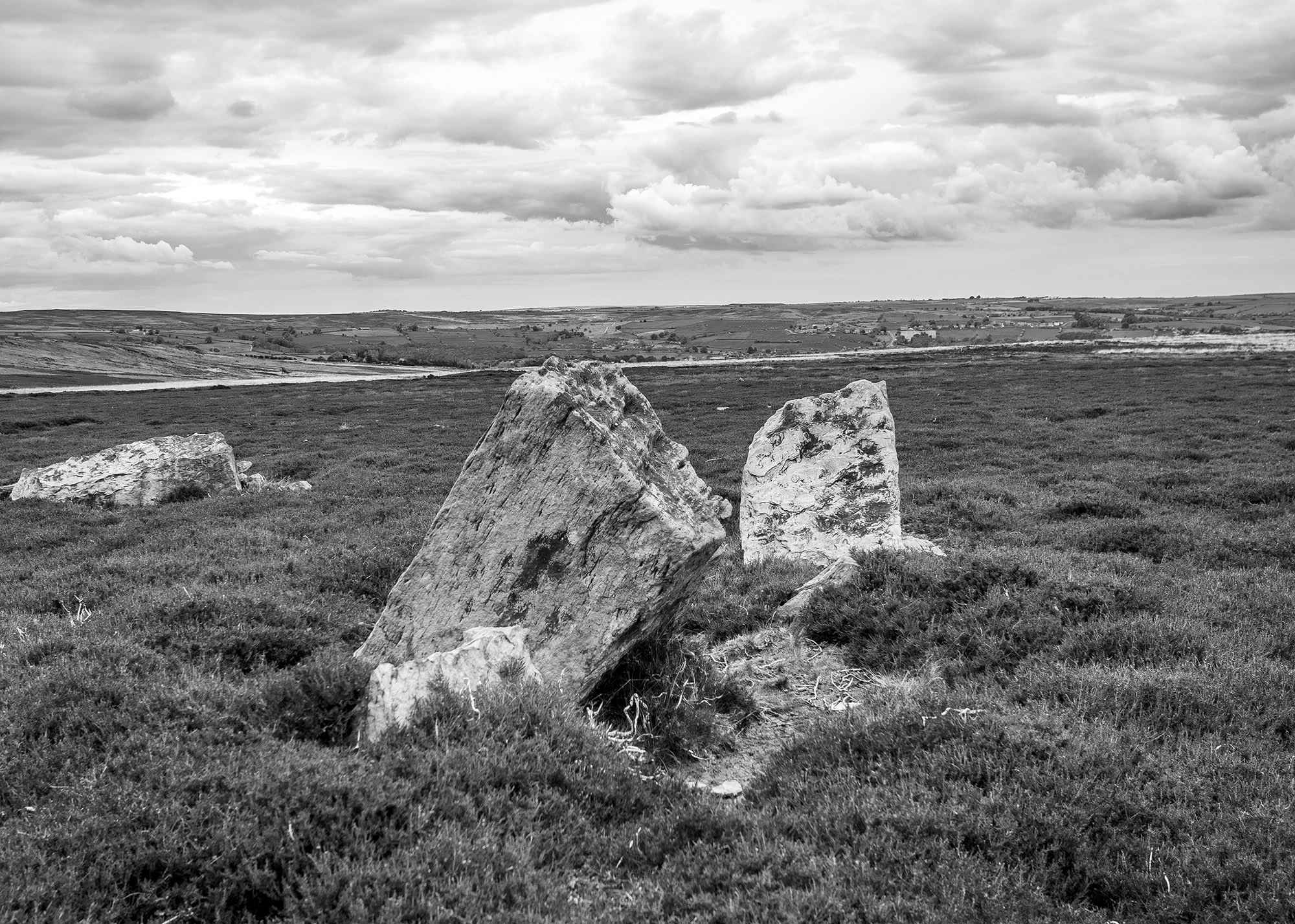
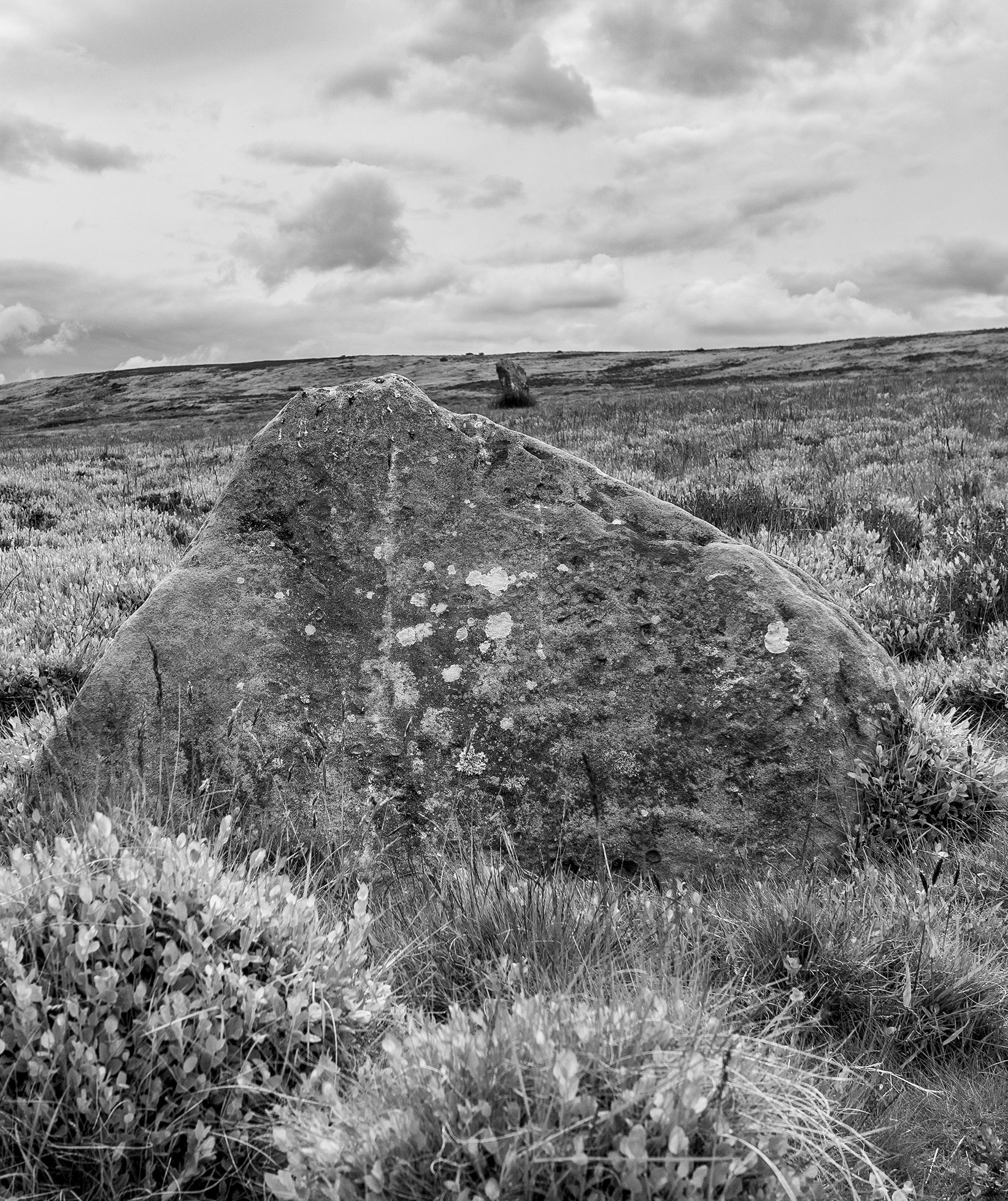
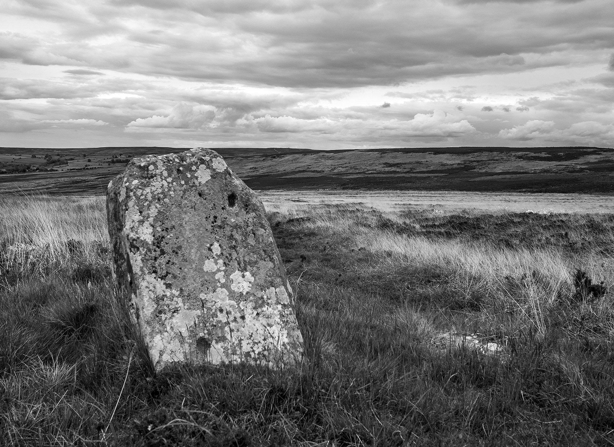
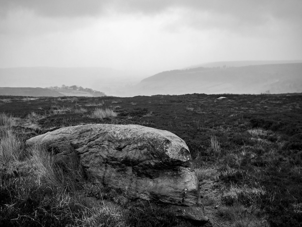
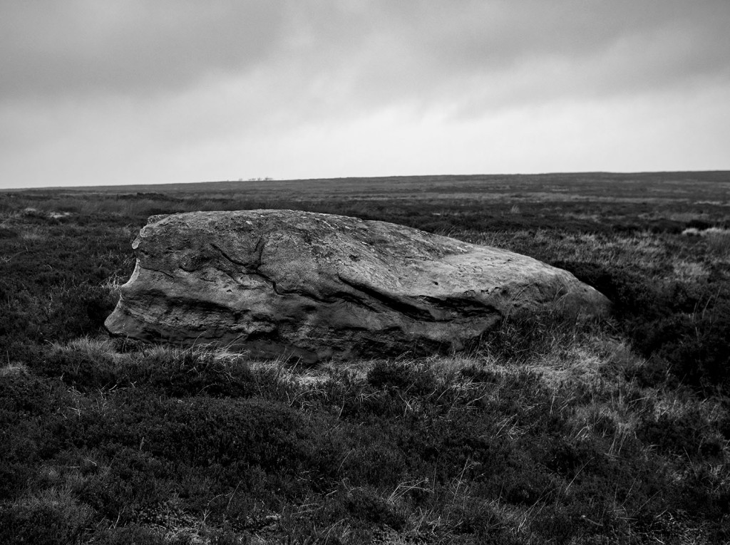
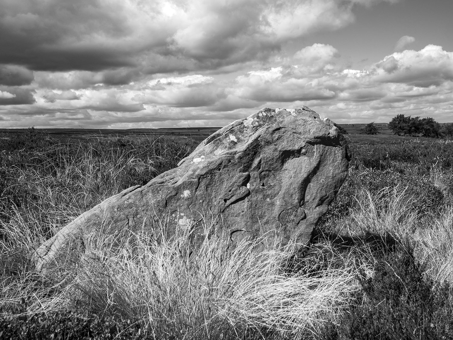
Walking across across the high moor towards Glaisdale I encounter a couple of low standing stones one of which is close to a low mound. These stones are not on the track and are too small to be guide stones. Another group of large stones look as through they were once standing but it is difficult to say much more about them.

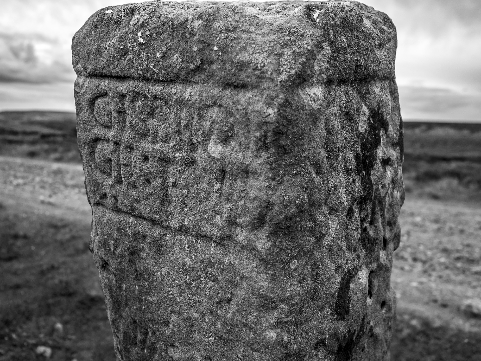
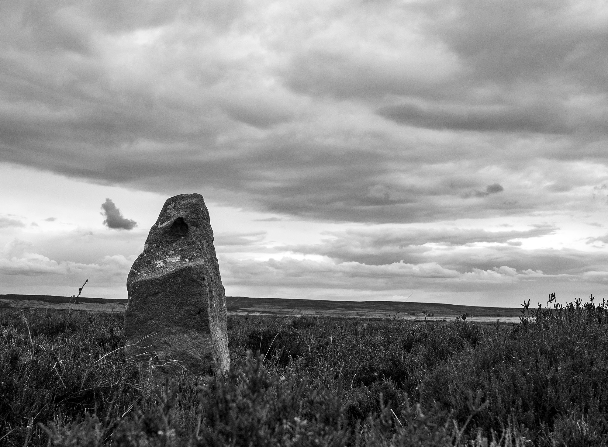
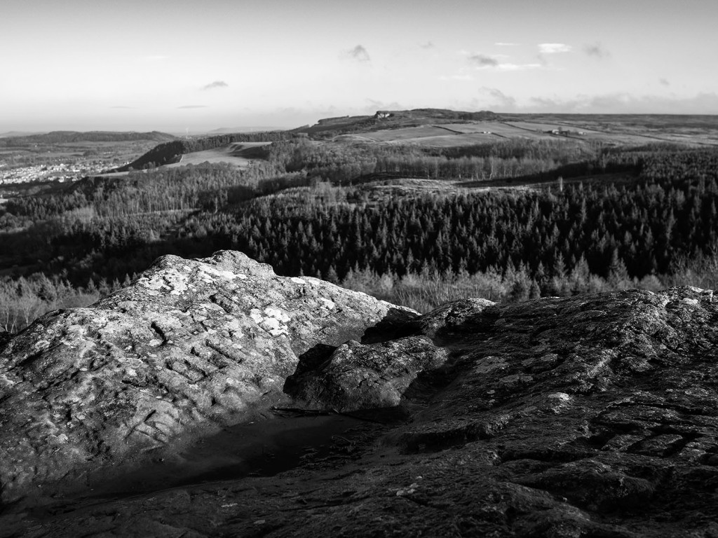
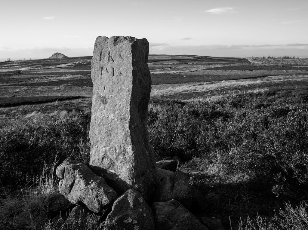
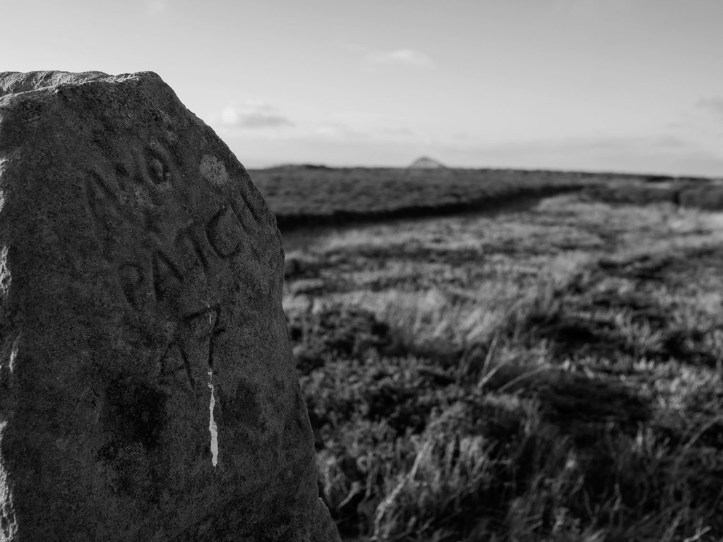
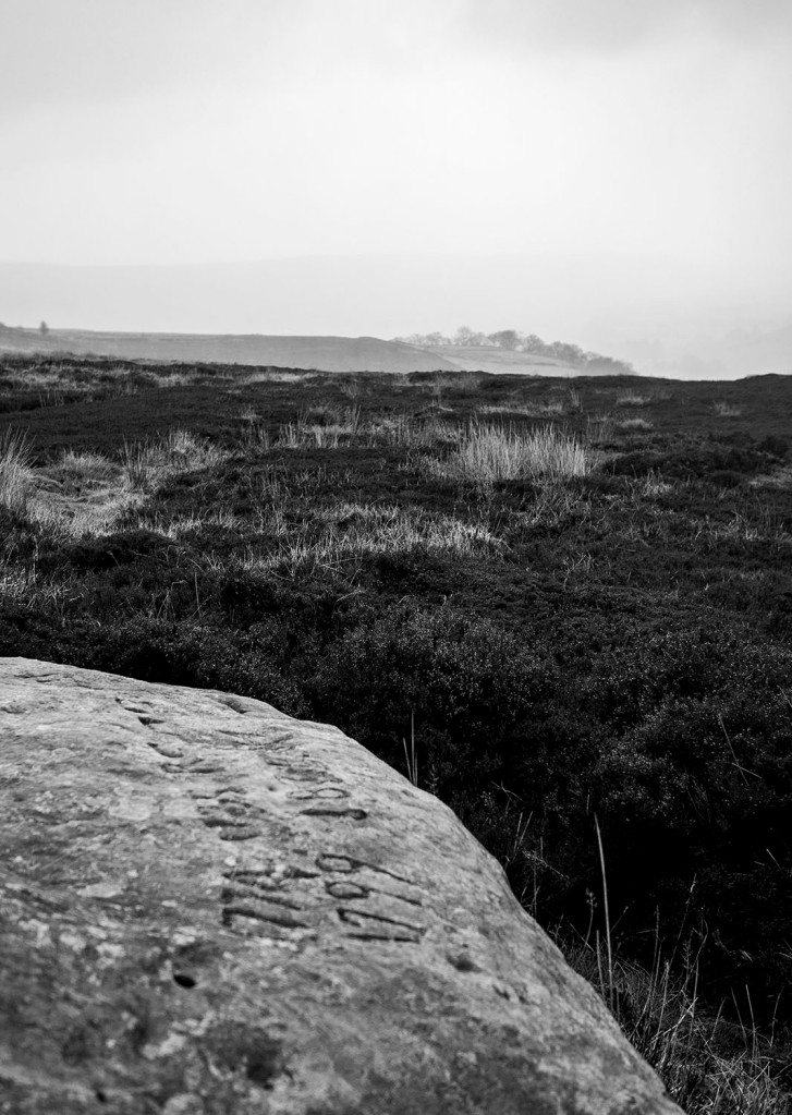
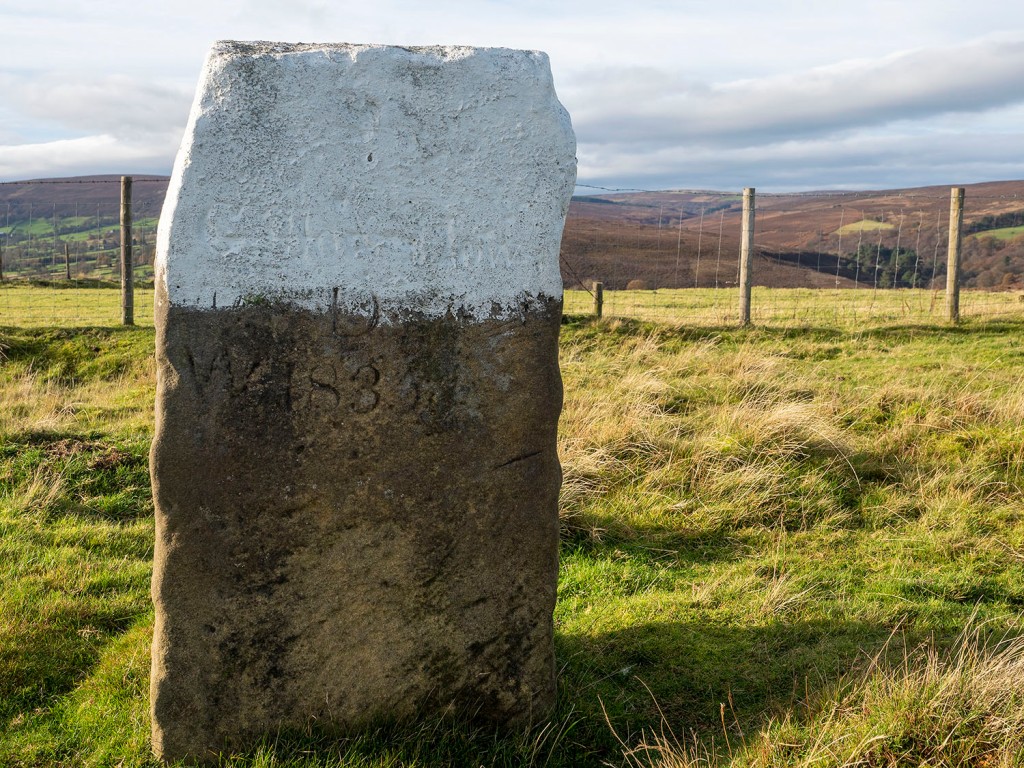
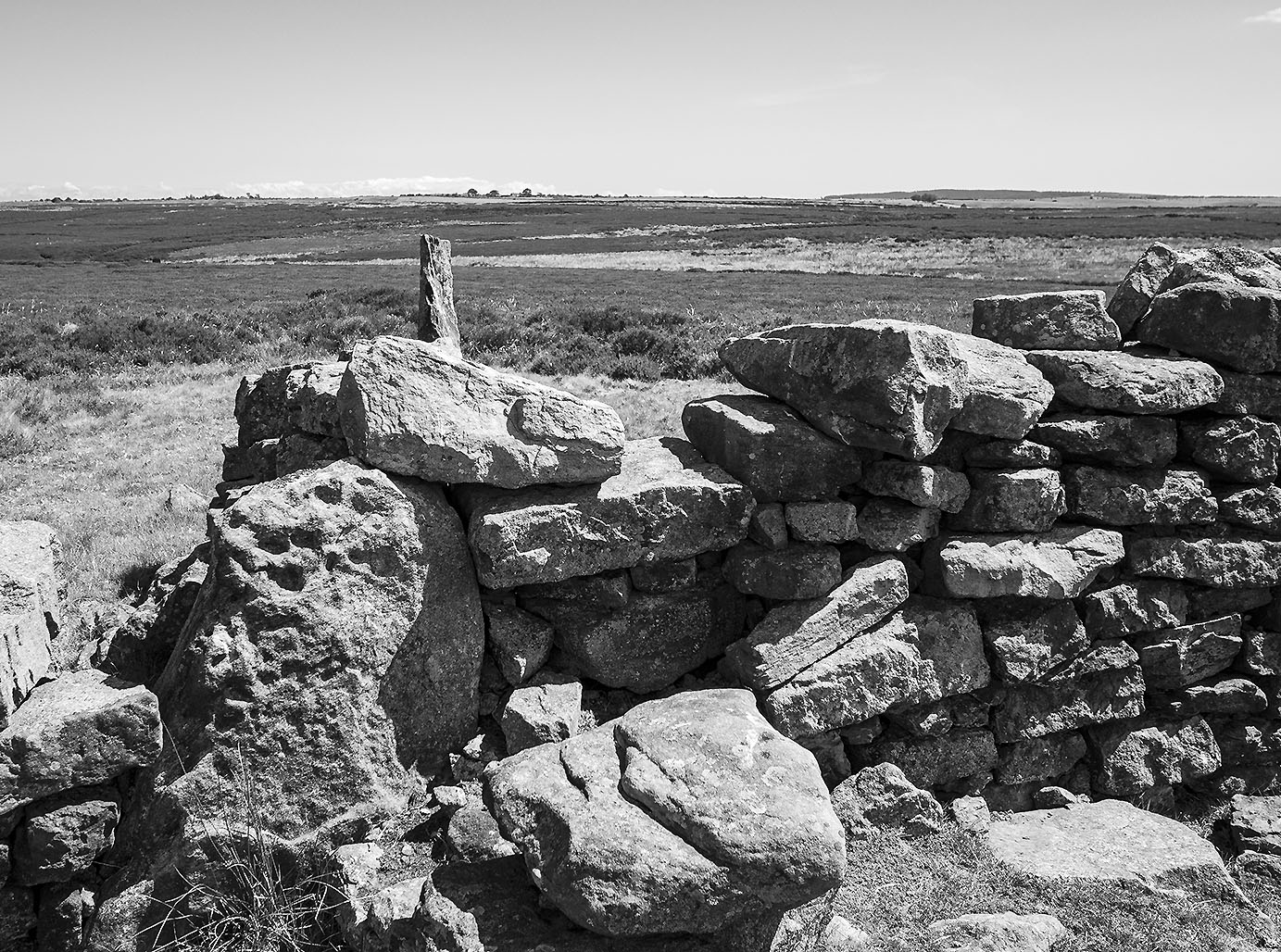
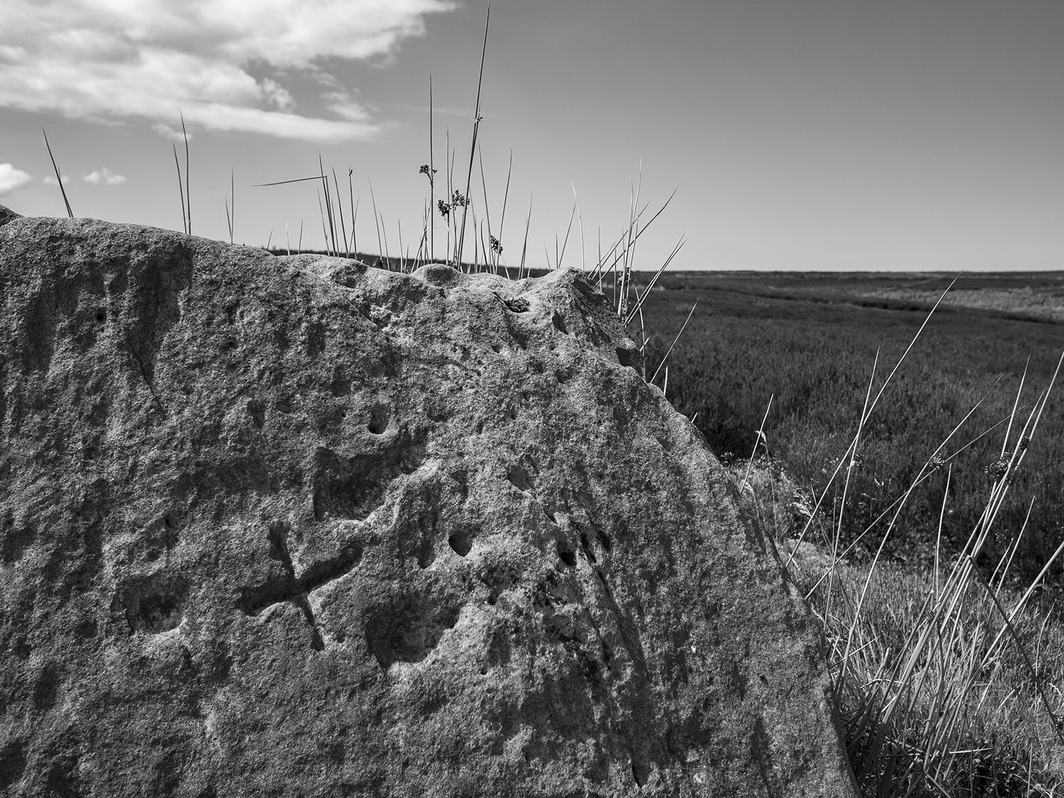
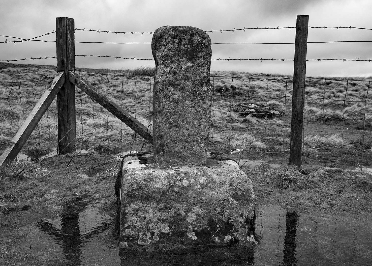
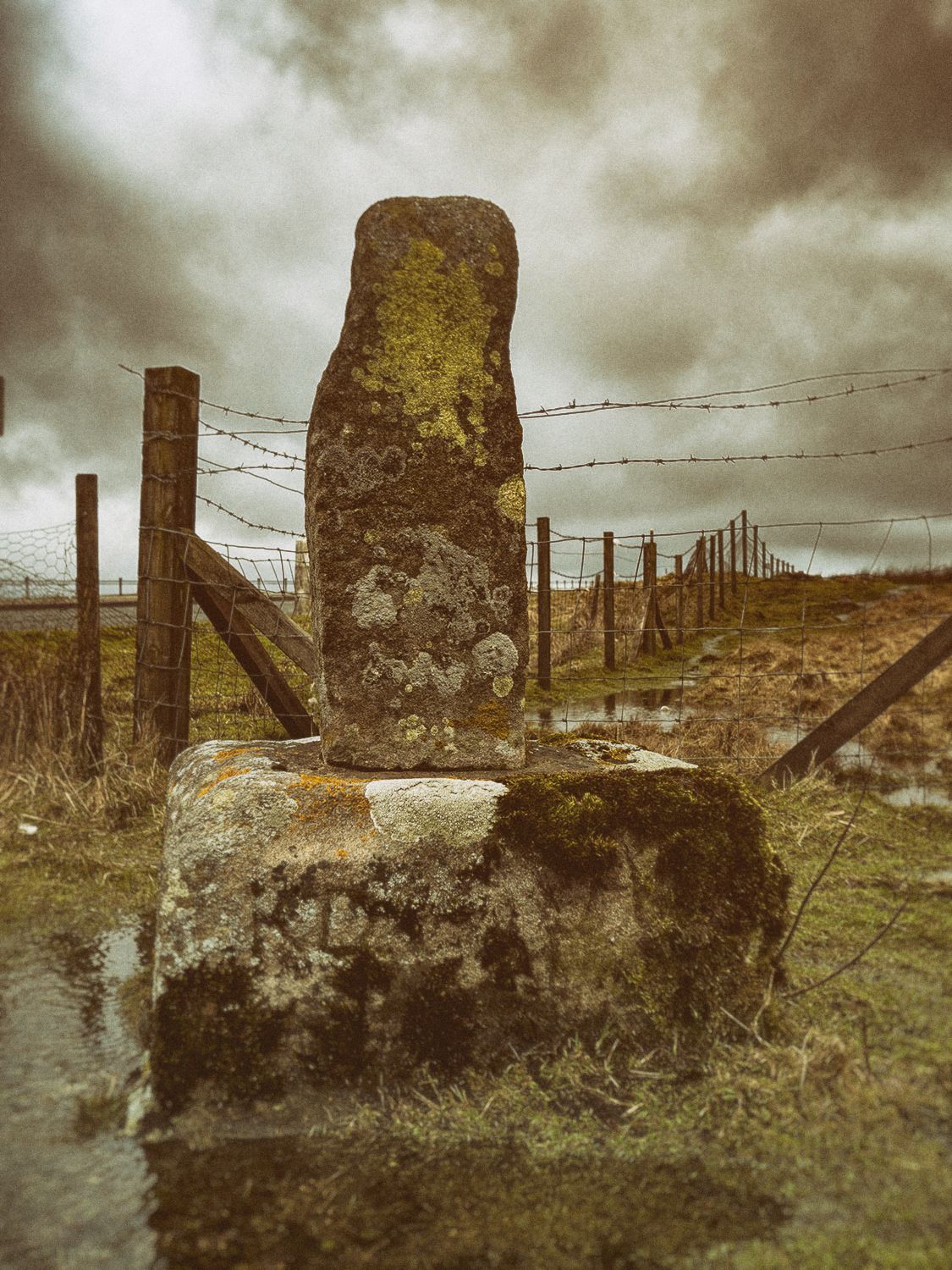
This guide stone was carved and erected by Thomas Harwood about 1735. Harwood erected four other similar stones on Glaisdale Rigg. The stone appears to be housed in an old cross base. It is possible to make out the inscriptions on the north and east faces, they read Gisbrogh Road and Whitby Road. The other two faces are illegible, Stanhope White writes that the south face reads Glaisdale Road TH.

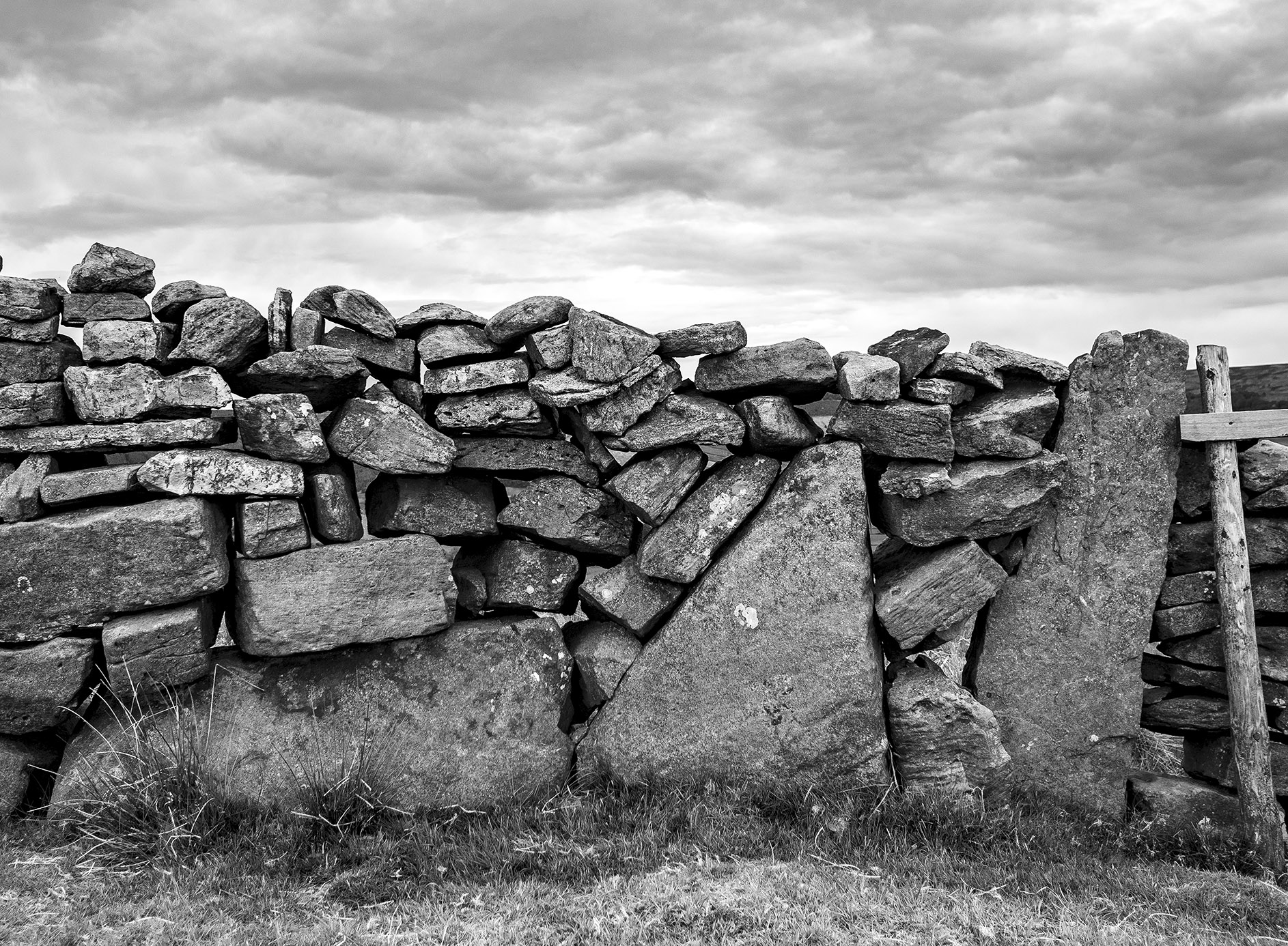
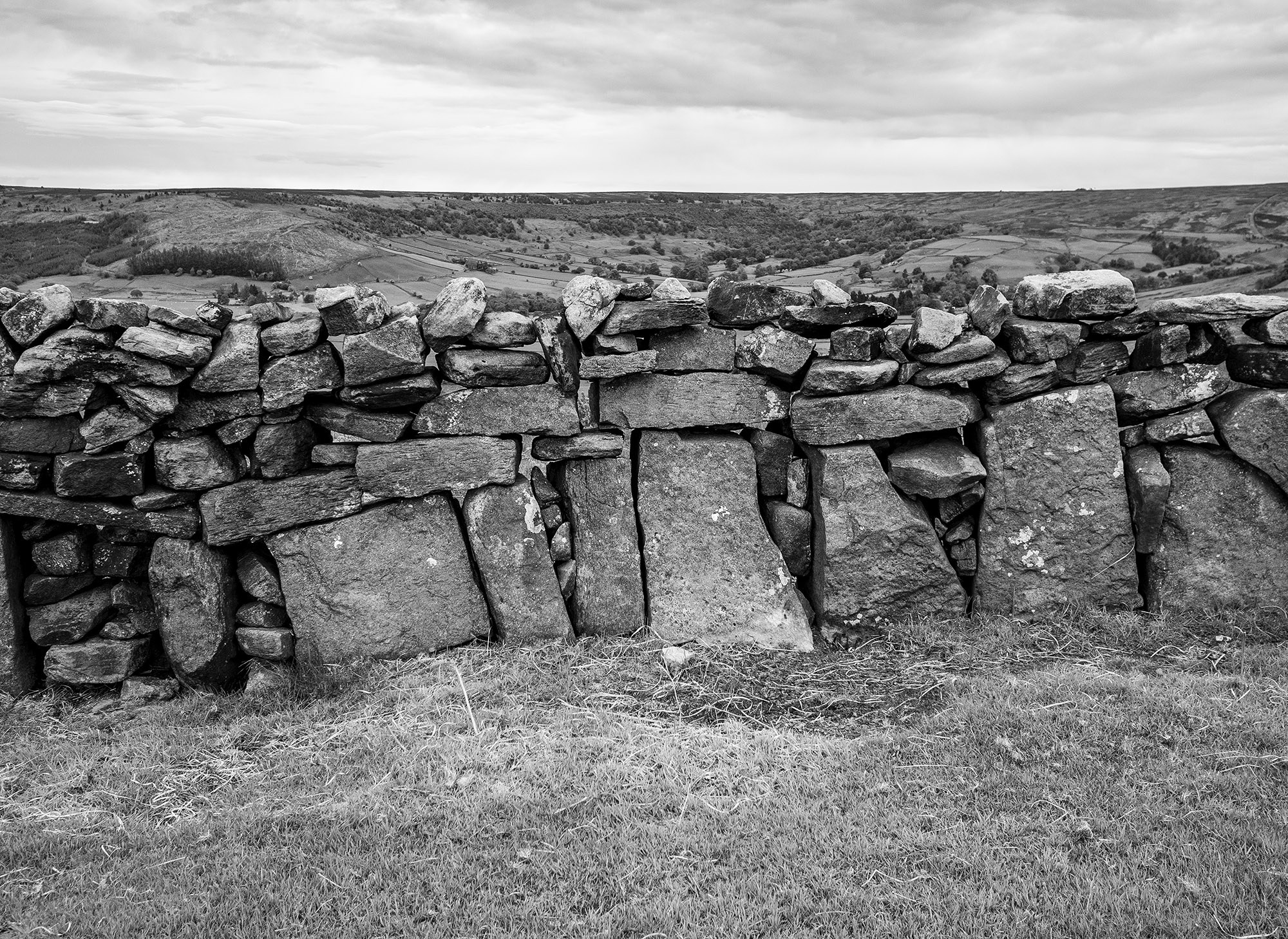
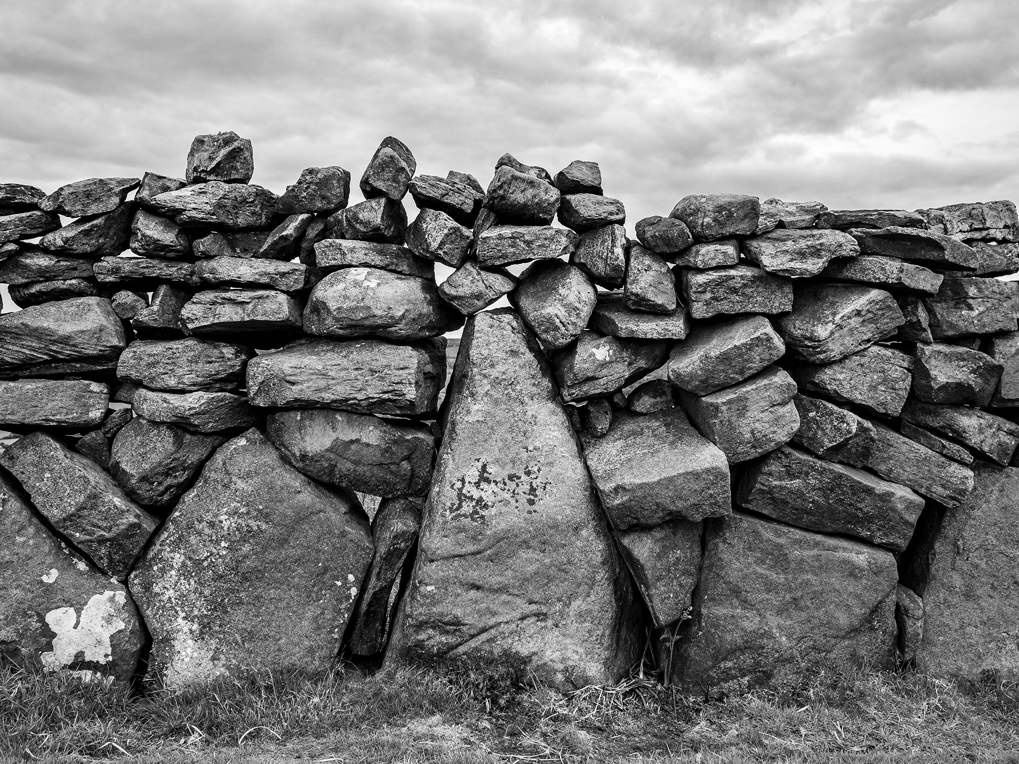
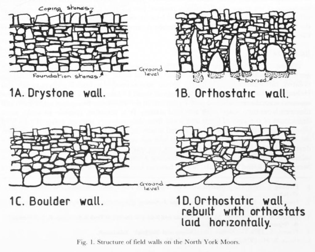
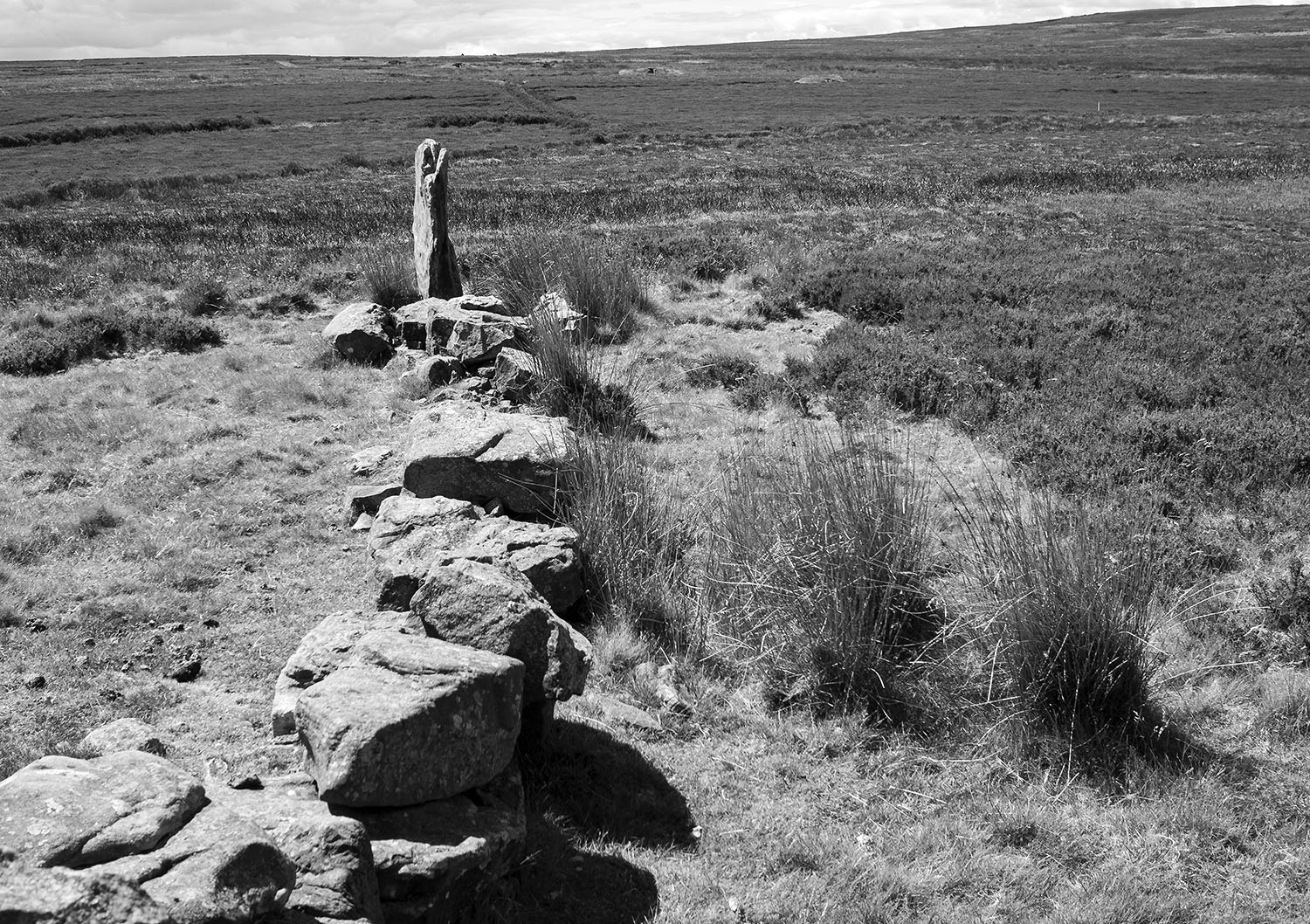
Walking over to the edge of Glaisdale I find this beautiful orthostatic wall, a real joy. About a century ago many of the original field walls across the moor and dales were rebuilt by professional wallers, this wall may be a survivor of an earlier age.

In his book, Some Reminiscences & Folk Lore of Danby Parish & District, Joseph Ford writes of Stone-Rearing Days. These were occasions when a farmers neighbours gathered together to build walls around newly-enclosed fields. Ford thinks that this tradition may stretch as far back in time to the original settlers of the moorland dales.

D. A. Spratt YAJ 60 1988

Etymology

Glaisdale – YN [Glasedale 12 Guisb. Glasedal 1223, Glasdale 1228 FF] ‘The valley of R Glas’

OW gleis, Welsh glais ‘stream’

Glas is a British river-name derived from the Welsh glas ‘blue, green, grey’

Sources

Yorkshire Wit, Character, Folklore & Customs. R Blakeborough. W Rapp & Sons Ltd. 1911

The North York Moors. An Introduction by Stanhope White. The Dalesman Publishing Co. 1979

Some Reminiscences & Folk Lore of Danby Parish & District. Joseph Ford. M.T.D. Rigg Publications. 1990

The Concise Oxford Dictionary of English Placenames. E Ekwall. 1974

Orthostatic Field Walls on the North York Moors. D.A. Spratt. Yorkshire Archaeological Journal No. 60 1988

Stone

Crossing the muddy, cattle-churned field from the Hutton Road, there are various earthworks visible in the low winter sun. This was once the site of a Medieval leper hospital overlain by a nineteenth century tramway, built to transport ironstone from the local mines.

I follow the path uphill, the woodland sits in the winter shadow of the escarpment. I stumble up the steep, muddy track to the lichen-splattered, table-top outcrop, the Hanging Stone.

Many visitors have left their mark on the outcrop.

Out of the shadows, walking from Ryston Nab along Ryston Bank, warmed by the low winter sun. A line of prehistoric barrows follows the scarp edge, the ancestors watch over Bousdale. An intake wall, now in ruins, has been built across the barrows, the tumbled wall stones contain fossils. There were once other cairns here, marked on the early maps, erased by the forester’s plough.

I leave the footpath and follow a line of boundary stones across Hutton and Newton Moors. The stones follow a low ridge and have been erected on top of prehistoric mounds. The mounds are most likely Bronze Age in date, all have been disturbed by excavation. The boundary stones date from the mid-eighteenth to early nineteenth centuries and mark the parish boundaries between Newton, Pinchinthorpe, Hutton Lowcross, Guisborough and Great Ayton.

Ryston: rhiw – Welsh ‘hill, ascent’

Roseberry Topping – Othensberg 1119

The Grey Mare Stone

A large earth-fast boulder on open moorland below Glaisdale Head

The stone marks an ancient boundary, it has been carved with the dates of estate perambulations.

The carvings read EGTON, RG 1713, 1719, 1735RC, E1745, F1752, 1779, 1799, 1821, 1844.

Gallow Howe – Prehistory to the Cold War

Gallow Howe was a large prehistoric burial mound located beside the moorland road that runs across the high moors connecting Eskdale with the Vale of Pickering. Today, there are no traces of the mound to be seen and it is no longer marked on the OS maps.

In 1863 R.C Atkinson, described the mound as a chambered cairn 7 – 8 feet in height and about 9 yards in diameter, with a kerb of stones standing 3-4 feet high around its base. On excavating the mound, an internal dry stone walled chamber or cist, 5 feet long 3 feet wide, was found. The excavator dug 5-6 feet down into the cist and found nothing.

Atkinson also tells us that there was a tradition that a gallows once stood on or near to the mound.

It’s unfortunate that large cairns close to roads were often used as convenient quarries for road menders and stone wallers. Today, the only trace of the site is a nearby stone carved with the name Gallow How, the stone is one of 25 erected along length of Castleton Rigg to mark the boundary between the Westerdale and Danby estates.

The site is intervisible with other large barrow groups along the Esk Valley margins including Danby Beacon which can be seen on the far right of the image above.

A lorry passing the site of Gallow Howe carrying moorland stone… there’s a metaphor here somewhere.

In her book, An Illustrated Guide to Stone Antiquities on the North Yorkshire Moors, Elizabeth Ogilvie wrote that the gallows was in use until around 1760 and that a gibbet* stood on the howe long after it was last used.

She also wrote that the Hand of Glory, which is now in the Whitby Museum, was alleged to have come from a corpse hanged on Gallow Howe.

Gallows sites were viewed as places of dread, inhabited by the lost souls of those executed, they were often located in liminal places. This site, a gallows built on top of a pagan burial mound, on an estate boundary, on an empty moor would have been seen and understood by everyone travelling to the dale. Two thousand years earlier, the Chambered Cairn may have been located here for similar reasons.

The site maintained its strategic value into the twentieth century. During the Second World War it was used by the Royal Observer Corps. During the Cold War an underground bunker was built on the site to monitor radiation levels during a nuclear attack. The bunker was abandoned in the 1990s and has recently been restored and can be visited on open days

* A gibbet was a cage or set of chains where the body of the hanged person was left to rot as a warning. The body was sometimes covered in tar to preserve it.

Sources

Map extract reproduced with the permission of the National Library of Scotland’

J.C. Atkinson. Traces of our Remote Ancestors The Gentleman’s Magazine Vol. 214. 1863

E. Ogilve. An Illustrated Guide to Stone Antiquities on the North Yorkshire Moors. 1996

Gallows image credit  Wellcome CollectionAttribution 4.0 International (CC BY 4.0)

S. White. Standing Stones and Earthworks on the North Yorkshire Moors.

Castleton Cold War Bunker


Boundaries, Pits & Zeppelins

I’ve been interested in the notion of boundaries recently so decided to combine this with a wander over Easington High Moor following the route of an eighteenth century perambulation that I found posted online a few years ago.

route

Manorial perambulations are an ancient practice, the boundaries of the district are walked to confirm ownership and ensure that no territorial infringements have taken place. What is interesting about this route is that it continues to be used as a formal boundary to define at least 13 different regional, county, unitary authority, parliamentary, and parish territories.

The route starts on the little-walked western section of the moor beside the Danby Road at a stone called Harlow Bush, the perambulation states that it is also called Harlot-Busk,Ā  Harlot-Thorn, otherwise Harlow-Thorn, otherwise High- Thorn.

The early OS map shows Harlow Bush and High Thorn as two separate stones. I was unable to find the latter stone but there has been much road widening since the map was drawn so the stone has either been removed or is lost in a mass of gorse and brambles at the junction between the Danby and Moors road. it doesn’t take the moor long to swallow-up the fallen.

A number of the stones have dates carved into them, mainly from the early 1800s and post-date the enclosure of the moor in 1817. The names of the perambulation sites imply that prominent stones and trees were used as boundary markers, this was formalised during the 19th century by the erection of many of the boundary stones that we see across the northern moors today. Some of them, especially the earth-fast stones, probably pre-date this period.

Others stand beside older stones and bear their names.

15

I cross a marshy section and come across a long section of cast iron pipe. The 40″ diameter pipe is a remnant from an attempt to build a railway across the moor. The railway, known locally as Paddy Waddell’s Railway, was supposed to be built to carry iron ore from the mines at Skelton and Brotton to the ironworks of Grosmont. The project was halted due to lack of funds and a recession in the iron trade

The Great Dinnod stone has fallen, beside it is a concrete post marked GT on one face and DT on the other. Further along the low ridge is the Little Dinnod, still standing.

14

Beneath the Great Dinnod ridge is a beautiful low grassy valley, it’s a marked contrast to the heather moorland that surrounds it. The valley terminates at the Mellowdale Slack. As I walk along the slack, dozens of tiny birds fly out around me and land in the trees. It’s a magical place. I stop and sit in the shade of a beautiful Rowan listening to the chirruping birds and watch dragonflies busying themselves along the valley.

Refreshed, I climb up onto Middle Rigg to have a look at a form of Prehistoric boundary marker, a Segmented Pit Alignment or SEPA. Double pit alignments have been found in other parts of our islands but this particular class of monument is unique to the North York Moors. This definition is taken from the excellent official blog for the North York Moors National Park

A SEPA earthwork however is made up of two or three pairs of pits inside two parallel enclosing banks largely made from the spoil from the pits, these are generally in what appear to be conjoined segments. The segmentation suggests development over time rather than a linear structure created in one go as a land boundary.

In each case the SEPAs appear to be aligned with nearby Bronze Age barrows (burial mounds), which suggest the SEPA are Bronze Age too and could have had a related ritual purpose. The alignment of all the SEPAs is north-west to south-east. This alignment seems to have taken precedence to any alignment with the barrows. The parallel banks were oddly low, which means the earthworks were not prominent in the landscape when they were constructed, unlike the barrows.

1716

Most of the pits are filled with grasses and sedges, the low enclosing banks are visible where the heather has been burned-off.

15

One of the pits has an excavation trench running across the pit and bank. This may have been left from Canon Atkinson’s 1848 excavation where he interpreted the pits as the remains of an ancient British pit village.

lidar

There is another line of pits close to the SEPA, this has a much more recent history and has nothing to do with boundaries. The LIDAR image above shows the pit alignments and barrows of Middle Rigg. It also shows a curving line of four pits, these are bomb craters caused by the dropping of bombs during a Zeppelin raid on the North Eastern coast in May 1916. A full account of the raid can be read here

1616

I walk over the rigg to the Long Stone. This beautiful monolith with it’s strange disc is probably one of the tallest stones of the Northern Moors and is one of my favourites. Is it prehistoric? I don’t know but would like to think so. It is also a fitting end point for my wander across this section of this lovely moor.

Sources

Maps and Lidar image reproduced with the permission of the National Library of Scotland

The Official Blog of the North York Moors National Park

Zeppelin Raids Gothas and ‘Giants’, Britain’s first blitz by Ian Castle

The Sheep Fold by Bryan Hoggarth

Easington High Moor

Slack –Ā  a shallow valley

Swang – a boggy or marshy area

Beck – a small stream

Rigg – a ridge

Bield – a sheep shelter

11

Easington High Moor, Roxby High Moor and Black Dike Moor form one of my favourite places on the North York Moors. They are an expanse of heather moorland, wetland and grassy moorland. It is difficult to say where one moor finishes and another starts, the boundaries are loosely defined by the Slacks and Riggs.

11

I follow the old peat road that runs beside the ancient barrow of Sail Howe. Beside the track are a couple ofĀ  large, unnamed, boundary stones.

11

Wooden shooting stands march along the edge of the slack. Heather has been machine- cut in a number areas of the moor such as the one above defining the boundary of an area of burning.Ā  A days grouse shooting on the moor in August and September will set you back Ā£23,250. This includes a mid morning snack and lunch f or a party of 8 guns. source

1
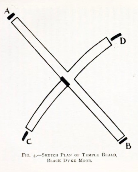
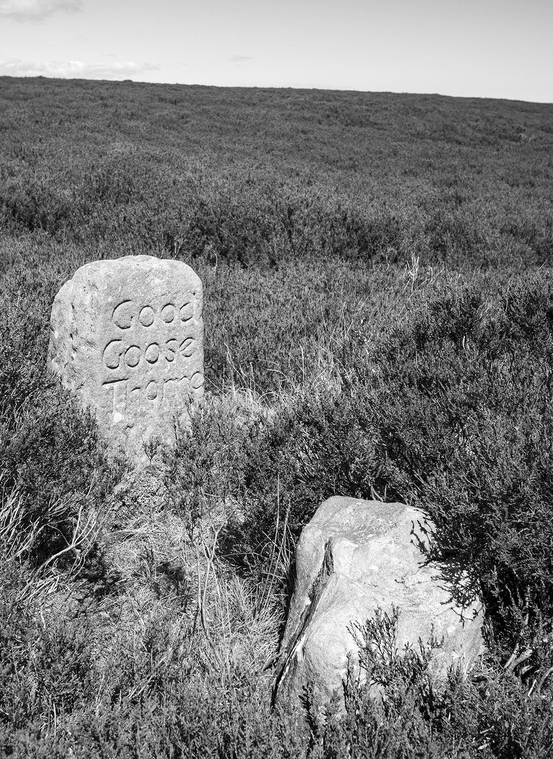
I pass one of the two Good Goose Thorne boundary stones that can be found on the moor. The beautifully mason-lettered stone stands beside it’s ancient predecessor.Ā  The path leads me across a section of Black Dike Moor marked as Horse Flesh on the old OS maps. I then drop down to the stepping stones across Black Dike Slack and walk up onto Temple Beeld Hill.

111111

Temple Beeld Hill, is barely a hill. On the higher ground is Temple Beeld itself. The North York Moors has many wonderful sites, what ever its origins, this one is definitely worth a visit.

Frank Elgee’s account and sketch plan of Temple Beeld

.. the most remarkable stones known to me occur on Temple Beald Hill on Black Dyke Moor, north of the village of Lealholm. Here, on a slight elevation between two boggy valleys, a quincunx arrangement of ancient menhirs has been converted into a cross- shaped beald or sheep shelter, shown on the annexed diagram. Originally, the site appears to have been occupied by five stones which are from four to five feet high ; those at C, D and in the centre, being thin and flat, and roughly shaped, whilst the two remaining stones at A and B are more regular and rectangular in form. High stone walls at a later period have been built between the ancient stones ; the wall from A to B is straight, and about thirty-five yards long ; and the wall from C to D decidedly curved and about twenty-two yards in length. This arrangement of the walls gives ample shelter to the moor sheep, and at one time the centre was partly roofed in ā€” the timbers of an old thatch still lie in an irregular manner across the central angles. That the five stones are of pre-historic origin is highly probable, seeing that the central one has distinct cup-like markings at the top of the only side visible. The name Temple, too, is suggestive of some ancient circle of stones, for whatever purpose constructed. It may also be remarked that the four stones are not built into the ends of the walls, but stand off a few inches in distinct hollows in the ground. Temple Beald is the simplest type of stone circle upon the moors, where they are far from common.

Elgee

Isn’t Quincunx a wonderful word?

In his 1987 book, Standing Stones and Earthworks on the North York Moors, Stanhope White describes how he surveyed Temple Beeld and sent the results to the Royal Observatory to ascertain whether the site had any astronomical alignments, none were found.

I’m sceptical regarding the Prehistoric origins of Temple Beeld as a monument. Three of the large standing may have been erected in prehistory but I suspect they may have been re-used and possibly relocated to create the sheep shelter around a central earth-fast stone. The cup-like marks that Elgee mentions appear to be the result of natural weathering. That said, I hope that one day someone proves me wrong because I love this place.

‘Noble ruins stand only where virgin stone is plentiful’

111

On my return I call in on the Nan Stone located on the edge of Hardale Slack above the Roxby Peat Holes.Ā  The stone has its name carved into it, faded but still legible. As with the Good Goose Thorn, the stone stands beside an earth fast boulder. The older stone has a cross carved into it. I have seen this on other moorland stones, I have also seen these crosses explained as the ‘christianisation’ of an ancient pagan stone. I suspect that the explanation is far simpler and involves the marking of the stone to identify it as a boundary stone. I am planning to write a blog post soon exploring these boundary stones and their meaning.

These three moors are a place that I am constantly revisiting, over the years I have learned much about the North York Moors by walking their tracks and revisiting their sites. A first glance these Moors may appear to be a featureless places, set foot on them and you’ll soon learn that this is not the case.

1

Sources

The Moorlands of North-Eastern Yorkshire – Frank Elgee. 1912

Standing Stones and Earthworks on the North York Moors – Stanhope White. 1987

Rey Cross ii

OE stan ‘stone, stones’ is a very common pl. el. It is used alone as a pl. n. in STAINES, STEANE, STONE, where a Roman milestone or some prominant stone of another kindmay be referred to.

The Concise Oxford Dictionary of English Place Names. Eilert Ekwall. 1959

I recently took a trip over the Pennines to Cumbria. On the way home I stopped on Stainmore to have a look at Reyā€™s Cross. The Cross is located in a lay-by beside the A66. The A66 crosses the Pennines through the Stainmore Gap, a Pennine pass that was created by the flow of ice sheets during past glacial periods.

Historically, This part of Stainmore has always been important. The moor is rich in late Prehistoric remains. It was also the site of a large Roman marching camp, within the ruins of the camp is a wrecked prehistoric stone circle. Legend has it that the stone cross was raised as a memorial to Eric Bloodaxe, the last king of York, who was slain on the moor in 954.

Eric_Bloodaxe_coin_b

The cross, situated near the highest point of Stainmore, is close to an ancient county boundary, is a weathered shaft set into a substantial stone base and is thought to date to the early anglo saxon period. The name`Rey’ is thought to have been derived from the Old Norse element `hreyrr’ which can be taken to mean a heap of stones forming a boundary.

OLYMPUS DIGITAL CAMERA

One of the earliest references to the stone is from The Chronicle of Lanercost where it is call ” Rer Cros in Staynmor ” The chronicler states that it was set up as a boundary marker. The boundary was between the Westmoringas and the Northumbrians, the Glasgow diocesan border, before that it marked the border between the Cumbrians and the Northumbrians.

map

The antiquarian William Camden tells us ” This stone was set up as a boundary between England and Scotland, when William (the Conqueror) first gave Cumberland to the Scots.”Ā  Camden was incorrect, at the time of the Norman conquest much of Cumberland was already under Scot’s rule. The historic county of Cumberland was not established until 1177, however the stone could still have marked the boundary of the territory.

The A99 was widened in the early 1990ā€™s so in 1990 the stone was moved from the south side of the road to its present site on the north side. An archaeological survey and excavation was undertaken as part of a wider archaeological project, sadly no burial was found beneath or around the stone.

OLYMPUS DIGITAL CAMERA

What fascinates me about this stone is that it marks a place that has been significant to the people of our islands for thousands of years. The people of the Neolithic period used this as route way between the east and west coasts. Later, the people bronze age erected a stone circle close to the site. Later still, the Romans heavily fortified road to guard the legions marching between Catterick and Penrith and it has remained the primary northern trans-pennine link ever since.Ā  A hundred or so metres west of the stone is the modern east/west boundary between Cumbria and Durham and the route was also once the medieval border between Scotland and England. East meets west, north meets south all within sight of the weather-beaten old stone.

Three stones

Blakey Ridge – The Honey Poke – Flat Howe – Esklets – Sweet Banks – South Flat Howe – Bimshaw – Blakey Gill Head

It was a fine day on the coast so I thought I’d take a walk onto the moors. As I climbed onto Castleton Rigg the wind picked-up and the skies started to darken. I decided to wander over to the head of Westerdale via Flat Howe and the remains of the Blakey colliery bell pits.

OLYMPUS DIGITAL CAMERA

The moorland path starts at one of the most accessible of the moorland prehistoric standing stones, Margery Bradley. The view is to the south into Rosedale.

OLYMPUS DIGITAL CAMERA
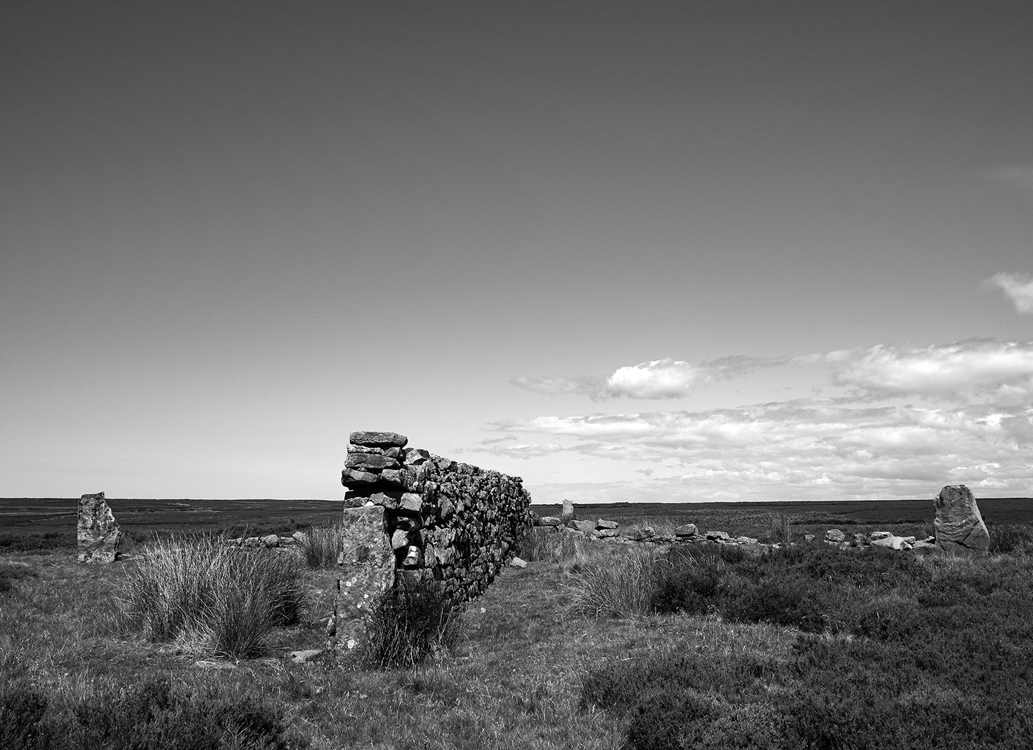
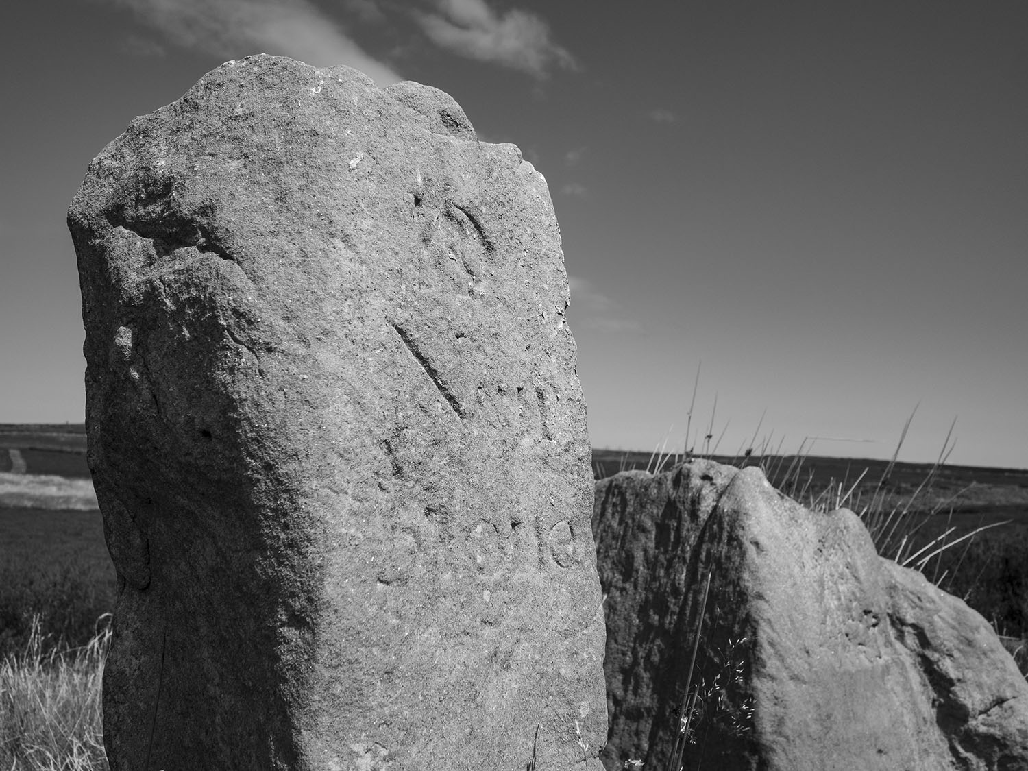
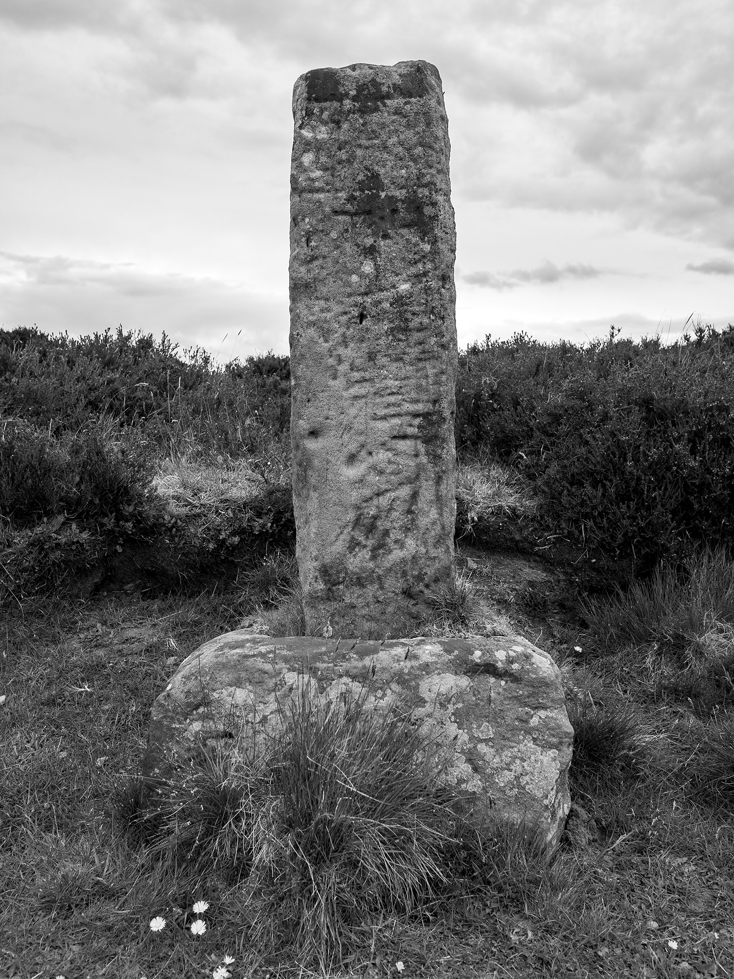
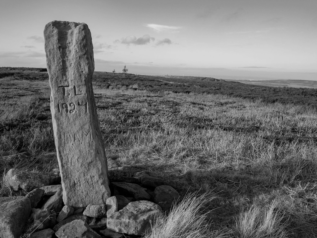
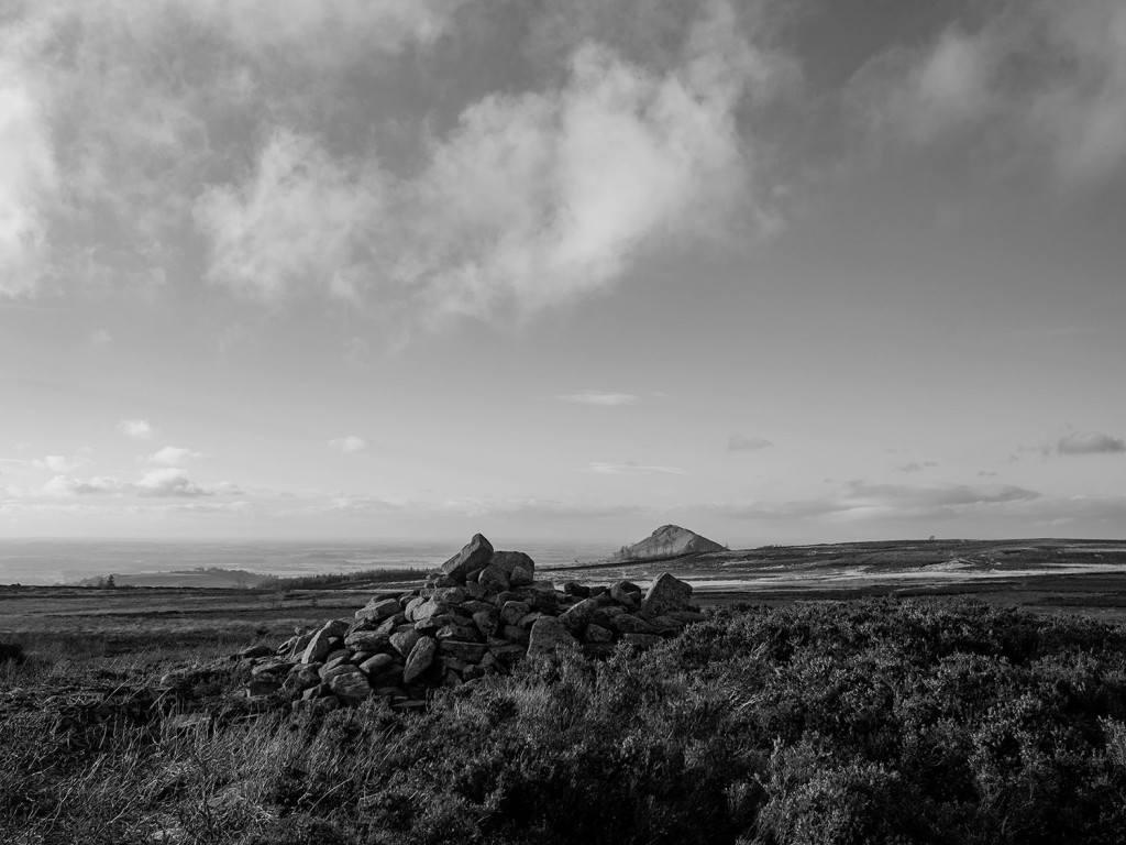
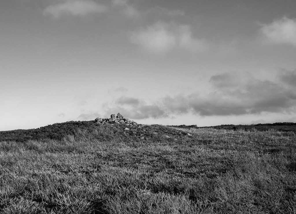
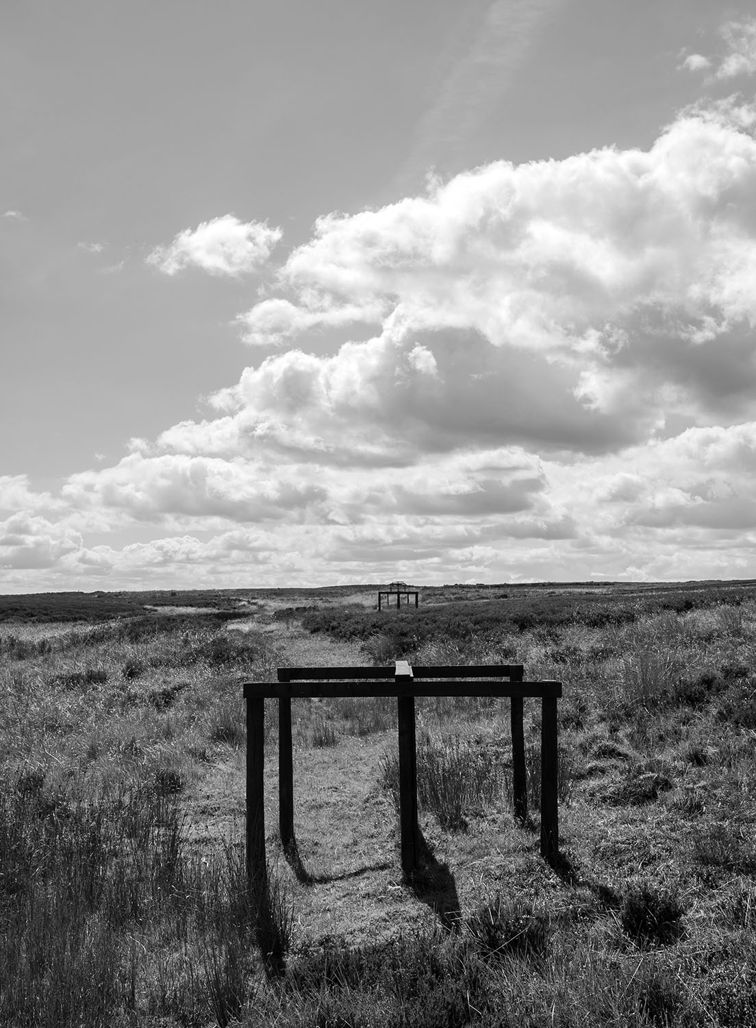
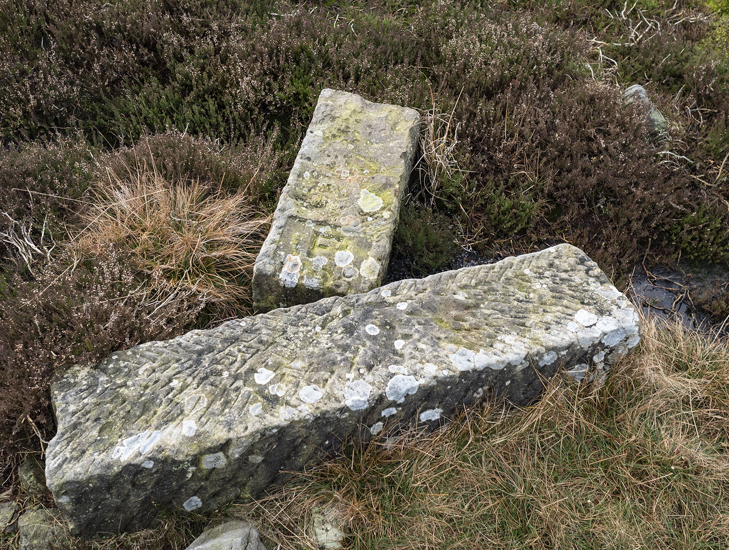
The path is marked by small walker’s cairns and the occasional estate boundary stone. This one, marking the boundary of the Feversham Estate, has been broken for many years.

OLYMPUS DIGITAL CAMERA

Moorland sands wash out from the peat and collect on the trackway.

OLYMPUS DIGITAL CAMERA

Towards the head of the valley the remains of ancient trees are visible where the peat has eroded away.

OLYMPUS DIGITAL CAMERA

Sediment profiles taken at nearby Esklets also provides a vegetation record from the late Mesolithic, showing a heavily wooded landscape dominated by alder and hazel, perhaps indicating low stature woodland, rather than oak forest.

OLYMPUS DIGITAL CAMERA

Netting made from natural fibres has been laid on the worst of the eroded areas, presumably to give the moorland grasses a foothold and try to limit the erosion of the peat.

OLYMPUS DIGITAL CAMERA

The weather suddenly changes as a storm blows-in from the west. As the storm increases I decide to head back.

OLYMPUS DIGITAL CAMERA

The storm has passed, I arrive back on Blakey Ridge close to the old road mender’s boundary stone.

SourceĀ  North East Yorkshire Mesolithic Project Phase 2 Report by Mags Waughman