Wandering Upper Teesdale with Graham Vasey looking for an outcrop of the Cleveland Dyke.
Hudeshope, Elphatory Allotment, Coldberry Gutter, Cleveland Dyke, Harberry Hill, Pikestone, Skears, Brown Dodd
Wandering Upper Teesdale with Graham Vasey looking for an outcrop of the Cleveland Dyke.


Hudeshope, Elphatory Allotment, Coldberry Gutter, Cleveland Dyke, Harberry Hill, Pikestone, Skears, Brown Dodd
A recent online conversation with a friend re-sparked my curiosity about the Tank Road. It’s an area that I’ve visited many times over the years, I’ve always felt that it was an important place but I’ve never fully got to grips with it. So I decided to walk it and try to pull together a description of the area.

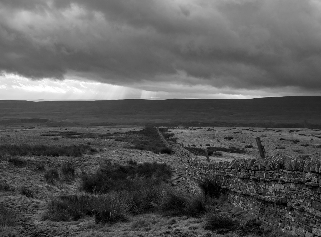
I’ve always known it as the Tank Road or Old Tank Road, presumably it got this name from when it was used as a Tank training ground during WWII. The road itself is only 3.5km long, it runs between the main north-south roads to Castleton and Danby. From east to west, the road starts on the main north-south road to Danby and then crosses Gerrick Moor, Tomgate Moor and Middle heads where it meets the Castleton Road at White Cross on Three Howes Ridge.
On walking the road it becomes apparent that it was a busy route in the past, there is evidence of a number of sunken trackways, following the line of the road and joining the road from other routes, this becomes more obvious when you look at the LIDAR images of the area.

Regarding the origins of the road itself. There have been two excellent books written on the trackways of the North York Moors, Old Roads and Pannierways in North East Yorkshire by Raymond H. Hayes and Trods of the North York Moors by Christopher P. Evans. Hayes regards the route as possibly part of the Pannierman’s Causeway from Castleton to Staithes. Evans thinks it is part of a trod from Liverton Moor to Commondale. I suspect this route may have its origins in Prehistory.
Walking from east to west.

The road starts at the bend of the road that runs from the A171 to Danby where there is a small parking area. I definitely would not recommend trying to drive along the road. The road crosses a number water courses, the boggy areas have been filled with building rubble, it’s not unusual to find parts of cars on the side of the road.

The most prominent monument at the start of the road is a large Barrow, one of a group known as Robin Hood’s Butts. Danby Beacon can be seen in the distance in the image above .

The next group of monuments lie just south of the road comprising of a barrow and an embanked circular feature known as an Enclosed Urnfield. The enclosure and barrow date to the Bronze Age. The enclosure was a place where the cremated remains of the dead were placed, often in small pottery vessels. This type of monument is quite rare, they are generally only found in Northern England and Southern Scotland. Only 50 examples are known, 3 of which are within a few minutes walk of the Tank Road.
Photographing many of these prehistoric monuments is quite difficult, most of them are fairly low-lying features, covered in heather on a heather moor. The vegetation is quite low at the moment so this is probably the best time of the year to visit and once you get you eye in they are not to difficult to spot. I’ve included a few Open Access LIDAR images as they give a better idea of the form of the monuments.
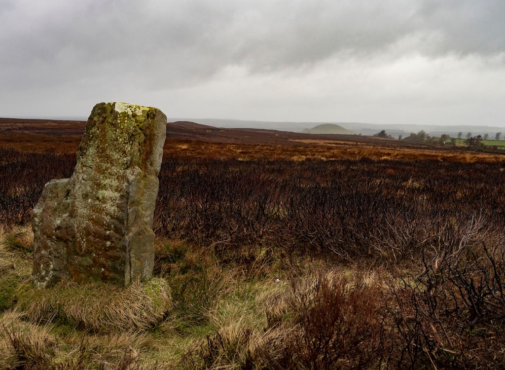

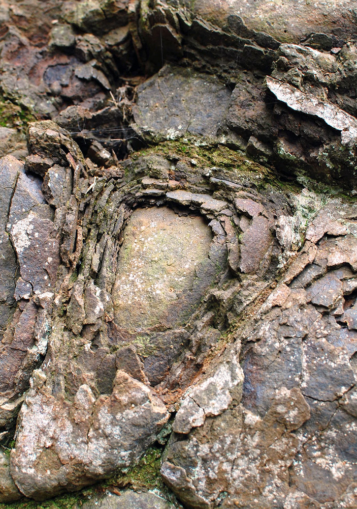
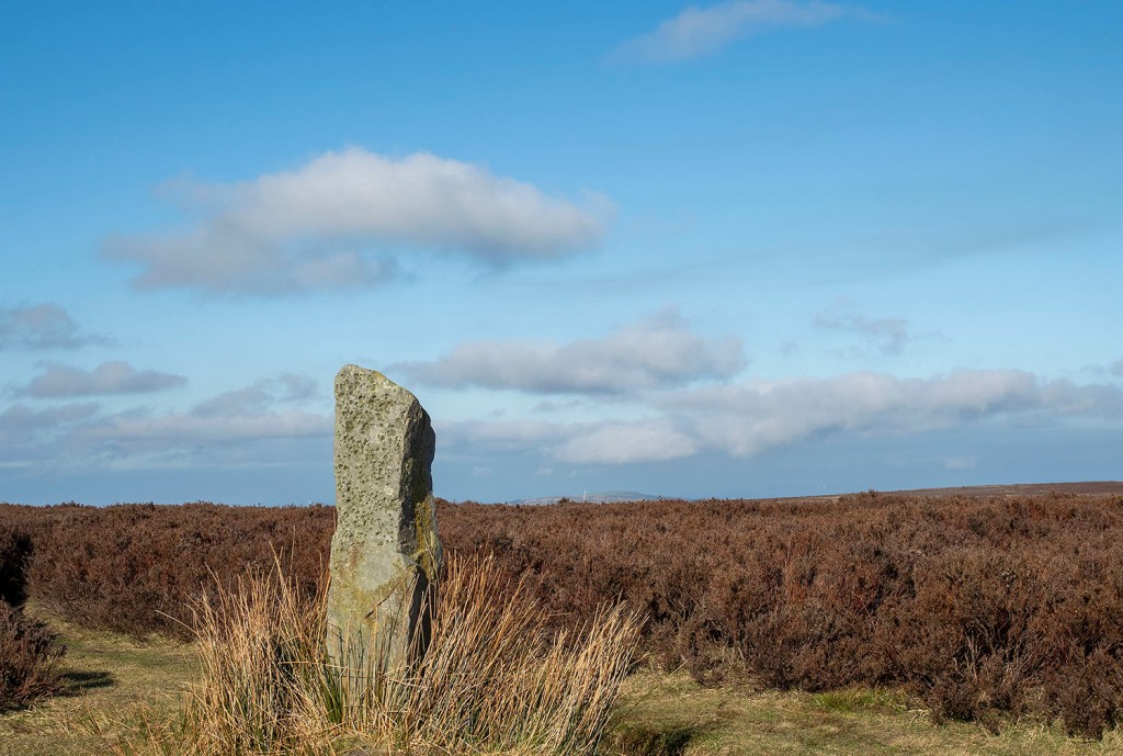
To the north of the road is a large standing stone. The stone is unusual as it is ‘L’ shaped and its surface has fossil ripple marks on its surface. There are no obvious outcrops of stone on this part of the moor, but there is an outcrop with similar ripple marks on the western flanks of Siss Cross Hill just under 2km away. Perhaps this was the source of the stone.
In the top image, behind the standing stone, you can see the large burial mound of Herd Howe in the middle distance and beyond that Freebrough Hill. Just below Herd Howe is an enclosure that dates to the Iron Age. I have previously written an account of the enclosure, Herd Howe and the nearby Cross Dyke.
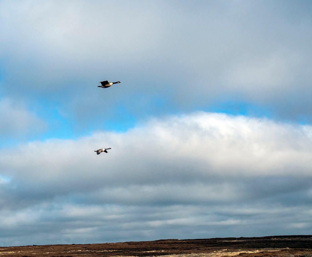
On my last two walks along the road I have seen quite a number of geese. I presume they are overwintering here. On my last visit this pair flew towards me honking, circled me and then headed back to Dimmingdale.


Leaving the road I followed a track south to have a look at Siss Cross. The cross is a crude unworked upright stone, it may be a replacement for the original cross. Running down the hill from the cross are a number of sunken trackways, perhaps the cross was a route-marker. Back in the 19th Century local Antiquarian J.C Atkinson discovered what he described as a flint tool making site just south of Siss Cross. He collected enough flint tools and debitage to fill ‘half a fair sized fishing basket’. The flint tools are thought to have been made by Mesolithic hunter gatherers. The site would have been a good place for a hunting camp, it is well drained and has a large viewshed, even on a muggy day I was able to look along the Esk Valley and make out the distinctive profile of the RAF site on Fylingdales Moor over 21km away.

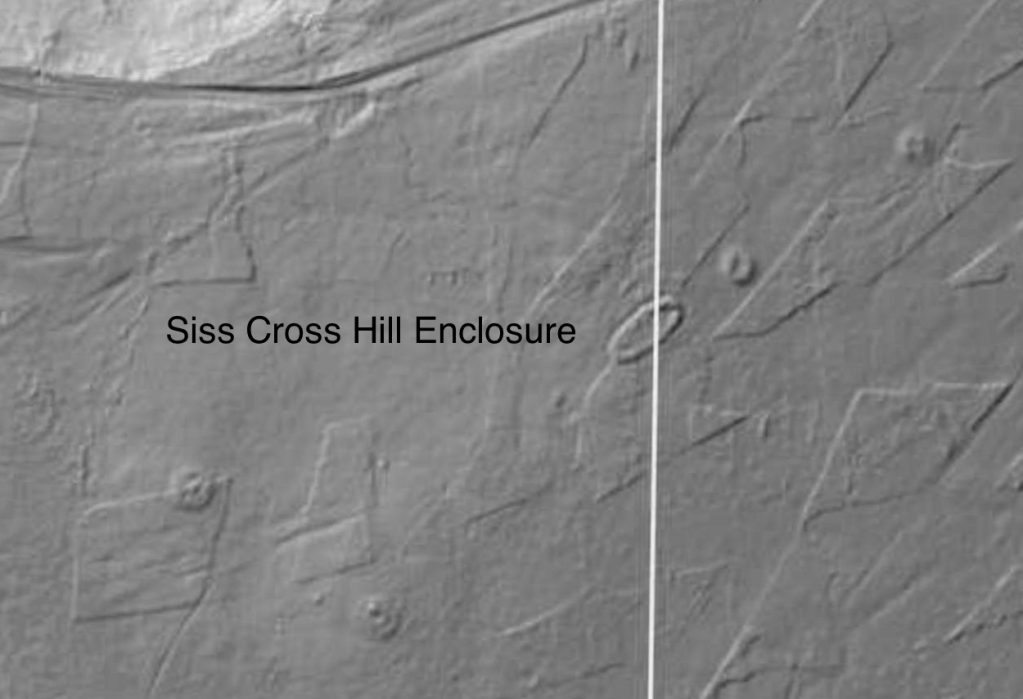

I headed back to the Tank Road via the Trig point on the top of Siss Cross Hill. There is another Enclosed Urnfield with associated Barrows here. Unlike the previous enclosure this one is oval in shape and quite large 38x20m. Interestingly, the enclosure and the two associated barrows are aligned on the western-most Barrow of the Robin Hood’s Butts group. This alignment is also roughly the direction of the Midsummer sunrise and Midwinter sunset. The enclosure is also intervisible with the third Enclosed Urnfield on Moorsholm Rigg.


I walked back onto the road from Siss Hill and followed it down into Ewe Crag Slack. The slack is a former glacial drainage channel and is generally quite boggy. The keepers and the farmer struggle to keep the road passable down here, the place is a jumble of boulders, concrete posts and deep muddy ruts.

Ewe Crag Slack is a significant location in the study of prehistory on the moors as it was one of a number of places where Paleoenvironmental pollen cores were taken from the peat and the sediments below it. The data from Ewe Crag helped provide evidence that the people who lived here during the Mesolithic period may have been actively managing the land. The pollen cores showed evidence of forest destruction and subsequent soil erosion, this combined with charcoal deposits suggests that people may have been creating forest clearings much earlier that was previously thought.

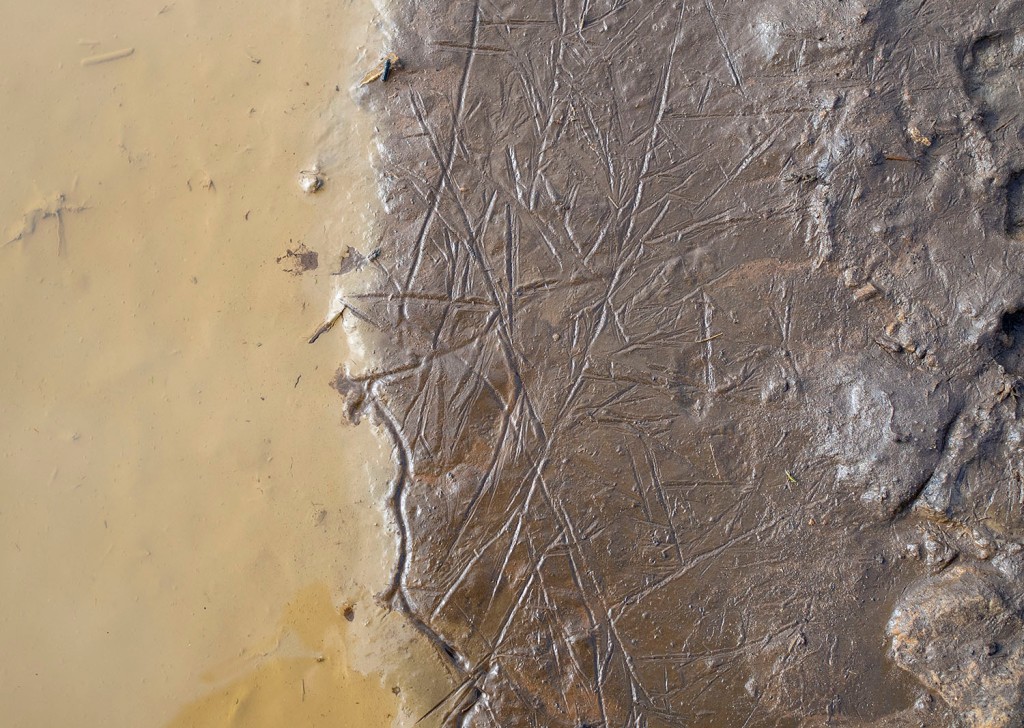
I noticed this boulder by the side of the road. The boulder has been broken but you can see that it’s original form was rounded. The rock type looks like a fine grained igneous rock, basalt or andesite. I presume it is a glacial erratic. It’s curious because less than a kilometre away, at Dimmingdale, is a barrow that was excavated in the 19th Century by J.C. Atkinson, the same antiquarian who found the Siss Cross Flints. Atkinson wrote that the barrow contained ‘blocks of basalt from the Cleveland Dyke’. It is possible that the stones came from the Cleveland Dyke, the nearest potential outcrop that I’m aware of is at Scale Cross 4.2km away, where it was quarried in the modern era. I wonder if the barrow stones may have originated closer to home as glacial erratics washed-down to Dimmingdale when the ice began to melt. One for further research.


Walking the final section of the road to White Cross my camera battery died. The final 2 images were taken when wandering the road in 2017, they are a Danby-Moorsholm guidestone & White Cross.
Resources
Lidar Maps – Open Data Maps
Old Roads and Pannierways in North East Yorkshire by Raymond H. Hayes. 1988
Trods of the North York Moors by Christopher P. Evans. 2008
Early Man in North-East Yorkshire by Frank Elgee. 1930
Excavated Bronze Age Burial Mounds of North East Yorkshire by M.J.B Smith. 1994
Along The Esk. A Guide to the Mining Geology of the Esk Valley by Denis Goldring. 2006
Another name for the Cleveland Dyke is the Armathwaite-Cleveland Dyke. The dyke outcrops in the Eden Valley at Armathwaite where it forms a weir across the river.


This natural weir was exploited in the past by a watermill on the Armathwaite side of the river and a salmon fishery on the other. The mill site is currently being redeveloped, all thats left of the fishery is a ruined building and a large keep pool.


The dyke was quarried on a small scale locally
Heading south on the A6 I noticed this.
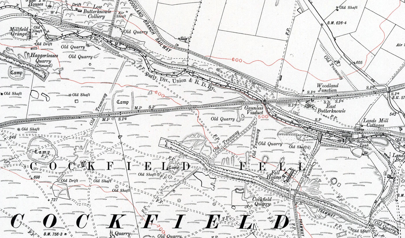
Cockfield Fell is described as “one of the most important early industrial landscapes in Britain”. In addition to four Iron Age (or Romano-British) settlement enclosures, there is evidence within the landscape of early coal mines (the Bishop of Durham licensed mining here at least as early as 1303), medieval agricultural field patterns, centuries of quarrying activity, a railway line established in the 1830s and several earlier tramways All together, Cockfield Fell constitutes England’s largest Scheduled Ancient Monument, described as ‘an incomparable association of field monuments relating to the Iron settlement history and industrial evolution of a northern English County’. One reason for its preservation – unusual for a lowland fell – is that it was not subject to enclosure in the 18th or 19th centuries, perhaps due to its highly industrialised past. Source
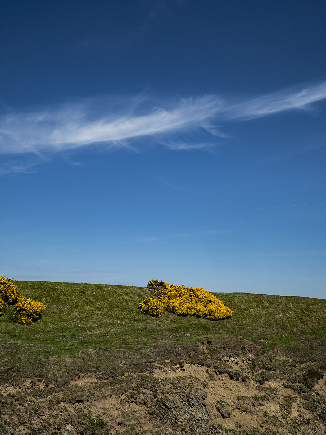
The fell is ablaze with fragrant golden whin


The Cleveland Dyke outcrops on the fell and was quarried for roadstone.


The remains of the Gaunless Viaduct
Gaunless ME gaghenles ‘useless’ (from ON gagnlauss). The name may refer to scarcity of fish or the like. English Place-Names. Eilert Ekwall. 1959
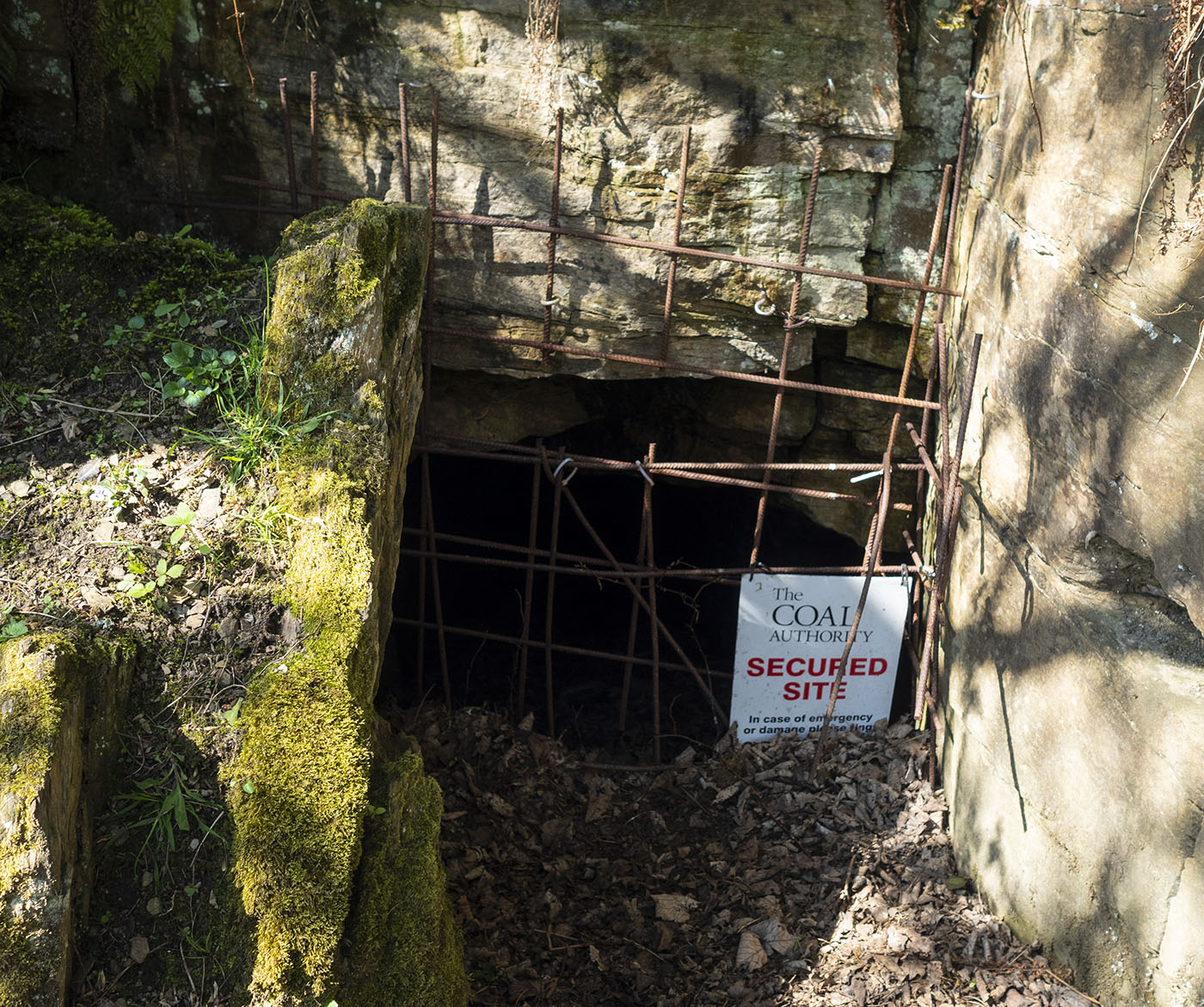
Coal was mined on the fell from the early medieval period until the late nineteenth century


Beehive coke ovens on the valley floor
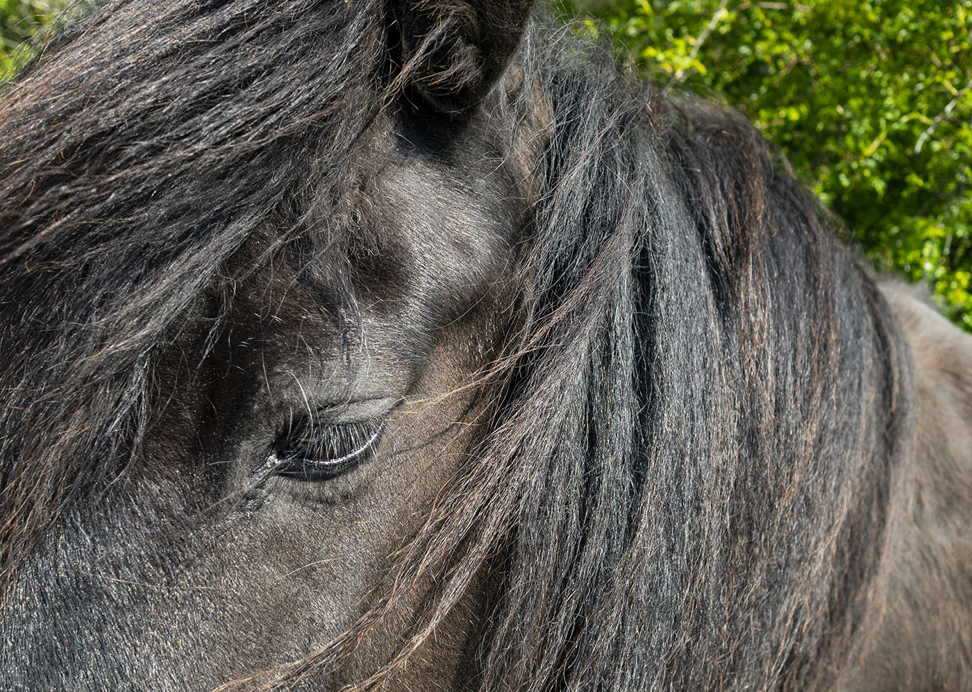
A beautiful Cob keeps me company
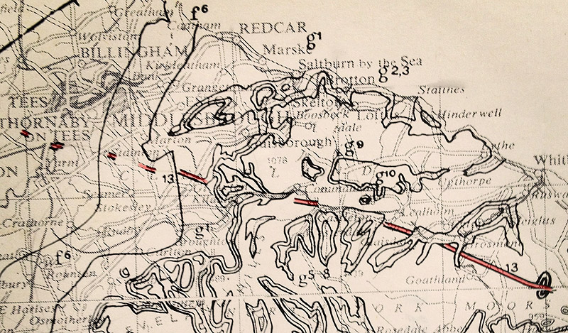
Map reproduced with the permission of the National Library of Scotland
Many thanks to Graham Vasey for showing me around this wonderful place
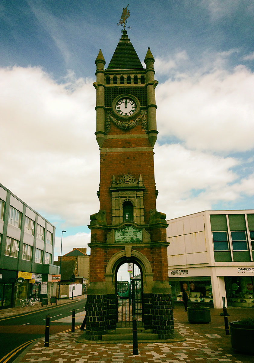
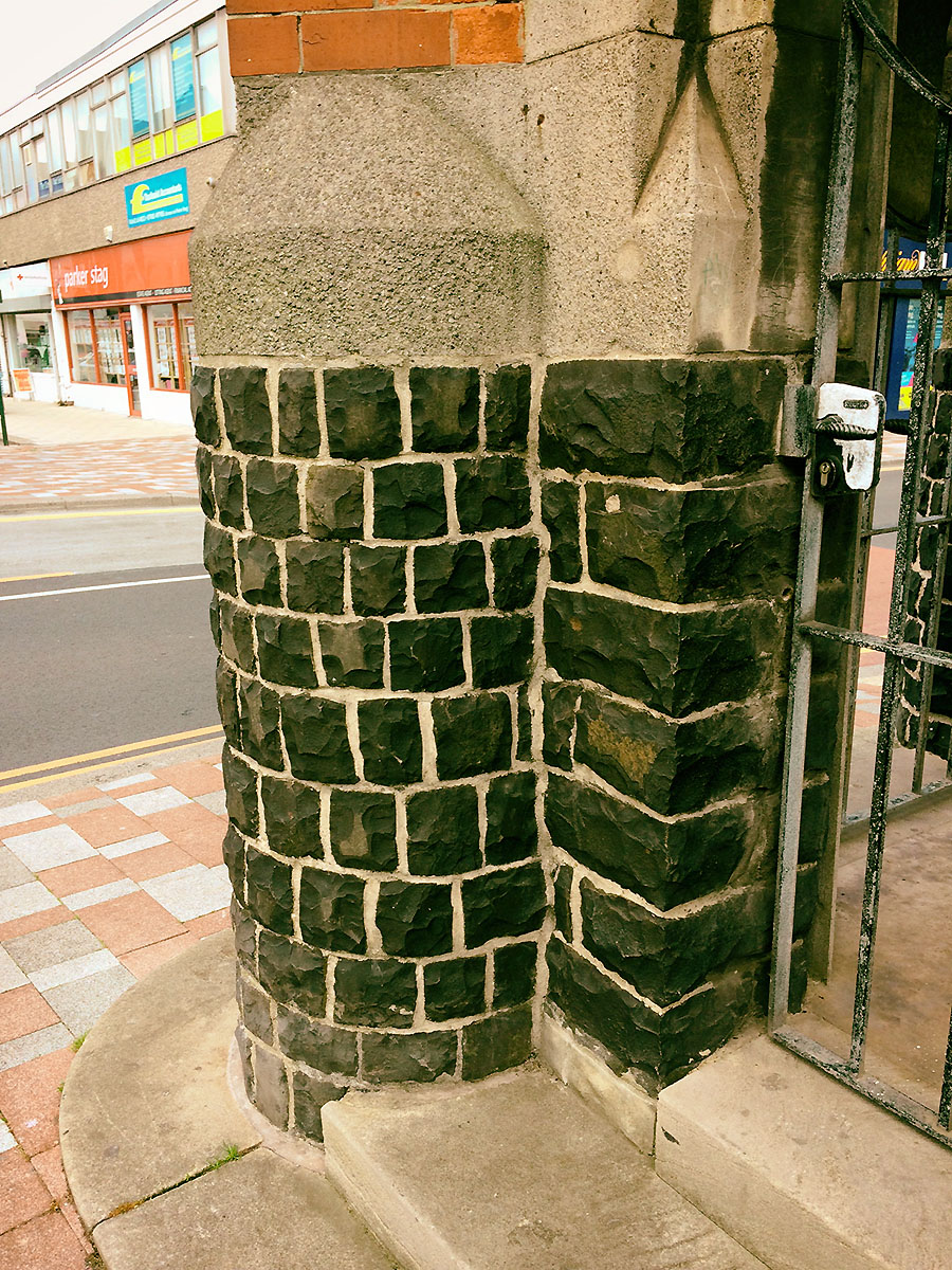
The Redcar Memorial Clock tower was designed by John Dobson and erected in 1913 in memory of King Edward VII. It is built of red engineering brick and concrete. The plinth is made of Whinstone, making it one of the few buildings in the area that utilises this local stone.
Grey Towers in Nunthorpe, built for William Hopkins, and the former home of Arthur Dorman, is also faced with Whinstone.
The Cleveland Dyke is a band of igneous rock that was injected, whilst molten, into the local rocks during the Tertiary period of geological time (approx 60 million years ago). The dyke originated in a large magma chamber beneath the Island of Mull on the west coast of Scotland and has been estimated to have taken between 1-5 days to travel to North Yorkshire.

Looking from Cliff Rigg Quarry to the Langbaurgh Ridge. The old quarry sites along the ridge can be seen between the trees. I have often wondered whether the people who lived in this area during prehistory used the Langbaurgh Ridge as a routeway from the River Tees to the moorlands. Bronze Age burials have been found in Ingleby Barwick close to the outcrop of the dyke. There are many prehistoric sites around the outcroppings on the North York Moors, particularly on Fylingdales Moor.
The dyke is mainly buried beneath glacial deposits but outcrops at a number of locations across Cleveland and the North York Moors. Where ever the dyke outcrops it has generally been quarried away. The rock, a basaltic andesite but popularly known as whinstone, it is a very hard rock and was ideal for road building both as a hardcore and to make setts and blocks for surfacing.

During the late 1800’s Leeds Corporation operated the quarries at Cliff Rigg just outside Great Ayton. The Middlesbrough to Whitby railway runs just beneath the quarry so it was possible to extract the stone and ship it by rail to Leeds.
Ironstone was also mined at Cliff Rigg and the surrounding area.