The ongoing destruction of a Prehistoric Round Barrow on Patterson’s Bank

https://www.gazettelive.co.uk/news/teesside-news/soapwell-wood-damage-mountain-bikers-20207591?fbclid=IwAR0wnHEwGSZ8cvEilmhQMX5nmqrXHo_94ppyWpYgGShfcVJrXbv3LSSiQbc

The Prehistoric Round Barrow on the margins of the woods at the top of Patterson’s Bank is currently being destroyed by cyclists. The Barrow is one of few that survive in this area. It is a Scheduled Monument and is legally protected. It is also a burial monument and contains the remains of our Prehistoric ancestors. Action is urgently required to prevent the destruction of this beautiful monument.

Lealholm Moor

2

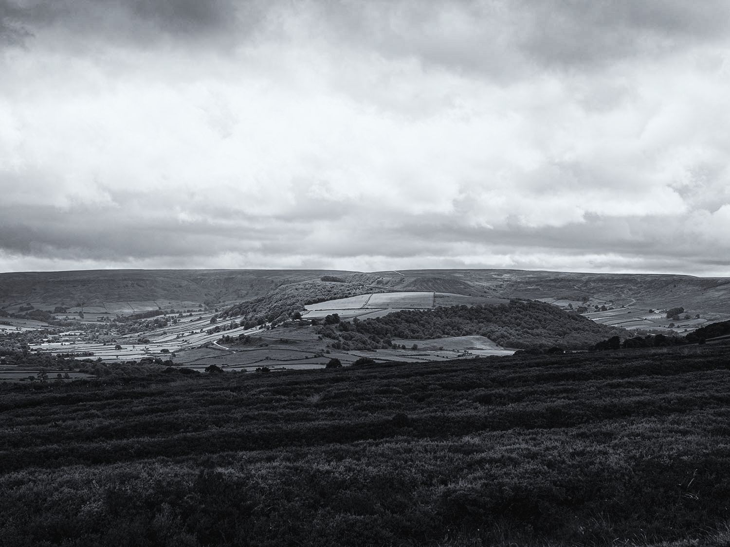
I took a walk from Danby Beacon to Lealholm Moor to have a look at a Ring Cairn that I had recently read about.

1

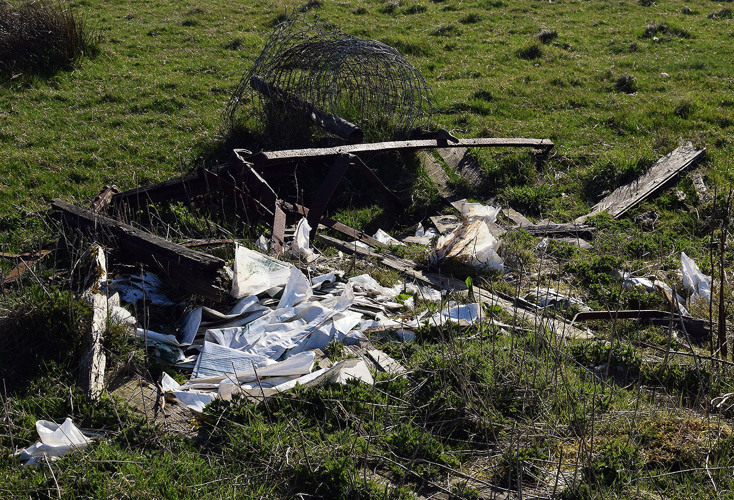
The wide track from the Beacon is made of slag, the slag would probably have been brought from the furnaces of Teesside during the early days of WWII when a large radar installation was built on the moors. Ironstone travelling from Rosedale and the Esk valley down to the furnaces of Teesside with iron-rich slag returning to the moors.

1

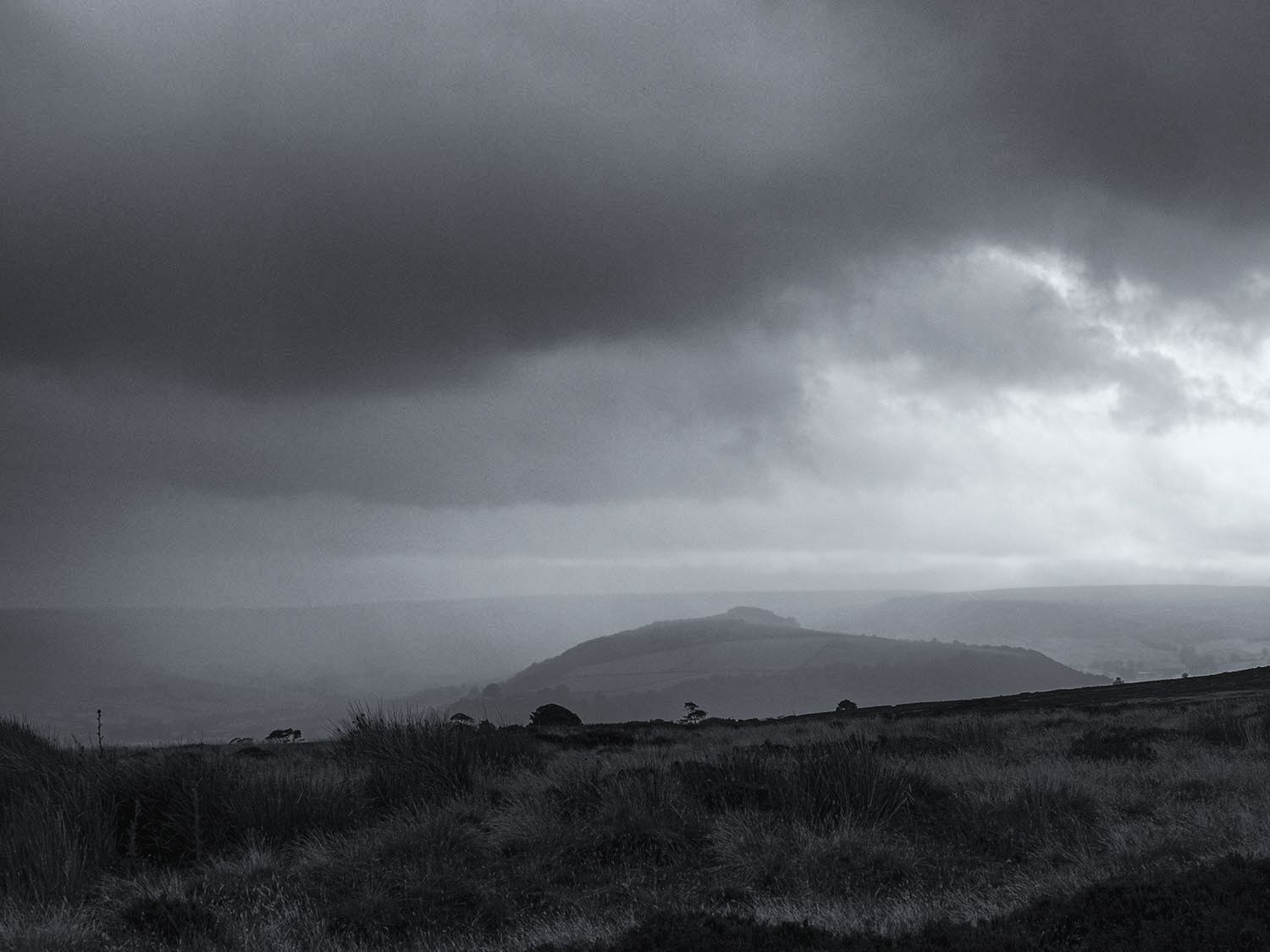
A rainstorm blows into Great Fryup Dale from the high moors

1

The storm tracks along the Esk valley, the sun briefly follows behind.

1

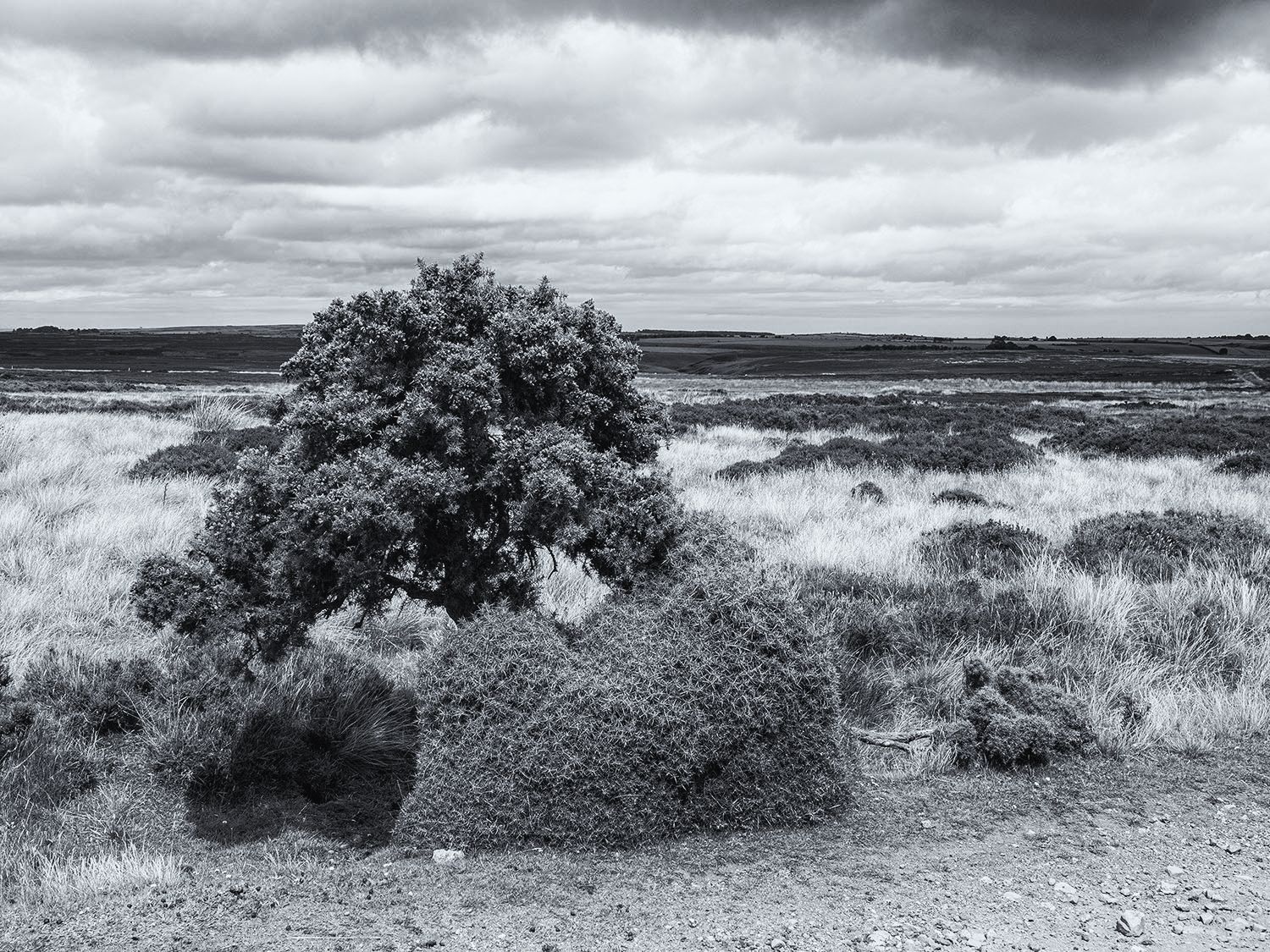
At the side of the track a gorse bush has grown a hedge around its base, a prickly windbreak for itself and the moorland sheep

1

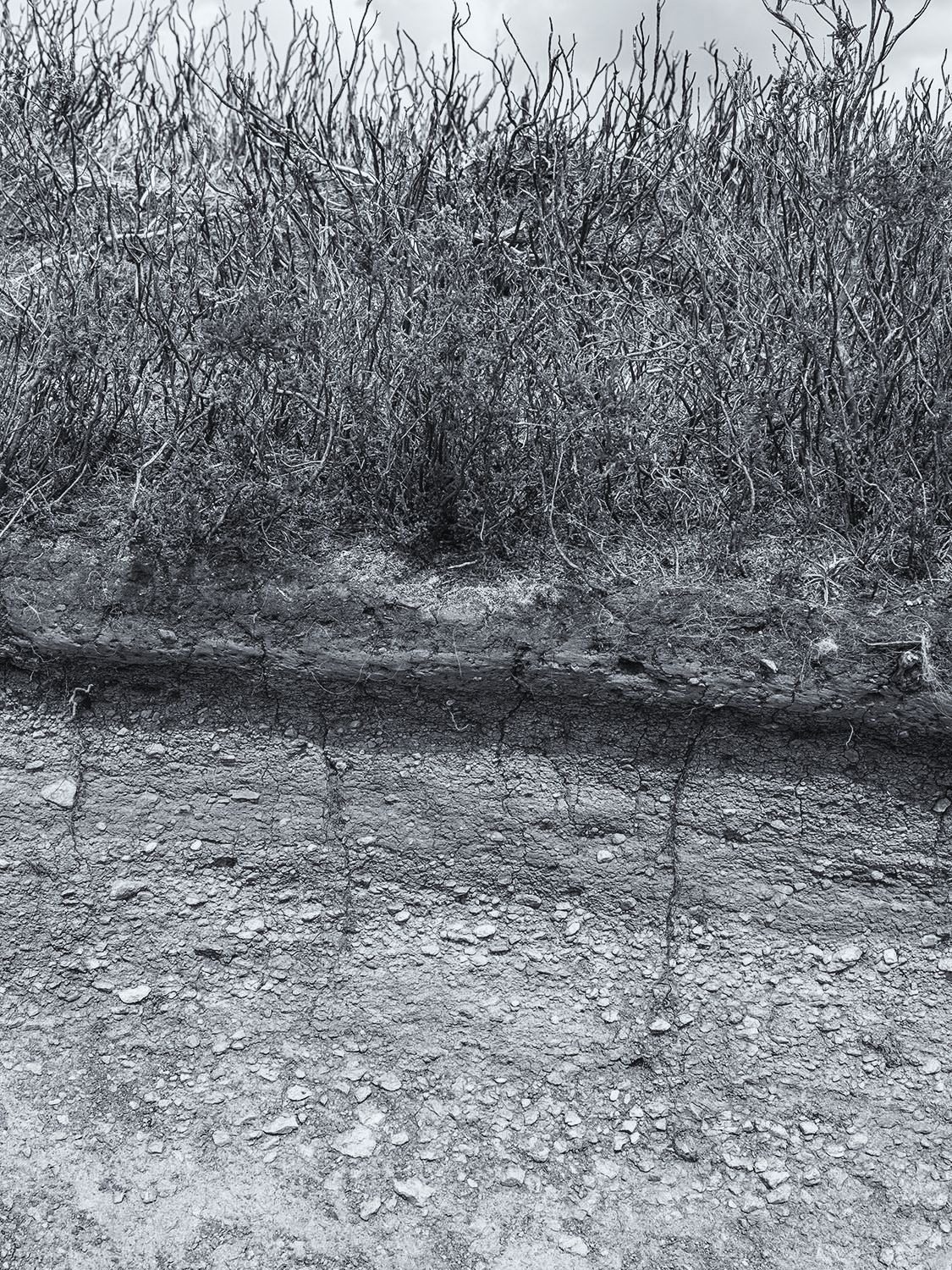
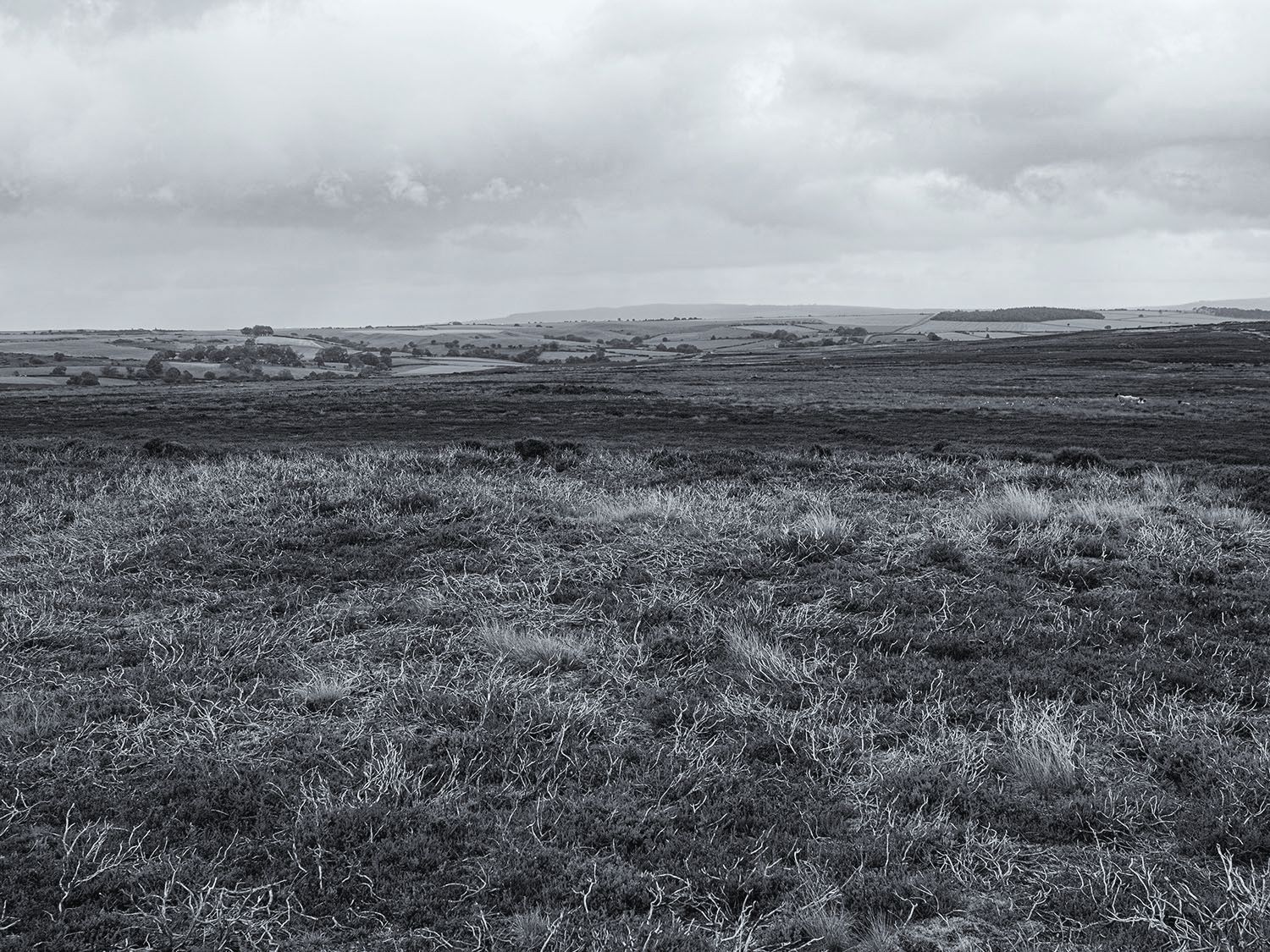
On the rigg the thin moorland soils offer little, this is compounded by the regular burning and draining of the moors, ensuring that very little apart from heather and a few grasses can thrive. In times of increasing climate instability and the loss of native species, the management of grouse moors is coming under increasing pressure to change its ways.  Stanhope White once called the moors ‘a man made desert’.

2

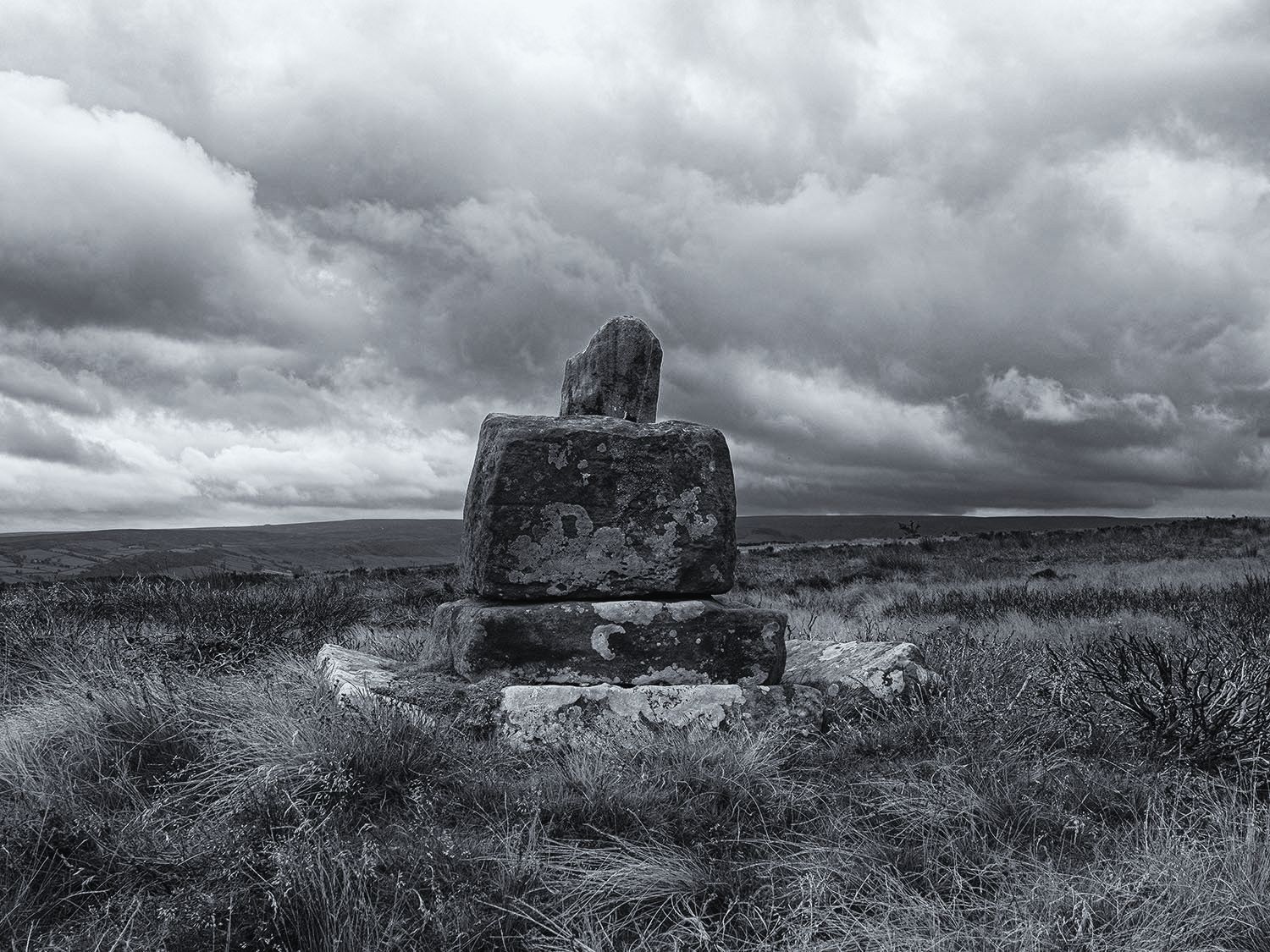
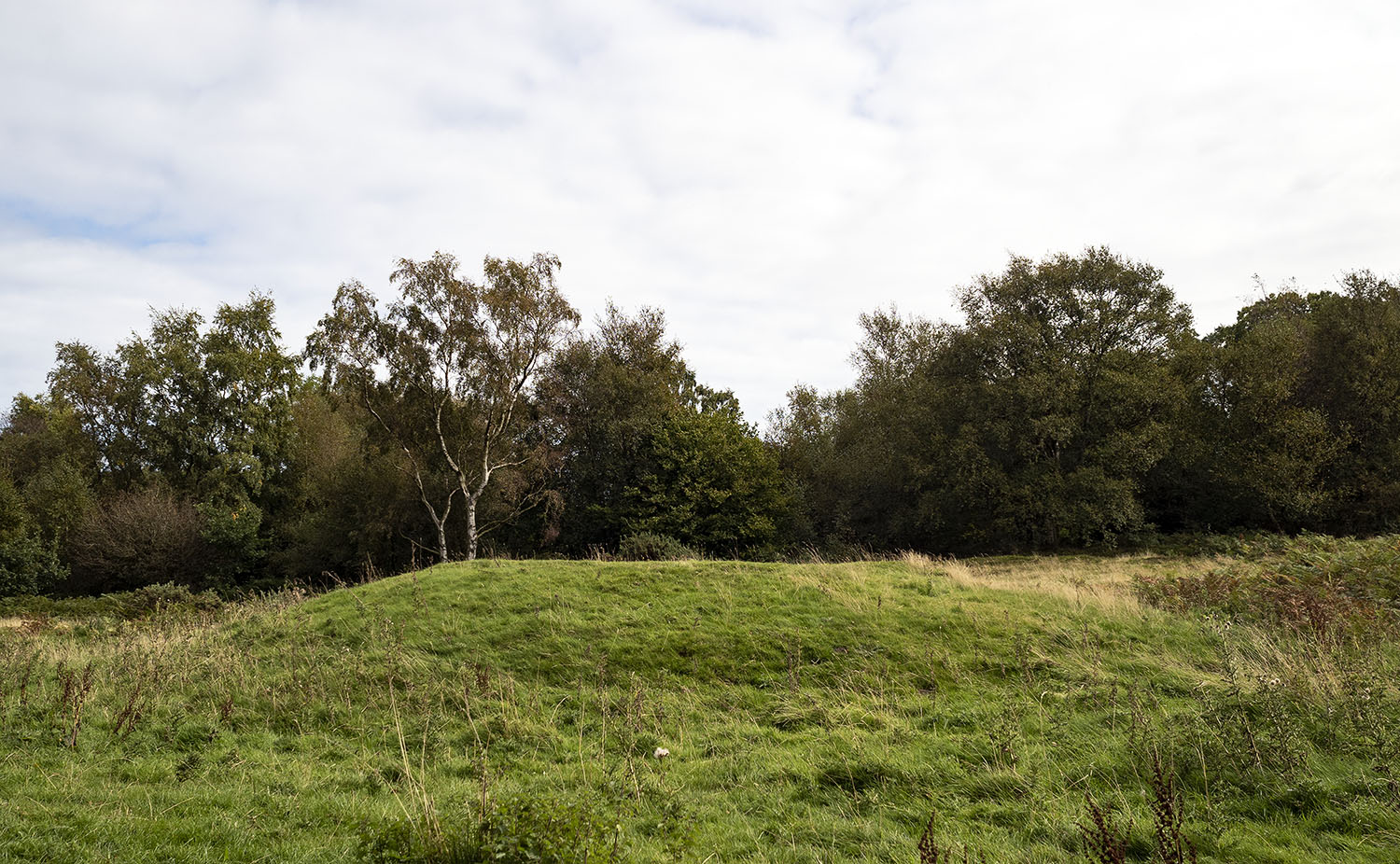
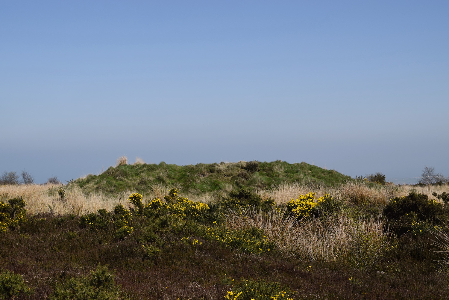
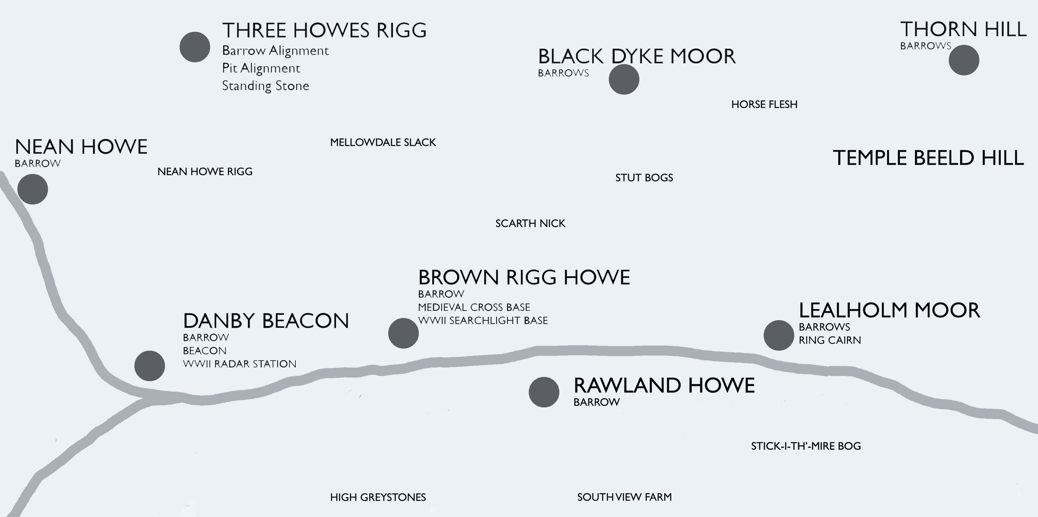
A moorland cross base and cradle, the remains of Stump Cross. The cross was located at the junction of 2 medieval trackways, Stonegate and Leavergate.

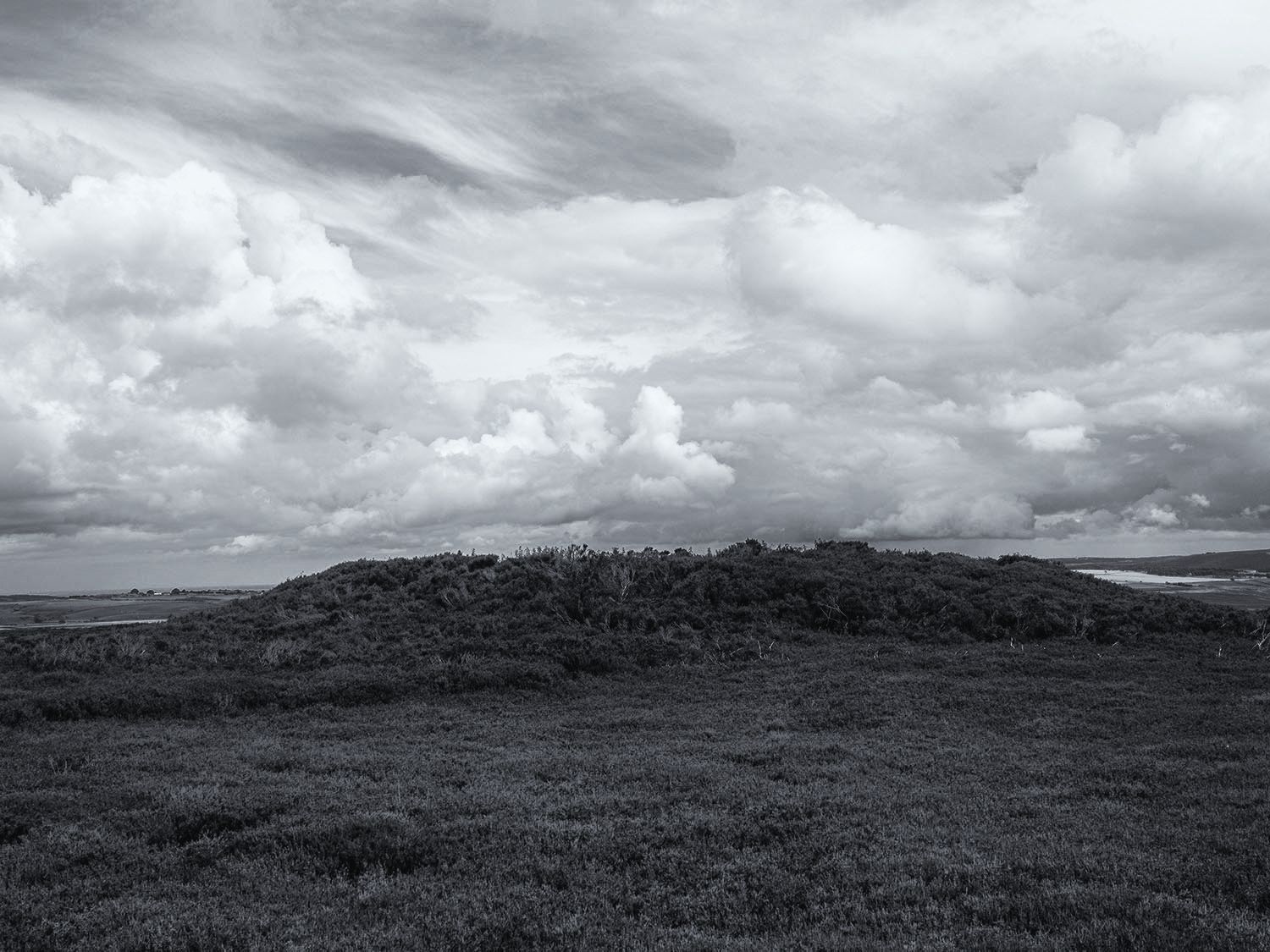
The cross base sits at the foot of Brown Rigg Howe, a Bronze Age Round Barrow located on a small hill. The barrow is intervisible with a number of other prehistoric monuments including mounds on the other side of the Esk Valley.

1

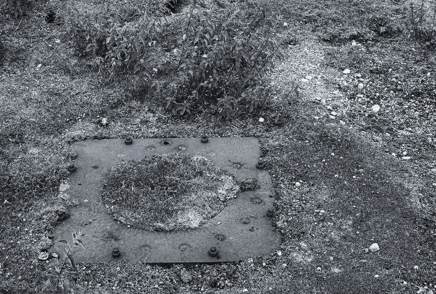
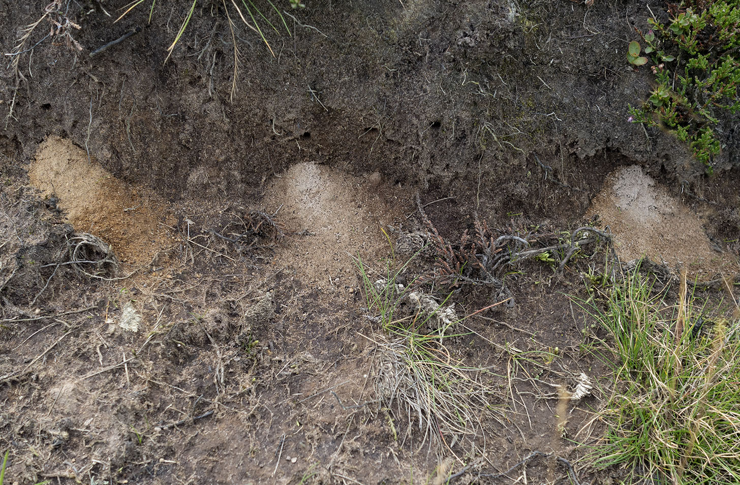
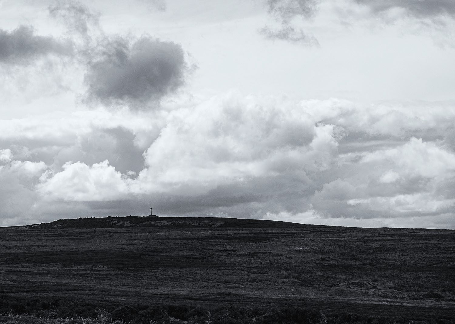
On top of the barrow is a steel plate, a base plate of a military searchlight, used for guarding the nearby Radar station during WWII.

ironstone-axe-blade
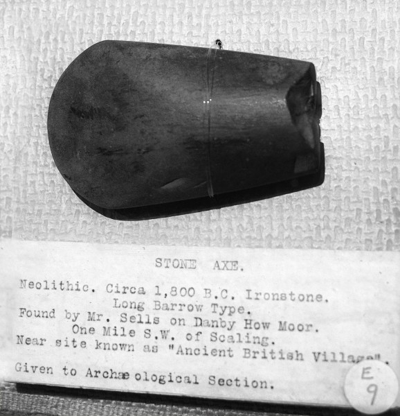
The Brown Rigg barrow was opened by Canon Atkinson of Danby, he found a cremation burial and a stone axe made of basalt. A number of stone axes have been found locally including one made from Ironstone, it is now in the Whitby Museum.

1

Rabbits have made the mound their home, their paths revealed where the heather has been burned-off.

2I walk on to the next barrow, a gamekeeper cruises by in his large 4×4. The keepers work for the Baron of Danby, Viscount Downe owner of the Dawnay Estate. The Dawnay estate website states that the Barons ancestors came from Aunay in Normandy. I would like to think that a number of my ancestors lie beneath the earth and stone mounds of the moors.

1

I arrive at the Ring Cairn. As with most surviving North Yorkshire moorland Ring Cairns there is very little to be seen, the 14 meter diameter ring can just be made out in the heather.

What draws me to these places is not necessarily the physical remains of the monuments but the opportunity to walk and observe their viewsheds, seeing how they sit in the landscape and speculate on their relationship with the many other prehistoric monuments of the area. Lines of mounds running across the moors and along the coast, marking the trackways and territories of our ancestors.

MAP

intervisibility/alignment – monuments – invasion beacons – radar stations – trackways

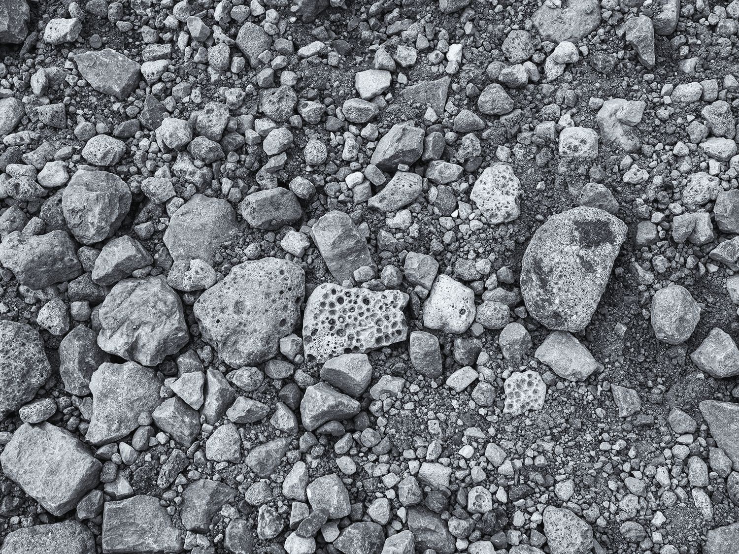
axe – ironstone – scoria

A great article on the WWII radar site at Danby Beacon http://liminalwhitby.blogspot.com/2012/12/danby-beacon.html

Heather Burning Article Yorkshire Post March 2020 

Dykes on the Tabular Hills

The linear dykes of the Tabular Hills of north east Yorkshire are the third largest group in Britain both in area and the number of dykes.

The Scamridge Dykes are the most famous of the North Yorkshire Dykes, they run six abreast in a large curve for almost three kilometers from the scarp edge of Troutsdale south to the head of Kirkdale.  Their scale can only really be appreciated from the air. The dykes are thought to be prehistoric in origin, they most probably define prehistoric territorial boundariesDykes

The Cockmoor Dykes also run south from the Troutsdale scarp where as six large dykes. As they run south to Wydale they are joined by another fourteen smaller parallel dykes.  The six large dykes are thought to be prehistoric and the additional dykes are thought to be burrowing mounds connected with the large-scale rabbit warrening industry of the eighteenth and nineteenth centuries.

Cockmoor

My friend Chris Corner and I took a trip down to the Tabular Hills to have a look at these mighty earthworks. We started by trying to find an embanked pit alignment at Givendale but found nothing apart from dense conifer woodland, debris and deep forestry plough ruts. We moved east to Cockmoor.

OLYMPUS DIGITAL CAMERA

The multiple small dykes at Cockmoor, probably the result of commercial rabbit warrening.

OLYMPUS DIGITAL CAMERA

One of three round barrows on the margins of the Cockmoor Dykes. The other two barrows have been destroyed by agricultural activities.

OLYMPUS DIGITAL CAMERA

The rabbits have all gone. Tiny spoil heaps in the sides of the dyke, probably caused by burrowing miner bees.

One of the six large Cockmoor Dykes running down to the scarp edge overlooking Troutsdale.

A Penny Bun & Oysters

The Scamridge Dykes form a dense mixed woodland corridor across the large open fields.

 We dropped down into Troutsdale and come across this beautiful abandoned building. Chris informs me that it is a school house built in 1870

Map

Sources

Linear Earthworks of the Tabular Hills, North East Yorkshire. D.A Spratt 1989

MAGIC

Historic England

Google Earth


Willy Howe

willy Howe

Willy Howe is a large, tree-covered,  Neolithic round barrow in East Yorkshire. Local folklore tells the tale of a farmer returning home late one night  and hearing music coming from the Howe. On investigation he found a door which neither he or anyone else had seen before.  He opened the door and looked inside, he saw a table groaning with food and a group of hobs making merry.  The hobs spotted him and invited him in and offered him a drink. He took the drink and then rudely dashed off with the cup the drink was served in. The hobs gave chase but as soon as he crossed the first stream, the Gypsey Race, they gave up and returned to their feast.  On arriving home he saw that the cup was a fabulous gold vessel. He presented the cup to King Henry I who later passed it on to his brother-in-law King David of Scotland

Newton Mulgrave Moor – A long barrow, an antiquarian and some rubbish

Long Barrows are fairly scarce on the northern North York Moors, this is round barrow country. Newton Mulgrave and the surrounding moors are rich in prehistoric monuments, the dales running down from the moors to the coast are fertile and well drained, ideal for early farmers. A number of the barrows, including the Long Barrow are placed at points where they can be seen from the dale below, the ancestors looking down from the place where the land meets the sky.

Newton Moor map

In the past, the moor was a rich hunting ground for early antiquarians, especially, Samuel Anderson of Whitby. Anderson excavated many of the barrows on the moor and built up a large collection of prehistoric pottery. He eventually sold his collection to finance a new business manufacturing jet ornaments. Much of his collection was sold to Joseph Mayer of Liverpool for £150. He also gave or sold some of the pottery to the Mappin Art Gallery in Sheffield.

Collared Urn

Anderson’s pots in were displayed in the Liverpool Museum as part of the Mayer Collection, the museum and many of the displayed pots, were destroyed during a German bombing raid in May 1941.

The Long Barrow is recognisable but has suffered historic damage, that said, it’s well worth a visit. The walk takes you across a lovely grassy moor with views to the coast and a moorland skyline dotted with mounds. Below is a description of the barrow taken from the English Heritage Record of Scheduled Monuments.

The monument includes a long barrow situated in a prominent position at the top of a north east and north west facing slope on the edge of the North York Moors. The barrow has an earth and stone mound which is ovoid in shape, with its long axis oriented ESE to WNW. The mound measures 36m in length and is 13m wide at the west end and 20m wide at the east end. It stands up to 2.6m high at the east end, with the top sloping down towards the west. On the top of the mound and on the north side there are a number of small hollows caused by the robbing of stone from the fabric of the mound. Originally the mound would have been narrower and trapezoidal in shape with flanking quarry ditches up to 3m wide along its north and south edges. However, over the years erosion and stone robbing have resulted in a more rounded shape and soil has slipped from the mound, increasing its width and burying the quarry ditches which are no longer visible as earthworks. There would also have been a forecourt area up to 10m wide in front of the east end of the mound where rituals connected with the use of the barrow would have taken place. There is nothing of this visible now, but archaeological remains will survive as subsoil features. The long barrow lies in an area rich in prehistoric remains, including further burial monuments.

Flytip

Fly-tipped rubbish, polythene animal feed bags, scrap iron and fencing roll.

This is on the open moor a few meters from the Long Barrow and a good walk from any road. The moor is a managed moor, the fences are in good order, the grouse butts are well maintained yet this is tolerated. Sometimes there seems to be two rules in the countryside, one for the visitors and another for the landowners and farmers.

Sources

A 19th century antiquary: the excavations of Samuel Anderson by Terry Manby in Moorland Monuments CBA Research Report 101 1995

Pastscape www.pastscape.org.uk

Swarth Howe

Swart, adj. Black Looking

Houe, n. A hill of considerable size. A tumulus.

Swarth Howe iii


Near Swarthoue on Dunsley High Moor, which was no doubt, a Druid’s station, are several ancient stone-pillars, only about three feet high. Two of them stand one hundred west from this houe, and west from one another; a small houe also stands a few yards west from them. At a distance of one hundred and ten yards north by east of these, two more similar pillars, stand at nearly the same distance from, and also in the same direction from, each other. These four old erect stones forming a long square, may possibly be only parts of other figures, such as triangles or circles, or a long avenue. In setting these, reference  seems to have be made to the cardinal points, and perhaps, also to that conspicuous tumulus, Swarthoue, with which they form a nearly right angled triangle. The circular margin of that houe was set round with low curb-stones. It is about twenty yards round at the base, and from ten to twelve feet high.

Descriptions, Geological, Topographical and Antiquarian in Eastern Yorkshire

Robert Knox.  1855

Samuel Anderson excavated the barrow in 1852. On the outlying stones he notes –

 There has been a line of large stones pointing from one barrow to the other, only two of which remain to remind the Antiquary that the ‘Modern Goths’ have been pilfering Antiquity of its relics…I may mention that there are many markings on the two stones between the barrows numbered 1 and 2 but whether the work of man or time cannot now be determined altho’ some of the marks correspond with these on a stone found in the barrow which has evidently been done by the parties forming it.

Minutes of opening Ancient British Tumuli in the neighbourhood of Whitby

Samuel anderson 1852-1853