The Journal Of Antiquities

Ancient Sites In Great Britain & Southern Ireland


Boadicea’s Grave, Hampstead Heath, Greater London.

Queen Baodicea and her daughters riding their chariot into Roman Londinium.

NGR: TQ 27382 86518. A large Bronze Age bowl burial mound on Hampstead Heath, Greater London, which has trees and bushes growing from it and railings surrounding it, was tradi-tionally called ‘Boadicea’s Grave’, however, this often given assumption is considered to be a myth and has no historical association with Boadicea or Boudicca, Queen of the Iceni. She was the widow of King Prasutagus, who died in late 59 or early 60 AD. The circumstances of Boadicea’s death, the place of her death, and the place of her burial sometime around 61 AD is not known (some historians put her death a few years later on) although several theories have been put forward as to where she was buried in Londinium and further afield, though without any real evidence to back up those claims. Did she: take her own life? was she killed by a Roman soldier? was she poisoned? did she succumb to ill health or did she escape alto-gether, never to be seen again? – in truth though, these questions cannot be answered and probably never will be answered, but she is almost certainly not buried in the ancient tree-covered mound on Parliament Hill (Hampstead Heath) which predates her by 1,000 years or more. A second mound close by was built in the last few hundred years and was probably the site of a fire beacon.

Hampstead Heath is 4 miles northwest of the city. A very splendid bronze monument-cum-statue of the Celtic warrior Queen Boudicca stands on the Embankment close to Westminster Bridge in London, where she is shown riding her horse-drawn chariot with her two daughters at her side, and scythes on its wheels! This statue group was made in the late Victorian age, but not erected until 1902. The Latin form of her name was always written by Roman writers as BOUDICCA.

James Dyer writing in 1977 says of the barrow on Parliament Hill, Hampstead Heath, that it is: “Covered by bushes, halfway between Hampstead Ponds and Highgate Ponds. This barrow, now obscured by bushes and enclosed by iron railings, is about 41 m in diameter and 2.4 m high, with an encircling ditch about 4.9 m wide. In 1894 Sir Hercules Read trenched the mound but found nothing in it.  Some doubt has been cast on its antiquity, but a sketch made by Stukeley in May 1725 leaves little room for scepticism. His drawing clearly shows a causeway across the ditch on the north side, and another is reported on the south.”

Similarly, perhaps, ‘The King’s England — London’ tome from 1949 gives the following information on Boadicea’s Grave: “To the north stretch Parliament Hill Fields, the glorious extension of Hampstead Heath with hundreds of acres of grassy parkland. From the top of the hill, 320 feet high, is an extensive all-round view. with the churches of Hampstead and Highgate, and the Surrey hills across the Thames. A short distance from the summit is the little artificial hill called Baodicea’s Grave, now hidden in trees and undergrowth. It is 10 feet high and nearly 40 yards across, and is surrounded by a dry ditch. It is thought to be a grave of the early Bronze Age, and thus about 4000 years old. The mound on the north side has been added in the last two centuries, and was probably formed by beacon fires.”

Geoffrey Ashe wrote in 1993: “Boudicca’s campaign was not an act of resistance to conquest, but a reaction after the event. Her career illustrates the equality of Celtic queens, and their ability to take charge and command armies. Her name, perhaps an assumed one, means ‘Victory’, and her attachment to the war-goddess Adraste may hint at a religious quality in her leadership. She is described as tall, fierce-looking, and harsh-voiced, with a mass of red hair down to her waist.

“Her personal grievances are obvious, and so are her public ones, since the Romans made it plain that they were annexing her territory and not letting her continue as queen. She could enlist the Trinovantes – no longer subject to the Catuvellauni — because of the Romans’ treatment of Camulodunum in the course of its transformation into Colchester. Army veterans seized land by evicting Britons in possession, and the authorities extorted money and labour for a building programme such as no Briton could have foreseen……”

Ashe goes on to say: “Boudicca, therefore, exploited the indignation of the whole of East Anglia, a populous area. Late in the year 60 AD, probably, a horde of Britons under her leadership destroyed Colchester. The Roman forces in Britain were divided, and she captured London and Verulamium, burning both to the ground and massacring thousands, not only Roman but British collaborators. Rome’s historians take her triumphs no further, but there are archaeological hints of outbreaks beyond. 

“The governor, Suetonius Paullinus, was away in Anglesey stamping out Druids. During 61 he managed to assemble ten thousand men, and stationed them in a well-chosen spot, partly enclosed by hills and woods that nullified the Britons’ advantage in numbers. Its location is doubtful. One suggestion puts it near Towcester, in Northamptonshire; another near Mancetter between Nuneaton and Atherstone. The queen attacked, but Roman discipline prevailed and the Britons were routed. Her suicide may well be historical, and there is certainly no clue to her grave. The King’s Cross theory is due to Lewis Spence, who conjectured that she fought her last battle on the future site of the station.

“Paullinus carried out ruthless reprisals. However, his treasury officer Classicianus was a Gaul with ideas about Romanisation. Under his influence the regime grew milder, and the Britons, those of the upper classes at least, were largely reconciled and assimilated.” 

The idea that Queen Baodicea was buried at Stonehenge in Wiltshire is a myth as is King’s Cross railway station in London, where it has been suggested by some that her body lay beneath platforms 8, 9 or 10! It’s possible the Queen’s body was taken back to her native East Anglia and cremated and buried somewhere in Norfolk.

Sources/References & Related Websites:-

Ashe, Geoffrey, Mythology Of The British Isles, Methuen, London, 1993.

Dyer, James, Southern England — An Archaeological Guide, Faber And Faber Limited, London, 1977.

Richmond, I. A., The Pelican History Of England — Roman Britain, Penguin Books Limited, Harmondsworth, Middlesex, 1963.

The King’s England, London — Heart of the Empire and Wonder of the World,  Hodder And Stoughton, London, 1949.

https://www.megalithic.co.uk/article.php?sid=4724

https://en.wikipedia.org/wiki/Boudica

https://www.historic-uk.com/HistoryUK/HistoryofEngland/Boudica/

More info here:  https://www.visitnorfolk.co.uk/post/romans-boudicca-and-the-iceni-in-norfolk

Copyright © Ray Spencer, The Journal of Antiquities, 2024.


Willy Howe, Near Wold Newton and Burton Fleming, East Yorkshire.

Willy Howe burial mounds, near Burton Fleming, East Yorkshire.

NGR: TA 0616 7234. About 152 metres north of Low Barn Farm (also called Willy Howe Farm), roughly located between Wold Newton and Burton Fleming, in the Great Wold Valley, East Yorkshire, are the large tree-covered mounds or round barrows known as Willy Howe, which date from the mid to late Neolithic age. The site is 295 m to the south of Burton Fleming Lane, close to a farm track. There are numerous far-fetched legends and tall tales associated with the burial mounds (there are actually three mounds together but they are usually classed as one), however, these are “only legends” and in reality, there is no truth whatsoever in any of them, although they are interesting and worth mentioning here. Local people used to think the mound was inhabited by fairy folk and it was thought there was a doorway leading into it.

Excavations at the site have not produced any tangible evidence of burials, although a shaft going down into the mound was discovered, so maybe it was left unfinished and its builders had to leave or flee the area suddenly for some reason, or maybe this was made by the antiquarian excavators. It was excavated in the mid and late 19th century by antiqua-rians of some repute. Willy Howe is a Scheduled Ancient Monument and is under the protection of Historic England (H.E.). There are a few other round barrows not too far away from here, and the famous Rudston standing stone is only 3 miles to the southeast.

Timothy Darvill writing in 1988 says of the site that it is: “another fine middle Neolithic round barrow surviving as a mound nearly 40m in diameter and 7m high. Excavations produced no certain evidence of burials, but a rock-cut shaft rather similar to the one at Duggleby Howe was located under the centre of the mound.” Richard Cavendish writing in 1983 regarding the Rudstone Standing Stone adds that: “About 3 miles (4.8km) to the NW and of the same period is the giant, tree-shrouded barrow called Willy Howe…. 24ft (7.2m) high and 130ft (40m) across.  

Janet & Colin Bord (1991) tell us more and say: “Ancient sites (usually cairns or barrows) were often believed to be fairy haunts, and they were said to dance or make music there. Willy Howe (Humberside) is a prominent round barrow which housed a fairy dwelling, seen by a drunken villager late one night. He heard people singing and went to see who it was. Through an open door in the side of the mound he could see people banqueting at large tables. One of the people saw him and offered him a cup. He took it but threw away the contents, not wishing to come under the spell of the fairies, and ran off with the goblet, which was made of an unknown material. This tale was recorded by William of Newburgh in the twelfth century. Another tale told of people digging into the mound and finding a golden chest. They tried to pull it out with horses, but it sank back into the mound and no one has ever been able to recover it.”

Willy Howe in 2007. Photo by John Phillips (Creative Commons).

The Wikipedia website gives us more information on the site:- “Willy Howe is a large round barrow 7.5 m (25 ft) high, located between Wold Newton and Buron Fleming in the civil parish of Thwing. The mound has been recorded as being excavated several times: by Lord Londes-borough in 1857; and by Canon William Greenwell in 1887. Neither found burials or grave goods; Greenwell found a feature approximating a shallow grave. The structure has a central space, resulting from the 19th-century excavations, additionally, an earthwork ramp created as part of Greenwell’s excavations has also modified the site. Use as a Thingstead during the medieval period has been speculated. Willy Howe is registered on the National Heritage List for England as a Scheduled ancient monument. Its List Entry Number is 1008040.”

Sources / References & Related Websites:-

Bord, Janet & Colin, Ancient Mysteries of Britain, Diamond Books, 1991.

Cavendish, Richard, The English Tourists Board — Discover England — Prehistoric England, Guild Publishing (Book Club Associates), London, 1983.

Darvill, Timothy, AA – Glovebox Guide – Ancient Britain, The Publishing Division of The Automobile Association, Basingstoke, Hampshire, 1988.

https://historicengland.org.uk/listing/the-list/list-entry/1008040

https://en.wikipedia.org/wiki/Willy_Howe

2nd photo down is of Willy Howe in 2007 by John Phillips for Creative Commons. https://en.wikipedia.org/wiki/File:Willy_Howe.jpg

https://www.megalithic.co.uk/article.php?sid=7397

https://www.spookyisles.com/willy-howe/

Copyright © Ray Spencer, The Journal of Antiquities, 2023.


1 Comment

Lower Colgarth Hill Burial Mound, Near Bell Busk, North Yorkshire

Lower Colgarth Hill, near Bell Busk (burial mound)

Lower Colgarth Hill, near Bell Busk (burial mound)

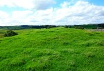
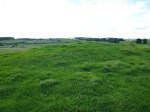
    OS grid reference:- SD 90489 57365.  At the foot of Lower Colgarth Hill beside Carseylands road about halfway between Bell Busk and Airton, north Yorkshire, there is a large and prominent Bronze Age burial mound (tumulus), which is close to a footpath and a ruined barn called Allamire Laithe. The burial mound is also called a bowl barrow or round barrow in archaeological terms, although this one is more like a long barrow, due to its size. You will also notice, although quite faint at ground level, that there are ancient cultivation terraces in this field and those close by. From here you get a good view over the River Aire. From Carseylands Hill road, at the south-side of the ruined barn, go 48m up the footpath to where there is a small boulder in the opening of the wall, then via off to the south for 35m – and you will soon see the grassy mound in the field just ahead of you.

Lower Colgarth Hill, near Bell Busk (a large grassy burial mound).

Lower Colgarth Hill, near Bell Busk (and the large, grassy burial mound).

Lower Colgarth Hill near Bell Busk (the long-shaped burial mound)

Lower Colgarth Hill (and the long-shaped burial mound)

    The burial mound (tumulus) here at the foot of Lower Colgarth Hill is rather oddly-shaped, especially at its SW side, where it may have been dug into at some point in the past, although originally it was almost certainly bowl-shaped or bowl barrow-shaped; at a distance it has the look of a long barrow because of this. It measures roughly 11m (36 ft) long and 5.6m (18 ft) wide and is about 5 feet high. This was probably the place where a chieftain or a high-ranking individual of a local tribe was buried – either in the late Neolithic or the Bronze Age. Maybe more than one individual was buried in the mound and, or, quite possibly other members of the chieftain’s family.

Lower Colgarth Hill (and the grassy mound).

Lower Colgarth Hill (and the grassy mound).

    However, nothing more seems to be known about the burial mound on Lower Colgarth Hill – which seems to have been overlooked by antiquarians of the past few centuries, although Harry Speight does mention some other ancient sites in Craven; and I don’t know whether the tumulus ‘here’ has ever been excavated.  The cultivation terraces in the same field, and in other fields close by, are obviously very ancient. They are of a similar age, perhaps, to the ancient field systems in the Grassington area, which are considered to be Iron Age. Some cultivation terraces, however, are of a more recent age, probably Medieval?

Sources and related websites:-

http://www.kirkbymalham.info/KMI/malhamdale/speight.html

http://www.skiptoncastle.co.uk/history-of-craven.asp?page=17

http://www.docbrown.info/docspics/dales/dspage52.htm

                                                              © Ray Spencer, The Journal Of Antiquities.