
I get scared. The thought of riding alone on remote roads through unknown landscapes populated by strange and foreign people is frightening. Anything could happen. My bike could fall apart, my mind could fall apart or bandits could take my life part. The weather could strand me or my compass misdirect me. The route could prove one step beyond my capabilities or not even exist at all. Anything could happen. But what does happen?
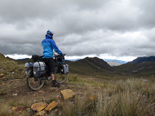
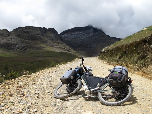
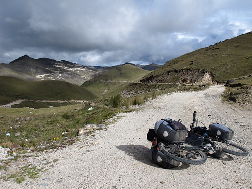
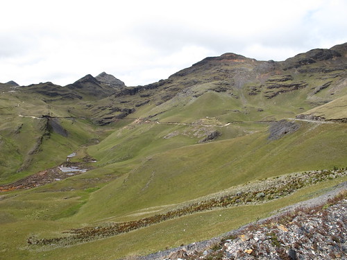
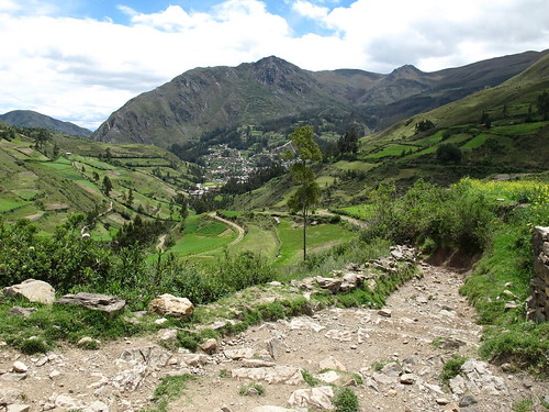
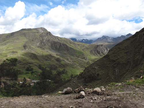
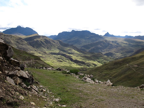
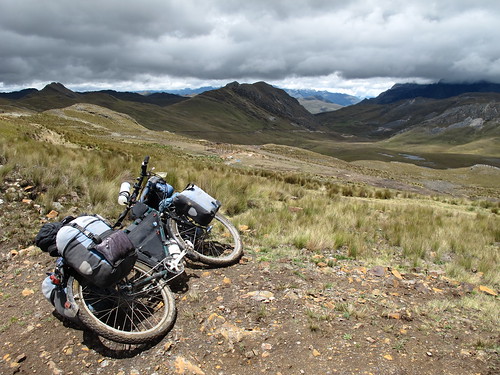
Taking in the high-point of the route from Conchucos to Sihuas
Before setting out on a route I will often find myself questioning the wisdom of my decision. I always know that taking the main roads will be quicker, easier and often safer. Most other cyclists take these roads and they seem happy with life. They seem to thrive on the movement, filling their blogs with rapid fire portraits of progress. But not me. In my cycling incarnation I have evolved to be part of a tribe for which progress is not enough. We seek a different adventure. We want to be involved in our routes and are obsessed with roads that need to be ridden, fearing more than anything else the monotony of cruising asphalted carriageways. We don’t want to be mere spectators, we seek to become a part of the landscapes through which we’re lucky enough to move.
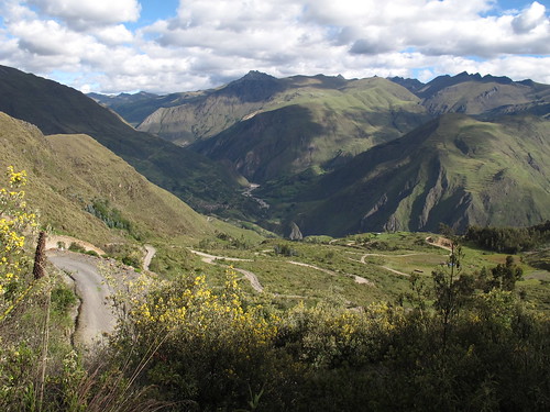
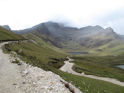
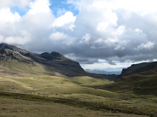
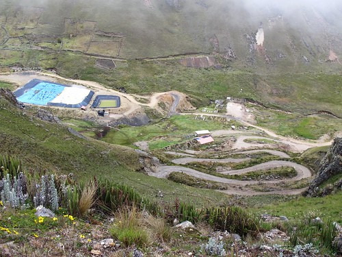
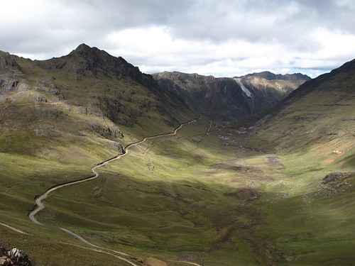
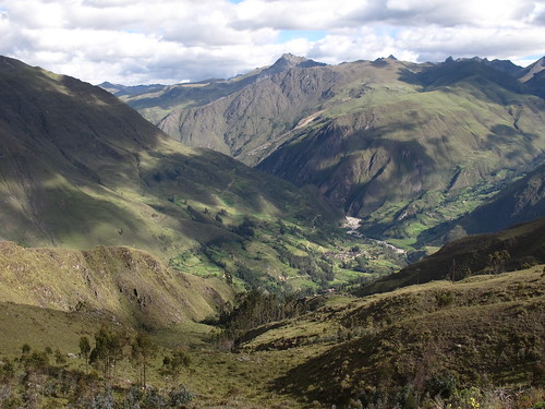
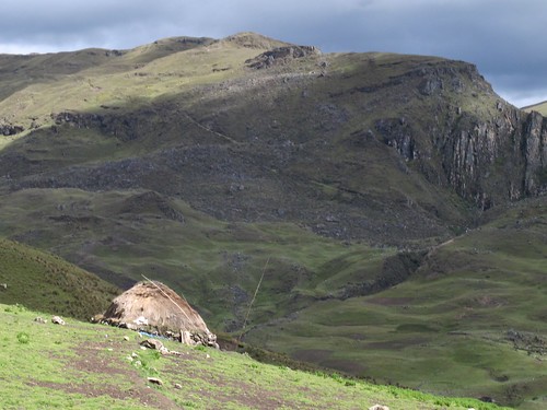
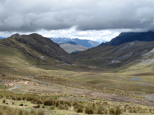
Descending towards Cochaconchucos and into the most tranquil of valleys
But why? Why shred my nerves and work myself so hard? Why not take the easy way south? The answer is simple; because dirt roads feel right. Before, during and after the experience, riding remote dirt roads feels right. To step out onto a route with no emotional involvement is too utilitarian, it is a waste of opportunity. If I am not scared before pushing the pedals onto a new route then I am not challenging myself, I am letting myself down. Fears are there to be conquered and to do so, to overcome challenges, is immensely exciting and rewarding. Overcoming my own nervousness is one of the major draws of dirty back roads.

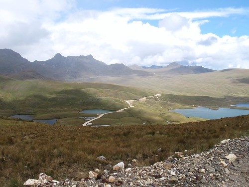
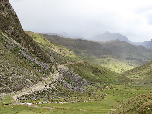
Route from Huamchuco south to Sihuas… click here to view the fully interactive map and elevation profile
I can get scared by the thought of riding lonely and vulnerable through the outer reaches of a foreign country. But the reality is very different. Once the plunge has been taken and I am inside a route any fears completely evaporate. Hitting my flow I soon feel at home and become quickly absorbed by the sense that there is nowhere else I should be. Everything feels right. An enormous rush of euphoria will often fill my chest to exploding and the extent of my happiness escapes description. Everything about riding these roads is what I’ve been looking for the previous four years. It feels so right. It feels like destiny.
Huamachuco to Sihuas Route elevation profile
Celtic religion talks of ‘thin places’, spaces in time where the individual moves closer to divinity. I am not a religious man but freely admit that picking a lonesome path through wild and deserted landscapes can become a spiritual experience. Ignoring the paved highways instead delivers me onto roads to my own ‘thin places’. That feeling of euphoria I described in my chest is how I imagine it feels to come closer to God, only less demanding. It means I am happy and having fun. It means that if there is a God, I am where he wants me to be.
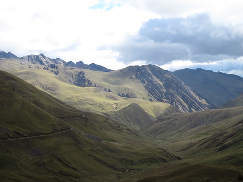
The route I eventually rode south from Huamachuco through deserted mountains to Sihuas was inspired by other members of my cycling tribe. The first part from Huamachuco up until my turn towards Pampas came from Tom and Sarah who rode the route in October 2011. The second part from Pampas through Conchucos to Sihuas was inspired by Anna who pioneered the route last year. In five days cycling I was passed by just four motorcycles and no other vehicles save for a small child on a bike. Quiet, tranquil and a little windy, this is a beauty of a ride…
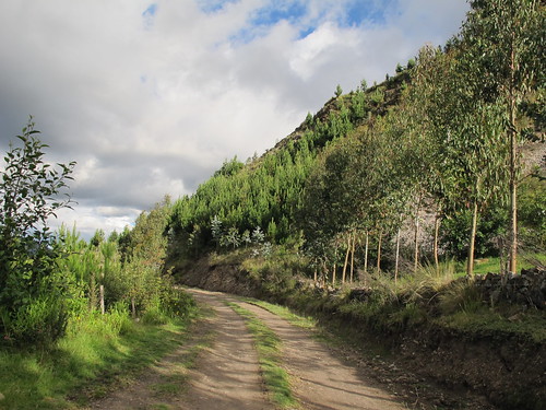
After a short stretch of pavement out of Humachuco I hit the dirt. It’s a relief to peel away from the traffic filled asphalt road that continues its course on the other side of the river
Soon I’m refinding my altitude and getting back into the mountain wilds…
… where rain comes and goes and the road gently but persistently climbs
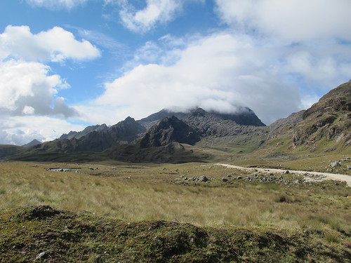
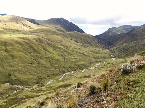
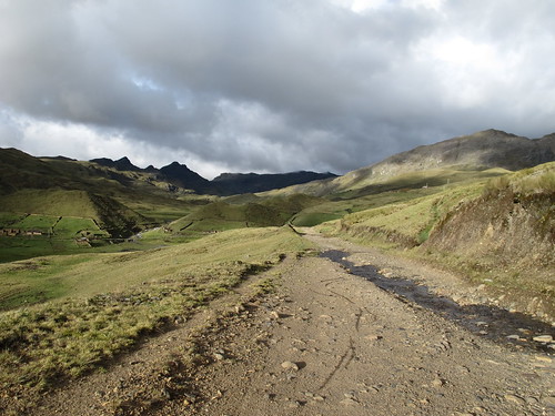
Every saddle and pass brings a new world into view…
… and more exciting riding
I spin past the calm beauty of still water…
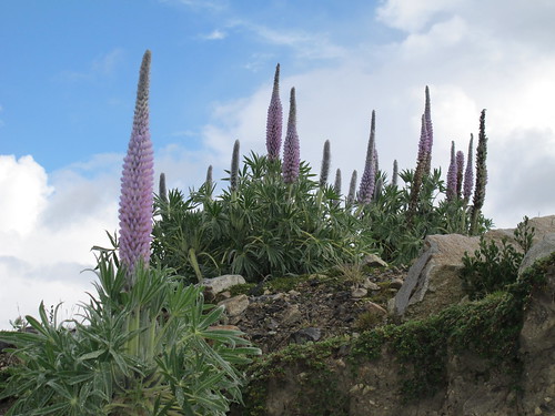
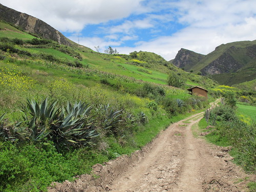
… through small forests of these indigenous plants…
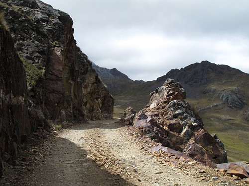
… in the shadow of imposing rocky crags…
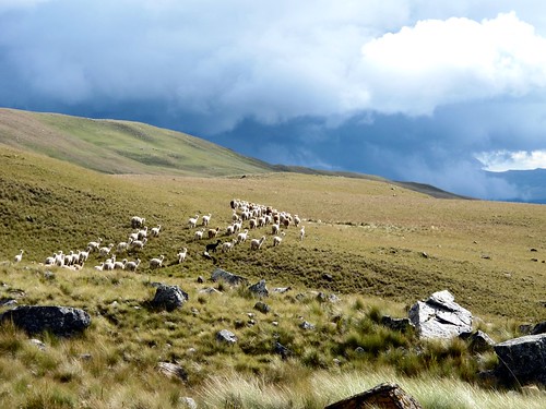
… and past huge herds of alpaca
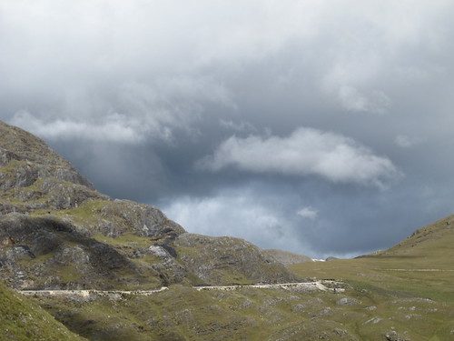
Weather passes through this high and exposed landscape in the blink of an eye. Behind every dark brooding rain cloud…
… hides a strong sun that usually manages to leak through
By the end of my first day out of Humachuco I find myself in this broad valley…
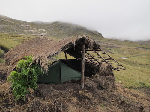
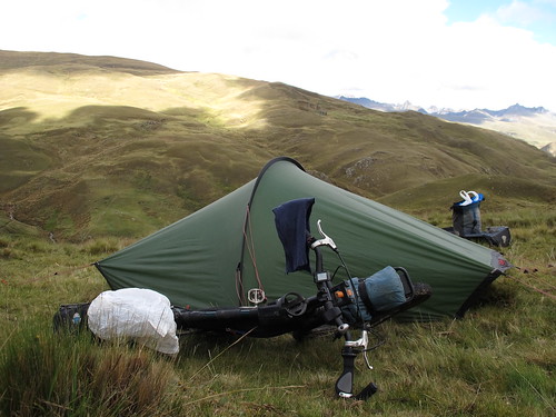
… and with a perfect home for the night
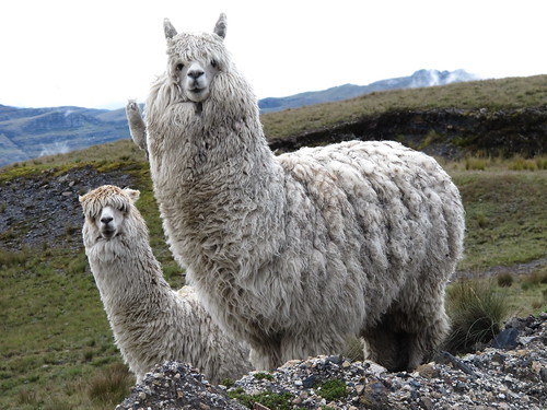
Day two begins cold. Passing yet more herds of alpaca I’m jealous of their coats. Stopping to take my shoes off and rub my numb feet I ponder the benefits of hooves
Onward I forge. Up, down and around
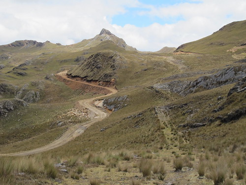
After Tom Walwyn’s great route notes run out I’m left to find my own way to Pampas. I descend down to a small mine to get directions and am pointed straight up an abrupt series of switchbacks
The switchbacks deliver me up into cold clouds and a biting rain storm. But after the rain comes sun and I’m soon dropping down towards the main road to Pampas
The main road is still little more than a track. I follow it up a valley…
… across the river and back down the valley again…
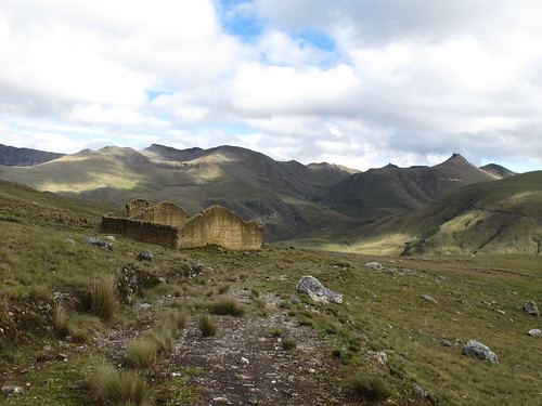
… until I reach some ruins I had spotted from across the way and bed down for the night
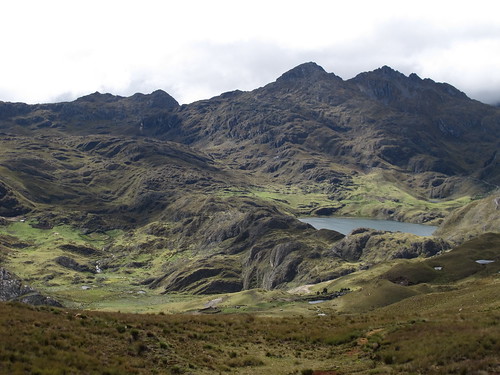
A short climb out of camp the next day and the rocks feel alive. Small lakes punctuate an emotive scene
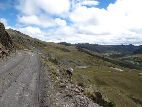
The route takes my up and up to over 14,000 ft. (4,300 m)…
… and then down and down…
… through this expansive valley…
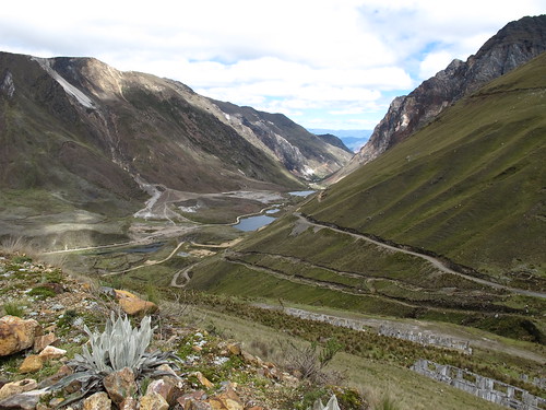
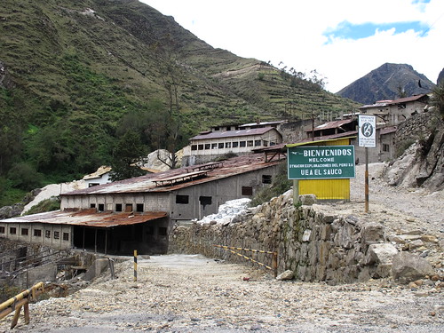
… past abandoned and polluted mine sites…
… to the Laguna Pelagatos
From the Laguna it’s a long descent through ramshackle and often intimidating half abandoned mining communities…
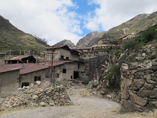
… where the distinction between industry and town is blurred…
… and rusty corrugated iron rules
But eventually the gorge opens up into a green valley and the turn is made…
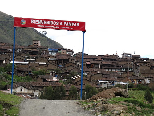
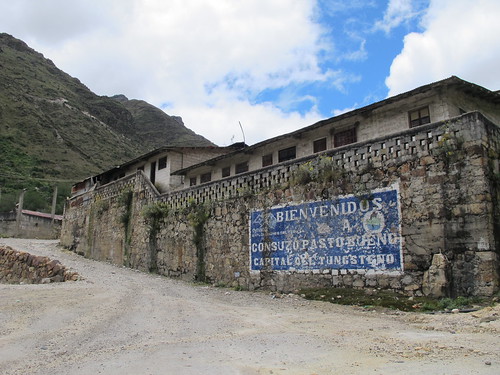
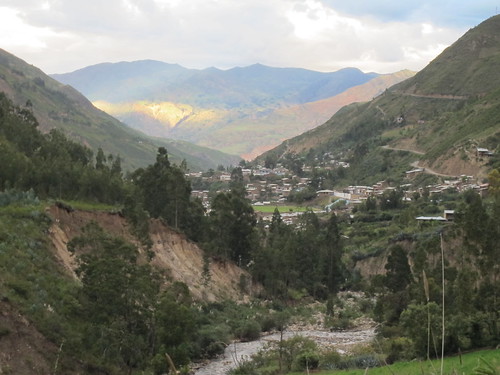
… down to Pampas. A charming little town I’m disappointed to hit on a Sunday when the aggressive drunks are out
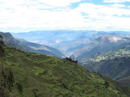
A peaceful lunch among the carefully farmed fields that surround Pampas and it’s time to start the climb out of town…
… up a series of broad looping switchbacks…
… and over into the blissful preserve of the next valley
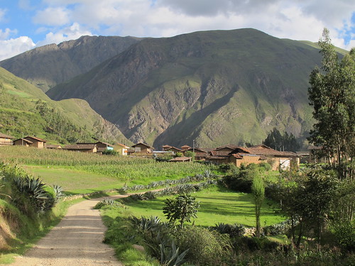
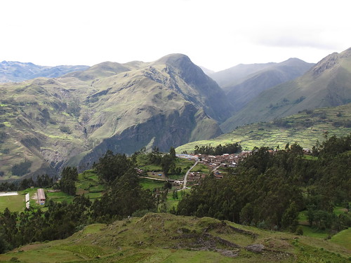
After a rapid descent I’m rolling into the village of Cochaconchucos. The people are kind a beautiful, the sun is shining and I’m sure I’ve found paradise
Resisting the strong urge to find a wife, and a small plot of land to farm in this otherworldly valley I cross the river…
… take one last look back at paradise…
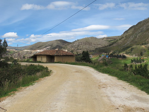
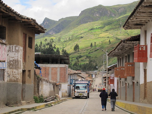
… and ride the short stretch of asphalt up river to Conchucos
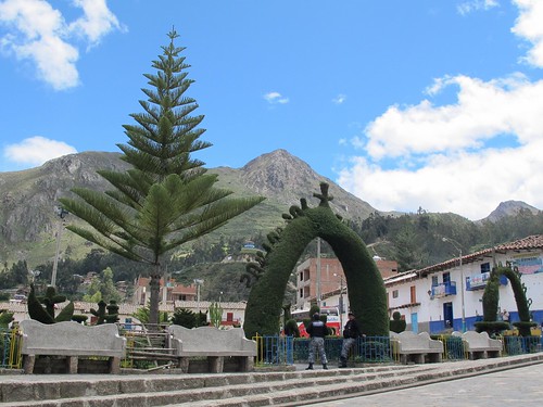
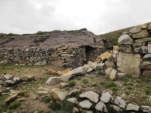
A night in Conchucos leads into a relaxing morning admiring the plaza topiary and fixing up the Shermster
Just before midday my hostal owner leads me through the centre of town to the start of my adventure back into the unmapped
All four seasons seem to pass on the ascent up river out of Conchucos
When the sun is out the lush green fields resonate positivity
The first of my loose list of route instructions says ignore the right turn down to the hamlet of Taoll, the very point where snow-capped peaks announce themselves in the distance
Continuing to climb, I pass a small number of homes
Scouring Google Earth I’d been unable to find this route, when the road turns to a grassy track it becomes clear why
Ten miles of climbing and it’s time to turn right up into the rain clouds. To ensure I’m taking the right way I chase down a family on horses up ahead. A mile of uphill struggle tracking a scared family who keep accelerating to escape my crazed shouts and eventually the mother turns to wait. She’s a little angry but confirms the route
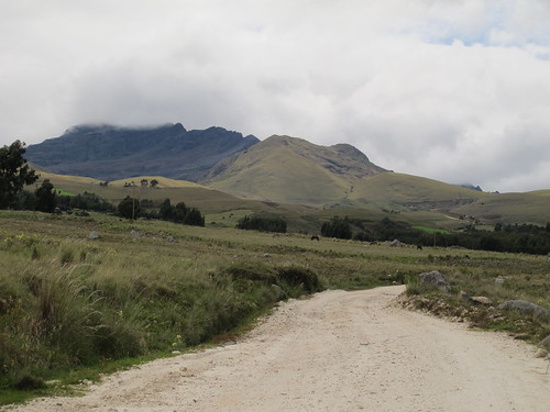
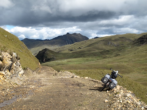
Higher and higher I cycle, up into increasingly dramatic scenery
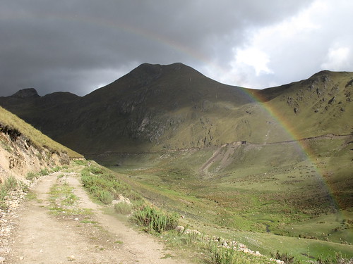
When the rain eventually pushes out the sun a rainbow appears. I can see the end in the valley below. This is Peru so I consider opening a mine and raping this quiet beauty spot of its gold. But in the end I can’t be bothered…
… and pitch camp instead.
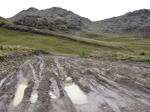
Despite sunshine the next morning is cold, in fact with the strong wind it’s bloody freezing. Seldom used, there is no point in repairing this road when it gets washed away. Within a mile of my morning start I’m removing my shoes to wade across an icy stream. My numb toes become numb feet… they don’t come back until Sihuas
Eventually the climb out of Conchucos ends at the 14,350 ft. (4,370 m) pass…
… where expansive views of the Cordillera Blanca work alongside the altitude to take my breath away
From the pass the road is much more distinct and traveled, but there is also a curious little track…
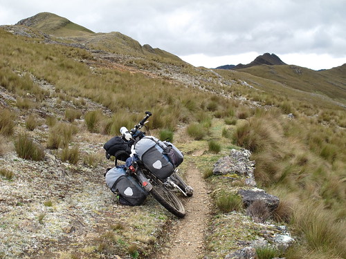
… so I enjoy a little bout of single track adventure before it degenerates into a rocky mess and I regretfully freestyle it back down to the road
The rain clouds follow me down from the pass, chasing me into a hut for lunch
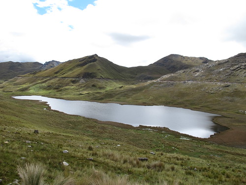
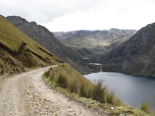
It takes a while for the descent to get going. First there is a lake to detour around…
… and a short muddy climb to negotiate
But soon I’m on my way down…
… back into a sweet-smelling world of trees and flowers…
… and on to a relaxing night in Sihuas
Route Tips
Be aware that distances and elevations are taken from my bicycle computer and barometric altimeter, thus they are in some ways an approximation.
Huamachuco to Conchucos
3 days, 96 miles (155 km), 10,790 ft. (3,290 m) of climbing
From Huamachuco follow Tom Walwyn’s excellent route notes to the point where he says ‘…but it may be possible to go L. to Pampas‘. Tom’s notes are available here: http://bicyclenomad.com/route-information/peru
- 13.7 miles (22 km) from last ‘Y’ at 13,890 ft. (4,230 m), reach saddle where Tom and Sarah went straight. Go left.
- 6.9 mile (11 km) drop down to a mine, 12,900 ft. (3,930 m), where take a right up steep switchbacks. (Note: an old shepherd told me of a right turn that will take you over to the main road to Pampas before this, without having to descend. I just missed it)
- 2.5 miles (4 km) of stubby switchbacks take you up to the summit pass at 13,910 ft. (4,240 m).
- 1.75 mile (2.8 km) descent then delivers you down to the main road towards Pampas (13,400 ft., 4,080 m). Take a left onto the Pampas road.
- 5.3 miles (8.5 km) later the road crosses the river and turns south-west. From there it is a steady climb up the valley before turning north-east to climb up and around. At this turn (13,400 ft., 4,080 m) the shell of a building that makes for good camping.
- 8 miles (13 km) from the river, at 14,100 ft. (4,300 m) take a right down the road to Pampas. (Left goes to Casga). The road descends past Laguna Pelagatos then down a gorge through a couple of semi deserted rough and ready mining communities.
- 16 miles (25.7 km) from the right turn is Pampas (10,600 ft., 3,230 m) with hospedajes, shops and restaurants. There is the option of a paved road out of Pampas towards Mollepata. I recommend the unpaved road out of Pampas towards Conchucos as follows…
- From Pampas it’s 4.4 miles (7 km) up to the pass at 12,130 ft. (3,700 m). Then a further 6.3 miles (10 km) of descent down to the idyllic village of Cochaconchucos (9,900 ft., 3,020 m).
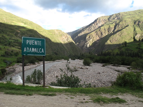
- 0.75 miles (1.2 km) through Cochaconchucos the route crosses the Puente Adamalca (9,700 ft. 2,955 m) and then 0.7 miles (1.1 km) (9,840 ft., 3,000 m) after that takes a left turn onto the paved road through the gorge to Conchucos.
- It’s 2.95 miles (4.7 km) on pavement from the left turn to Conchucos central plaza (10,540 ft. 3,210 m). On the north side of the plaza Hostal Plaza offers good value cycle friendly rooms and bubbly service.
Conchucos to Sihuas
2 days, 49 miles (80 km), 5,110 ft. (1,560 m) of climbing
There are two route options south from Conchucos to Sihuas. The high altitude route (which I describe here) follows an old Inca road up and over. The alternative route passes through a few pueblos including San Miguel.
- Follow the road on the east side of the river south out of Conchucos.
- Ignore the right turn at 7.5 miles (12 km), 12,480 ft. (3,800 m). This would take you down to the village of Taoll. This is the point I got my first views of snow-capped peaks.
- 10 miles (16 km) from Conchucos plaza (at 12,900 ft., 3,930 m) take the right turn over the stream and up towards the shack you can see up the hillside. Continuing on the left hand course is the alternative route to Sihuas via San Miguel. If in doubt ask for Toma Taoll and Sihuas.
- 10.7 miles (17 km) from the junction (14,200 ft., 4,330 m) pass over the saddle to new vistas. Then 1.2 miles (1.9 km) later (14,350 ft., 4,370 m) is the main pass and high-point of the route.
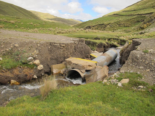
- The road up to the pass is seldom traveled. A couple of culverts had been washed away and not repaired. The road surface was often grass and with rain muddy, but never uncycleable. Water sources are good and frequent. There was not a single tire track of evidence that any other vehicles had passed this way any time recently when I rode the route.
- The northern section of the road ends at the pass.
- Once over the pass the road is obvious. There is also a single track that runs east. I followed this for a stretch but it is unrideable on a loaded bike. A good bikepacking opportunity for exploration though.
- 2.5 miles (4 km) down the road from the pass (13,750 ft., 4,190 m) are a couple of shelters that could make an ideal camp spot. (Having left Conchucos in the afternoon I camped way before these but used them for a comfortable lunch stop the next day).
- The route loops east around a lake before resuming its course south at 4.4 miles (7 km) from the shelters (13,730 ft., 4,185 m).
- A mile (1.6 km) later (13,740 ft., 4,188 m) at 7.9 miles (12.7 km) from the pass a small climb starts. Climbs for 0.7 miles (1.1 km) up to 13,970 ft. (4,260 m) before dropping and then rising to the saddle 0.6 miles (1 km) later at 13,870 ft. (4,230 m). From there the main descent down to Sihuas begins.
- After 9.8 miles (15.8 km) (11,140 ft., 3,400 m) continue straight (not left).
- 3.3 miles (5.3 km) later (10,100 ft. 3,080 m) continue straight (not left).
- 0.4 miles (0.6 km) after this (9,960 ft., 3,035 m) continue straight again (not right).
- From there it’s 3.7 miles (6 km) to the Sihuas central Plaza (9,240 ft., 2,816 m). That’s 26.4 miles (42 km) from the pass.
- Sihuas has plentiful accommodation, shopping and eating options.

Pingback: In The Loop – Riding in the Huascaran National Park, Cordillera Blanca | These Places In Between·
Pingback: Onwards to the Cordillera Blanca | THE RIDE SOUTH·