Student: Cesia Lopez-Angel (MS.Arch)
Instructor: Dr. Paulette Singley
Rome Center for Architecture and Culture
MAPPING the seen, the heard, the obvious, the hidden, the textures, the smells, the buried, the WATER
Piranesi mapped ruins. Lanciani mapped layers. Nolli mapped public space.
Describing the major characteristics of what makes Rome what it is today has been the constant study and obsession of scholars, architects, and seasoned travelers. Navigating through the serpentine roads and finding one’s way from the local coffee house near the Pantheon to the monument of Vittorio Emanuele II is a challenge that eludes few. Relief: the common representation of the city that allows for both a visual and analytical comprehension of Rome’s complex urban fabric is a map.
Recording architecture, roads, and aqueducts requires more than a trained eye and a Google map. Understanding what lies on and below the surface demands a complete submergence into Rome’s context and form. Submergence, or the act of placing under water, is a symbolic approach to finding one’s way via the waters of Rome. As markers that begin to re-emerge through a new reading of Rome, every fountain possesses a certain symbolism, every aqueduct an historical importance, and every grotto its unique characteristics.
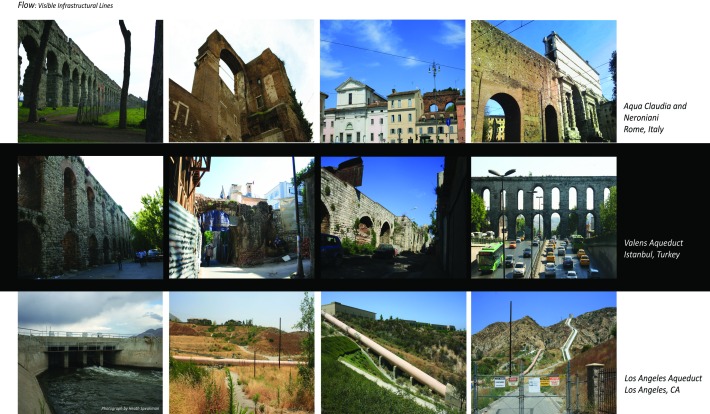
By documenting and representing infrastructure that provides opportunities for public space through the medium of water, one can begin to determine design solutions within Los Angeles, a semi-arid desert faced with real water scarcity problems. This investigation focuses on representing three major Roman cities and their respective aqueducts in Los Angles, Rome, and Istanbul. Through this exploration, I will look at water in the realm of architectural aesthetics, spectacle, and private/public urban domains by mining design opportunities from research questions addressed within these historical contexts. By following a similar approach of field visits to each of these three cities, I have collected artifacts and documented the major aqueducts and other water systems that have a significantly impacted urban form. Rome and Istanbul perform as mediators for learning how to design with water through a focused study of ancient systems and indigenous collaborations with public space at both an urban and architectural scale. The data these historical cities provide creates an assortment of tools that may be applied to the design of Los Angeles, a modern city founded on ancient Roman principles. The many layers and historical context describing each city’s water system is uncovered, represented, and identified as sites that demonstrate a formal language similar to Los Angeles’s water systems with a particular focus on its historic infrastructure
Slippery Surfaces
The use of water as a design material has been represented in this publication through a series of scales, building types, and techniques. Designing for water evokes emotional and intellectual responses that have become emblematic of authority and power. As history triumphs over the representation of water— from lush gardens to ancient baths to historic aqueducts—and systems become layered with the overgrowth of time, water’s political valence evolves. In other words, water’s role has had a significant mark in the development of architecture and urban design from ancient cities to thriving modern metropolises. In urban design, the development and implementation of an efficient waterworks system becomes an important role in the survival of the city. From its foundation to the location of its major buildings, a city’s relationship to its water sources becomes a major contributor to its success or failure. For instance, access to available drinking water as well as a proper drainage system has been one of the dominant factors that has shaped cities such as Los Angeles, Rome, and Istanbul.
Mapping
In “Heuristic Nolli Map: A Preliminary Study in Representing the Public Domain in Urban Space,”
a study from two doctoral candidates from Harvard and MIT, it is proposed the defining of the “public domain,” through the use of GIS and other techniques as ways of assessing the “publicness” of a space, the authors map unperceived information such as tax assessment data or social, racial, and economic datasets. These datasets begin to illustrate the degree of public space within an area that are often omitted due to the lack of physical perception. This form of investigation is regarded as a “Heuristic Nolli Map.” According to the authors, the Nolli map represents a perceived” or experiential public space that today holds little relevance due to the complex dynamics affecting the delineation of the public space such as private owned- public and public owned-private.
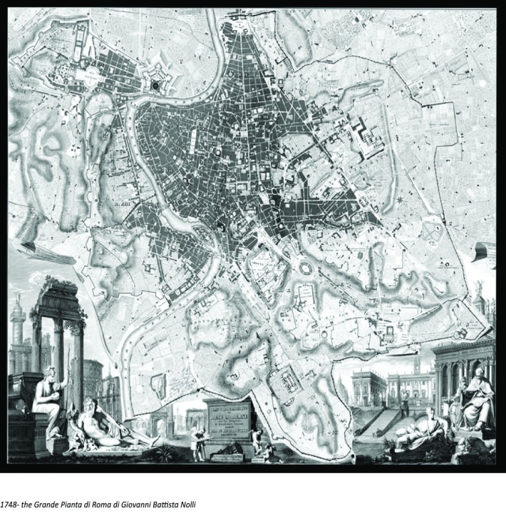
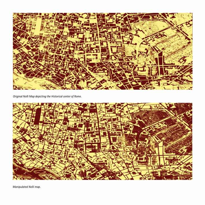
Giovanni Battista Nolli, an architect and printmaker famous for his map of Rome, depicted the complex fabric of the city by focusing on the representation of public and private domain through a graphical technique of a positive and negative space. (Ceen 1989, p.17) By coding public space as a void, Nolli outlined and detailed major spaces that had significant publicness associated with them. Such spaces include major piazzas and archeological sites, open areas, and religious places of worship such as basilicas. By portraying the private space as a solid, Nolli coded Rome as a uniform entity that, to borrow from in Kevin Lynch, began to emphasize paths, edges, districts, nodes, and landmarks as physical forms that allow perceptual navigation through the city. (Lynch 1960)
Through manipulating Nolli’s map one can obtain a new perceptual reading of Rome that, through a strategy of inversion, depicts public as voids and private as solids, illustrating the private as residual zones while portraying the public as inhabitable space. By further developing this idea, a new condition can be added in the form of Rome’s water infrastructure. Graphically minimizing the common urban physical forms and emphasizing the otherwise secondary systems, a new formal language can be perceived through a depiction of Rome’s major waterways as predominant sources for traversing the city. This illustration can be used to determine parallels in the integration of a third condition. The first condition would be the built environment, the second would be the piazza or the obvious public forum, and the third would be the imposition of the ancient infrastructure interpreted as opportunistic areas of design intervention.
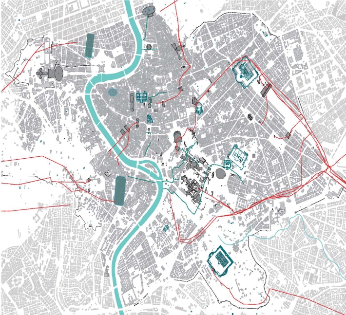
Imposition of the ancient infrastructure unto the urban fabric can become possible areas of design intervention.
Aqua Virgo
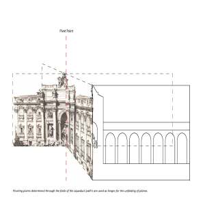
The first technique applied in the delineation of the Aqua Virgo was the production of a section cut. The path of the aqueduct was represented as a singular cut line traversing through a series of diverse buildings all represented through their elevational status. The path traced was limited by establishing boundaries through the depiction of two major public spaces. Unlike a previous depiction of the Los Angeles Aqueduct, the focus was placed on a moment of the aqueduct where visible traces and major monuments intersected.The second technique was to unfold a sequence of planes through their projection into a two dimensional surface. Such projection layered two existing, or previously existing, conditions upon the urban fabric. The placement of the aqueduct as a supplemental architectural layer allowed for the interpretation of a new condition depicted as space described through the use of shadows. Finally the unfolding of a three dimensional space onto a two dimensional surface characterizes the urban conditions as an uninterrupted processional link.
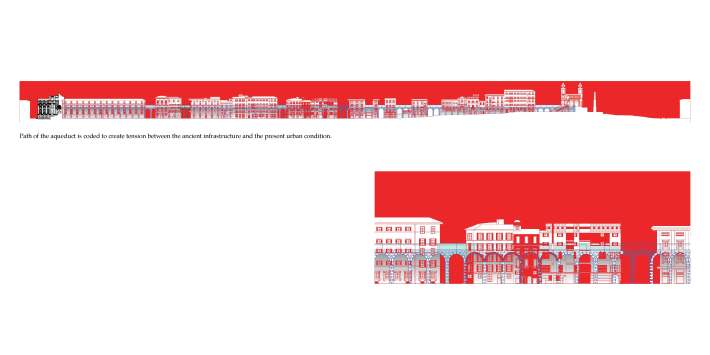
Imposition of the Aqua Virgo unto the existing fabric or Rome, with the Trevi Fountain as its terminus .
Color Coding:
By following Rodolfo Lanciani’s technique of establishing a color code for the interpretation of his Forma Urbis Romae, a color palette has been adopted to represent the layers that make up the area of intervention. Similar to Lanciani’s, the drawing follows the following color definitions:
• Black = existing
• Red = ancient
• Blue = water and future projection of space
The colors used are black to represent existing conditions, red to represent ancient buildings, and blue to represent water and future projected space.
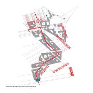
Tracing the Aqua Virgo from the Spanish Steps to the Trevi Fountain through a series of projected drawings.
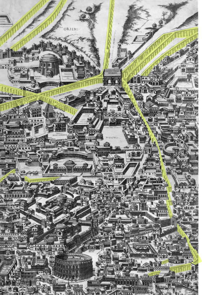
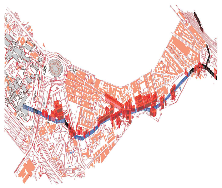
Aqua Claudio and Neroniani
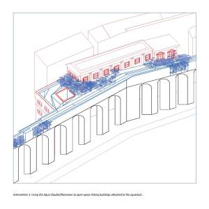
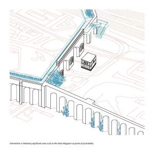
The aim of depicting the Aqua Claudio and Neroniani was to emphasize the aqueduct’s complex relationship with the existing urban fabric. The same color coding was used to represent existing, ancient, water and future space as the path of the aqueduct was traced. The focus in drawing the aqueduct was not to trace the aqueduct to its source, but to represent the major public spaces involved within a path linked by two major landmarks. This representation was visualized in the axonometric plan which illustrates current as well as possible urban conditions. By focusing on two major areas, the aqueduct was represented as a potential and viable site for a new urban design intervention that provides for a newly defined public space.

