Pwll y Wrach is a watery, woodland wander with waterfalls, rocks for climbing and pools for paddling. It is sheltered in the trees so is great on a drizzly day or when you need some shade from the hot (?) sun. This reserve is well used and the paths are clearly defined but also quite muddy if it has been wet, so wear appropriate boots. There is onsite parking for around 3 cars and an accessible linear trail suitable for pushchairs as well as circular routes for on foot.
Pwll y Wrach (accessible linear route)
Distance: about 2/3 of a mile
Time: 15-20 mins if you don’t stop to play
Pwll y Wrach (circular route)
Distance: just over a mile
Time: 40 mins (1 and a 1/2 hours including splash stops)
Guide to Pwll y Wrach
From the parking area you can see two gates. We went through the gate on the left which leads to the accessible trail.
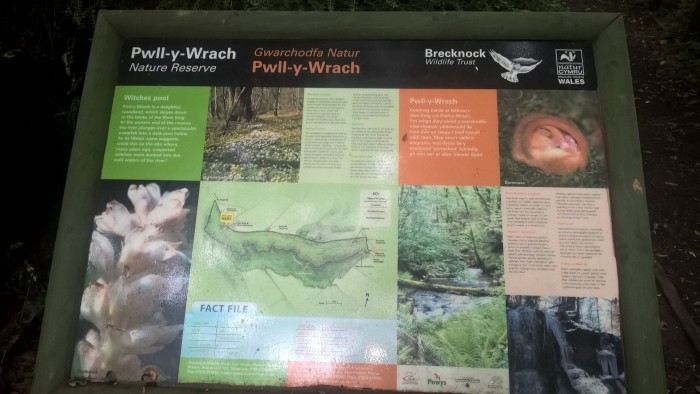
Just through the gate is a useful information sign including a guide to the trails.
This section of the wander continues for around 1/3 of a mile. The path is wide and well-surfaced and our adventurer enjoyed being able to look across, down and up through the trees. Listen out for the water rushing below. We went on a hunt to “find the water.”
Please be careful as there is a steep drop in places and some rails are missing. There are signs to say that these will be replaced.
You will come to a junction with an information sign. This is where the accessible trail ends. Turn back here if you have brought wheels with you, after you’ve had a splash in the stream directly ahead of course!
We took the left hand turn towards the main waterfall and pools. The terrain on this track is muddy, slippy and rocky in places, your adventurer will probably need a helping hand to balance and steady themselves along here.
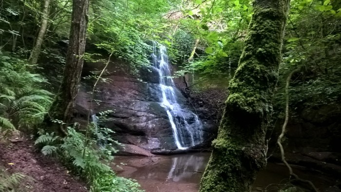
There are some fantastic views of the stream and you can hear the waterfall long before you catch sight of it through the trees.
The main waterfall and the pools beneath it, where the site gets its name from, are quite spectacular even in the summer when rainfall is less. Bigger adventurers might be brave enough to paddle or even swim here in the rocky pools, but it is too deep for little ones. (Don’t worry though, there’s lots of paddling to be had in a minute!)
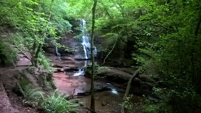
After having a really good look and listen we carried on past the waterfall and up the steps beside it. The path was quite narrow and the steps steep. Little adventurers will definitely need a hand to reach the top.
At the top there is a viewing platform where you can see the water falling over the edge of the rocks. I imagine this is deafening in the winter!
After this the trail forks…
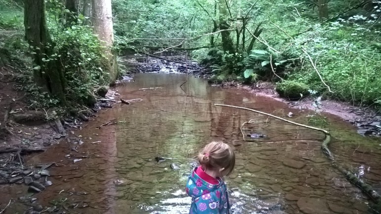
…we took the right hand fork and wandered until we found a good place to access the stream in a place where the bank was low and the water shallow. We spent ages here, in and out of the water and up and down the bank.
A bit later we turned around and headed back towards the waterfall, stopping again to have a good look at the different plants at the edge of the trail.
We followed our footsteps down the steps next to the waterfall and back to the junction with the accessible trail. Pausing en-route to have a climb on some rocks (blurry action shots…).
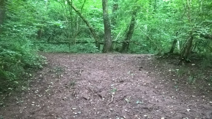
At the junction we followed the trail straight ahead down the hill. If your adventurer has tired legs I would suggest returning along the accessible route to the right as there is bumpy terrain and steps to follow.
This part of the trail is at the bottom of a picturesque valley with a stream running alongside. More opportunities for splashing if required!
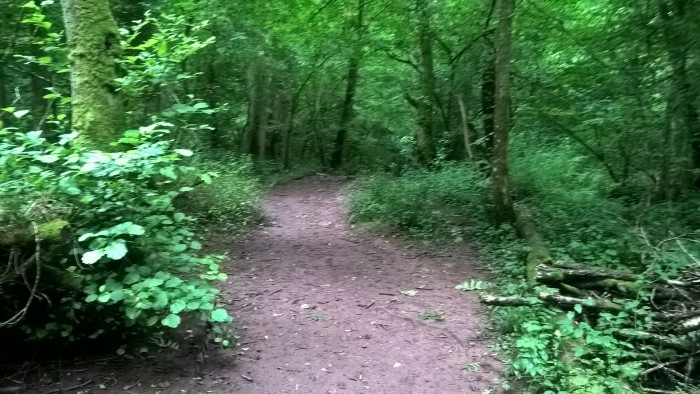
When you come to this junction (below) take the right hand trail.
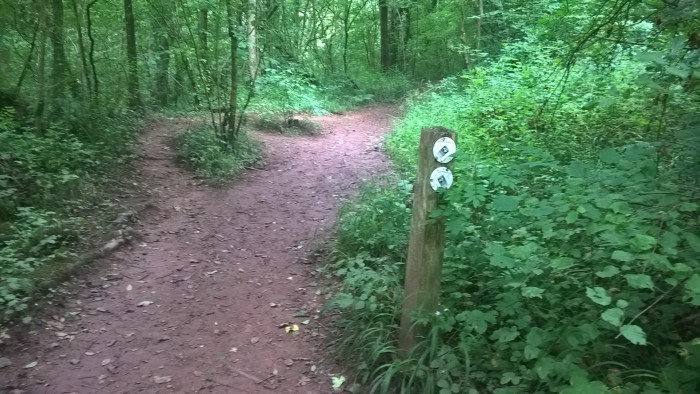
And when you come to the next junction, head right, up the steps.
At the top of the steps you will find the parking area.
If your adventurer is likely to get tired legs I would suggest starting off by going through the right hand gate (at the car park) and heading back along the accessible path after visiting the main waterfall.
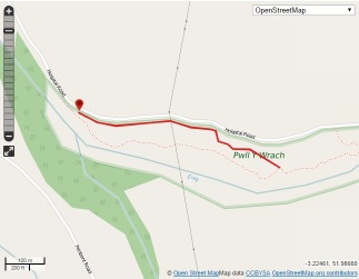
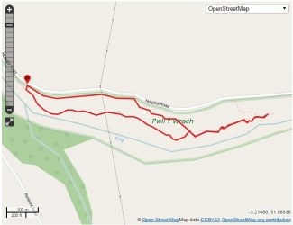
Use this map to guide you on your way. Click to enlarge.
Click on the maps below to view them on ViewRanger.
The OS grid reference is SO 165 326.
Pwll y Wrach (accessible)Pwll y Wrach
Pwll y Wrach is a Brecknock Wildlife Trust site and they have some great information on their website including a leaflet about the site and the following directions.
Directions: From the junction in the centre of Talgarth, with the Tourist Information & Resource Centre on your right, turn right. The road passes over the River Enig and then take the sharp left turn which leads into Bell Street. After 50 metres, turn left opposite the Bell Hotel and follow the minor road up a hill for about 1 mile. A short distance after the last houses of Talgarth, the main reserve car park and entrance is on the right where you will find an information panel.