
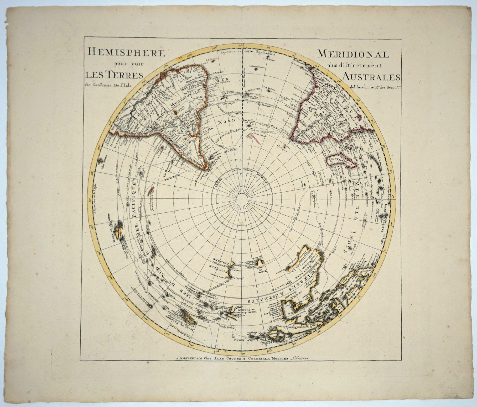
Hemisphere Meridional pour voir plus distinctement les Terres Australes.
Amsterdam: 1730. Map publ by Jean Covens et Mortier. 18" x 18". Antarctic hemisphere projection within ruled borders. Illustrates the World to the equator with land masses outlined in period color. The only Antarctic land mass noted is a vague outline of the "Cape des Terres Australes" south and west of the Cape of Good Hope. It shows no southern borders similar to the earlier theoretical Great South Land masses. Australia is shown without the east coast and New Guinea suggestively attached to it. Dampier & Tasman's routes are depicted. The New Hebrides are titled "Terre Australis ou St. Espirit" and suggest a possible east coast of Australia with large rivers, "Jordan" & "Sauyeur". Spence 3024B. In very good condition. Item #5042
Price: $1,250.00