
.
Monkton Farleigh
Bradford on Avon, Wiltshire
.

.
Monkton Farleigh (the name was frequently written as Farley in the past) lies in the northwest corner of the Bradford Hundred area. Also it includes its highest point, rising to 200m. The parish covered 1869 acres according to Kelly’s directory of 1915. On the western and northern sides much is covered by woodland and steep wooded slopes go down into the valley of the Avon and its tributary, the By Brook, which are both in Somerset. It shares boundaries with Bathford in Somerset on the west, Box on the north, South Wraxall on the east and Winsley on the south, all in Wiltshire.
Flint implements from the stone age have been found around the village and there are burial mounds and traces of field boundaries and settlements probably from the Bronze Age. The line of the Roman road from London to Bath is still followed by the northern boundary of the parish, remains of a Roman building have been found at Dry Arch and a large hoard of coins turned up in a garden.
It was outside the boundary covered by the Manor of Bradford and was not part of the ancient parish of Bradford. At the time of the Bradford charter in 1001 the manor of Farleigh was held by a man called Ælfgar, but by the time of the Domesday Book survey in 1086 and before 1066 it was held by his son Brictric (or Beorhtric) and under him by his brother Ælfwy. Brictic was a Saxon thegn who held much land elsewhere (including Trowbridge), however, he fell out of favour with King William’s Queen Matilda and Farleigh and his other properties were confiscated and descended to Humphrey de Bohun, a Norman. His son, also Humphrey, set up a Cluniac Priory there after 1120 and endowed it with the manor and other property which the priory held until it was dissolved in 1536. However, it was part of the Hundred and its people attended the Court of the Abbess of Shaftesbury until this obligation was exchanged for a monetary fee until the dissolution of the Abbey. The Priory’s manor and other land in Monkton Farleigh came to the Bishops of Salisbury who leased them tenants until sold as a freehold to Sir Charles Hobhouse in 1873 and still held by the Hobhouse family today. It was governed by the Bradford & Melksham Rural District Council until 1974, West Wiltshire District Council to 2009 and now is part of the Bradford on Avon Area Board under Wiltshire Council.
The site
The settlement grew up where several springs break out at the junction of the limestones and the clay that covers them. It lies close to the London-Bath Roman road and a large hoard of Roman coins was found in the village. Many of the fields around show signs of Iron Age farming. The hamlet of Farleigh Wick, including Pinckney Green, lies on the Bradford to Bath turnpike road (now A363), which bypasses the village itself. A hamlet called Woxehall or Wyxhale (perhaps also Wycchesole) that was mentioned in 1294, but its site is lost; it has sometimes been confused with South Wraxall.
Etymology
The Monkton of the name refers to the monks of the 12th century Priory of Farleigh. The old Saxon name Farnlege means a ferny clearing -the soil of the top of the Cotswold Hills here, on Farleigh Down, can be slightly more acidic than the surrounding land despite being on limestone, allowing the growth of bracken.
Economy
The Census records that the population has been falling slightly in recent decades: in 1981- 500; 1991- 478; 2001- 469; 2011- 460. Agriculture is carried out on the undulating land that slopes towards the east. Quarrying for building stone (Bath Stone) was formerly a major employer here, but it is no longer carried out; the vast worked-out underground quarries became huge armaments stores during World War 2, with above-ground accommodation for the workers. Plans to turn part of the workings into a museum failed and today have some use as storage. There were two public houses: the King’s Arms in the village, but the Fox & Hounds in Farleigh Wick has closed, probably forever. A small shop and post office near the church closed in December 2014, but eventually limited Post Office facilities opened at the King’s Arms in July 2019. There is a primary school, but with only 24 pupils it was combined with that at Atworth in 2006 and jointly called Churchfields School; secondary school pupils generally attend St Laurence School in Bradford.
Local bus services connect the village with Bradford and Bath.
.
.
.
.
.
- Explore Monkton Farleigh
- Monkton Farleigh in Domesday Book
- Monkton Farleigh Priory
- Monkton Farleigh medieval deer park
- Old photographs of Monkton Farleigh
- Listed buildings
- St Peter’s Parish Church
- Inwood
- Jugs Grave burial mound
- Browne’s Folly
- Monkton Farleigh Quarry in 1833
- Monkton Farleigh in the Second World War
.
.
St Peter’s Church, Monkton Farleigh
.
.
.
.
.
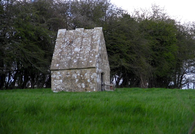
The Monks’ Conduit