First published in: The Times Click here to view a map for this walk in a new window

It was one of the mightiest winds I’d ever encountered, and it tore across the Wiltshire downs from the west like a mad thing. I was smashed in the face and shoved around as I climbed the flank of the Neolithic long barrow called Adam’s Grave, and when I got to the top the blast of the wind sent me staggering sideways.
;)
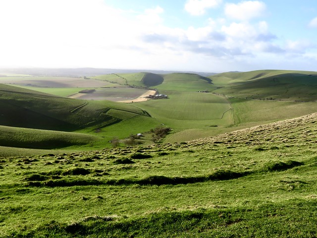
Maybe it was the unquiet ghost of Giant Adam, mythical occupant of the 5,000-year-old tomb, or maybe the bellicose spirits of the Anglo-Saxon warrior slain in a great battle here in 592 AD; but something up here was stirring the air into a maelstrom. My eyes were so blurred with wind tears I could hardly take in the magnificent view across the Vale of Pewsey, its brilliant green pastures and glittering floodwater lit up by the low winter sun.
I turned full face into the wind and battled along the slope of Walkers Hill. People with their backs to the gale came scudding by, hair and coat tails flapping, cheeks beaten red, gasping and nodding their complicity in outfacing the weather.
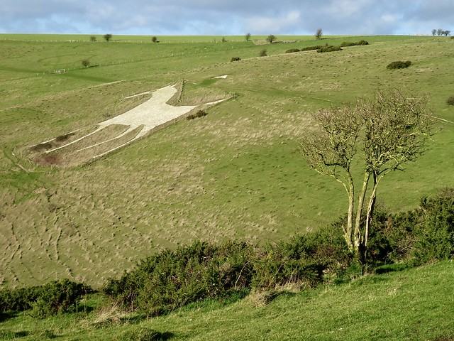
A turn of the hill brought the Pewsey White Horse into view, a slender-legged beast 180 feet tall with an elongated nose and a cropped tail twitched high. Farmer Robert Pile of Alton Barnes down in the vale below cut it out of the turf in 1812, and his handiwork has survived the two intervening centuries pretty well.
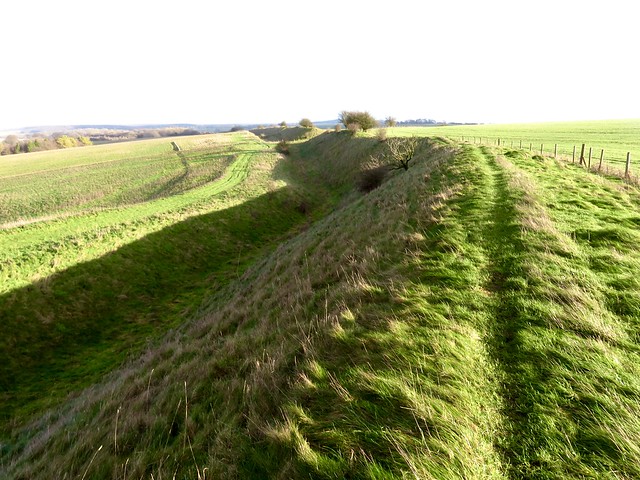
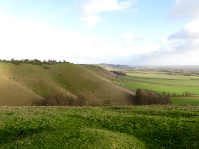
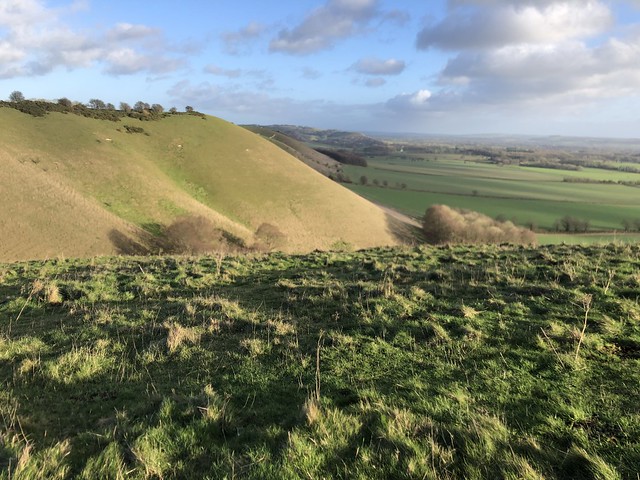
A crowd of fifty starlings went rushing across the slope, wings rigid, surfing the wind as one entity. I turned uphill past hissing gorse bushes and went east along the old bank and ditch of Wansdyke, a great groove thirty feet deep in the landscape. Wansdyke runs for sixty miles between the Hampshire Downs and the British Channel, but no-one knows the purpose of the Dark Ages folk who built it so tall and strong.
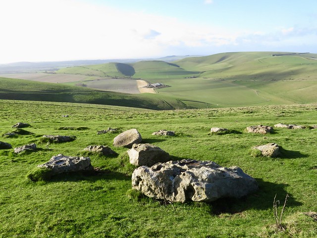
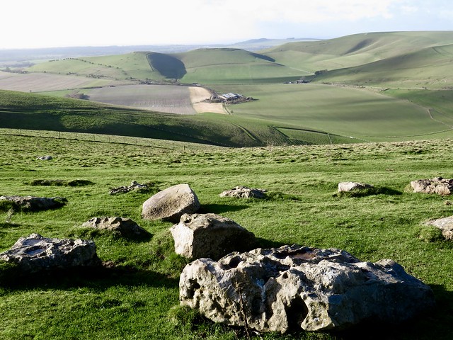
A broad green trackway took me down into the shelter of the valley once more. Beyond stood Knap Hill with its ceremonial ramparts and dimpled crown. I let the wind propel me up to the crest. There I revolved, soaking up the view of sun-gilded downland, marvelling at the energy of our ancestors who made their mark so forcefully all over these chalk hills of the west.
How hard is it? 4¾ miles; easy; downland tracks.
Start: Pewsey Downs car park, near Alton Barnes, SN8 4LU approx (OS ref SU 116637)
Getting there: On minor road between Alton Barnes and East Kennett (signed off A4 near Avebury)
Walk (OS Explorer 157): Cross road; through gate; immediately left through gate; follow clear grass path to top of Adam’s Grave (113634). Turn back across dip; bear left on path, passing above White Horse (107637) and on (‘Mid Wilts Way’/MWW; ‘White Horse Trail’/WHT). In 500m pass gorse patch on right; beside lone tree on left (101638), bear right uphill past another lone tree. Bear right to gate (101639, MWW, WHT); on to next gate; bear left with fence on right. In 450m, right through gate (102645, MWW, WHT); follow fence on right. In 200m through gate (103646); right along Wansdyke for 1 mile to T-junction (118648). Right on rutted track for ¾ mile to Pewsey Downs car park. Through car park, past stones and barrier; in 100m, left (117636, gate, fingerpost); fork right up Knap Hill. Half left off summit (122636) down to gate (123639); sharp left back to gate and car park.
Lunch: Barge Inn, Honey Street, Pewsey SN9 5PS (01672-851222, thebargeinnhoneystreet.uk)
Accommodation: Circles Guest House, 15 High St, Pewsey SN9 5AF (07769-018643, circlesbandb.com)
Info: visitpewseyvale.co.uk