2009
SX6263 : The Ranny Brook
taken 15 years ago, 4 km NNE of Cornwood, Devon, England
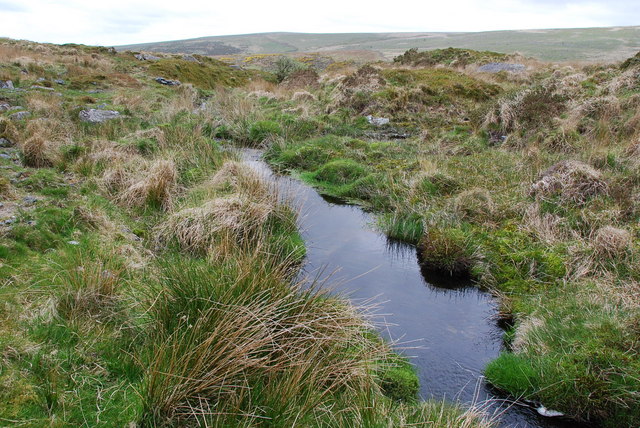
The Ranny Brook
Here just before the Brook plunges down the gully to join forces with the Yealm, it is fairly deep and slow moving.
 Map © Crown Copyright")
TIP: Click the map for more Large scale mapping
- Grid Square
- SX6263, 9 images (more nearby 🔍)
- Photographer
- jeff collins (more nearby)
- Date Taken
- Saturday, 9 May, 2009 (more nearby)
- Submitted
- Monday, 11 May, 2009
- Subject Location
-
OSGB36:
 SX 622 633 [100m precision]
WGS84: 50:27.1986N 3:56.5392W - Camera Location
-
OSGB36: SX 623 632
- View Direction
- WEST (about 270 degrees)