2012
NZ2230 : Coundon Burn tunnel
taken 12 years ago, near to Middlestone Moor, County Durham, England
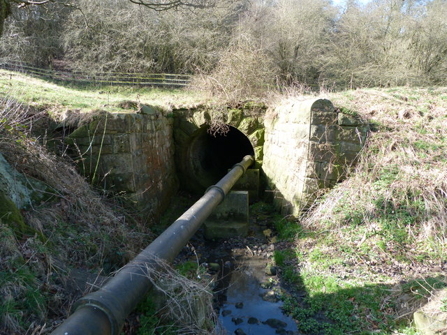
Coundon Burn tunnel
A culvert running under the old railway line with Bishop Auckland golf course on the other side. Known as the Witchy's when I was a kid, and I used to run through it.
 Map © Crown Copyright")
TIP: Click the map for more Large scale mapping
- Grid Square
- NZ2230, 34 images (more nearby 🔍)
- Photographer
- michael burns (more nearby)
- Date Taken
- Tuesday, 20 March, 2012 (more nearby)
- Submitted
- Wednesday, 21 March, 2012
- Subject Location
-
OSGB36:
 NZ 2273 3057 [10m precision]
WGS84: 54:40.1817N 1:38.9452W - View Direction
- WEST (about 270 degrees)