2012
SH5547 : Moel yr Ogof, "Hill of the Cave"
taken 12 years ago, 3 km from Beddgelert, Gwynedd, Wales
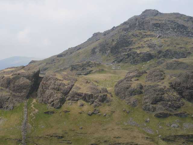
Moel yr Ogof, "Hill of the Cave"
Moel yr Ogof is the middle peak on the Moel Hebog ridge. The main path does not
pass the cave which requires a detour and a scramble to find it.
pass the cave which requires a detour and a scramble to find it.
 Map © Crown Copyright")
TIP: Click the map for more Large scale mapping
- Grid Square
- SH5547, 65 images (more nearby 🔍)
- Photographer
- Peter S (more nearby)
- Date Taken
- Monday, 21 May, 2012 (more nearby)
- Submitted
- Sunday, 17 June, 2012
- Subject Location
-
OSGB36:
 SH 5582 4763 [10m precision]
WGS84: 53:0.3908N 4:9.0149W - Camera Location
-
OSGB36: SH 5619 4739
- View Direction
- West-northwest (about 292 degrees)