
Sangweiher Habitat for many bird species
Extensive renaturation measures have breathed new life into the Sangweiher and the nature and bird sanctuary of the same name near Daun between Schalkenmehren and Udler.
Geology
The maar lies in the transition area of three units of the Devonian Lower Ems: From SE to NW there are the Eckfeld and Reudelsterz layers of sand-siltstones, greywackes and quartzites. This is followed by the ossuary layers, which consist of light sandy siltstones at the bottom and dark shales and siltstones at the top. Geomorphologically speaking, the maar lies in a noticeably wide valley of a tributary of the Alf. Lapilli tuffs are found in the SE and scoria in the N. Therefore, the eruptions must have occurred towards the north and southeast.
Info
- Coordinates: 50° 08 ´59´´N / 06° 52´ 19´´E
- Altitude: 399 m above sea level
- Maar dimensions: approx. 600m x 500m
Today's lake
- Funnel age: 10,900 years
- Lake diameter: approx. 285 m in W-E direction and
approx. 135 m in N-S direction - Lake surface: 38,500 m2
-
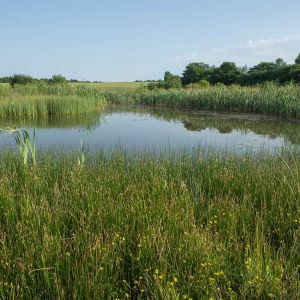
Ufersaum des Sangweihers © Natur- und Geopark Vulkaneifel GmbH
-
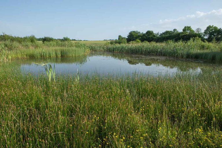
Vulcano-Pfad am Sangweiher © Eifel Tourismus GmbH, D. Ketz
Special features
The fact that the Sangweiher is an old maar was only recognized a few years ago when ejecta materials were found north and south of the pond. In the Middle Ages, the two streams flowing through it were dammed and the resulting ten hectare lake was used for fish farming.
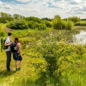
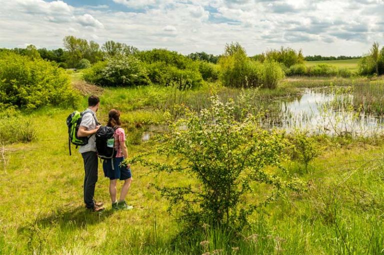
In the 19th century the lake was drained again and the area was used for agriculture. In the 1980s, the original condition was restored and the area around the Sangweiher was declared a nature reserve. Sedge and rush populations as well as wet meadows developed around the maar. The Sangweiher is therefore an important habitat for many bird species. Two bird watching stations hidden between trees on the bank are very popular.
Highlights nearby
- Mürmes
- Schalkenmehrener Maar
- Schalkenmehren Natural Outdoor Swimming Pool
- Schalkenmehren Home Weaving Museum
- Hoher List Observatory
- Pulvermaar
- Pulvermaar Natural Outdoor Swimming Pool
- Brockscheid Bell Foundry
Hiking trails
Nature lovers and especially bird lovers will see a lot while walking on one of the numerous hiking trails around the Sangweiher and will experience relaxing and exciting hours.
-

Muße-Pfad Vulcano-Pfad
Rundtour östlich von Schalkenmehren
Blicke über den Gartenzaun ins Land der Maare und Määrchen. Verliere dich nicht im Detail, nimm Abstand, blicke über den Gartenzaun und sieh das Ganze!
- Schwierigkeitsgrad:

- Strecke: 26,2 km -
- Dauer: 16:42 Std.
- Aufstieg: 652 hm -
- Abstieg: 652 hm
- Schwierigkeitsgrad:
Guided tours
Directions & Parking