Levant Map stock illustrations
Browse 30+ levant map stock illustrations and vector graphics available royalty-free, or start a new search to explore more great stock images and vector art.
Most popular
Western Asia, geoscheme and political map. Subregion of Asia, used for statistical purposes, covering geographical regions spanning from Anatolia, Caucasus, Levant, Mesopotamia till Arabian Peninsula.
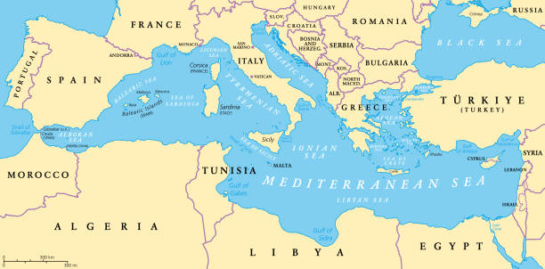
The Mediterranean Sea, political map with subdivisions, straits, islands and countries. Connected to the Atlantic Ocean, surrounded by the Mediterranean Basin, almost completely enclosed by land.
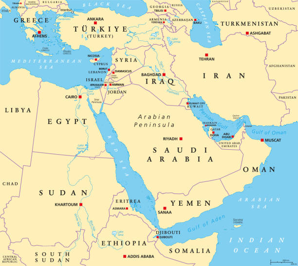
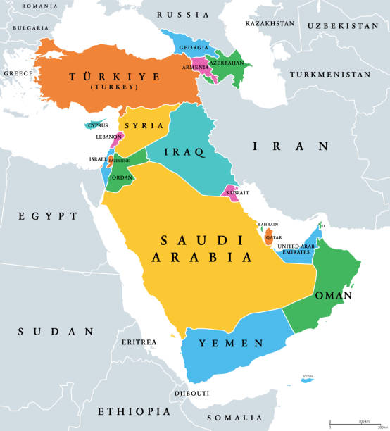
The Middle East, political map with capitals and international borders. Geopolitical region encompassing the Arabian Peninsula, the Levant, Turkey, Egypt, Iran and Iraq. Formerly called Near East.
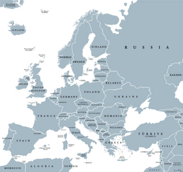
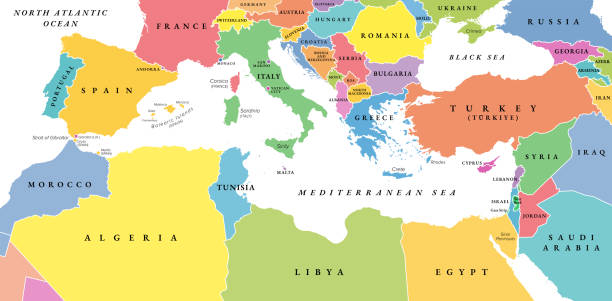
Europe with a part of the Middle East, gray political map. Western part of the continent Eurasia, located in the Northern Hemisphere. Countries with international borders and English labeling. Vector
MEDITERRANEAN REGION: South Europe (Spain, French Riviera, Côte d’Azur, Provence, Italy, Balkans, Greece), Asia Minor (Turkey, Black Sea), Near East (Levant, Syria), North Africa (Lower Egypt, Libya, Tunisia, Morocco). -- Geographic Map with coastline, islands, main rivers (detailed geodesic chart).
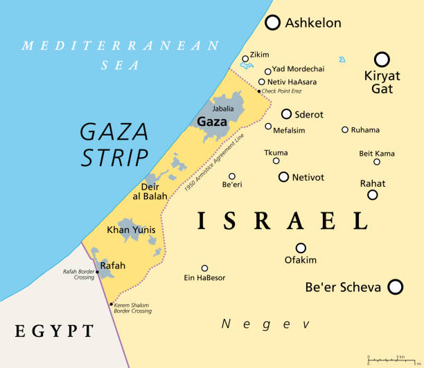
The Gaza Strip and surroundings, political map. Gaza is a self-governing Palestinian territory and narrow piece of land located on the coast of the Mediterranean Sea, bordered by Israel and Egypt.
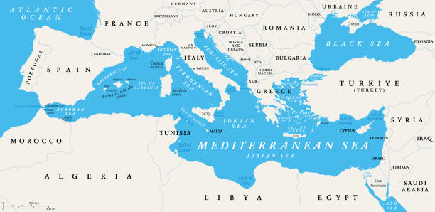
The Mediterranean Sea subdivisions, political map with straits, countries and the Black Sea. Connected to the Atlantic Ocean, surrounded by the Mediterranean Basin, almost completely enclosed by land.
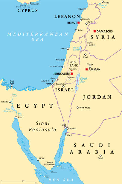
Israel and the Sinai Peninsula, political map. The Southern Levant, an arid geographical and historical region, encompassing Israel, Palestine, Jordan, Lebanon, southern Syria and the Sinai Peninsula.

Part of the Southern District of Israel, political map, with the Gaza Strip, bottom half of West Bank, Dead Sea, and with borders and most important cities in this region. Illustration. Vector.
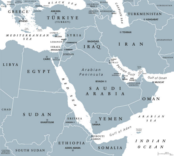
The Middle East, gray political map with capitals and international borders. Geopolitical region encompassing the Arabian Peninsula, the Levant, Turkey, Egypt, Iran and Iraq. Also called Near East.
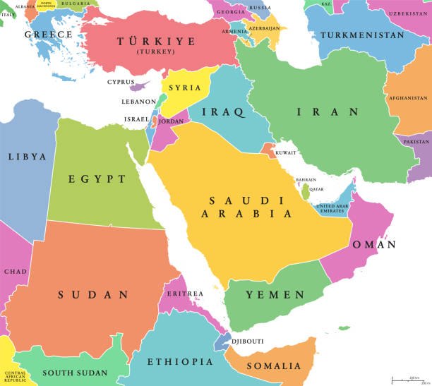
Middle East, colored countries, political map with international borders. Geopolitical region encompassing the Arabian Peninsula, the Levant, Turkey, Egypt, Iran and Iraq. Formerly known as Near East.
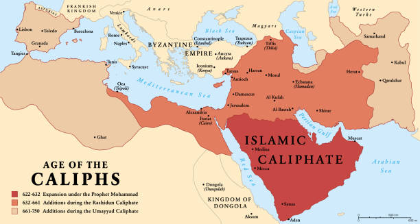
The age of the Caliphs, history map of the Islamic Caliphate from 622 to 750. The expansion under the Prophet Mohammad, with additions during the Rashidun Caliphate and the Umayyad Caliphate. Vector.
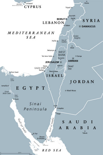
Israel and the Sinai Peninsula, gray political map. The Southern Levant, a geographical and historical region, encompassing Israel, Palestine, Jordan, Lebanon, southern Syria and the Sinai Peninsula.
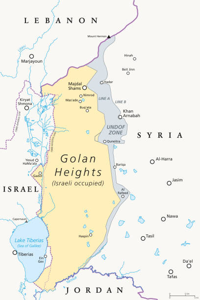
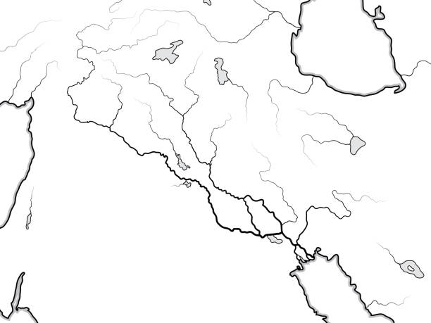
Golan Heights. political map with borders, important places, rivers and Lake Tiberias. A region in the Levant. Area, captured from Syria and occupied by Israel. English labeling. Illustration. Vector.
The Mediterranean Sea, gray political map with international borders, countries and islands. Connected to the Atlantic Ocean, surrounded by the Mediterranean Basin, almost completely enclosed by land.
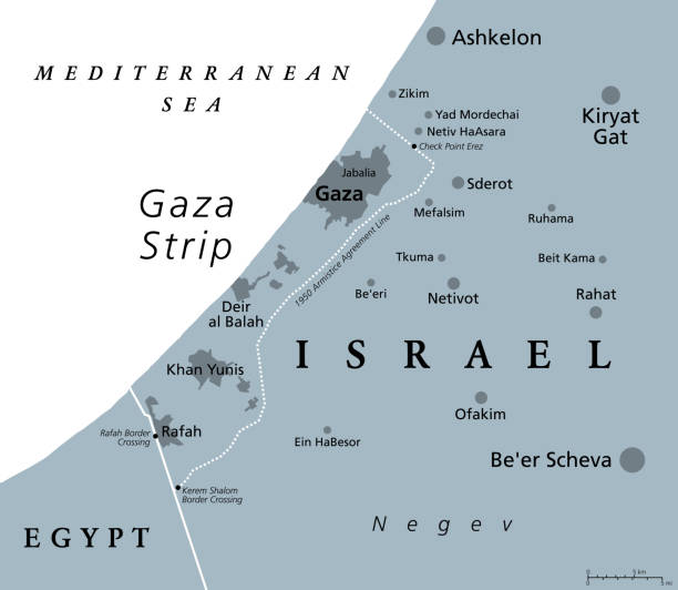
The Gaza Strip and surroundings, gray political map. Gaza, a self-governing Palestinian territory and narrow piece of land located on the coast of the Mediterranean Sea, bordered by Israel and Egypt.
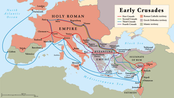
Early Crusades, history map. The first four Crusades, a series of religious wars to the Holy Land, to conquer Jerusalem and its surrounding area, by the Christian Latin Church in the medieval period.
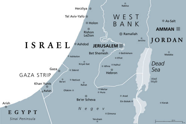
Part of the Southern District of Israel, gray political map, with the Gaza Strip, bottom half of West Bank, Dead Sea, and with borders and most important cities in this region. Illustration. Vector.
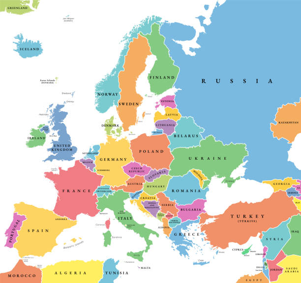
Europe with a part of the Middle East countries, political map. Western part of continent Eurasia, located in the Northern Hemisphere. Countries with international borders and English labeling. Vector
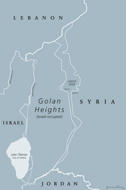
Golan Heights. political map with borders. A region in the Levant. Area, captured from Syria and occupied by Israel. English labeling. Gray illustration on white background. Vector.
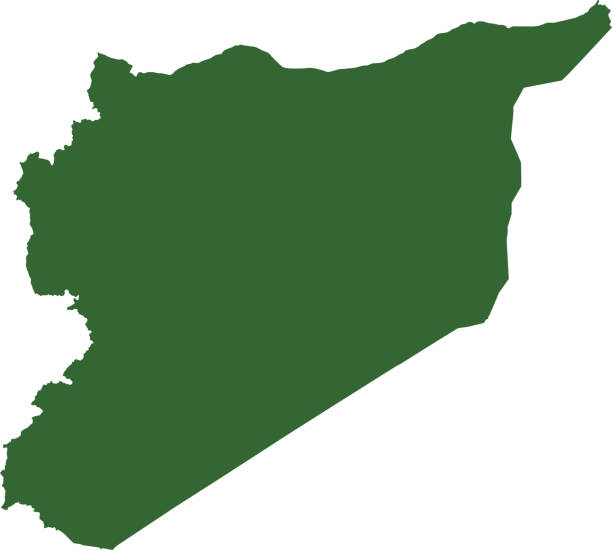
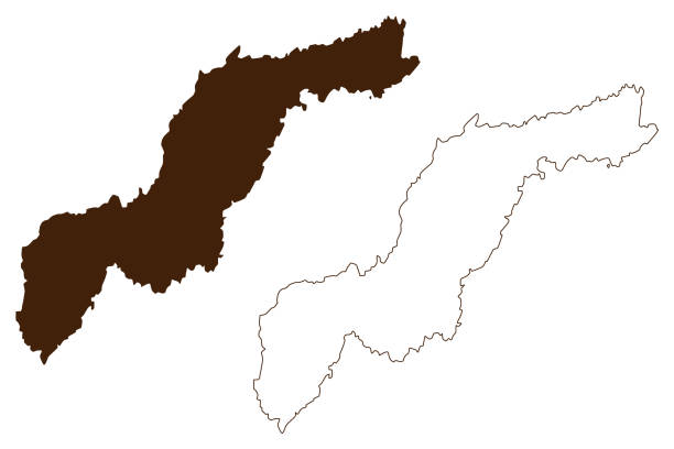
Map, country shape and borders of Syria
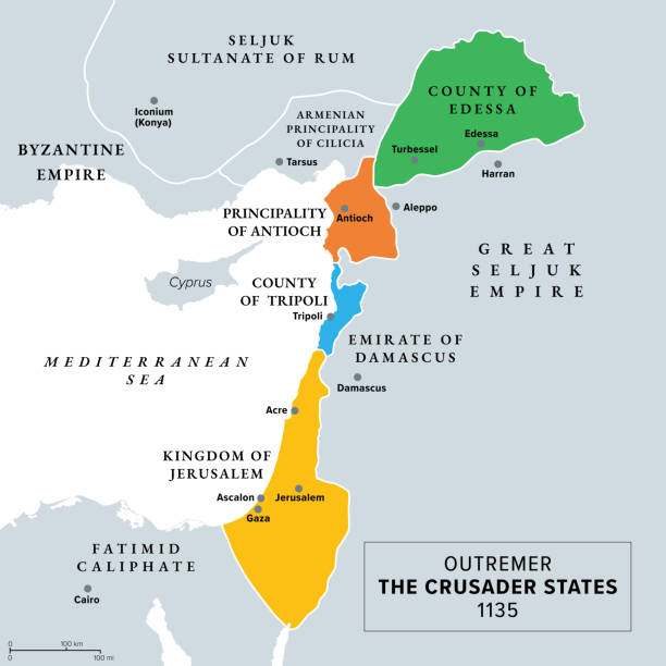
Outremer, the Crusader states at about 1135, gray history map. Latin Catholic realms, created after the First Crusade. Kingdom of Jerusalem, County of Edessa and Tripoli, and Principality of Antioch.
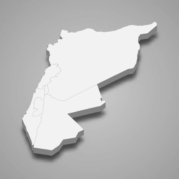
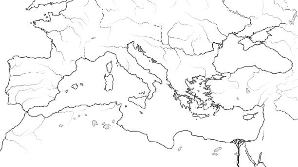
3d isometric map of Levant region, isolated with shadow vector illustration
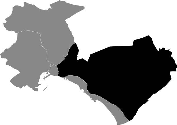
Black location map of the Distrito Levante (Levant) district inside gray urban districts map of the Spanish regional capital city of Palma, Spain
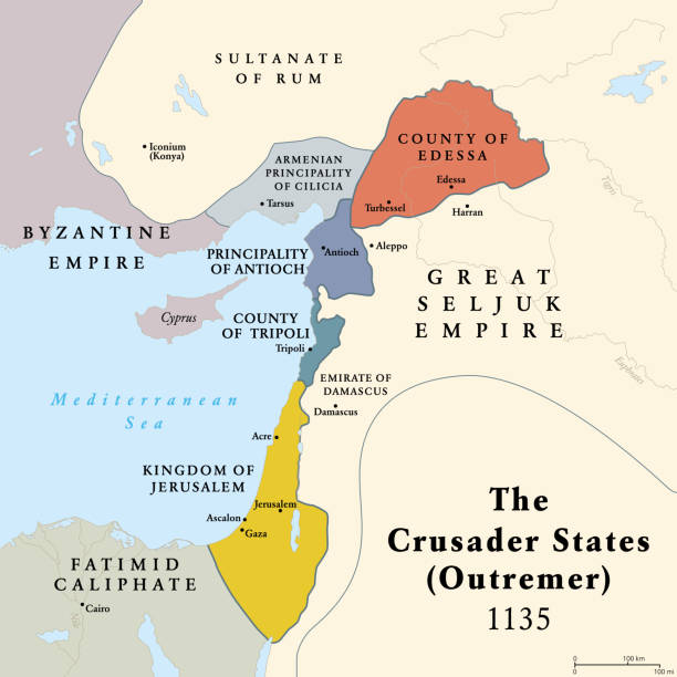
Crusader states, map of Outremer at about 1135. Four Latin Catholic realms in the Levant, created after First Crusade. Kingdom of Jerusalem, County of Edessa and Tripoli, and Principality of Antioch.
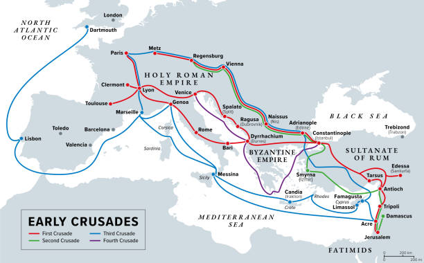
Early Crusades, gray history map. First four Crusades, a series of religious wars to the Holy Land, to conquer Jerusalem and its surrounding area by the Christian Latin Church in the medieval period.
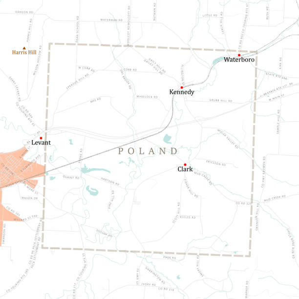
NY Chautauqua Poland Vector Road Map. All source data is in the public domain. U.S. Census Bureau Census Tiger. Used Layers: areawater, linearwater, roads, rails, cousub, pointlm, uac10.
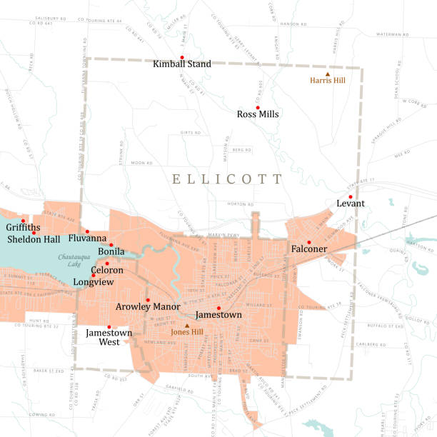
NY Chautauqua Ellicott Vector Road Map. All source data is in the public domain. U.S. Census Bureau Census Tiger. Used Layers: areawater, linearwater, roads, rails, cousub, pointlm, uac10.
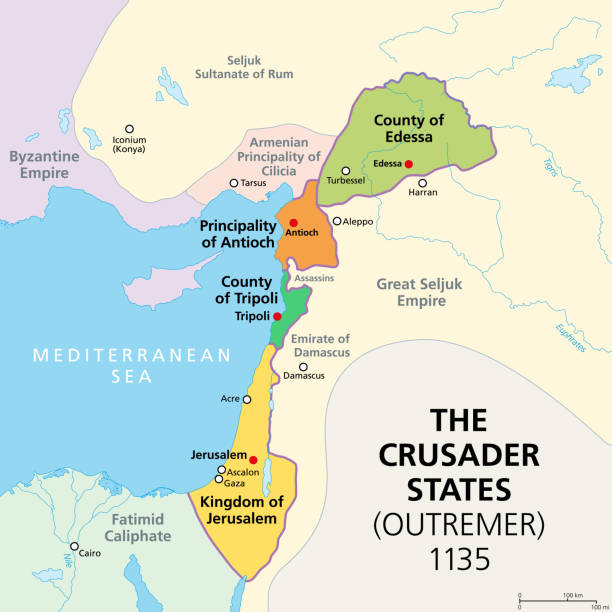
Crusader states at about 1135, map of Outremer, 4 Latin Catholic realms in the Levant, created after the First Crusade. Kingdom of Jerusalem, County of Edessa and Tripoli, and Principality of Antioch.
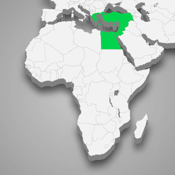
Levant location within Asia 3d isometric map
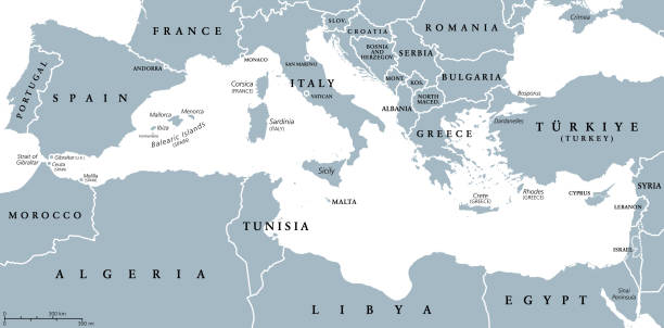
Mediterranean Basin, political map with different colored countries. The Mediterranean Sea and region with the countries of South Europe, North Africa and the Near East. Isolated illustration. Vector.