Hiking up High Willhays and Yes Tor: Dartmoor's Highest Point
Geographic high points are usually firm favourites. We know them even if we don't we know them. Ben Nevis, Snowdon, Scafell Pike, Whernside, Pen-y-Fan. Whenever I visit somewhere new, I make a note of the highest point. Not necessarily to summit it, just for reference, for comparison, for context.
Often, the highest points are particularly notable. Perhaps not so here though, on Dartmoor, Southern England's majestic, wild moorland.
Dartmoor's highest point is High Willhays, a great lumbering hill on the national park's north western boundary. It sits at over 2,000 feet, 2039 feet to be exact. Or, if you like metric (I do, but feet sounds more impressive), it's 621 metres. This makes it and its neighbour, Yes Tor, the only English 2,000+ summits south of Kinder Scout in the Peaks. Okay, Black Mountain meets this criteria too, but it's half in Wales so until it can make its mind up, I'm not counting it.
High Willhays is predominantly notable for its height and little else. To look at, it's not much. In fact, it's upstaged by its sister, Yes Tor, a stone's throw north and just 2 metres lower. But the surroundings contain myriad intrigue and hiking here is well worth the effort.
I headed up there in the summer and planned a hike around 10km. Fancy it? Yeah you do.
Walking up High Willhays
It's easy to get to the start of this walk as it's just off the A30, a major road linking Exeter to Cornwall and going over the top of Dartmoor. If you're coming from the south, the A386 brings you here too.
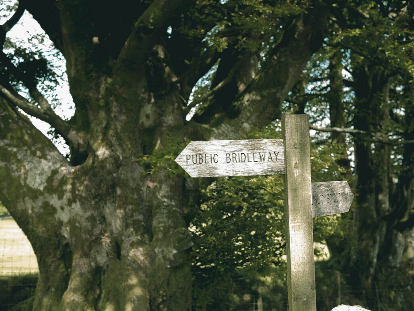
I parked at Meldon Reservoir, which has a car park and toilets. Always useful. From here, the route stays north of the reservoir, following tracks high above, past grazing sheep and low stone walls.
This section is actually part of with the Two Castles Trail and the West Devon Way, and is a bridle path. After about a mile, there's a crossroads where the bridle path continues south west. Here, we took a vague track south east, across a couple of sheep fields to find this view of the reservoir's southern reaches.
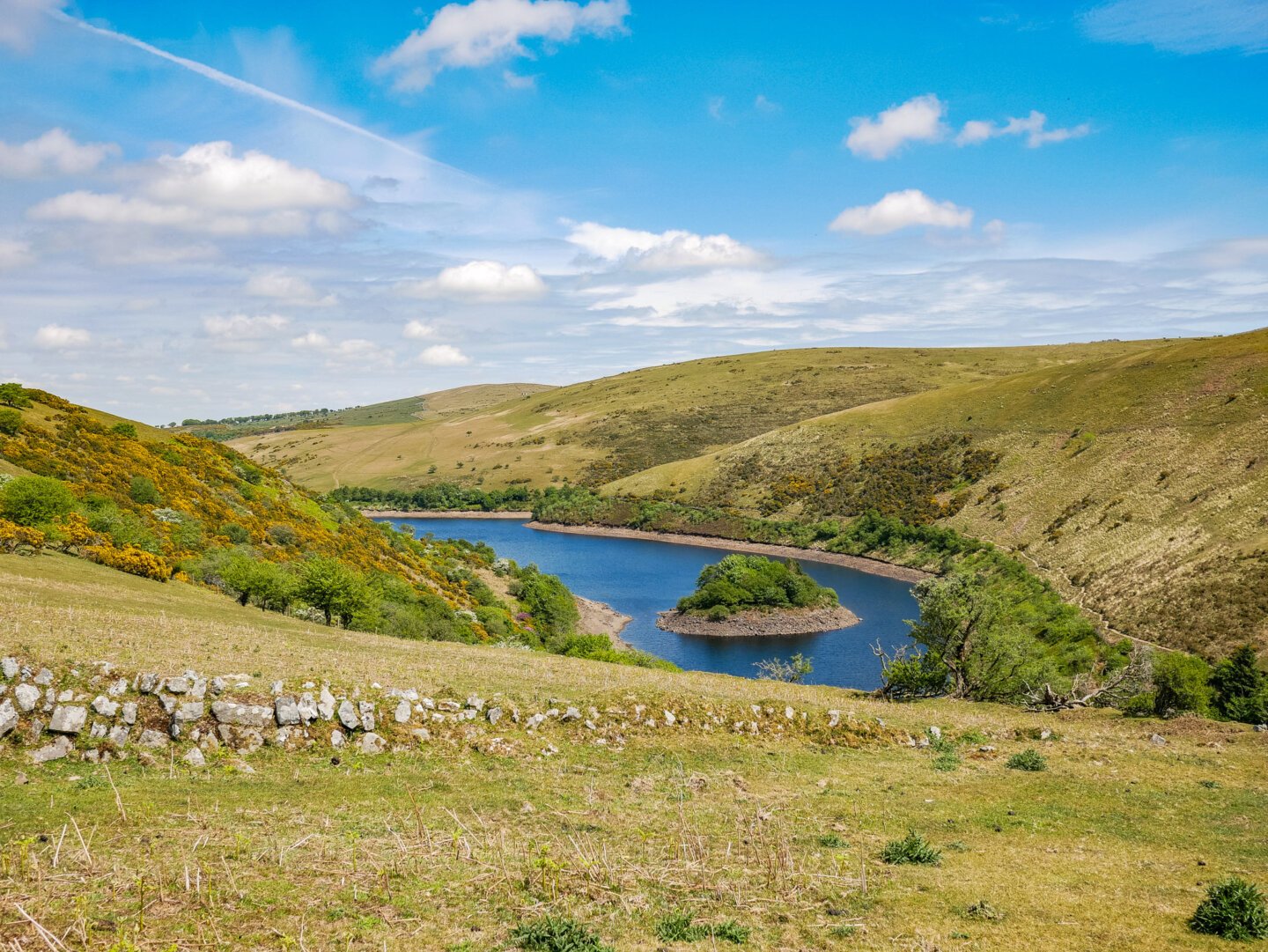
The track continues downhill and eventually leads to narrow stone steps. It then crosses the pretty footbridge at the bottom, spanning the West Okement River where it flows into the reservoir. Here, the paths get a little confused.
We headed upriver, leaving it on our right hand side and abruptly came across a pair of Canada geese and their merry troop of tiny, fluff ball goslings, paddling about in the river's meandering shallows.
The path continued just above the river and we found a wonderfully pretty copse that I immediately mistook for Black-a-Tor Copse, which is actually a little further up the river.


The first copse holds plenty of magic in its own right. Low, withered trees cling to its small but steep, bouldered edges and there's more tiny waterfalls than you can shake a sandwich at. But carry on to Black-a-Tor for something truly wondrous.
Black Tor and Black-a-Tor Copse
Black-a-Tor Copse is one of only three ancient high-altitude oak woodlands on Dartmoor. There are very few remaining in the entire country. This woodland is home to incredible rare lichen and the rivers runs directly alongside it. A National Nature Reserve, there's something altogether ethereal about the atmosphere in this tiny copse.
The route leaves Black-a-Tor Copse and heads up over pathless moorland to the imposing Black Tor above. As it stands on the edge of a steep valley, the tor has remarkably good views north and south, and it's far more eye-catching that the day's objective.
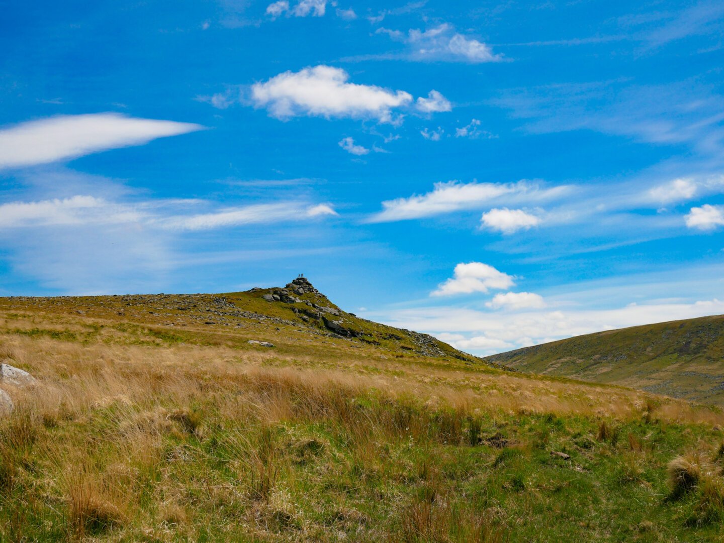
Once we'd larked about the granite for a while, regretting assuming Exeter's cold, overcast weather would be representative of northern Dartmoor's, we turned finally towards the goal. High Willhays.
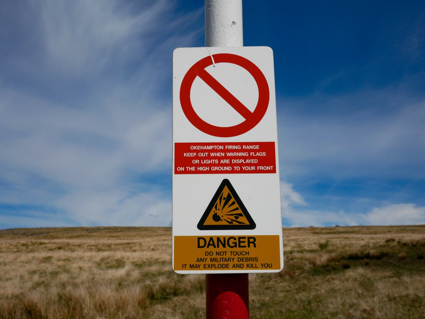
First, if you're planning on doing this walk, it's important to know that the next section crosses an MOD firing range. Whilst they don't seem to be active all that often, it's important that you check the Okehampton firing programme, lest you find the red flags flying and have packed your lunch and filled your thermos for nothing.
Hike to High Willhays
Shaking away the feeling that the MOD might have forgotten to fly the flags or update the programme, we hiked over the rough, grassy terrain of the hill until we reached High Willhays' summit.
There are two granite outcrops here and the highest point is technically the most southerly. The views are extensive, but the hill itself is so large and sprawling, it takes up much of the view. Don't stop here for a snack, head to Yes Tor instead.
A clear trail joins the two summits and it's almost flat going.
Yes Tor is far more distinctive than High Willhays, as a summit anyway. After all, they seem to share a body.
There's a trig pillar here, a military flag pole and a large amount of Dartmoor's favourite summit topping, granite.
Yes Tor also has some outstanding views. North, the moor ends and patchwork fields unfold to the horizon. South, High Willhays' cairn lies in the foreground and south east, Dartmoor itself rolls out.


From Yes Tor, the route heads down towards the reservoir, across open moorland. It's rough going but fun, with rocks, grass and curious sheep everywhere.
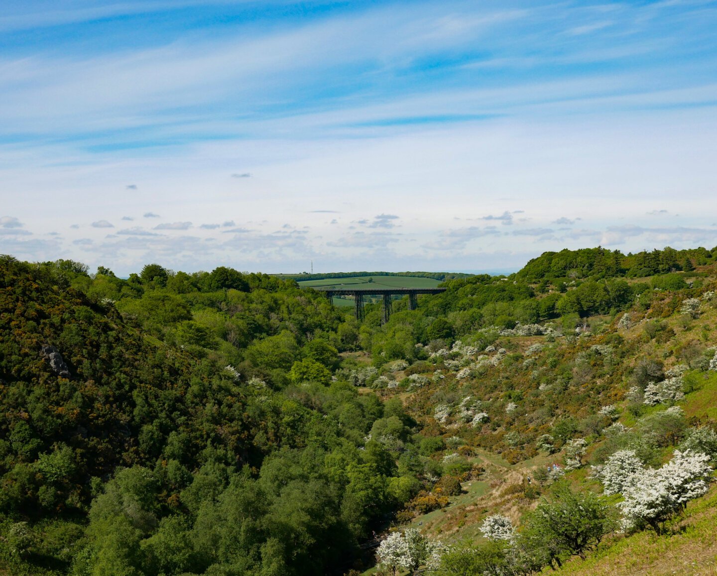
Shortly, we came to the tracks leading around the top of Longstone Hill and descended to the reservoir itself. Not before spying the Meldon Viaduct though, which forms part of the Granite Way cycle/walking route. If you fancy doing that beauty of a trail, check out my post on cycling the Granite Way.
We crossed the dam at the northern extent of the reservoir et voila, we were back at the car park.
Rambling about Dartmoor's highest points
The reservoir has its own loop walk which can get busy, but this High Willhays route was almost entirely devoid of other people.
We walked on a glorious summer's day but Dartmoor is lovely no matter what time of year. Except in driving rain and howling wind. It's less atmospheric when you're seething and soaking in equal measure.
Distance: 6.2 miles (10 km)
Time taken: God knows, maybe three hours with some stops.
Map used: OL28 - Ordnance Survey