'Hole punch' cloud spotted over SF Bay Area

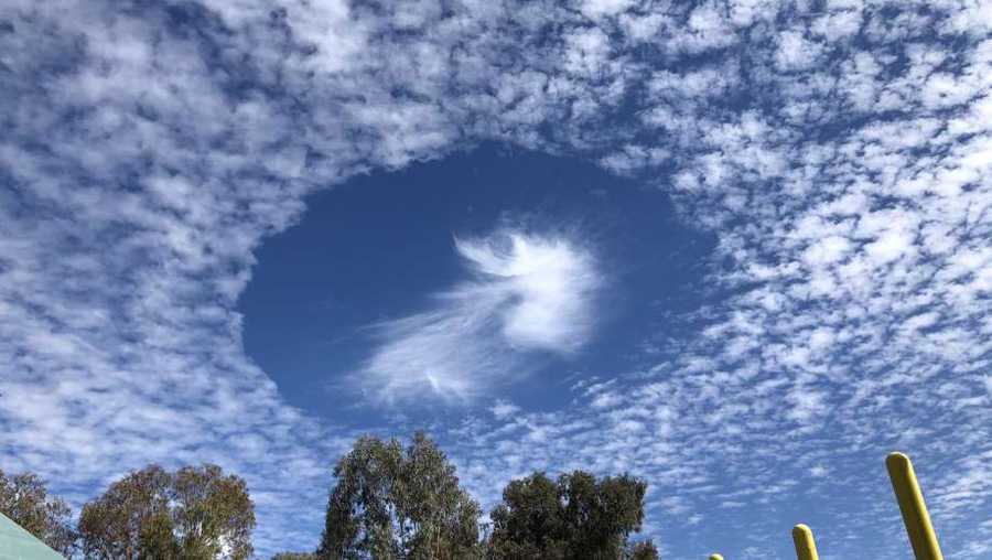
Folks around the San Francisco Bay Area were treated to an otherworldly spectacle in the sky Friday. What's known as a fallstreak cloud was spotted by many in both the East Bay and on the Peninsula in the late morning.
These stunning formations are also sometimes called hole punch clouds because it literally looks as if something punched the sky with cloud puffs dissipating from a large elliptical gap.
The National Weather Service explains fallstreaks occur when the water temperature in a cloud is below freezing, but the tiny water droplets forming the cloud have yet to freeze.
"These 'supercooled' water droplets need a 'reason' to freeze, which usually comes in the form of ice crystals," NWS explains. "Planes passing through the cloud layer can bring these ice crystals. Once the ice crystals are introduced, the water droplet quickly freeze, grow and start to fall. A hole is left behind, which will start to expand outward as neighboring droplets start to freeze."
Many residents photographed the strange sight in the sky and shared the images in social media.
"The sky was doing cool things over Santa Clara this morning," wrote @teapot_rabbit on Twitter.
"I think we can fill some atmo sci textbooks with perfect fallstreak cloud examples seen around the Bay Area today!" shared NBC Bay Area meteorologist Rob Mayeda.