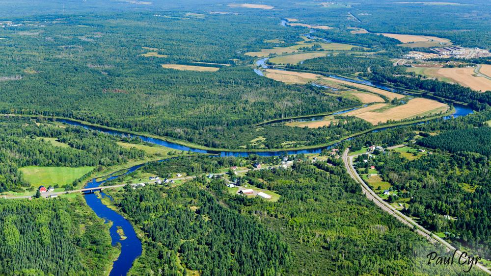
Flowing north, the water along this route is primarily flat and with gentle rips in the last mile. It is best run with a canoe during high to moderate water levels. Kayaking is possible during the summer except in extreme low water periods. This section of river passes through a mix of farmland and forests with lots of islands and backwater channels. Passing through two state wildlife management areas with numerous tributaries and wetlands, this stretch of river provides some of the best opportunity for wildlife viewing in the Aroostook River valley.
The put-in at the public boat launch in Masardis is just below the confluence of the Aroostook River and St. Croix Stream. The first hundred yards can be boney in low water, but the channel deepens and the river slows soon after you leave the village.
Below the bridge, the Pollard Flat Wildlife Management Area lies along the west bank of the river for the next 1.5 miles. This area is good for otter and beaver, and waterfowl are abundant. Look for moose in the bogan entering on the west shore just below the big island. Scopan Stream enters from the east at 4.7 miles. From here the river moves away from the road and becomes decidedly more quiet.
At the second westward (left) bend in the river below Scopan Stream, at about 7 miles into the route, the river enters the Butler Island Wildlife Management Area. The channel on the east side of Butler Island is narrow, but paddle-able in most water levels, and an interesting change from the wide expanse of the main river. There is a low-water crossing for the island access road, and in some years, a small beaver dam or two to drag over, but this canopied route offers a very wild feel and is the best opportunity to see wildlife. Quiet paddlers may spot white-tailed deer, mink, muskrat, wood ducks, and occasionally, a Barred Owl in the old growth maples on the island. The channel rejoins the main river after a mile.
The last three miles are primarily flat water, and after passing the historic Tilley Farm on the west bank, mostly forested. Past the confluence of the Machias River, the current picks up. The approach to the take-out below the ME-11 bridge in Ashland may require some dragging in low water. The public boat launch is about 250 yards past the bridge on the east (right) side of the river.
A USGS Aroostook River Gauge is located on the west bank just before the Garfield Road Bridge, about 1.7 miles into the route. Instantaneous river level and flows for the upper Aroostook River can be accessed online.
For additional information, visit the Aroostook County Tourism website, or contact:
![]()
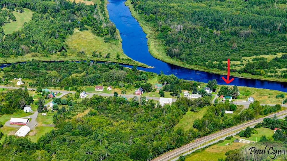
PUT-IN AT MASARDIS
From US-1 or Presque Isle, head west on ME-163 for about 19 miles. In Ashland, head south on ME-11. Go 9 miles on ME-11 from ME-163 to River Road on the right. It is about 400 feet to the boat launch at the end of River Road. From the south, is it 47 miles on ME-11 to River Road in Masardis from exit 264 off I-95 in Sherman. The parking here is limited but rarely crowded.
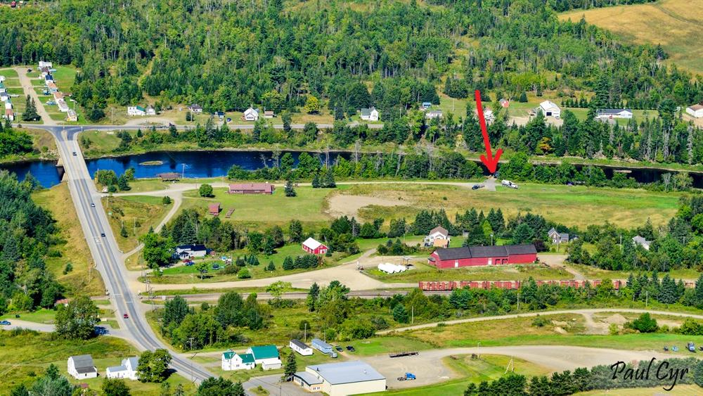
TAKE-OUT AT ASHLAND
From US-1 or Presque Isle, head west on ME-163 for about 19 miles. In Ashland, head north on ME-11. Go 0.3 miles from ME-163 and turn left to stay on ME-11. Continue another 0.7 miles to the driveway for the Ashland Fish and Game Club on the right, just before (on the east side of) the river. Continue past the picnic pavilion and the Club building another 0.2 miles to the boat launch.
Success! A new password has been emailed to you.